Clitheroe

Settlement in Lancashire Ribble Valley

England

Clitheroe

Brungerley Bridge The B6274 from Slaidburn to Clitheroe crosses the River Ribble.
Brungerley Bridge Credit: Oliver Dixon

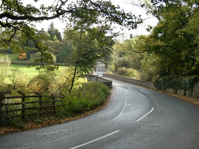
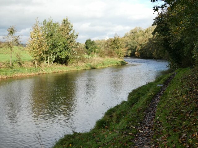
Clitheroe is a small market town located in the picturesque Ribble Valley district of Lancashire, England. Situated on the banks of the River Ribble, it is surrounded by rolling hills and beautiful countryside, making it a popular destination for nature lovers and outdoor enthusiasts.

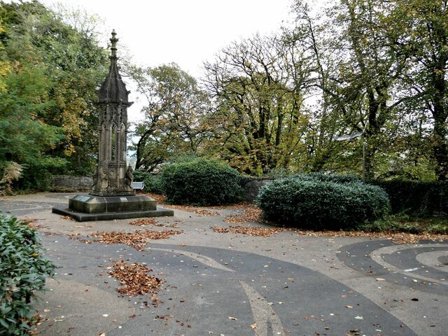
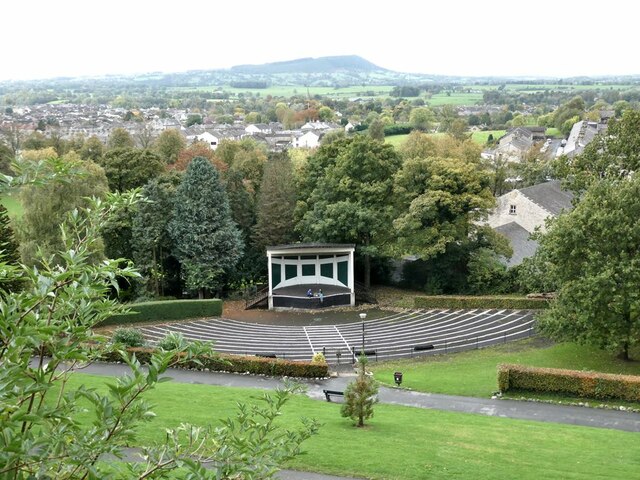
With a population of around 15,000, Clitheroe has a rich history dating back to the Roman era. It is home to several historic landmarks, including Clitheroe Castle, a medieval fortification that offers panoramic views of the town and the surrounding area. The castle is now a museum and hosts various events throughout the year.

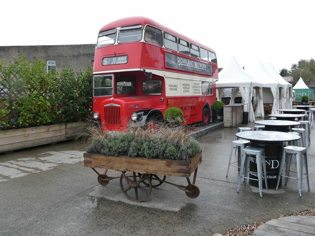
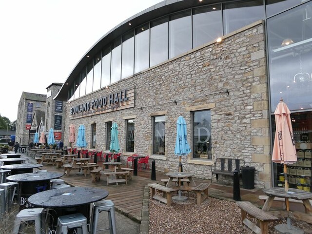
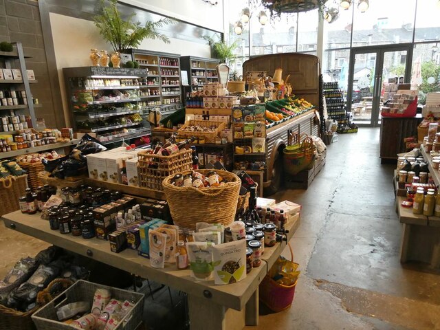
The town center of Clitheroe is characterized by its quaint streets lined with independent shops, boutiques, and cafes, making it a haven for shoppers seeking unique and locally sourced products. Market days, held on Tuesdays, Thursdays, and Saturdays, add to the vibrant atmosphere, where locals and visitors can browse a range of stalls selling fresh produce, clothing, and crafts.

Clitheroe is also known for its thriving arts scene, with several galleries and theaters showcasing local talent. The Grand Theatre, a restored Victorian building, hosts a variety of performances, including plays, musicals, and live music concerts.

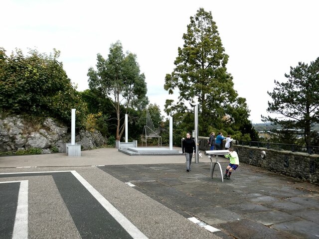
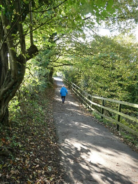
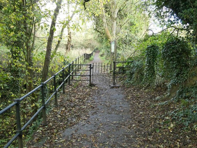
For those seeking outdoor pursuits, Clitheroe offers numerous walking and cycling routes, including the popular Ribble Way, which follows the course of the River Ribble. The surrounding countryside provides ample opportunities for hiking, birdwatching, and picnicking.

Overall, Clitheroe is a charming town that seamlessly blends history, culture, and natural beauty, making it an appealing destination for both residents and tourists alike.

If you have any feedback on the listing, please let us know in the comments section below.
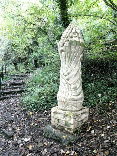
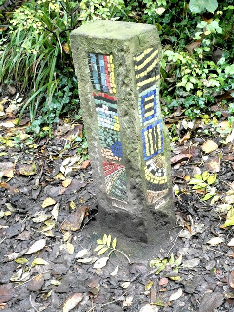
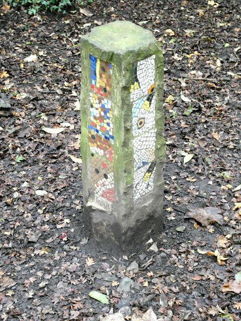
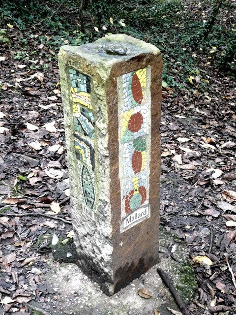
Clitheroe Images

Images are sourced within 2km of 53.874943/-2.387445 or Grid Reference SD7442. Thanks to Geograph Open Source API. All images are credited.

Brungerley Bridge The B6274 from Slaidburn to Clitheroe crosses the River Ribble.
Brungerley Bridge
The B6274 from Slaidburn to Clitheroe crosses the River Ribble.
"Alder Cone" Sculpture by Halima Cassell, one of the sculptures on the Ribble Valley Sculpture Trail. Dated 2009, this is one of the most recent sculptures on the Trail.
"Alder Cone"
Sculpture by Halima Cassell, one of the sculptures on the Ribble Valley Sculpture Trail. Dated 2009, this is one of the most recent sculptures on the Trail.
Bowland Brewery bus One of the attractions at the Holmes Mill retail development.
Bowland Brewery bus
One of the attractions at the Holmes Mill retail development.
Bowland Food Hall Part of the Holmes Mill retail development.
Bowland Food Hall
Part of the Holmes Mill retail development.
Inside the Bowland Food Hall Part of the Holmes Mill retail development.
Inside the Bowland Food Hall
Part of the Holmes Mill retail development.
The "Pinnacle" in Clitheroe Castle Park A panel close by describes how the monument was bought by Sir William Brass (MP for Clitheroe from 1922 to 1945) and transported from the Palace of Westminster, of which it was originally part, to Clitheroe Castle grounds to commemorate the Coronation of George VI in 1937. Other commemorative plaques have subsequently been added to the base. The Pinnacle underwent major restoration in 2014-2016.
The "Pinnacle" in Clitheroe Castle Park
A panel close by describes how the monument was bought by Sir William Brass (MP for Clitheroe from 1922 to 1945) and transported from the Palace of Westminster, of which it was originally part, to Clitheroe Castle grounds to commemorate the Coronation of George VI in 1937. Other commemorative plaques have subsequently been added to the base. The Pinnacle underwent major restoration in 2014-2016.
Creative Activity Space, Clitheroe Castle Some intriguing acoustic equipment installed in 2009 just below the Castle Keep.
Creative Activity Space, Clitheroe Castle
Some intriguing acoustic equipment installed in 2009 just below the Castle Keep.
Creative Activity Space, Clitheroe Castle An intriguing piece of acoustic equipment installed just below the Castle Keep.
Creative Activity Space, Clitheroe Castle
An intriguing piece of acoustic equipment installed just below the Castle Keep.
Band stand, Clitheroe Castle Park On the horizon, the eastern end of Longridge Fell <a href="https://www.geograph.org.uk/gridref/SD6840">SD6840</a>.
Band stand, Clitheroe Castle Park
On the horizon, the eastern end of Longridge Fell SD6840.
Clitheroe War Memorial Situated in the Clitheroe Castle Park. On the skyline, the distinctive outline of Pendle Hill <a href="https://www.geograph.org.uk/gridref/SD7941">SD7941</a>.
Clitheroe War Memorial
Situated in the Clitheroe Castle Park. On the skyline, the distinctive outline of Pendle Hill SD7941.
Fish mobile Sculpture by Julie Ann Seaman on the banks of the River Ribble, part of the Ribble Valley Sculpture Trail.
Fish mobile
Sculpture by Julie Ann Seaman on the banks of the River Ribble, part of the Ribble Valley Sculpture Trail.
River Ribble Looking upstream a short way above Brungerley Bridge.
River Ribble
Looking upstream a short way above Brungerley Bridge.
Path from Cross Hill Quarry to Brungerley Park The fence guards a long very steep drop down to the River Ribble.
Path from Cross Hill Quarry to Brungerley Park
The fence guards a long very steep drop down to the River Ribble.
"Lords and Ladies" Sculpture by Halima Cassell, one of the sculptures on the Ribble Valley Sculpture Trail. Dated 2009, this is one of the most recent sculptures on the Trail. It is constructed from over 100 intricately carved ceramic bricks and evokes the complex flower structure of the Lords and Ladies plant which can be found growing along the Trail.
"Lords and Ladies"
Sculpture by Halima Cassell, one of the sculptures on the Ribble Valley Sculpture Trail. Dated 2009, this is one of the most recent sculptures on the Trail. It is constructed from over 100 intricately carved ceramic bricks and evokes the complex flower structure of the Lords and Ladies plant which can be found growing along the Trail.
Mosaic Way Marker Sculpture by Paul Smith, one of three created in conjunction with Clitheroe school children through the Wildlife after School project. The four sides of the pillar each carry a mosaic representing examples of natural history to be found along this path; the two sides visible here depict Perch and Bee. Part of the Ribble Valley Sculpture Trail.
Mosaic Way Marker
Sculpture by Paul Smith, one of three created in conjunction with Clitheroe school children through the Wildlife after School project. The four sides of the pillar each carry a mosaic representing examples of natural history to be found along this path; the two sides visible here depict Perch and Bee. Part of the Ribble Valley Sculpture Trail.
Mosaic Way Marker Sculpture by Paul Smith, one of three created in conjunction with Clitheroe school children through the Wildlife after School project. The four sides of the pillar each carry a mosaic representing examples of natural history to be found along this path; the two sides visible here depict Trout and Heron. Part of the Ribble Valley Sculpture Trail.
Mosaic Way Marker
Sculpture by Paul Smith, one of three created in conjunction with Clitheroe school children through the Wildlife after School project. The four sides of the pillar each carry a mosaic representing examples of natural history to be found along this path; the two sides visible here depict Trout and Heron. Part of the Ribble Valley Sculpture Trail.
Mosaic Way Marker Sculpture by Paul Smith, one of three created in conjunction with Clitheroe school children through the Wildlife after School project. The four sides of the pillar each carry a mosaic representing examples of natural history to be found along this path; the two sides visible here depict Frog and Mallard. Part of the Ribble Valley Sculpture Trail.
Mosaic Way Marker
Sculpture by Paul Smith, one of three created in conjunction with Clitheroe school children through the Wildlife after School project. The four sides of the pillar each carry a mosaic representing examples of natural history to be found along this path; the two sides visible here depict Frog and Mallard. Part of the Ribble Valley Sculpture Trail.
Path past Cross Hill Quarry The railings protect the steep drop to the old quarry to the left.
Path past Cross Hill Quarry
The railings protect the steep drop to the old quarry to the left.
Show me another place!

Clitheroe is located at Grid Ref: SD7442 (Lat: 53.874943, Lng: -2.387445)

Administrative County: Lancashire

District: Ribble Valley

Police Authority: Lancashire

What 3 Words

///wasps.fortress.keepers. Near Clitheroe, Lancashire

Nearby Locations

Clitheroe Clitheroe

Related Wikis

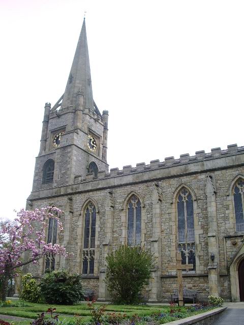
St Mary Magdalene's Church, Clitheroe

St Mary Magdalene's Church is located in Church Street, Clitheroe, Lancashire, England. It is the Anglican parish church of the town, and is in the deanery...

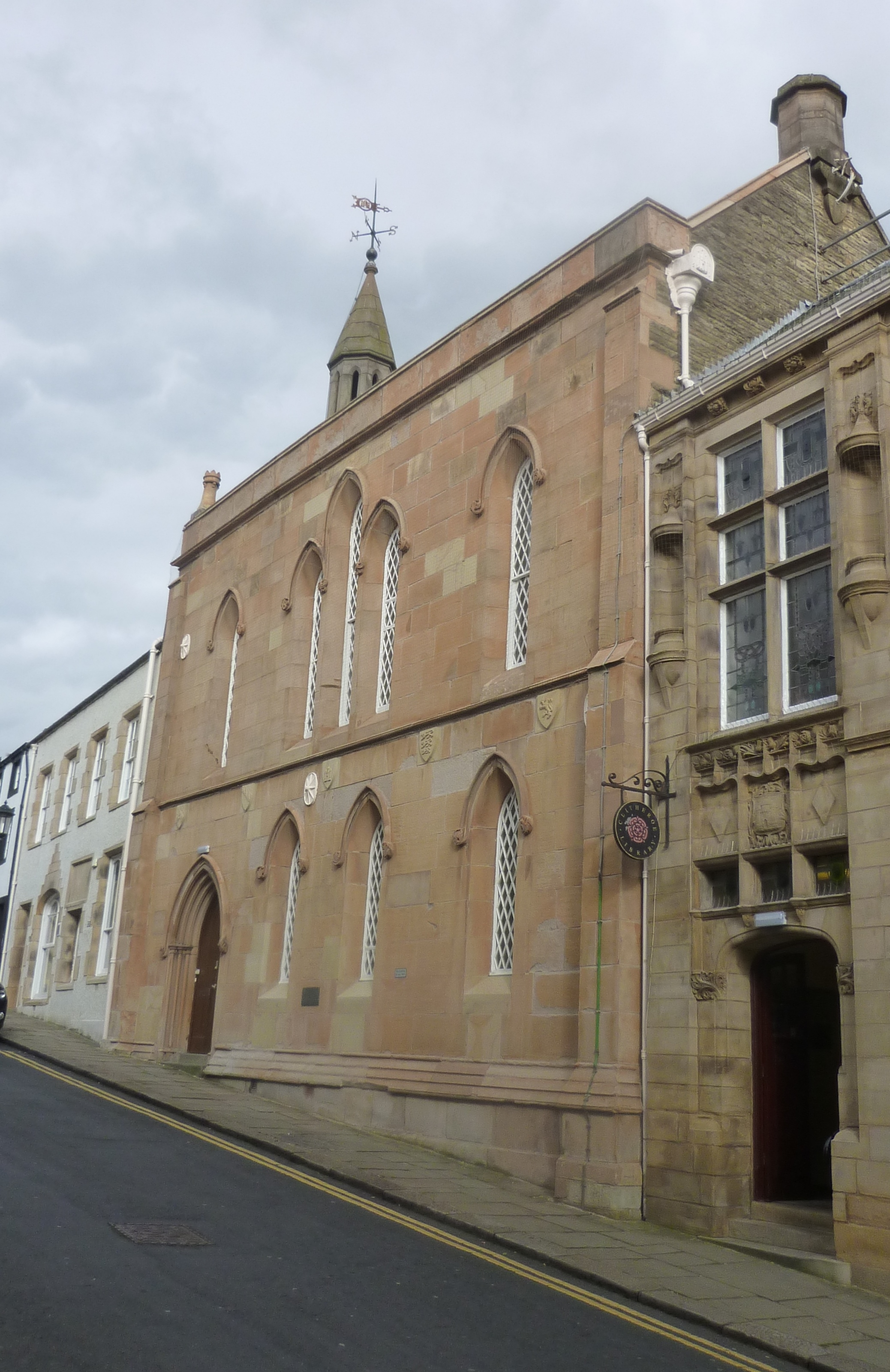
Old Town Hall, Clitheroe

The Old Town Hall, sometimes referred to as the Moot Hall, is a municipal building in Church Street, Clitheroe, Lancashire, England. The structure, which...

Clitheroe Library

Clitheroe Library is a Carnegie library in Clitheroe, Lancashire, England. It was opened in 1905. == History == The library was designed by the partnership...

Ribble Valley (UK Parliament constituency)

Ribble Valley is a constituency in Lancashire represented in the House of Commons of the UK Parliament since 1992 by Nigel Evans, a Conservative. Evans...

Nearby Amenities

Located within 500m of 53.874943,-2.387445
Clitheroe Interchange
Naptan AtcoCode: 9100CLITHRO
Railway: stop
Lat/Long: 53.8737488/-2.3943117
Clitheroe
Place: town
Population: 14765
Wikidata: Q1008765
Wikipedia: en:Clitheroe
Lat/Long: 53.8717465/-2.3926783
Mini Roundabout
Direction: clockwise
Lat/Long: 53.8734073/-2.3940262
Crossing
Crossing: marked
Crossing Markings: yes
Crossing Ref: zebra
Kerb: lowered
Tactile Paving: yes
Lat/Long: 53.8747405/-2.3876039
Mini Roundabout
Direction: clockwise
Lat/Long: 53.8714555/-2.3878415
Clitheroe Interchange
Bus: yes
Public Transport: stop_position
Lat/Long: 53.8743693/-2.3934011
Police
Clitheroe Police Station
Addr City: Clitheroe
Addr Postcode: BB7 2EU
Addr Street: King Street
Lat/Long: 53.8732068/-2.3933111
Dalbys Barbers
Shop: hairdresser
Lat/Long: 53.8731488/-2.3929862
Restaurant
The Apricot Meringue
Lat/Long: 53.8731332/-2.3926528
Townhall
Clitheroe Town Hall
Lat/Long: 53.8734147/-2.3915789
Pub
The White Lion
Lat/Long: 53.8728918/-2.391008
Bus Stop
Market Place
Bench: no
Bin: no
Bus: yes
Lit: no
Naptan AtcoCode: 25001248
Naptan NaptanCode: lanajdpg
Public Transport: platform
Shelter: no
Tactile Paving: no
Lat/Long: 53.8727378/-2.3910182
Disused Shop: yes
Lat/Long: 53.8729167/-2.3903159
Bank
Lloyds Bank
Atm: yes
Branch: Clitheroe Branch
Brand: Lloyds Bank
Brand Wikidata: Q1152847
Brand Wikipedia: en:Lloyds Bank
Contact Website: https://branches.lloydsbank.com/clitheroe/7-church-street
Operator: Lloyds Bank
Lat/Long: 53.873246/-2.3907678
Post Box
Collection Times: Mo-Fr 17:30; Sa 12:45
Post Box Design: type_g
Post Box Type: pillar
Ref: BB7 492
Royal Cypher: EIIR
Royal Cypher Wikidata: Q33102113
Lat/Long: 53.8727463/-2.3918491
Post Office
Clitheroe Post Office
Addr City: Clitheroe
Addr Housenumber: 1
Addr Postcode: BB7 2EN
Addr Street: King Street
Brand: Post Office
Brand Wikidata: Q1783168
Opening Hours: Mo-Fr 09:00-17:30; Sa 09:00-15:30
Ref Pol Id: 4183
Website: https://www.postoffice.co.uk/branch-finder/1664271/clitheroe
Wheelchair: yes
Lat/Long: 53.8727008/-2.3919039
Library
Clitheroe Library
Operator: Lancashire County Council
Operator Wikidata: Q6386149
Wikidata: Q21127516
Wikipedia: en:Clitheroe Library
Lat/Long: 53.8730672/-2.3905359
Post Box
Lat/Long: 53.8746889/-2.3799126
Turning Circle
Lat/Long: 53.8773969/-2.383281
Turning Circle
Lat/Long: 53.8775291/-2.3830486
Bus Stop
Bus: yes
Public Transport: platform
Lat/Long: 53.8770739/-2.3891167
Pedal Power
Landuse: retail
Shop: bicycle
Lat/Long: 53.8749802/-2.3904944
Noexit: yes
Lat/Long: 53.8770794/-2.3902351
Noexit: yes
Lat/Long: 53.8770864/-2.3861492
Bus Stop
Bus: yes
Public Transport: platform
Lat/Long: 53.8783518/-2.3880748
Bus Stop
Bus: yes
Naptan AtcoCode: 2500IMG2321
Naptan NaptanCode: langaptm
Public Transport: platform
Lat/Long: 53.8783888/-2.3878366
Post Box
Lat/Long: 53.8764912/-2.3945896
Post Box
Lat/Long: 53.8722485/-2.3891434
Post Box
Post Box Type: pillar
Lat/Long: 53.8747065/-2.3868682
Fuel
BP
Brand: BP
Brand Wikidata: Q152057
Brand Wikipedia: en:BP
Fuel Adblue: yes
Fuel Bp Ultimate Diesel: yes
Fuel Bp Ultimate Super: yes
Fuel Diesel: yes
Self Service: no
Lat/Long: 53.8750993/-2.3870185
Fire Station
Source: OS Streetview
Lat/Long: 53.87682/-2.3883954
Outdoor World
Shop: clothes
Lat/Long: 53.8727953/-2.3928295
Cafe
Blueberries
Lat/Long: 53.872719/-2.3930779
Dawsons
Shop: hardware
Lat/Long: 53.8734962/-2.3937
Disused Shop: yes
Lat/Long: 53.8724143/-2.391537
Defibrillator
Booth: K6
Covered: booth
Defibrillator Location: in red phone box, Market Place, Clitheroe
Disused Amenity: telephone
Emergency: defibrillator
Indoor: no
Listed Status: Grade II
Man Made: telephone_box
Operator: Clisteroe Town Council
Ref GB The Circuit: D23D7B5E-1112-4058-B447-AFC600D623C2
Lat/Long: 53.872555/-2.391098
Pub
Rose and Crown
Wheelchair: limited
Lat/Long: 53.8719783/-2.3920809
Banana News
Shop: newsagent
Wheelchair: limited
Lat/Long: 53.8719595/-2.391742
Pub
The Swan and Royal Hotel
Wheelchair: no
Lat/Long: 53.8720819/-2.3916359
WHSmith
Brand: WHSmith
Brand Wikidata: Q1548712
Brand Wikipedia: en:WHSmith
Shop: newsagent
Wheelchair: yes
Lat/Long: 53.8723285/-2.3916292
Cowmans
Shop: butcher
Wheelchair: limited
Lat/Long: 53.8717631/-2.3922044
Pharmacy
Boots
Brand: Boots
Brand Wikidata: Q6123139
Brand Wikipedia: en:Boots (company)
Healthcare: pharmacy
Website: https://www.boots.com/stores/1248-clitheroe-castle-street-bb7-2bt
Wheelchair: yes
Lat/Long: 53.8718517/-2.3921555
Telephone
Booth: K6
Covered: booth
Lat/Long: 53.8748921/-2.3877411
Thorougoods
Shop: convenience
Lat/Long: 53.8745759/-2.3870008
Pub
Royal Oak
Lat/Long: 53.8746265/-2.3865824
Fast Food
Evergreen Chip Shop
Lat/Long: 53.8744557/-2.3865395
Veterinary
Lat/Long: 53.8726276/-2.3869885
Bus Stop
Bus: yes
Public Transport: platform
Lat/Long: 53.876018/-2.3939429
Fast Food
The Chippy
Lat/Long: 53.8750439/-2.3910247
Fast Food
Ribble Tandoori
Lat/Long: 53.8749554/-2.3907887
Fast Food
Rumbletums
Lat/Long: 53.8752079/-2.3885379
The Barbers Shop
Shop: hairdresser
Lat/Long: 53.8732113/-2.3897751
Bus Stop
Bus: yes
Public Transport: platform
Lat/Long: 53.8735132/-2.3896493
Theatre
The Grand
Addr City: Clitheroe
Addr Housenumber: 18
Addr Postcode: BB7 2DL
Addr Street: York Street
Phone: +44 1200 421599
Website: https://www.thegrandvenue.co.uk/
Lat/Long: 53.873646/-2.3890645
Kelly Mitchell Hair
Female Signed: no
Male Signed: no
Shop: hairdresser
Lat/Long: 53.8726731/-2.3897735
Bar
The Parlour
Lat/Long: 53.8727162/-2.3899602
Cafe
Colborne House
Lat/Long: 53.8727863/-2.3901508
Bus Stop
King Street
Bench: no
Bin: no
Bus: yes
Lit: no
Public Transport: platform
Shelter: no
Tactile Paving: no
Lat/Long: 53.8726258/-2.391653
Pub
Buck Inn
Lat/Long: 53.8720125/-2.388925
Pub
The Dog
Operator: Stonegate
Operator Wikidata: Q7619176
Website: https://www.craftunionpubs.com/dog-and-partridge-clitheroe
Lat/Long: 53.8724236/-2.3889048
Cafe
Exchange Coffee
Lat/Long: 53.8724782/-2.3896936
Garays
Shop: hairdresser
Lat/Long: 53.8724477/-2.3896093
Alpes the Butchers
Shop: butcher
Lat/Long: 53.8706414/-2.3867739
Booth: K6
Removed Amenity: telephone
Lat/Long: 53.871209/-2.387142
Crossing
Crossing: uncontrolled
Crossing Ref: zebra
Kerb: lowered
Tactile Paving: yes
Lat/Long: 53.8729475/-2.3905588
Crossing
Barrier: kerb
Crossing: traffic_signals
Crossing Ref: puffin
Kerb: lowered
Tactile Paving: yes
Lat/Long: 53.8738519/-2.3870762
Crossing
Crossing: traffic_signals
Crossing Ref: pelican
Tactile Paving: yes
Lat/Long: 53.8711614/-2.3879629
Place Of Worship
The United Reformed Church
Denomination: united_reformed
Religion: christian
Lat/Long: 53.8711894/-2.3915592
Pub
Keystreet
Lat/Long: 53.8711876/-2.3909656
Horrocksford Junction
Railway: switch
Lat/Long: 53.8786023/-2.3881047
Post Box
Lat/Long: 53.8755561/-2.3891692
Waste Basket
Lat/Long: 53.8723833/-2.3891315
Doctors
Clitheroe Health Centre
No
Addr City: Clitheroe
Addr Postcode: BB7 2JG
Addr Street: Railway View Road
Emergency: no
Healthcare: doctor
Source: local knowledge
Lat/Long: 53.8738386/-2.3929782
Tourist Information
Source: local_knowledge
Tourism: information
Lat/Long: 53.8733835/-2.3943702
D Bryne
Shop: alcohol
Wheelchair: limited
Lat/Long: 53.8729041/-2.3917677
Railway: switch
Lat/Long: 53.8793572/-2.3872142
Clitheroe
Naptan AtcoCode: 9100CLITHRO
Railway: stop
Lat/Long: 53.8737332/-2.3942567
Post Box
Collection Times: Mo-Fr 17:30; Sa 12:45
Post Box Design: type_g
Post Box Type: pillar
Ref: BB7 493
Royal Cypher: EIIR
Royal Cypher Wikidata: Q33102113
Lat/Long: 53.8727604/-2.3918815
Crossing
Crossing: marked
Crossing Markings: yes
Kerb: lowered
Tactile Paving: yes
Lat/Long: 53.8723571/-2.3914682
Doctors
Pendleside Medical Practice
Healthcare: doctor
Name En: Pendleside Medical Practice
Lat/Long: 53.8739105/-2.3931243
Shop: optician
Wheelchair: no
Lat/Long: 53.8717143/-2.3922253
Mortimers
Office: estate_agent
Wheelchair: limited
Lat/Long: 53.8716018/-2.3923002
The Departure Lounge
Phone: +44 1200 422975
Shop: travel_agency
Wheelchair: limited
Lat/Long: 53.8715595/-2.3923405
Railway: switch
Lat/Long: 53.8784351/-2.3882874
Give Way
Direction: forward
Lat/Long: 53.8754742/-2.3921212
Clitheroe
Naptan AtcoCode: 9100CLITHRO
Network: National Rail
Network Website: https://www.nationalrail.co.uk/stations/clh/
Network Wikidata: Q26334
Operator: Northern
Operator Website: https://www.northernrailway.co.uk/stations/clitheroe
Operator Wikidata: Q85789775
Public Transport: station
Railway: station
Ref Crs: CLH
Train: yes
Wheelchair: yes
Wikidata: Q2195813
Wikipedia: en:Clitheroe railway station
Lat/Long: 53.8735624/-2.3944323
Crossing
Crossing: zebra
Kerb: lowered
Tactile Paving: yes
Lat/Long: 53.8737045/-2.3939549
Fast Food
CJ's Sandwich Shop
Cuisine: sandwich
Drive Through: no
Takeaway: only
Lat/Long: 53.8730394/-2.3908803
Cafe
Caffè Nero
Brand: Caffè Nero
Brand Wikidata: Q675808
Brand Wikipedia: en:Caffè Nero
Contact Website: https://caffenero.com/uk/store/clitheroe-478/
Cuisine: coffee_shop
Outdoor Seating: no
Takeaway: yes
Lat/Long: 53.8721159/-2.3918844
Cafe
Maxwell’s Cafe Wine Bar
Addr City: Clitheroe
Addr Housenumber: 54-55
Addr Postcode: BB7 2EU
Addr Street: King Street
Bar: yes
Diet Vegan: yes
Diet Vegetarian: yes
Internet Access: wlan
Internet Access Fee: no
Outdoor Seating: yes
Phone: +44 1200 443906
Smoking: outside
Website: http://www.maxwellscafebar.co.uk
Wheelchair: yes
Lat/Long: 53.8735429/-2.3939038
Pub
The Ale House
Addr City: Clitheroe
Addr Housenumber: 12-14
Addr Postcode: BB7 2DA
Addr Street: Market Place
Lat/Long: 53.872715/-2.3906669
Pub
Inn at the Station
Addr City: Clitheroe
Addr Postcode: BB7 2EU
Addr Street: King Street
Lat/Long: 53.8732754/-2.393813
Noexit: yes
Lat/Long: 53.8782737/-2.3858903
Generator Method: photovoltaic
Generator Output Electricity: yes
Generator Source: solar
Generator Type: solar_photovoltaic_panel
Location: roof
Power: generator
Lat/Long: 53.8710933/-2.3841957
Generator Method: photovoltaic
Generator Output Electricity: yes
Generator Source: solar
Generator Type: solar_photovoltaic_panel
Location: roof
Power: generator
Lat/Long: 53.8714152/-2.3837958
Generator Method: photovoltaic
Generator Output Electricity: yes
Generator Source: solar
Generator Type: solar_photovoltaic_panel
Location: roof
Power: generator
Lat/Long: 53.8784801/-2.3853934
Generator Method: photovoltaic
Generator Output Electricity: yes
Generator Source: solar
Generator Type: solar_photovoltaic_panel
Location: roof
Power: generator
Lat/Long: 53.8772358/-2.3831135
Generator Method: photovoltaic
Generator Output Electricity: yes
Generator Source: solar
Generator Type: solar_photovoltaic_panel
Location: roof
Power: generator
Lat/Long: 53.8771361/-2.3832395
Generator Method: photovoltaic
Generator Output Electricity: yes
Generator Source: solar
Generator Type: solar_photovoltaic_panel
Location: roof
Power: generator
Lat/Long: 53.877231/-2.383658
Generator Method: photovoltaic
Generator Output Electricity: yes
Generator Source: solar
Generator Type: solar_photovoltaic_panel
Location: roof
Power: generator
Lat/Long: 53.8772864/-2.3835936
Generator Method: photovoltaic
Generator Output Electricity: yes
Generator Source: solar
Generator Type: solar_photovoltaic_panel
Location: roof
Power: generator
Lat/Long: 53.8771551/-2.3837518
Generator Method: photovoltaic
Generator Output Electricity: yes
Generator Source: solar
Generator Type: solar_photovoltaic_panel
Location: roof
Power: generator
Lat/Long: 53.8770349/-2.3839503
Generator Method: photovoltaic
Generator Output Electricity: yes
Generator Source: solar
Generator Type: solar_photovoltaic_panel
Location: roof
Power: generator
Lat/Long: 53.8769891/-2.384004
Generator Method: photovoltaic
Generator Output Electricity: yes
Generator Source: solar
Generator Type: solar_photovoltaic_panel
Location: roof
Power: generator
Lat/Long: 53.8769195/-2.3841139
Generator Method: photovoltaic
Generator Output Electricity: yes
Generator Source: solar
Generator Type: solar_photovoltaic_panel
Location: roof
Power: generator
Lat/Long: 53.8768689/-2.3841756
Generator Method: photovoltaic
Generator Output Electricity: yes
Generator Source: solar
Generator Type: solar_photovoltaic_panel
Location: roof
Power: generator
Lat/Long: 53.8767677/-2.3842641
Generator Method: photovoltaic
Generator Output Electricity: yes
Generator Source: solar
Generator Type: solar_photovoltaic_panel
Location: roof
Power: generator
Lat/Long: 53.8767124/-2.3843205
Generator Method: photovoltaic
Generator Output Electricity: yes
Generator Source: solar
Generator Type: solar_photovoltaic_panel
Location: roof
Power: generator
Lat/Long: 53.8766428/-2.3844465
Generator Method: photovoltaic
Generator Output Electricity: yes
Generator Source: solar
Generator Type: solar_photovoltaic_panel
Location: roof
Power: generator
Lat/Long: 53.8765985/-2.3844975
Generator Method: photovoltaic
Generator Output Electricity: yes
Generator Source: solar
Generator Type: solar_photovoltaic_panel
Location: roof
Power: generator
Lat/Long: 53.8765036/-2.3845431
Generator Method: photovoltaic
Generator Output Electricity: yes
Generator Source: solar
Generator Type: solar_photovoltaic_panel
Location: roof
Power: generator
Lat/Long: 53.8764499/-2.3846182
Generator Method: photovoltaic
Generator Output Electricity: yes
Generator Source: solar
Generator Type: solar_photovoltaic_panel
Location: roof
Power: generator
Lat/Long: 53.8763809/-2.3847156
Generator Method: photovoltaic
Generator Output Electricity: yes
Generator Source: solar
Generator Type: solar_photovoltaic_panel
Location: roof
Power: generator
Lat/Long: 53.876325/-2.3847768
Generator Method: photovoltaic
Generator Output Electricity: yes
Generator Source: solar
Generator Type: solar_photovoltaic_panel
Location: roof
Power: generator
Lat/Long: 53.8762323/-2.3849065
Generator Method: photovoltaic
Generator Output Electricity: yes
Generator Source: solar
Generator Type: solar_photovoltaic_panel
Location: roof
Power: generator
Lat/Long: 53.8761618/-2.3844271
Generator Method: photovoltaic
Generator Output Electricity: yes
Generator Source: solar
Generator Type: solar_photovoltaic_panel
Location: roof
Power: generator
Lat/Long: 53.8762099/-2.3843411
Generator Method: photovoltaic
Generator Output Electricity: yes
Generator Source: solar
Generator Type: solar_photovoltaic_panel
Location: roof
Power: generator
Lat/Long: 53.8762941/-2.3842784
Generator Method: photovoltaic
Generator Output Electricity: yes
Generator Source: solar
Generator Type: solar_photovoltaic_panel
Location: roof
Power: generator
Lat/Long: 53.8763508/-2.3842128
Generator Method: photovoltaic
Generator Output Electricity: yes
Generator Source: solar
Generator Type: solar_photovoltaic_panel
Location: roof
Power: generator
Lat/Long: 53.8764049/-2.3840744
Generator Method: photovoltaic
Generator Output Electricity: yes
Generator Source: solar
Generator Type: solar_photovoltaic_panel
Location: roof
Power: generator
Lat/Long: 53.8764625/-2.3840015
Generator Method: photovoltaic
Generator Output Electricity: yes
Generator Source: solar
Generator Type: solar_photovoltaic_panel
Location: roof
Power: generator
Lat/Long: 53.876539/-2.383933
Generator Method: photovoltaic
Generator Output Electricity: yes
Generator Source: solar
Generator Type: solar_photovoltaic_panel
Location: roof
Power: generator
Lat/Long: 53.8765931/-2.3838733
Generator Method: photovoltaic
Generator Output Electricity: yes
Generator Source: solar
Generator Type: solar_photovoltaic_panel
Location: roof
Power: generator
Lat/Long: 53.8766885/-2.3837596
Generator Method: photovoltaic
Generator Output Electricity: yes
Generator Source: solar
Generator Type: solar_photovoltaic_panel
Location: roof
Power: generator
Lat/Long: 53.8765733/-2.3832014
Generator Method: photovoltaic
Generator Output Electricity: yes
Generator Source: solar
Generator Type: solar_photovoltaic_panel
Location: roof
Power: generator
Lat/Long: 53.8765098/-2.3833501
Generator Method: photovoltaic
Generator Output Electricity: yes
Generator Source: solar
Generator Type: solar_photovoltaic_panel
Location: roof
Power: generator
Lat/Long: 53.8764634/-2.383404
Generator Method: photovoltaic
Generator Output Electricity: yes
Generator Source: solar
Generator Type: solar_photovoltaic_panel
Location: roof
Power: generator
Lat/Long: 53.8763783/-2.3835133
Generator Method: photovoltaic
Generator Output Electricity: yes
Generator Source: solar
Generator Type: solar_photovoltaic_panel
Location: roof
Power: generator
Lat/Long: 53.8763233/-2.3835949
Generator Method: photovoltaic
Generator Output Electricity: yes
Generator Source: solar
Generator Type: solar_photovoltaic_panel
Location: roof
Power: generator
Lat/Long: 53.8761073/-2.3845837
Generator Method: photovoltaic
Generator Output Electricity: yes
Generator Source: solar
Generator Type: solar_photovoltaic_panel
Location: roof
Power: generator
Lat/Long: 53.8759349/-2.3844174
Generator Method: photovoltaic
Generator Output Electricity: yes
Generator Source: solar
Generator Type: solar_photovoltaic_panel
Location: roof
Power: generator
Lat/Long: 53.87578/-2.3847902
Generator Method: photovoltaic
Generator Output Electricity: yes
Generator Source: solar
Generator Type: solar_photovoltaic_panel
Location: roof
Power: generator
Lat/Long: 53.8759071/-2.3850856
Generator Method: photovoltaic
Generator Output Electricity: yes
Generator Source: solar
Generator Type: solar_photovoltaic_panel
Location: roof
Power: generator
Lat/Long: 53.8759349/-2.3851643
Generator Method: photovoltaic
Generator Output Electricity: yes
Generator Source: solar
Generator Type: solar_photovoltaic_panel
Location: roof
Power: generator
Lat/Long: 53.8760087/-2.3853469
Generator Method: photovoltaic
Generator Output Electricity: yes
Generator Source: solar
Generator Type: solar_photovoltaic_panel
Location: roof
Power: generator
Lat/Long: 53.8760487/-2.3854199
Generator Method: photovoltaic
Generator Output Electricity: yes
Generator Source: solar
Generator Type: solar_photovoltaic_panel
Location: roof
Power: generator
Lat/Long: 53.8758487/-2.3848799
Generator Method: photovoltaic
Generator Output Electricity: yes
Generator Source: solar
Generator Type: solar_photovoltaic_panel
Location: roof
Power: generator
Lat/Long: 53.8750505/-2.3851825
Generator Method: photovoltaic
Generator Output Electricity: yes
Generator Source: solar
Generator Type: solar_photovoltaic_panel
Location: roof
Power: generator
Lat/Long: 53.8749466/-2.3950296
Generator Method: photovoltaic
Generator Output Electricity: yes
Generator Source: solar
Generator Type: solar_photovoltaic_panel
Location: roof
Power: generator
Lat/Long: 53.8750312/-2.3949606
Generator Method: photovoltaic
Generator Output Electricity: yes
Generator Source: solar
Generator Type: solar_photovoltaic_panel
Location: roof
Power: generator
Lat/Long: 53.8751303/-2.3948669
Generator Method: photovoltaic
Generator Output Electricity: yes
Generator Source: solar
Generator Type: solar_photovoltaic_panel
Location: roof
Power: generator
Lat/Long: 53.8753921/-2.3949606
Generator Method: photovoltaic
Generator Output Electricity: yes
Generator Source: solar
Generator Type: solar_photovoltaic_panel
Location: roof
Power: generator
Lat/Long: 53.8753319/-2.3948145
Generator Method: photovoltaic
Generator Output Electricity: yes
Generator Source: solar
Generator Type: solar_photovoltaic_panel
Location: roof
Power: generator
Lat/Long: 53.8752734/-2.3946325
Generator Method: photovoltaic
Generator Output Electricity: yes
Generator Source: solar
Generator Type: solar_photovoltaic_panel
Location: roof
Power: generator
Lat/Long: 53.8777689/-2.3926034
Generator Method: photovoltaic
Generator Output Electricity: yes
Generator Source: solar
Generator Type: solar_photovoltaic_panel
Location: roof
Power: generator
Lat/Long: 53.8763869/-2.3912032
Generator Method: photovoltaic
Generator Output Electricity: yes
Generator Source: solar
Generator Type: solar_photovoltaic_panel
Location: roof
Power: generator
Lat/Long: 53.8784738/-2.3845058
Generator Method: photovoltaic
Generator Output Electricity: yes
Generator Source: solar
Generator Type: solar_photovoltaic_panel
Location: roof
Power: generator
Lat/Long: 53.8785141/-2.384483
Cafe
Chocolate Works
Lat/Long: 53.872374/-2.3912875
Clitheroe Foot Clinic
Healthcare: podiatrist
Lat/Long: 53.8715248/-2.392405
Edinburgh Woollen Mill
Check Date: 2020-07-18
Old Name: M&Co
Shop: clothes
Lat/Long: 53.8718942/-2.3918276
Nettleton Jewellers
Shop: jewelry
Lat/Long: 53.8718098/-2.3918866
Bodycare
Brand: Bodycare
Brand Wikidata: Q99938329
Shop: chemist
Lat/Long: 53.8717182/-2.3919649
Bus Stop
Lowergate
Bus: yes
Naptan AtcoCode: 25001247
Naptan NaptanCode: lanajdmp
Public Transport: platform
Lat/Long: 53.8717152/-2.3902056
Bus Stop
Tesco
Bus: yes
Naptan AtcoCode: 2500IMG2323
Naptan NaptanCode: langaptw
Public Transport: platform
Lat/Long: 53.8724015/-2.3880552
Bus Stop
Holden Street
Bus: yes
Public Transport: platform
Lat/Long: 53.8723106/-2.3875268
Bus Stop
Tesco
Bus: yes
Public Transport: platform
Lat/Long: 53.873454/-2.3873497
Bus Stop
BP Garage
Bus: yes
Naptan AtcoCode: 2500IMG2342
Naptan NaptanCode: langatdp
Public Transport: platform
Lat/Long: 53.8751586/-2.387158
Bus Stop
BP Garage
Bus: yes
Naptan AtcoCode: 2500IMG2343
Naptan NaptanCode: langatdt
Public Transport: platform
Lat/Long: 53.8751412/-2.3874188
Bus Stop
Well Terrace
Bus: yes
Naptan AtcoCode: 25001252
Naptan NaptanCode: lanajdwp
Public Transport: platform
Lat/Long: 53.875051/-2.3878822
Bus Stop
Well Terrace
Bus: yes
Naptan AtcoCode: 2500IMG2341
Naptan NaptanCode: langatdm
Public Transport: platform
Lat/Long: 53.8750629/-2.389062
Bus Stop
Clitheroe Interchange
Bus: yes
Local Ref: 10
Naptan AtcoCode: 2500IMG2337
Naptan NaptanCode: langataw
Public Transport: platform
Lat/Long: 53.8746114/-2.3931272
Bus Stop
Clitheroe Interchange
Bus: yes
Local Ref: 9
Naptan AtcoCode: 2500IMG2338
Naptan NaptanCode: langatda
Public Transport: platform
Lat/Long: 53.8747854/-2.3931983
Bus Stop
Clitheroe Interchange
Bus: yes
Local Ref: 6
Naptan AtcoCode: 2500IMG2339
Naptan NaptanCode: langatdg
Public Transport: platform
Lat/Long: 53.8745371/-2.3933579
Bus Stop
Clitheroe Interchange
Bus: yes
Local Ref: 5
Naptan AtcoCode: 2500IMG2340
Naptan NaptanCode: langatdj
Public Transport: platform
Lat/Long: 53.8743932/-2.3934893
Bus Stop
Clitheroe Interchange
Bus: yes
Local Ref: 4
Naptan AtcoCode: 2500DCL477
Naptan NaptanCode: landmapa
Public Transport: platform
Lat/Long: 53.8742525/-2.3936181
Bus Stop
Clitheroe Interchange
Bench: no
Bin: no
Bus: yes
Lit: no
Local Ref: 8
Public Transport: platform
Shelter: no
Tactile Paving: no
Lat/Long: 53.8733725/-2.3935913
Bus Stop
Clitheroe Interchange
Bench: no
Bin: no
Bus: yes
Lit: no
Local Ref: 7
Public Transport: platform
Shelter: no
Tactile Paving: no
Lat/Long: 53.8733432/-2.3938125
Bus Stop
Clitheroe Interchange
Bus: yes
Local Ref: 3
Public Transport: platform
Lat/Long: 53.8732859/-2.3943269
Give Way
Lat/Long: 53.8749741/-2.3875681
Give Way
Lat/Long: 53.8748229/-2.3875604
Give Way
Lat/Long: 53.8748002/-2.3872842
Give Way
Lat/Long: 53.8750128/-2.3872634
Pharmacy
Peter Buckley Pharmacy
Dispensing: yes
Healthcare: pharmacy
Lat/Long: 53.8732912/-2.3926598
Restaurant
Ice And Spice And All Things Nice
Lat/Long: 53.8730825/-2.3925686
Pharmacy
The Clitheroe Pharmacy
Dispensing: yes
Healthcare: pharmacy
Lat/Long: 53.873326/-2.392354
Fitright Footwear
Shop: shoes
Lat/Long: 53.8734494/-2.3924076
The Mens Room
Shop: hairdresser
Lat/Long: 53.8727615/-2.391612
Elan Boutique
Shop: clothes
Lat/Long: 53.8714062/-2.3920375
Bus Stop
Warwick Drive
Bus: yes
Naptan AtcoCode: 2500IMG2334
Naptan NaptanCode: langatam
Public Transport: platform
Lat/Long: 53.8775263/-2.3844469
Bus Stop
Warwick Drive
Bus: yes
Public Transport: platform
Lat/Long: 53.8777996/-2.3839299
Bus Stop
King Lane
Bus: yes
Naptan AtcoCode: 25001244
Naptan NaptanCode: lanajdgt
Public Transport: platform
Lat/Long: 53.872137/-2.3904088
Bus Stop
Peel Street
Bus: yes
Naptan AtcoCode: 2500IMG2327
Naptan NaptanCode: langapwj
Public Transport: platform
Lat/Long: 53.8710103/-2.3870748
Bus Stop
Hayhurst Street
Bus: yes
Public Transport: platform
Lat/Long: 53.8705955/-2.3863627
Harry Garlick the TV center
Shop: electronics
Lat/Long: 53.87316/-2.3921689
Brittons Jewellers
Shop: jewelry
Lat/Long: 53.8727393/-2.3905328
Timpson
Brand: Timpson
Brand Wikidata: Q7807658
Shop: shoe_repair
Lat/Long: 53.8723413/-2.3913425
The Footware Department Rieker
Shop: shoes
Lat/Long: 53.8715357/-2.3921321
Restaurant
Toms Table
Lat/Long: 53.8714869/-2.3918149
Rue5
Shop: jewelry
Lat/Long: 53.8729165/-2.3921797
Entrance: yes
Lat/Long: 53.8748247/-2.388562
Crossing
Crossing: marked
Crossing Markings: yes
Lat/Long: 53.8748595/-2.3881541
Entrance: yes
Lat/Long: 53.8746959/-2.3882151
Entrance: yes
Lat/Long: 53.8744807/-2.3882257
Bank
Skipton Building Society
Brand: Skipton Building Society
Brand Wikidata: Q16931747
Brand Wikipedia: en:Skipton Building Society
Lat/Long: 53.8727768/-2.3911212
Horrocksford Junction
Railway: junction
Lat/Long: 53.8789855/-2.3875944
Bicycle Parking
Bicycle Parking: stands
Capacity: 6
Covered: no
Lat/Long: 53.8732237/-2.3942052
Bench
Backrest: yes
Lat/Long: 53.8732216/-2.394257
Cafe
Bowland Bikes CIC
Addr City: Clitheroe
Addr Housename: Unit 5 Old Shawbridge Sawmill
Addr Postcode: BB7 1LY
Addr Street: Taylor Street
Bar: yes
Cuisine: coffee_shop;regional
Internet Access: yes
Internet Access Fee: customers
Phone: +44 1200 871271
Toilets: yes
Website: https://bowlandbikescic.co.uk/
Lat/Long: 53.8718641/-2.386984
Place Of Worship
The Salvation Army - Clitheroe
Addr City: Clitheroe
Addr Country: GB
Addr Housenumber: 31-31a
Addr Postcode: BB7 1AD
Addr Street: Lowergate
Religion: christian
Website: https://www.salvationarmy.org.uk/clitheroe
Lat/Long: 53.8719034/-2.3895156
Honeywells
Office: estate_agent
Lat/Long: 53.8714825/-2.3921344
Willows & Co
Shop: interior_decoration
Lat/Long: 53.8713709/-2.3919433
Abu Gypsy & Fig
Shop: hairdresser
Lat/Long: 53.8713271/-2.391892
Longitutde Art Gallery and Interiors
Tourism: gallery
Lat/Long: 53.8714045/-2.3916928
Three Wishes
Shop: confectionery
Lat/Long: 53.8715819/-2.3920994
Modern Mobility
Shop: yes
Lat/Long: 53.8716562/-2.3920242
Cancer Research UK
Brand: Cancer Research UK
Brand Wikidata: Q326079
Shop: charity
Lat/Long: 53.8717605/-2.3919388
Clitheroe Conservative Club
Club: yes
Lat/Long: 53.8720613/-2.3919693
Yads Barbers
Shop: hairdresser
Lat/Long: 53.8722255/-2.391766
Shop of Hope
Shop: yes
Lat/Long: 53.8722806/-2.3917132
Stansfields
Shop: deli
Lat/Long: 53.8723178/-2.3913838
Purdie Oak
Shop: gift
Lat/Long: 53.872301/-2.3914265
Disused Shop: yes
Lat/Long: 53.8721979/-2.3917965
Disused Shop: yes
Lat/Long: 53.8721728/-2.3918209
Disused Shop: yes
Lat/Long: 53.8716646/-2.3922762
Vareys Town and Country
Shop: country_store
Lat/Long: 53.8724724/-2.3910586
Valley Living
Shop: yes
Lat/Long: 53.8726797/-2.3912212
Cowgills of Clitheroe
Shop: toys
Lat/Long: 53.8726078/-2.3909285
Oxfam Bookshop
Brand: Oxfam Bookshop
Brand Wikidata: Q7115196
Second Hand: only
Shop: books
Lat/Long: 53.8726618/-2.3907984
Bar
EscCC
Lat/Long: 53.8726965/-2.3907293
Fast Food
Doe Bakehouse
Cuisine: donut
Lat/Long: 53.8728403/-2.3910647
Keenans
Office: estate_agent
Lat/Long: 53.8727301/-2.3904183
Your Style Boutique
Shop: clothes
Lat/Long: 53.8727025/-2.3903451
North West Barber co
Shop: hairdresser
Lat/Long: 53.872754/-2.3900422
Cafe
Brioche
Lat/Long: 53.872633/-2.3901947
Clitheroe Security
Shop: yes
Lat/Long: 53.8725982/-2.390089
Beryl's
Shop: shoes
Lat/Long: 53.8725791/-2.3900097
Hilton & Horsfall
Office: estate_agent
Lat/Long: 53.8725455/-2.3899243
Bar
Solos Late Night Bar
Lat/Long: 53.8725024/-2.3898471
Clitheroe Dry Cleaners
Shop: dry_cleaning
Lat/Long: 53.8726953/-2.3898634
Ooh la la Nails & Beauty
Beauty: nails
Shop: beauty
Lat/Long: 53.8724352/-2.3895381
Fast Food
Romero's Clitheroe
Lat/Long: 53.8725719/-2.3893958
The Flower Shop
Shop: florist
Lat/Long: 53.8725323/-2.3892495
Disused Shop: yes
Lat/Long: 53.8724724/-2.389093
Wellgate Fisheries
Shop: seafood
Lat/Long: 53.8722766/-2.3888771
Make do and Mend
Shop: yes
Lat/Long: 53.8722312/-2.3888062
Bar
Shawbridge
Lat/Long: 53.8719678/-2.3886891
Houldsworth Solicitors
Office: lawyer
Lat/Long: 53.8720713/-2.3885258
Clitheroe Country Furniture
Shop: furniture
Lat/Long: 53.8723783/-2.3883687
John Pallister Chartered Surveyors
Office: surveyor
Lat/Long: 53.8723629/-2.3879625
Philip Michael Hair Studio
Shop: hairdresser
Lat/Long: 53.8723139/-2.3880751
Preferential Treatment & The Modern School of Ancient Therapies
Shop: beauty
Lat/Long: 53.8722633/-2.3881932
Euronics
Shop: appliance
Lat/Long: 53.8722981/-2.3904006
William Hill
Brand: William Hill
Brand Wikidata: Q4053147
Shop: bookmaker
Lat/Long: 53.8722664/-2.391047
Steve the Cobbler
Shop: shoe_repair
Lat/Long: 53.8722253/-2.3909022
The Snip
Shop: hairdresser
Lat/Long: 53.8722048/-2.3908137
Bank
Marsden Building Society
Lat/Long: 53.8722088/-2.3915238
The Departure Lounge
Shop: travel_agency
Lat/Long: 53.8726768/-2.3914949
Sowerbutts
Shop: furniture
Lat/Long: 53.8728374/-2.3916799
Bar
SoBar
Lat/Long: 53.8727607/-2.3919889
Specsavers
Brand: Specsavers
Brand Wikidata: Q2000610
Shop: optician
Lat/Long: 53.8728254/-2.3920438
BoyleSports
Brand: BoyleSports
Brand Wikidata: Q56760280
Shop: bookmaker
Lat/Long: 53.8728709/-2.3920966
Seasons
Shop: clothes
Lat/Long: 53.8730088/-2.3919076
Althams Travel
Shop: travel_agency
Lat/Long: 53.8730663/-2.3919868
Kym Nails & Beauty
Beauty: nails
Shop: beauty
Lat/Long: 53.8728709/-2.3923141
Clitheroe Health Store
Shop: health_food
Lat/Long: 53.872817/-2.3924198
Clitheroe Wool Attic
Shop: yes
Lat/Long: 53.8727954/-2.3924666
Cafe
Secret Garden
Lat/Long: 53.8727607/-2.3925133
Bar
The Beer Shack
Lat/Long: 53.8731094/-2.3920641
The Bridal Lounge
Clothes: wedding
Shop: clothes
Lat/Long: 53.8731454/-2.3928284
Raffia
Shop: gift
Lat/Long: 53.8733323/-2.3928081
Perfect Fit
Clothes: underwear
Shop: clothes
Lat/Long: 53.8733491/-2.3928711
Hope
Shop: clothes
Lat/Long: 53.8733767/-2.3930012
Dr Sobia Medispa
Healthcare: yes
Lat/Long: 53.8733971/-2.3930866
Elise Hair
Shop: hairdresser
Lat/Long: 53.8734042/-2.3931862
The data included in this document is from www.openstreetmap.org. The data is made available under ODbL.

Have you been to Clitheroe?

Leave your review of Clitheroe below (or comments, questions and feedback).