Ansty

Settlement in Sussex Mid Sussex

England

Ansty

The village sign at Ansty Some relatively recent maps spell Ansty with an 'e' on the end.
The village sign at Ansty Credit: Marathon

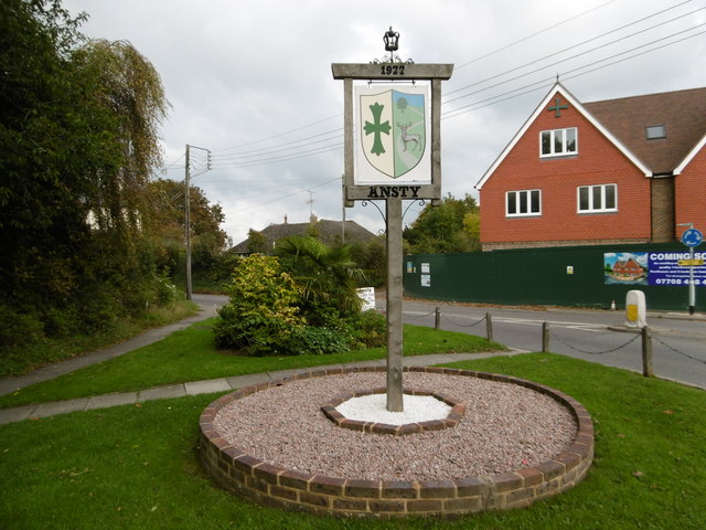
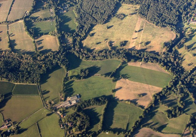
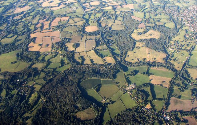
Ansty is a small village located in the county of Sussex, England. Situated approximately 10 miles northwest of the historic town of Lewes, Ansty is nestled amidst the picturesque South Downs National Park. The village covers an area of about one square mile and is home to a population of around 500 residents.

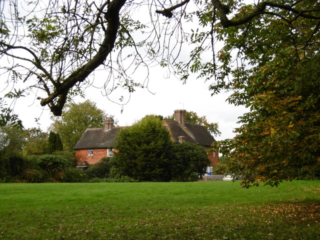
Ansty is known for its quaint charm and natural beauty. Surrounded by rolling hills and lush green countryside, the village offers breathtaking views and a tranquil atmosphere. The area is peppered with traditional English cottages and farmhouses, adding to its idyllic appeal.

The village itself boasts a few amenities for its residents and visitors. There is a local pub, The Ansty Arms, which serves as a gathering place for the community. Additionally, Ansty has a primary school, providing education for the village's children.

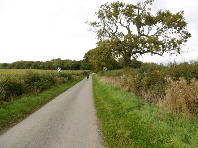
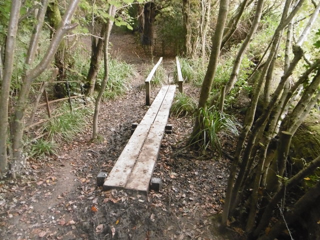
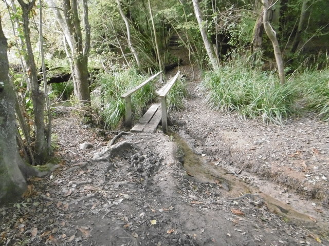
For outdoor enthusiasts, Ansty offers ample opportunities for exploration and recreation. The surrounding countryside is crisscrossed with walking paths and bridleways, allowing visitors to enjoy the stunning landscapes on foot, bike, or horseback. The nearby South Downs Way, a long-distance footpath, presents a chance for longer hikes and offers breathtaking views of the surrounding area.

Ansty's close proximity to Lewes provides residents with access to a wider range of amenities, including shops, restaurants, and cultural attractions. The village is also well-connected to other major towns and cities in the region, with good transport links via road and rail.

In summary, Ansty is a charming village nestled in the heart of the Sussex countryside. With its natural beauty, friendly community, and convenient location, it offers a peaceful retreat for both residents and visitors alike.

If you have any feedback on the listing, please let us know in the comments section below.
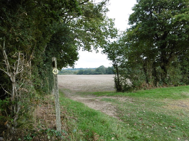
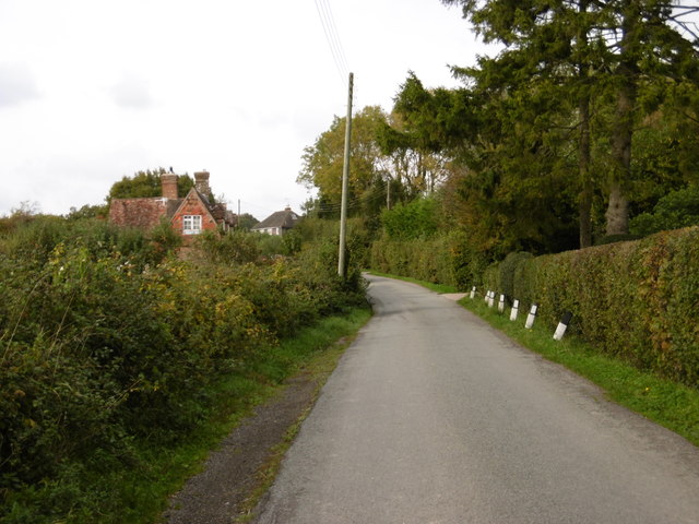
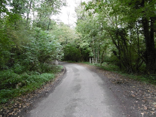
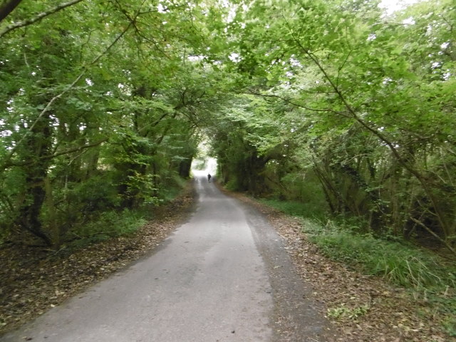
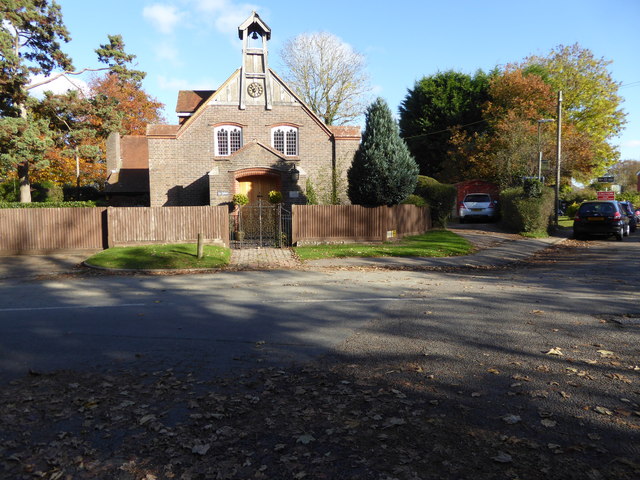
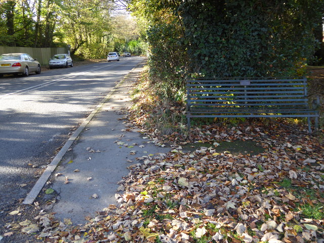
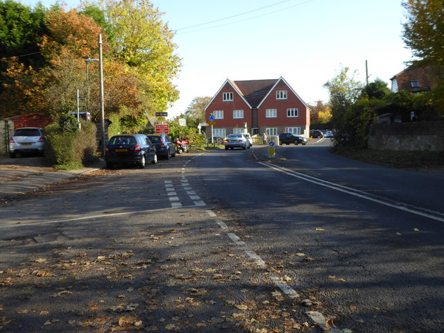
Ansty Images

Images are sourced within 2km of 50.993756/-0.162048 or Grid Reference TQ2923. Thanks to Geograph Open Source API. All images are credited.

The village sign at Ansty Some relatively recent maps spell Ansty with an 'e' on the end.
The village sign at Ansty
Some relatively recent maps spell Ansty with an 'e' on the end.
Deak's Lane Westup Wood is in the distance.
Deak's Lane
Westup Wood is in the distance.
The High Weald Landscape Trail The High Weald Landscape Trail heads away from Deak's Lane here on its way through Cuckfield Park to Cuckfield.
The High Weald Landscape Trail
The High Weald Landscape Trail heads away from Deak's Lane here on its way through Cuckfield Park to Cuckfield.
Cuckfield Park Cuckfield Park was built in 1574. This view from the High Weald Landscape Trail to the west of Cuckfield looks across Cuckfield Park.
Cuckfield Park
Cuckfield Park was built in 1574. This view from the High Weald Landscape Trail to the west of Cuckfield looks across Cuckfield Park.
House to the east of Ansty This fine house is seen from a footpath leading east from Ansty to Furnace Wood.
House to the east of Ansty
This fine house is seen from a footpath leading east from Ansty to Furnace Wood.
The footpath turns left here It then turns right again just beyond the hedge on the left before heading to Furnace Wood in the distance.
The footpath turns left here
It then turns right again just beyond the hedge on the left before heading to Furnace Wood in the distance.
Deak's Lane This is just north of Ansty before countryside is reached.
Deak's Lane
This is just north of Ansty before countryside is reached.
Deak's Lane Deak's Lane crosses a stream here as it passes through Westup Wood.
Deak's Lane
Deak's Lane crosses a stream here as it passes through Westup Wood.
Deak's Lane passing through Westup Wood Pondtail Cottage is just ahead after leaving Westup Wood.
Deak's Lane passing through Westup Wood
Pondtail Cottage is just ahead after leaving Westup Wood.
Can cats contact the Feline Advisory Bureau? I love the idea of cats contacting the Feline Advisory Bureau for advice on diet etc. A bit like a while back seeing a cat on its own go through the door of a pet shop in Sheerness.

This sign is in Deak's Lane
Can cats contact the Feline Advisory Bureau?
I love the idea of cats contacting the Feline Advisory Bureau for advice on diet etc. A bit like a while back seeing a cat on its own go through the door of a pet shop in Sheerness. This sign is in Deak's Lane
Footbridge on the High Weald Landscape Trail This is where the High Weald Landscape Trail crosses a stream in Walks Wood.
Footbridge on the High Weald Landscape Trail
This is where the High Weald Landscape Trail crosses a stream in Walks Wood.
Footbridge in Cuckfield Park Cuckfield Park was built in 1574. This is where the High Weald Landscape Trail crosses a stream in New England Wood. The stream opens out to form the lake in Cuckfield Park just to the right of the footbridge.
Footbridge in Cuckfield Park
Cuckfield Park was built in 1574. This is where the High Weald Landscape Trail crosses a stream in New England Wood. The stream opens out to form the lake in Cuckfield Park just to the right of the footbridge.
Footbridge in Cuckfield Park Cuckfield Park was built in 1574. This is where the High Weald Landscape Trail crosses a stream in New England Wood. The stream opens out to form the lake in Cuckfield Park just to the left of the footbridge.
Footbridge in Cuckfield Park
Cuckfield Park was built in 1574. This is where the High Weald Landscape Trail crosses a stream in New England Wood. The stream opens out to form the lake in Cuckfield Park just to the left of the footbridge.
Cuckfield Park from the air The park and two of its woods is at the upper part of the image; a tributary of the Adur crosses beneath it, with fields in the foreground, and Ansty Farm.
Cuckfield Park from the air
The park and two of its woods is at the upper part of the image; a tributary of the Adur crosses beneath it, with fields in the foreground, and Ansty Farm.
Winscot from the air The tiny hamlet of Winscot is at upper centre, with woods almost all around, and the High Weald Landscape Trail crosses the image through it.
Winscot from the air
The tiny hamlet of Winscot is at upper centre, with woods almost all around, and the High Weald Landscape Trail crosses the image through it.
"St John's" on Deak's Lane See <a title="https://www.geograph.org.uk/photo/4195839" href="https://www.geograph.org.uk/photo/4195839">Link</a> from 2014 for more information.
"St John's" on Deak's Lane
See Link from 2014 for more information.
Looking westwards on Bolney Road There is a commemorative bench in the foreground.
Looking westwards on Bolney Road
There is a commemorative bench in the foreground.
Houses at the mini roundabout in Ansty The road is the A272.  See <a title="https://www.geograph.org.uk/photo/4297403" href="https://www.geograph.org.uk/photo/4297403">Link</a> for information on the history of this site.  Both houses sport a green cross.
Houses at the mini roundabout in Ansty
The road is the A272. See Link for information on the history of this site. Both houses sport a green cross.
Show me another place!

Ansty is located at Grid Ref: TQ2923 (Lat: 50.993756, Lng: -0.162048)

Administrative County: West Sussex

District: Mid Sussex

Police Authority: Sussex

What 3 Words

///notes.parade.ending. Near Cuckfield, West Sussex

Nearby Locations

Ansty

Related Wikis

Ansty, West Sussex

Ansty is a village in the Mid Sussex district of West Sussex, England. It lies on the A272 road 1.4 miles (2.2 km) southwest of Cuckfield. It is in the...

Ansty and Staplefield

Ansty and Staplefield, previously Cuckfield Rural, is a civil parish in the Mid Sussex District of West Sussex, England, covering an area from the north...

Holy Trinity Church, Cuckfield

Holy Trinity Church is an Anglican church in the village of Cuckfield in the district of Mid Sussex; one of seven local government districts in the English...

Ockenden Manor

Ockenden Manor is located in Cuckfield, West Sussex, England. The building itself dates from 1520 and is operated as a hotel and restaurant by the Historic...

Whitemans Green

Whiteman's Green is a place in the north of the large village and civil parish of Cuckfield in the Mid Sussex District of West Sussex, England. It is located...

Cuckfield

Cuckfield ( KUUK-feeld) is a village and civil parish in the Mid Sussex District of West Sussex, England, on the southern slopes of the Weald. It lies...

Warden Park Secondary Academy

Warden Park Secondary Academy is a coeducational secondary school based in Cuckfield (near Haywards Heath), West Sussex, England. == Description == There...

Cuckfield & Lucastes (electoral division)

Cuckfield & Lucastes is an electoral division of West Sussex in England, and returns one member to sit on West Sussex County Council. == Extent == The...

Related Videos

6-second clip Visiting the Triberg/Black Forest & Cuckoo Clock shop

6-second clip Visiting the Black Forest & Cuckoo Clock. "Shop of a thousand Cuckoo Clocks" "Triberg, a holiday resort with its ...

Cuckfield Village - Drone Flight

Cuckfield is one of the prettiest villages in West Sussex, full of beautifully kept old buildings and with a really attractive main street.

Cute horses riding by Luke & Michael

More videos coming soon guys, stay tuned Thanks for watching.

Beech Hurst Park Miniature Railway (4k)

Beech Hurst Park is a railway nearly half a mile long. Superb collection of locos and very friendly. The park is a great place for all ...

Nearby Amenities

Located within 500m of 50.993756,-0.162048
Ansty
Place: village
Wikidata: Q4770795
Lat/Long: 50.9946092/-0.1613706
Mini Roundabout
Direction: clockwise
Lat/Long: 50.9945101/-0.1612739
Bus Stop
Ansty
Alt Name: Ifield Station
Bus: yes
Naptan AltCommonName: Ifield Station
Naptan AltStreet: Not Specified
Naptan AtcoCode: 4400EG0052
Naptan Bearing: W
Naptan CommonName: The Ansty Cross PH
Naptan Indicator: opp Deak's Lane
Naptan Landmark: Deaks Lane
Naptan NaptanCode: wsxampwt
Naptan Street: A272. Bolney Rd
Naptan Verified: yes
Note: rebuilt in Jan 2020. Moved slighlty Westwards
Public Transport: platform
Source: naptan_import
Lat/Long: 50.9943089/-0.1624983
Bus Stop
Ansty
Alt Name: Ifield Station
Bus: yes
Naptan AltCommonName: Ifield Station
Naptan AltStreet: Not Specified
Naptan AtcoCode: 4400EG0053
Naptan Bearing: E
Naptan CommonName: The Ansty Cross PH
Naptan Indicator: opp Ansty Cross PH
Naptan Landmark: Deaks Lane
Naptan NaptanCode: wsxamtad
Naptan Street: A272. Bolney Rd
Naptan Verified: yes
Note: rebuilt in Jan 2020
Public Transport: platform
Shelter: yes
Source: naptan_import
Lat/Long: 50.9946075/-0.1617614
Cuckfield Road A272
Naptan AtcoCode: 4400EG0364
Naptan Bearing: SW
Naptan BusStopType: CUS
Naptan CommonName: Cuckfield Road A272
Naptan Indicator: HAR
Naptan Landmark: Hail & Ride
Naptan NaptanCode: wsxdtjmp
Naptan Street: Cuckfield Road. A272
Naptan Verified: no
Source: naptan_import
Lat/Long: 50.997388/-0.1580015
A272 Cuckfield Road
Naptan AtcoCode: 4400EG0365
Naptan Bearing: NE
Naptan BusStopType: CUS
Naptan CommonName: A272 Cuckfield Road
Naptan Indicator: HAR
Naptan Landmark: Hail & Ride
Naptan NaptanCode: wsxdtjwp
Naptan Street: A272
Naptan Verified: no
Source: naptan_import
Lat/Long: 50.997468/-0.1581012
Shop: convenience
Lat/Long: 50.9941121/-0.1610704
Addr City: Haywards Heath
Addr Housename: West Riddens Cottages
Addr Postcode: RH17 5AG
Addr Street: Cuckfield Road
Addr Village: Ansty
Lat/Long: 50.9918978/-0.1599527
Addr City: Haywards Heath
Addr Housename: Green Cross Cottages
Addr Postcode: RH17 5AG
Addr Street: Cuckfield Road
Addr Village: Ansty
Lat/Long: 50.9931423/-0.1604691
Addr City: Haywards Heath
Addr Housename: West Hill Villas
Addr Postcode: RH17 5AF
Addr Street: Cuckfield Road
Addr Village: Ansty
Lat/Long: 50.9951934/-0.1609185
Addr City: Haywards Heath
Addr Housename: Rock Cottages
Addr Postcode: RH17 5AF
Addr Street: Cuckfield Road
Addr Village: Ansty
Lat/Long: 50.9948485/-0.1614151
Addr City: Haywards Heath
Addr Housename: Lavender Cottages
Addr Postcode: RH17 5AS
Addr Street: Deaks Lane
Addr Village: Ansty
Lat/Long: 50.9958629/-0.163766
Addr City: Haywards Heath
Addr Housename: North Cottages
Addr Postcode: RH17 5AG
Addr Street: Cuckfield Road
Addr Village: Ansty
Lat/Long: 50.9930678/-0.161544
Addr City: Ansty
Addr Housename: Old Cottage
Addr Postcode: RH17 5AG
Addr Street: Cuckfield Road
Lat/Long: 50.994446/-0.1616403
Addr City: Haywards Heath
Addr Housename: Jubilee Cottages
Addr Postcode: RH17 5AW
Addr Street: Bolney Road
Addr Village: Ansty
Lat/Long: 50.9924936/-0.1672958
Bench
Colour: green
Material: metal
Lat/Long: 50.9945304/-0.1621449
Traffic Calming: island
Lat/Long: 50.9945475/-0.1615627
Post Box
Brand: Royal Mail
Brand Wikidata: Q638098
Brand Wikipedia: en:Royal Mail
Collection Times: Mo-Fr 17:00; Sa 09:30
Operator: Royal Mail
Operator Wikidata: Q638098
Post Box Type: lamp
Ref: RH17 60
Royal Cypher: EIIR
Royal Cypher Wikidata: Q33102113
Lat/Long: 50.9942422/-0.1612058
Power: pole
Lat/Long: 50.9974787/-0.1589651
Power: pole
Lat/Long: 50.9953728/-0.1570514
Power: pole
Lat/Long: 50.9960734/-0.1581484
Bar
Lat/Long: 50.995258/-0.1619196
Power: pole
Lat/Long: 50.996641/-0.1590423
Waste Basket
Lat/Long: 50.9948788/-0.1620403
The data included in this document is from www.openstreetmap.org. The data is made available under ODbL.

Have you been to Ansty?

Leave your review of Ansty below (or comments, questions and feedback).