Clipstone

Settlement in Bedfordshire

England

Clipstone

Leighton Buzzard: Narrow gauge railway The railway was originally built in 1919 to carry sand from nearby quarries to the now dismantled Leighton Buzzard to Dunstable standard gauge railway line close to Page's Park. It closed as an industrial line in 1969, but was taken over by volunteers to be run as a heritage railway. The railway has a very informative website here <span class="nowrap"><a title="http://www.buzzrail.co.uk/" rel="nofollow ugc noopener" href="http://www.buzzrail.co.uk/">Link</a><img style="margin-left:2px;" alt="External link" title="External link - shift click to open in new window" src="https://s1.geograph.org.uk/img/external.png" width="10" height="10"/></span> A light dusting of snow covers the ground in this view, taken looking north westwards where the railway runs parallel to the road called Meadway on the left. The brick walls are the parapets of the railway bridge over Clipstone Brook, a tributary of the River Ouzel.
Leighton Buzzard: Narrow gauge railway Credit: Nigel Cox

Clipstone is a small village located in the county of Bedfordshire, England. Situated approximately 3 miles southeast of Leighton Buzzard, it is surrounded by picturesque countryside and is known for its rural charm. The village is part of the Central Bedfordshire district and falls within the parliamentary constituency of South West Bedfordshire.

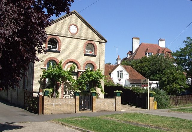
Clipstone is a close-knit community with a population of around 500 residents. It boasts a mix of traditional cottages and more modern housing, creating an appealing blend of architectural styles. The village is well-maintained, with neat gardens and well-kept streets adding to its overall charm.

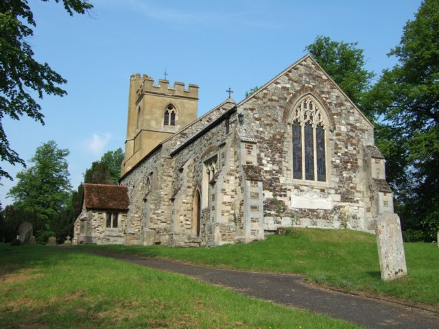
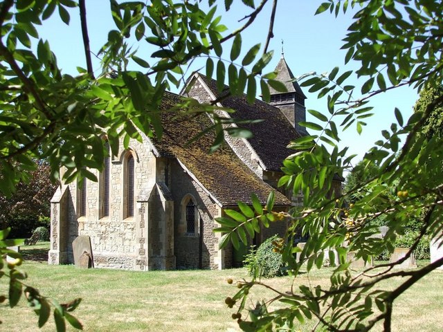
A notable feature of Clipstone is its village church, St. Mary's Church, which dates back to the 12th century. This historic building is a focal point for the community and holds regular services and events. The churchyard is also home to a number of ancient gravestones, providing a glimpse into the village's rich history.

Despite being a small village, Clipstone offers a range of amenities for its residents. These include a local primary school, a village hall, and a post office. The surrounding countryside provides ample opportunities for outdoor activities such as walking, cycling, and horse riding.

In summary, Clipstone is a charming village in Bedfordshire, characterized by its rural setting, historic church, and close-knit community. With its range of amenities and picturesque surroundings, it offers a peaceful and idyllic lifestyle for its residents.

If you have any feedback on the listing, please let us know in the comments section below.
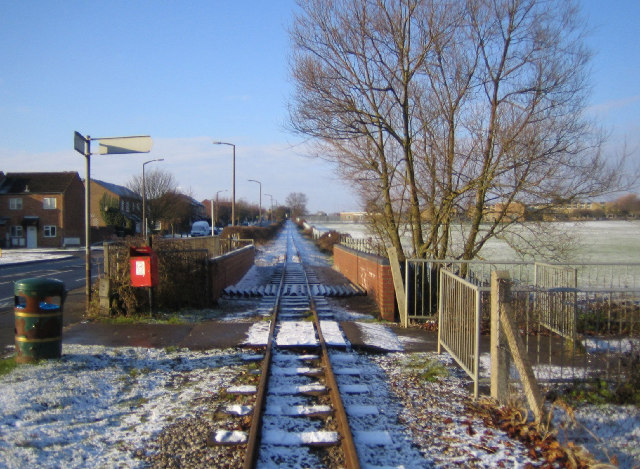
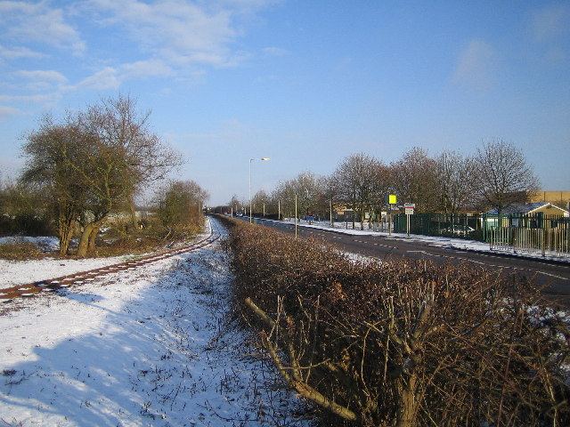
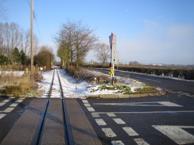
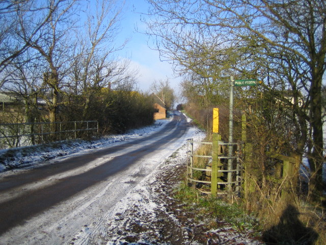
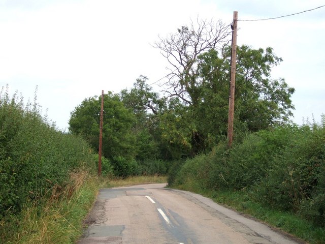
Clipstone Images

Images are sourced within 2km of 51.926943/-0.623757 or Grid Reference SP9426. Thanks to Geograph Open Source API. All images are credited.

Leighton Buzzard: Narrow gauge railway The railway was originally built in 1919 to carry sand from nearby quarries to the now dismantled Leighton Buzzard to Dunstable standard gauge railway line close to Page's Park. It closed as an industrial line in 1969, but was taken over by volunteers to be run as a heritage railway. The railway has a very informative website here <span class="nowrap"><a title="http://www.buzzrail.co.uk/" rel="nofollow ugc noopener" href="http://www.buzzrail.co.uk/">Link</a><img style="margin-left:2px;" alt="External link" title="External link - shift click to open in new window" src="https://s1.geograph.org.uk/img/external.png" width="10" height="10"/></span> A light dusting of snow covers the ground in this view, taken looking north westwards where the railway runs parallel to the road called Meadway on the left. The brick walls are the parapets of the railway bridge over Clipstone Brook, a tributary of the River Ouzel.
Leighton Buzzard: Narrow gauge railway
The railway was originally built in 1919 to carry sand from nearby quarries to the now dismantled Leighton Buzzard to Dunstable standard gauge railway line close to Page's Park. It closed as an industrial line in 1969, but was taken over by volunteers to be run as a heritage railway. The railway has a very informative website here LinkExternal link A light dusting of snow covers the ground in this view, taken looking north westwards where the railway runs parallel to the road called Meadway on the left. The brick walls are the parapets of the railway bridge over Clipstone Brook, a tributary of the River Ouzel.
Leighton Buzzard: Narrow gauge railway The railway was originally built in 1919 to carry sand from nearby quarries to the now dismantled Leighton Buzzard to Dunstable standard gauge railway line close to Page's Park. It closed as an industrial line in 1969, but was taken over by volunteers to be run as a heritage railway. The railway has a very informative website here <span class="nowrap"><a title="http://www.buzzrail.co.uk/" rel="nofollow ugc noopener" href="http://www.buzzrail.co.uk/">Link</a><img style="margin-left:2px;" alt="External link" title="External link - shift click to open in new window" src="https://s1.geograph.org.uk/img/external.png" width="10" height="10"/></span> Viewed looking north eastwards, the railway runs parallel to Vandyke Road here. The buildings of Vandyke Upper School are visible on the right of the road. The School's website is here <span class="nowrap"><a title="http://www.vandyke.beds.sch.uk/" rel="nofollow ugc noopener" href="http://www.vandyke.beds.sch.uk/">Link</a><img style="margin-left:2px;" alt="External link" title="External link - shift click to open in new window" src="https://s1.geograph.org.uk/img/external.png" width="10" height="10"/></span>
Leighton Buzzard: Narrow gauge railway
The railway was originally built in 1919 to carry sand from nearby quarries to the now dismantled Leighton Buzzard to Dunstable standard gauge railway line close to Page's Park. It closed as an industrial line in 1969, but was taken over by volunteers to be run as a heritage railway. The railway has a very informative website here LinkExternal link Viewed looking north eastwards, the railway runs parallel to Vandyke Road here. The buildings of Vandyke Upper School are visible on the right of the road. The School's website is here LinkExternal link
Leighton Buzzard: Narrow gauge railway The railway was originally built in 1919 to carry sand from nearby quarries to the now dismantled Leighton Buzzard to Dunstable standard gauge railway line close to Page's Park. It closed as an industrial line in 1969, but was taken over by volunteers to be run as a heritage railway. The railway has a very informative website here <span class="nowrap"><a title="http://www.buzzrail.co.uk/" rel="nofollow ugc noopener" href="http://www.buzzrail.co.uk/">Link</a><img style="margin-left:2px;" alt="External link" title="External link - shift click to open in new window" src="https://s1.geograph.org.uk/img/external.png" width="10" height="10"/></span> This view was taken, with a light dusting of snow on the ground, looking north eastwards across the Shenley Hill Road level crossing, with Mile Tree Road running parallel to the railway to the right.
Leighton Buzzard: Narrow gauge railway
The railway was originally built in 1919 to carry sand from nearby quarries to the now dismantled Leighton Buzzard to Dunstable standard gauge railway line close to Page's Park. It closed as an industrial line in 1969, but was taken over by volunteers to be run as a heritage railway. The railway has a very informative website here LinkExternal link This view was taken, with a light dusting of snow on the ground, looking north eastwards across the Shenley Hill Road level crossing, with Mile Tree Road running parallel to the railway to the right.
Leighton Buzzard: Clipstone Viewed looking north from the bridge over Clipstone Brook towards Clipstone.
Leighton Buzzard: Clipstone
Viewed looking north from the bridge over Clipstone Brook towards Clipstone.
Leighton Buzzard: Narrow gauge railway Stonehenge Works on the railway viewed looking southwards with Mile Tree Road on the left. This is the current northern terminus of the railway although the track does continue for about another 500 metres northwards. The railway was originally built in 1919 to carry sand from nearby quarries to the now dismantled Leighton Buzzard to Dunstable standard gauge railway line close to Page's Park. It closed as an industrial line in 1969, but was taken over by volunteers to be run as a heritage railway. The railway has a very informative website here <span class="nowrap"><a title="http://www.buzzrail.co.uk/" rel="nofollow ugc noopener" href="http://www.buzzrail.co.uk/">Link</a><img style="margin-left:2px;" alt="External link" title="External link - shift click to open in new window" src="https://s1.geograph.org.uk/img/external.png" width="10" height="10"/></span>
Leighton Buzzard: Narrow gauge railway
Stonehenge Works on the railway viewed looking southwards with Mile Tree Road on the left. This is the current northern terminus of the railway although the track does continue for about another 500 metres northwards. The railway was originally built in 1919 to carry sand from nearby quarries to the now dismantled Leighton Buzzard to Dunstable standard gauge railway line close to Page's Park. It closed as an industrial line in 1969, but was taken over by volunteers to be run as a heritage railway. The railway has a very informative website here LinkExternal link
St. Nicholas, Church End, Hockliffe Church End is a lovely quiet backwater of Hockliffe. Most of the village sprawls along the very busy A5 Watling Street, but this part of the village seems miles from hectic activity.
St. Nicholas, Church End, Hockliffe
Church End is a lovely quiet backwater of Hockliffe. Most of the village sprawls along the very busy A5 Watling Street, but this part of the village seems miles from hectic activity.
Hockliffe Grange Peeping over the trees which surround it, this is about the best view you can get of Hockliffe Grange, taken from the lane that approaches it from the church.
Hockliffe Grange
Peeping over the trees which surround it, this is about the best view you can get of Hockliffe Grange, taken from the lane that approaches it from the church.
Ground Farm, Hockliffe The road from the church out to this farm gradually deteriorates until it becomes a muddy track with grass in the middle. It then improves a little just before you reach this farm. The area the farm is in is called "Hockliffe Grounds" hence the name of the farm.
Ground Farm, Hockliffe
The road from the church out to this farm gradually deteriorates until it becomes a muddy track with grass in the middle. It then improves a little just before you reach this farm. The area the farm is in is called "Hockliffe Grounds" hence the name of the farm.
Church End, Hockliffe As it says on the sign. The eponymous church is <a href="https://www.geograph.org.uk/photo/182708">SP9626 : St. Nicholas, Church End, Hockliffe</a>
Church End, Hockliffe
As it says on the sign. The eponymous church is SP9626 : St. Nicholas, Church End, Hockliffe
Church Lane, Church End, Hockliffe This is the view back roughly southwards down Church Lane from near the lane junction at Church End. Note: The map shows this lane as Goose Green, but I'm pretty sure its street nameplate said Church Lane.
Church Lane, Church End, Hockliffe
This is the view back roughly southwards down Church Lane from near the lane junction at Church End. Note: The map shows this lane as Goose Green, but I'm pretty sure its street nameplate said Church Lane.
Steps & churchyard Steps illuminated with dappled light lead into the churchyard of <a href="https://www.geograph.org.uk/photo/182708">SP9626 : St. Nicholas, Church End, Hockliffe</a>
Steps & churchyard
Steps illuminated with dappled light lead into the churchyard of SP9626 : St. Nicholas, Church End, Hockliffe
Hockliffe Grounds Looking back down the track to Grounds Farm, Hockliffe. Just beyond this bend was a quite deep, very muddy puddle straddling the whole track.
Hockliffe Grounds
Looking back down the track to Grounds Farm, Hockliffe. Just beyond this bend was a quite deep, very muddy puddle straddling the whole track.
Track to Grange Farm, Hockliffe This track leads to Grange Farm, Hockliffe. It strikes off at 90º from a 90º bend in the main lane, therefore effectively being a straight continuation of one limb of that lane.
Track to Grange Farm, Hockliffe
This track leads to Grange Farm, Hockliffe. It strikes off at 90º from a 90º bend in the main lane, therefore effectively being a straight continuation of one limb of that lane.
Cricket Ground, Eggington Taken from a track that runs between the cricket ground and the grounds of Eggington House.
Cricket Ground, Eggington
Taken from a track that runs between the cricket ground and the grounds of Eggington House.
St. Michaels, Eggington Strangely this charming little church in the lovely village of Eggington doesn't seem to be marked on the current 1:25000 maps - though it is shown on the 1:50000 scale ones.
St. Michaels, Eggington
Strangely this charming little church in the lovely village of Eggington doesn't seem to be marked on the current 1:25000 maps - though it is shown on the 1:50000 scale ones.
Eggington - Village Houses The nearest of these buildings was originally a Wesleyan Chapel which the circular plaque informs us was enlarged in 1867. The large building in background is now a residential nursing home. So while one public building has become a private home, a private home two doors away has made the opposite transition.
Eggington - Village Houses
The nearest of these buildings was originally a Wesleyan Chapel which the circular plaque informs us was enlarged in 1867. The large building in background is now a residential nursing home. So while one public building has become a private home, a private home two doors away has made the opposite transition.
Vehicle Testing Station This Department of Transport Vehicle Testing Station is just to the east of Leighton Buzzard and seems to specialise in testing lorries. It looked to be doing brisk business when I took this shot.
Vehicle Testing Station
This Department of Transport Vehicle Testing Station is just to the east of Leighton Buzzard and seems to specialise in testing lorries. It looked to be doing brisk business when I took this shot.
Lane to Clipstone This lane leaves the A4012 on a bend, this is just down the lane from that junction just before a double 90º bend in the lane.
Lane to Clipstone
This lane leaves the A4012 on a bend, this is just down the lane from that junction just before a double 90º bend in the lane.
Show me another place!

Clipstone is located at Grid Ref: SP9426 (Lat: 51.926943, Lng: -0.623757)

Unitary Authority: Central Bedfordshire

Police Authority: Bedfordshire

What 3 Words

///coughed.bake.detonated. Near Leighton Buzzard, Bedfordshire

Nearby Locations

Clipstone

Related Wikis

Clipstone, Bedfordshire

Clipstone is a small hamlet in Bedfordshire, England. It lies within the parish of Eggington that borders with Leighton Buzzard, Heath and Reach and Hockliffe...
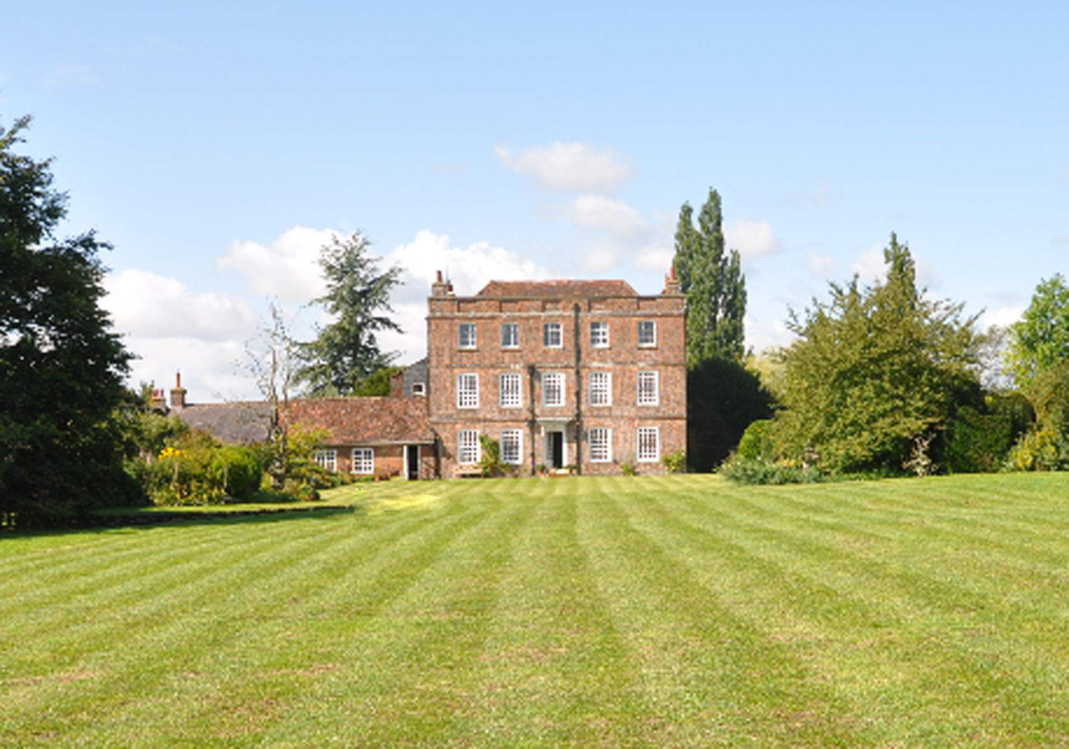
Eggington House

Eggington House is the manor house of the village of Eggington situated near Leighton Buzzard, Bedfordshire, England. The house is regarded as a very...

Eggington

Egginton – or Eggington as it is now known – is a village and civil parish in the Central Bedfordshire district of Bedfordshire, England, about three miles...
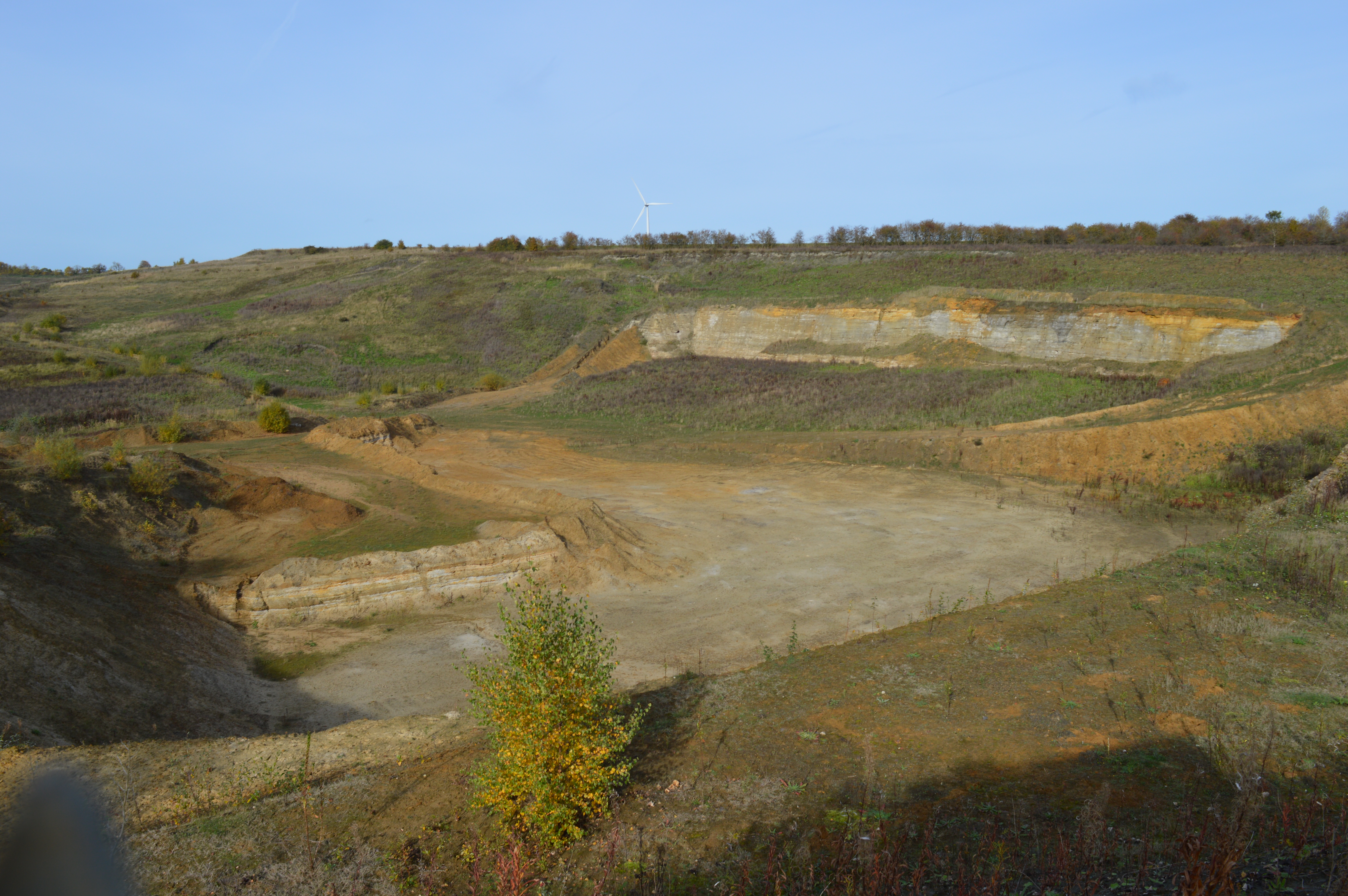
Nine Acres Pit

Nine Acres Pit is a 20.7-hectare (51-acre) geological Site of Special Scientific Importance north-east of Leighton Buzzard in Bedfordshire. It was notified...

Nearby Amenities

Located within 500m of 51.926943,-0.623757
Clipstone
Place: hamlet
Wikidata: Q1521901
Lat/Long: 51.9269172/-0.6224106
The data included in this document is from www.openstreetmap.org. The data is made available under ODbL.

Have you been to Clipstone?

Leave your review of Clipstone below (or comments, questions and feedback).