Clints

Settlement in Yorkshire Richmondshire

England

Clints

Stile near Downholme Bridge The stile gives walkers access to the footpath that takes them initially beside the River Swale before heading west towards Cat Bank and Marske.
Stile near Downholme Bridge Credit: Maigheach-gheal

Clints is a small village located in the picturesque county of Yorkshire, England. Situated in the North York Moors National Park, it offers breathtaking views of the surrounding countryside and provides an idyllic setting for nature enthusiasts and outdoor lovers alike.

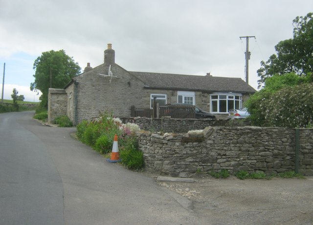
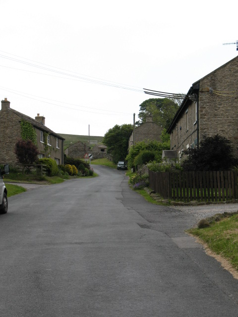
The village is characterized by its charming stone houses and traditional architecture, reflecting the area's rich history and heritage. With a population of around 200 residents, Clints exudes a tight-knit and friendly community atmosphere. The residents mainly rely on agriculture and tourism for their livelihoods, making it a peaceful and serene place to visit or reside.

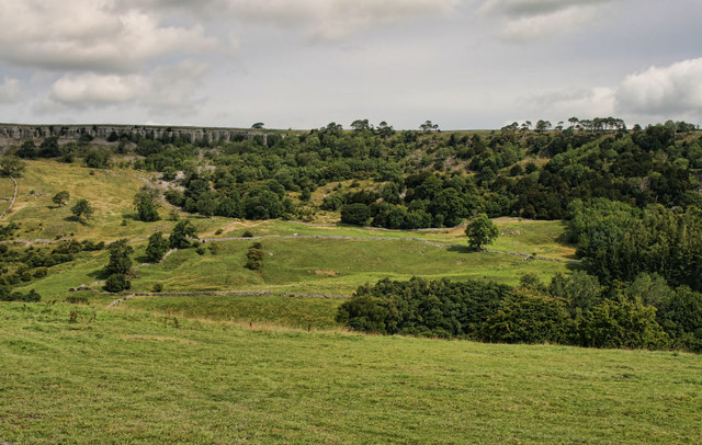
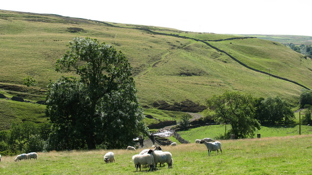
Clints is renowned for its natural beauty, with numerous walking trails and cycling routes that showcase the stunning moorland scenery. The nearby Clints Wood is a popular spot for hikers, offering enchanting woodland walks and the opportunity to spot local wildlife, including deer and various bird species.

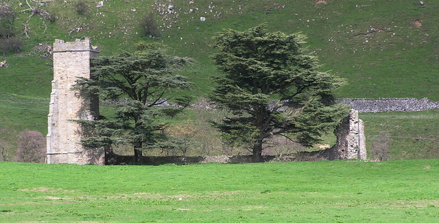
For those interested in history, Clints boasts several historical sites, such as the medieval St. Mary's Church, which dates back to the 12th century. The church is adorned with intricate stained glass windows and provides visitors with a glimpse into the village's past.

Although Clints itself is a small village, it is conveniently located near larger towns and cities, such as York and Leeds, providing easy access to amenities and cultural attractions. However, many visitors are drawn to Clints for its tranquility and the chance to immerse themselves in the beauty of the Yorkshire countryside.

If you have any feedback on the listing, please let us know in the comments section below.

Clints Images

Images are sourced within 2km of 54.402487/-1.845613 or Grid Reference NZ1000. Thanks to Geograph Open Source API. All images are credited.

Stile near Downholme Bridge The stile gives walkers access to the footpath that takes them initially beside the River Swale before heading west towards Cat Bank and Marske.
Stile near Downholme Bridge
The stile gives walkers access to the footpath that takes them initially beside the River Swale before heading west towards Cat Bank and Marske.
River Swale, Downholme Looking downstream from Downholme Bridge.
 
The River Swale is the northernmost tributary of the Yorkshire Ouse with its headwaters located in the eastern Yorkshire Dales, from where it flows in an easterly direction towards Richmond.
River Swale, Downholme
Looking downstream from Downholme Bridge. The River Swale is the northernmost tributary of the Yorkshire Ouse with its headwaters located in the eastern Yorkshire Dales, from where it flows in an easterly direction towards Richmond.
Grazing land, Downholme The field is currently being grazed by sheep, although cattle have also grazed the field recently.  The hay crib is designed to take large round bales.
Grazing land, Downholme
The field is currently being grazed by sheep, although cattle have also grazed the field recently. The hay crib is designed to take large round bales.
Bridleway to Hollins Farm The bridleway heads across grazing fields towards Hollins Farm which is about 1 mile away. Ewes and lambs graze this field.
Bridleway to Hollins Farm
The bridleway heads across grazing fields towards Hollins Farm which is about 1 mile away. Ewes and lambs graze this field.
Footpath near Marske The footpath crosses this small field as it takes walkers towards Low Hollins and Hollins Farm.
Footpath near Marske
The footpath crosses this small field as it takes walkers towards Low Hollins and Hollins Farm.
Gate over the hedge, Marske When the gate is fully open it swings over the dividing hedge of the fields.  The fields are at present being grazed by ewes and lambs.
Gate over the hedge, Marske
When the gate is fully open it swings over the dividing hedge of the fields. The fields are at present being grazed by ewes and lambs.
Pasture near Skelton The pasture field has been infested with moles who have left plenty of molehills.

Moles live in loose, easily diggable soil throughout Britain, from sea level to about 3000ft, but there are no moles in Ireland. They do not colonise poor mountain soil or acid, sandy soil because these contain few earthworms. 

Moles belong to the order of mammals called insectivores, and are related to hedgehogs.

Molehills spoil lawns and sports grounds and reduce the value of pasture. They may also damage blades of cutting machines. In addition, moles rob the soil of earthworms. Farmers and gardeners are therefore their chief enemies. Other enemies include owls, foxes, dogs and cats.

The mole's name is possibly a shortened form of 'mouldiwarp', a names still used in northern England, which is derived from Old English 'molde', meaning earth and 'werpen', meaning to throw. But how can they make the hills when the earth is as hard as iron.
Pasture near Skelton
The pasture field has been infested with moles who have left plenty of molehills. Moles live in loose, easily diggable soil throughout Britain, from sea level to about 3000ft, but there are no moles in Ireland. They do not colonise poor mountain soil or acid, sandy soil because these contain few earthworms. Moles belong to the order of mammals called insectivores, and are related to hedgehogs. Molehills spoil lawns and sports grounds and reduce the value of pasture. They may also damage blades of cutting machines. In addition, moles rob the soil of earthworms. Farmers and gardeners are therefore their chief enemies. Other enemies include owls, foxes, dogs and cats. The mole's name is possibly a shortened form of 'mouldiwarp', a names still used in northern England, which is derived from Old English 'molde', meaning earth and 'werpen', meaning to throw. But how can they make the hills when the earth is as hard as iron.
Sheep grazing near Skelton These loving mothers are looking after their young as I lean over the fence to photograph them.  The ewe furthest from the camera was stamping her feet as a warning, so that I would not go any closer.
Sheep grazing near Skelton
These loving mothers are looking after their young as I lean over the fence to photograph them. The ewe furthest from the camera was stamping her feet as a warning, so that I would not go any closer.
Skelton Hall Skelton Hall seen from Skelton lane.
Skelton Hall
Skelton Hall seen from Skelton lane.
Clints Scar View looking across Marske Beck to Clints Scar.
Clints Scar
View looking across Marske Beck to Clints Scar.
Large Lay by on A6108 Just north of Downholme Bridge
Large Lay by on A6108
Just north of Downholme Bridge
Approaching Downholme Bridge junction
Cottage at Hardstiles Top
Bridleway through Clints Wood Bridleway through woodland above Marske Beck. The mature tree on the left is of interest as it is an elm, a rare sight these days. [presumed to be a wych elm]
Bridleway through Clints Wood
Bridleway through woodland above Marske Beck. The mature tree on the left is of interest as it is an elm, a rare sight these days. [presumed to be a wych elm]
Marske Beck valley The deeply incised valley that contains Marske Beck deserves to be a named dale, but lacks such a title.
Marske Beck valley
The deeply incised valley that contains Marske Beck deserves to be a named dale, but lacks such a title.
Bridleway to Orgate The bridleway contours the valley above Marske Beck with the limestone outcrop of Clints Scar visible ahead.
Bridleway to Orgate
The bridleway contours the valley above Marske Beck with the limestone outcrop of Clints Scar visible ahead.
Orgate Farm The approach to the farm along the bridleway from Marske. One wonders if the name has anything to do with the mining and transportation of lead ore [galena] which was mined nearby and once smelted at furnaces in the valley below.
Orgate Farm
The approach to the farm along the bridleway from Marske. One wonders if the name has anything to do with the mining and transportation of lead ore [galena] which was mined nearby and once smelted at furnaces in the valley below.
Marske Beck Looking upstream along this clear running beck towards Orgate Force, which is just out of picture.
Marske Beck
Looking upstream along this clear running beck towards Orgate Force, which is just out of picture.
Show me another place!

Clints is located at Grid Ref: NZ1000 (Lat: 54.402487, Lng: -1.845613)

Division: North Riding

Administrative County: North Yorkshire

District: Richmondshire

Police Authority: North Yorkshire

What 3 Words

///monitors.mouths.collected. Near Richmond, North Yorkshire

Related Wikis

Marske, west North Yorkshire

Marske is a village and civil parish in the Richmondshire district of North Yorkshire, England, situated in lower Swaledale on the boundary of the Yorkshire...

Skelton, west North Yorkshire

Skelton is a small hamlet in the Richmondshire district of North Yorkshire, England. It is within the Yorkshire Dales National Park near the larger village...

Scott Trial

The Scott Trial is a British motorcycle trials competition dating from 1914 run over an off-road course of approximately 70 miles. One of the most challenging...

Applegarth, North Yorkshire

Applegarth is a historic settlement located north of the River Swale in Yorkshire, England. It lies about three-quarters of a mile north-east of the village...

Downholme

Downholme is a village and civil parish in North Yorkshire, England. It is situated approximately 4 miles (6 km) west from the market town of Richmond...

Helwith

Helwith is a hamlet and farm in North Yorkshire, England about 6 miles north-west of Richmond. It lies in the valley of Marske Beck, a tributary of the...

Marrick

Marrick is a village and civil parish in the Richmondshire district of North Yorkshire, England, situated in lower Swaledale in the Yorkshire Dales National...

Ellerton Priory (Swaledale)

Ellerton Priory was a priory of Cistercian nuns in Swaledale in North Yorkshire, England. Its ruins lie in the civil parish of Ellerton Abbey. == History... ==

Nearby Amenities

Located within 500m of 54.402487,-1.845613
Bench
Lat/Long: 54.4007121/-1.8390057
Marske
Place: village
Wikidata: Q3938976
Wikipedia: en:Marske, west North Yorkshire
Lat/Long: 54.3992322/-1.8414019
Jingle Pot
Place: farm
Lat/Long: 54.4060591/-1.8460059
Post Box
Post Box Type: lamp
Lat/Long: 54.4007836/-1.8394584
Defibrillator
Defibrillator Location: on outside wall in Marske
Emergency: defibrillator
Indoor: no
Lat/Long: 54.4006603/-1.8387932
Telephone
Booth: KX100
Covered: booth
Lat/Long: 54.4007367/-1.8390936
Power: pole
Lat/Long: 54.4005975/-1.8509495
Power: pole
Lat/Long: 54.3999714/-1.852017
Power: pole
Lat/Long: 54.401169/-1.8494797
Barrier: stile
Lat/Long: 54.400973/-1.8410837
The data included in this document is from www.openstreetmap.org. The data is made available under ODbL.

Have you been to Clints?

Leave your review of Clints below (or comments, questions and feedback).