Black Moss

Wood, Forest in Cumberland Allerdale

England

Black Moss

Southerndale
Southerndale Credit: David Brown

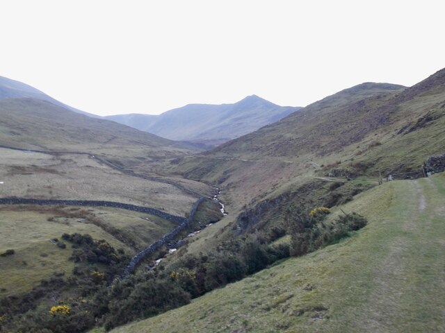
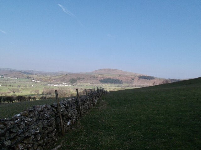
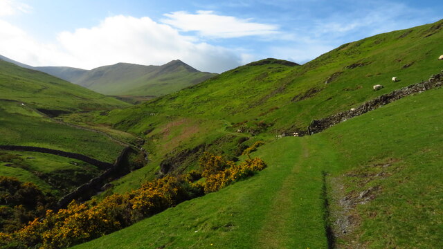
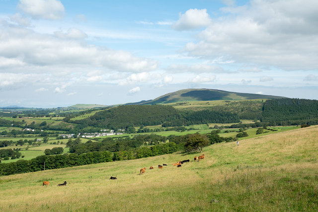
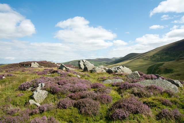
Black Moss, Cumberland is a dense woodland located in the county of Cumbria, England. Covering an area of approximately 200 acres, this ancient forest is situated within the Lake District National Park, renowned for its outstanding natural beauty. The woodland is predominantly composed of various species of deciduous and coniferous trees, creating a diverse and vibrant ecosystem.

The name "Black Moss" refers to the dark, moss-covered forest floor, which adds to the overall enchanting atmosphere of the woodland. The forest is characterized by a mix of towering oak, beech, and ash trees, providing a dense canopy that allows only pockets of sunlight to penetrate through. The undergrowth is abundant with ferns, wildflowers, and mosses, contributing to the rich biodiversity of the area.

Black Moss is home to a variety of wildlife, including deer, badgers, foxes, and numerous bird species. It serves as an important habitat for many woodland creatures, offering shelter, nesting sites, and a reliable food source. The forest is also known for its diverse insect population, with butterflies, beetles, and bees thriving in its diverse ecosystem.

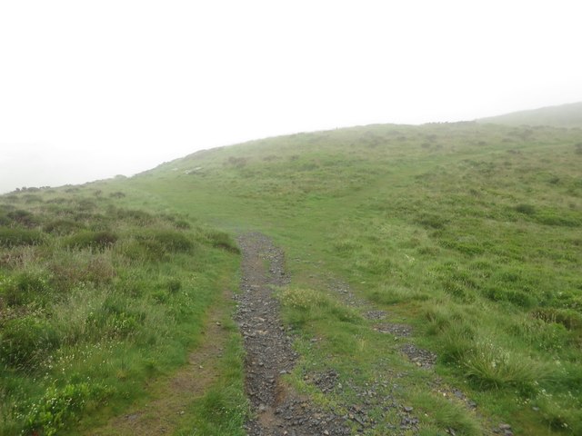
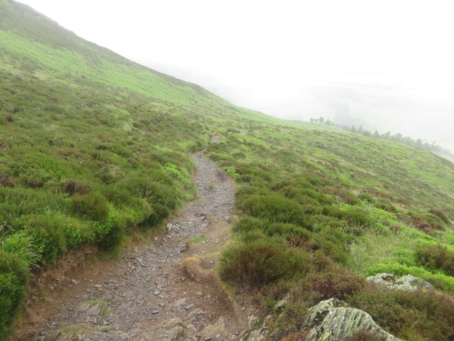
Visitors to Black Moss can explore the woodland through a network of well-maintained walking trails. These trails wind their way through the forest, allowing nature enthusiasts and hikers to immerse themselves in the tranquility and beauty of the surroundings. The forest is a popular destination for outdoor activities such as birdwatching, photography, and nature walks.

Overall, Black Moss in Cumberland is a captivating woodland, offering a glimpse into the enchanting world of ancient forests. Its diverse flora and fauna, combined with its peaceful ambiance, make it a cherished destination for both locals and tourists alike.

If you have any feedback on the listing, please let us know in the comments section below.

Black Moss Images

Images are sourced within 2km of 54.660466/-3.1954175 or Grid Reference NY2230. Thanks to Geograph Open Source API. All images are credited.

Southerndale
Southerndale
Wall in the shadow of the hills looking north
Grazing on Barkbeth Hill
Start of track leading up to Ullock Pike & Longside Edge
Direction Sign – Signpost on the A591 at Chapel Bridge Located at Chapel Bridge on the southwest side of the crossroads of the A591 and School Road. Bassenthwaite parish. 4 arms and annulus finial. Refurbished by Terry Moore. For an earlier photo, see <a title="https://www.geograph.org.uk/photo/6048969" href="https://www.geograph.org.uk/photo/6048969">Link</a>. See also <span class="nowrap"><a title="http://www.geog.port.ac.uk/webmap/thelakes/photos/blo49.jpg" rel="nofollow ugc noopener" href="http://www.geog.port.ac.uk/webmap/thelakes/photos/blo49.jpg">Link</a><img style="margin-left:2px;" alt="External link" title="External link - shift click to open in new window" src="https://s1.geograph.org.uk/img/external.png" width="10" height="10"/></span>.

Milestone Society National ID: CU_NY2231
Direction Sign – Signpost on the A591 at Chapel Bridge
Located at Chapel Bridge on the southwest side of the crossroads of the A591 and School Road. Bassenthwaite parish. 4 arms and annulus finial. Refurbished by Terry Moore. For an earlier photo, see Link. See also LinkExternal link. Milestone Society National ID: CU_NY2231
Field beside minor road The field lies south-east from the village of Bassenthwaite and Bassenthwaite Lake can be seen in the image. Sale Fell is the wooded hill.
Field beside minor road
The field lies south-east from the village of Bassenthwaite and Bassenthwaite Lake can be seen in the image. Sale Fell is the wooded hill.
Bridleway rising towards north ridge of Ullock Pike The stretch of bridleway seen in this image appears to be little used as the route seems generally to be joined at the camera position by walkers climbing from a road and cutting the angle by crossing a field. Above this location the route is very clear and leads by one variation or another on to Ullock Pike. Binsey is the distant hill.
Bridleway rising towards north ridge of Ullock Pike
The stretch of bridleway seen in this image appears to be little used as the route seems generally to be joined at the camera position by walkers climbing from a road and cutting the angle by crossing a field. Above this location the route is very clear and leads by one variation or another on to Ullock Pike. Binsey is the distant hill.
Rocks and flowering heather at Watches Watches is the curious name for a collection of rocks at a levelling of the north ridge of Ullock Pike at around 330 m. In mid-August the flowering heather is close to its best.
Rocks and flowering heather at Watches
Watches is the curious name for a collection of rocks at a levelling of the north ridge of Ullock Pike at around 330 m. In mid-August the flowering heather is close to its best.
Chapel Beck, downstream of Walk Mill Bridge After heavy rain, when the ground was already waterlogged.
Chapel Beck, downstream of Walk Mill Bridge
After heavy rain, when the ground was already waterlogged.
Chapel Beck, looking upstream After heavy rain on already waterlogged ground.
Chapel Beck, looking upstream
After heavy rain on already waterlogged ground.
Burthwaite, near Bassenthwaite The name of both the lane and the farm. Looking westwards.
Burthwaite, near Bassenthwaite
The name of both the lane and the farm. Looking westwards.
Footpath at Ling How The footpath descends from Ling How to the Ravenstone Hotel beside the A591.
Footpath at Ling How
The footpath descends from Ling How to the Ravenstone Hotel beside the A591.
Footpath towards the Ravenstone Hotel Looking along the public footpath from Ling How as it descends towards the Ravenstone Hotel.
Footpath towards the Ravenstone Hotel
Looking along the public footpath from Ling How as it descends towards the Ravenstone Hotel.
Pink houses at High Side Turn off for Orthwaite (3m) from the A591.
View from the top of a bus.
Pink houses at High Side
Turn off for Orthwaite (3m) from the A591. View from the top of a bus.
The church of Saint John Bassenthwaite
And then there was plastic.. This bench, possibly made of oak is 118 years old and is sited by St John's church in Bassenthwaite.
And then there was plastic..
This bench, possibly made of oak is 118 years old and is sited by St John's church in Bassenthwaite.
A view towards Skiddaw You can only get grass this green when there's lots of rainfall!
A view towards Skiddaw
You can only get grass this green when there's lots of rainfall!
View from lane south of Bassenthwaite Village Looking across pasture towards Skiddaw and Ullock Pike (with mist on its flank).
View from lane south of Bassenthwaite Village
Looking across pasture towards Skiddaw and Ullock Pike (with mist on its flank).
Show me another place!

Black Moss is located at Grid Ref: NY2230 (Lat: 54.660466, Lng: -3.1954175)

Administrative County: Cumbria

District: Allerdale

Police Authority: Cumbria

What 3 Words

///curving.bedrooms.chiefs. Near Keswick, Cumbria

Nearby Locations

Black Moss Scarness

Related Wikis

Chapel, Cumbria

Chapel is a hamlet in the English county of Cumbria. Chapel is located on the A591 road between Bassenthwaite and Bassenthwaite Lake. The Cumbria Way crosses...

Mirehouse

Mirehouse is a 17th-century house to the north of Keswick in Cumbria, at the foot of Dodd, near Bassenthwaite Lake and St Bega's Church, on the A591 road...

Bassenthwaite Lake

Bassenthwaite Lake is a body of water in the Lake District in North West England, near the town of Keswick. It has an area of 5.3 km2 (2.0 sq mi), making...

Ullock Pike

Ullock Pike is a fell situated in northern part of the English Lake District. It is located seven kilometres north west of Keswick and achieves a height...

St Bega's Way

St Bega's Way is a 36-mile (58 km) walk through rural West Cumbria and the north west corner of the English Lake District. It is usually completed as a...

Bassenthwaite

Bassenthwaite is a village and civil parish to the west of Bassenthwaite Lake in Cumbria, historically part of Cumberland, within the Lake District National...

Long Side

Long Side is a fell in the English Lake District, it is situated six kilometres north west of Keswick in the northern sector of the national park and is...

Little Crosthwaite

Little Crosthwaite is a hamlet in the Borough of Allerdale in the English county of Cumbria. It forms part of the civil parish of Underskiddaw. Little...

Nearby Amenities

Located within 500m of 54.660466,-3.1954175
Barrier: stile
Lat/Long: 54.6641218/-3.194334
Barrier: stile
Lat/Long: 54.6641334/-3.1944386
Barrier: stile
Material: wood
Step Count: 2
Stile: stepover
Lat/Long: 54.6632414/-3.1977009
Barrier: stile
Source: gps
Lat/Long: 54.6600862/-3.2013118
Barrier: stile
Source: gps
Lat/Long: 54.6622166/-3.2002478
Barrier: stile
Lat/Long: 54.6621777/-3.2002412
Parkergate
Place: locality
Lat/Long: 54.6621858/-3.1887194
Moss Side
Place: locality
Lat/Long: 54.6635822/-3.1970778
High Side
Place: locality
Lat/Long: 54.6609051/-3.1878424
Black Moss
Place: locality
Lat/Long: 54.6608609/-3.1960821
Power: pole
Lat/Long: 54.6595366/-3.2016242
Power: pole
Lat/Long: 54.658601/-3.2013103
Power: pole
Lat/Long: 54.6576593/-3.2009992
Power: pole
Lat/Long: 54.6564033/-3.1961323
Power: pole
Lat/Long: 54.6570441/-3.1968029
Power: pole
Lat/Long: 54.6575887/-3.1973796
Power: pole
Lat/Long: 54.6588795/-3.1987408
Power: pole
Lat/Long: 54.6596173/-3.199524
Power: pole
Lat/Long: 54.6602635/-3.2002106
Power: pole
Lat/Long: 54.6609034/-3.2008852
Power: pole
Lat/Long: 54.6615488/-3.2015678
Power: pole
Lat/Long: 54.662174/-3.2022277
Power: pole
Lat/Long: 54.6627233/-3.1959905
Power: pole
Lat/Long: 54.6623202/-3.1946338
Power: pole
Lat/Long: 54.6619121/-3.1932618
Power: pole
Lat/Long: 54.6617125/-3.1914535
Power: pole
Lat/Long: 54.6615047/-3.1896115
Power: pole
Lat/Long: 54.6616158/-3.1885749
Power: pole
Lat/Long: 54.662857/-3.2019397
Power: pole
Lat/Long: 54.6623221/-3.2007024
Power: pole
Lat/Long: 54.6631207/-3.1973267
Power: pole
Lat/Long: 54.6625073/-3.1987833
Power: pole
Lat/Long: 54.6605994/-3.2019517
Power: pole
Lat/Long: 54.6611858/-3.2021579
Power: pole
Lat/Long: 54.6619856/-3.2025964
Power: pole
Lat/Long: 54.6575367/-3.1897776
Power: pole
Lat/Long: 54.6577037/-3.1916293
Power: pole
Lat/Long: 54.6578444/-3.1930642
Power: pole
Lat/Long: 54.6580013/-3.1945057
Power: pole
Lat/Long: 54.6581508/-3.1960188
Power: pole
Lat/Long: 54.6581232/-3.1979432
The data included in this document is from www.openstreetmap.org. The data is made available under ODbL.

Have you been to Black Moss?

Leave your review of Black Moss below (or comments, questions and feedback).