Big Wood

Wood, Forest in Cumberland Allerdale

England

Big Wood

A Bright Spring Day Old Limestone Quarries near High Ireby.
A Bright Spring Day Credit: Matthew Hatton

Big Wood is a vast forest located in Cumberland, a county in the northwest of England. Spanning over thousands of acres, it is one of the largest woodlands in the region. The forest is characterized by its dense canopy of tall, mature trees, predominantly oak and beech, which provide a habitat for a diverse range of flora and fauna.

The woodland is a popular destination for nature enthusiasts and outdoor enthusiasts alike. Its extensive network of well-maintained trails and paths allows visitors to explore the forest on foot, bike, or horseback. The serene atmosphere and natural beauty of Big Wood make it an ideal spot for leisurely walks, picnics, and wildlife observation.

The forest is home to an array of wildlife species. Visitors may come across deer, foxes, badgers, and a variety of bird species, including owls and woodpeckers. The woodland also supports a rich variety of plant life, with carpets of bluebells and wildflowers adorning the forest floor during the spring and summer months.

Big Wood has a long history, dating back centuries. It was once part of the royal hunting grounds and has been managed by the local authorities for conservation and recreational purposes. Efforts have been made to preserve the natural integrity of the forest, with sustainable management practices implemented to ensure the longevity of its ecosystems.

Overall, Big Wood in Cumberland offers a tranquil and picturesque escape into nature, providing visitors with an opportunity to connect with the great outdoors and experience the beauty of a diverse woodland ecosystem.

If you have any feedback on the listing, please let us know in the comments section below.
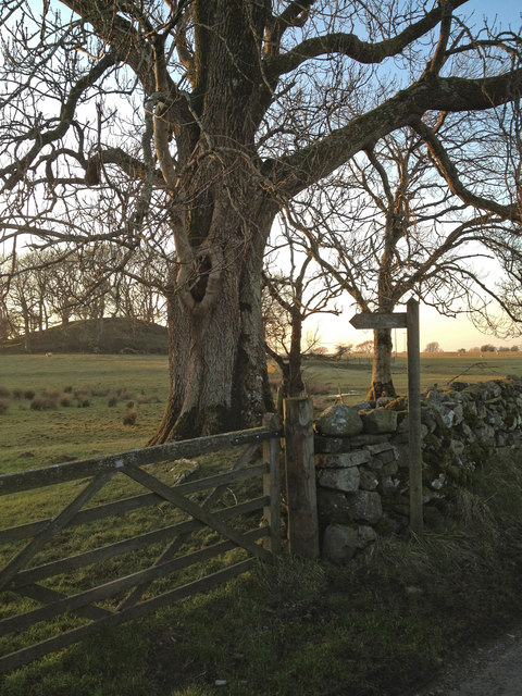
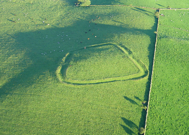
Big Wood Images

Images are sourced within 2km of 54.732088/-3.2176991 or Grid Reference NY2138. Thanks to Geograph Open Source API. All images are credited.

A Bright Spring Day Old Limestone Quarries near High Ireby.
A Bright Spring Day
Old Limestone Quarries near High Ireby.
Torpenhow, St. Michael's Church: The chancel
Torpenhow, St. Michael's Church: Southern aspect
Torpenhow, St. Michael's Church: South western aspect
Farm Building, Torpenhow Hall This long farm building adjoins Torpenhow Hall.
There is an Ordnance Survey flush bracket benchmark just above ground level on the wall at the corner of the building, beside the downspout (photograph <a href="https://www.geograph.org.uk/photo/6909218">NY2039 : Flush Bracket Benchmark, Torpenhow Hall</a>).
Farm Building, Torpenhow Hall
This long farm building adjoins Torpenhow Hall. There is an Ordnance Survey flush bracket benchmark just above ground level on the wall at the corner of the building, beside the downspout (photograph NY2039 : Flush Bracket Benchmark, Torpenhow Hall).
Flush Bracket Benchmark, Torpenhow Hall Detail of Ordnance Survey flush bracket benchmark number G3123 on the south west corner of a farm building at Torpenhow Hall.  The benchmark marks a height of 135.4581m above mean sea level (Ordnance Datum Newlyn) last levelled in 1955 and verified in 1969 (location photograph <a href="https://www.geograph.org.uk/photo/6909209">NY2039 : Farm Building, Torpenhow Hall</a>).
Flush Bracket Benchmark, Torpenhow Hall
Detail of Ordnance Survey flush bracket benchmark number G3123 on the south west corner of a farm building at Torpenhow Hall. The benchmark marks a height of 135.4581m above mean sea level (Ordnance Datum Newlyn) last levelled in 1955 and verified in 1969 (location photograph NY2039 : Farm Building, Torpenhow Hall).
The track to Whitrigg
Bird House Farm
Bird House Farm
Ireby Old Chancel from footpath
Junction of footpath tracks and lane Ireby
Junction of Lanes near Ireby
Ireby Old Church This is a Grade One listed building, a redundant church near to the hamlet of Ireby in Cumbria.  Visitors are able to enter the church and there is a visitors book inside.  See <span class="nowrap"><a title="http://en.wikipedia.org/wiki/Ireby_Old_Church" rel="nofollow ugc noopener" href="http://en.wikipedia.org/wiki/Ireby_Old_Church">Link</a><img style="margin-left:2px;" alt="External link" title="External link - shift click to open in new window" src="https://s1.geograph.org.uk/img/external.png" width="10" height="10"/></span> for further information.
Ireby Old Church
This is a Grade One listed building, a redundant church near to the hamlet of Ireby in Cumbria. Visitors are able to enter the church and there is a visitors book inside. See LinkExternal link for further information.
Internal view of Ireby Old Church or Chancel Inside view of the Old Church.  See <span class="nowrap"><a title="http://en.wikipedia.org/wiki/Ireby_Old_Church" rel="nofollow ugc noopener" href="http://en.wikipedia.org/wiki/Ireby_Old_Church">Link</a><img style="margin-left:2px;" alt="External link" title="External link - shift click to open in new window" src="https://s1.geograph.org.uk/img/external.png" width="10" height="10"/></span> for more information about the building.
Internal view of Ireby Old Church or Chancel
Inside view of the Old Church. See LinkExternal link for more information about the building.
Cockshot Beck running through Cockshot Wood The beck runs through the wood splitting it neatly in half.  There is a path appearing to lead to a crossing point however it consists of a fallen tree over the beck with quite a drop should you slip off.
Cockshot Beck running through Cockshot Wood
The beck runs through the wood splitting it neatly in half. There is a path appearing to lead to a crossing point however it consists of a fallen tree over the beck with quite a drop should you slip off.
Footpath High Ireby
Footpath High Ireby
Broken lane leading to High Ireby This lane is marked as unsuitable for vehicles at both ends.  It is no longer maintained as a road.  It is very interesting to see how rapidly nature reclaims a man made environment.  You can see it was once a fully adopted carriageway as there are drains with grids all along the edges.  It now has pot holes up to 6-7 inches deep and you would not be able to travel along it in a standard car.
Broken lane leading to High Ireby
This lane is marked as unsuitable for vehicles at both ends. It is no longer maintained as a road. It is very interesting to see how rapidly nature reclaims a man made environment. You can see it was once a fully adopted carriageway as there are drains with grids all along the edges. It now has pot holes up to 6-7 inches deep and you would not be able to travel along it in a standard car.
Track from High Ireby Some satnav systems will try and feed the unwary down this lane.  The signs at either end are not joking, you really won't be able to pass in a normal car due to the deep pot holes and steep drops where the surface has been degraded by the elements.
Track from High Ireby
Some satnav systems will try and feed the unwary down this lane. The signs at either end are not joking, you really won't be able to pass in a normal car due to the deep pot holes and steep drops where the surface has been degraded by the elements.
Farmland near High Ireby
Show me another place!

Big Wood is located at Grid Ref: NY2138 (Lat: 54.732088, Lng: -3.2176991)

Administrative County: Cumbria

District: Allerdale

Police Authority: Cumbria

What 3 Words

///crouches.airstrip.bracelet. Near Aspatria, Cumbria

Nearby Locations

Big Wood

Related Wikis

Ireby Old Church

Ireby Old Church is a redundant Anglican church, of which only the chancel remains. It stands in an isolated position 1 mile (2 km) to the west of the...

St Michael's Church, Torpenhow

St Michael's Church is in the civil parish of Blennerhasset and Torpenhow, Cumbria, England. It is an active Anglican church in the deanery of Derwent...

Caer Mote

Caer Mote is a hill of 289 metres (948 ft) in the north of the English Lake District near Bothel, Cumbria. Its summit lies just outside the boundary of...

Ireby, Cumbria

Ireby is a village in Cumbria, England with a population of around 180. Between 1974 and 2023, it was in Allerdale district, Cumbria. Since April 2023...

Nearby Amenities

Located within 500m of 54.732088,-3.2176991
Post Box
Ref: CA7 219
Lat/Long: 54.7330419/-3.2118986
Snittlegarth Park
Place: locality
Lat/Long: 54.7311187/-3.2155664
Power: pole
Lat/Long: 54.7346059/-3.2241122
Power: pole
Lat/Long: 54.7341536/-3.2229341
Power: pole
Lat/Long: 54.7337061/-3.2217374
Power: pole
Lat/Long: 54.7333015/-3.2206729
Power: pole
Lat/Long: 54.7328958/-3.219594
Power: pole
Lat/Long: 54.7324363/-3.2183766
Power: pole
Lat/Long: 54.7319924/-3.2172005
Power: pole
Lat/Long: 54.7315222/-3.2160203
Power: pole
Lat/Long: 54.7310436/-3.2148174
Power: pole
Lat/Long: 54.7306593/-3.2138542
Power: pole
Lat/Long: 54.7301974/-3.2127195
Power: pole
Lat/Long: 54.7301544/-3.2113202
The data included in this document is from www.openstreetmap.org. The data is made available under ODbL.

Have you been to Big Wood?

Leave your review of Big Wood below (or comments, questions and feedback).