Beckstones Plantation

Wood, Forest in Cumberland Allerdale

England

Beckstones Plantation

Whinlatter Top A remarkably well-trodden path leads to this rather undistinguished summit west of Whinlatter Forest, and we weren't the only visitors despite the increasingly unpleasant weather with winds rising towards gale force later in the day.
Whinlatter Top Credit: Andy Waddington

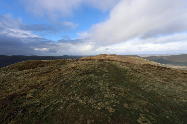
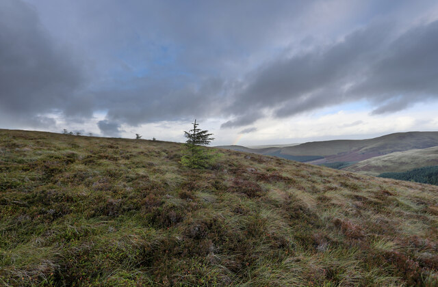
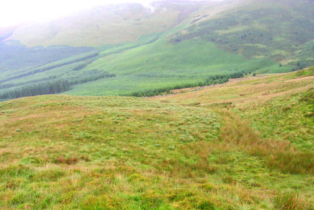
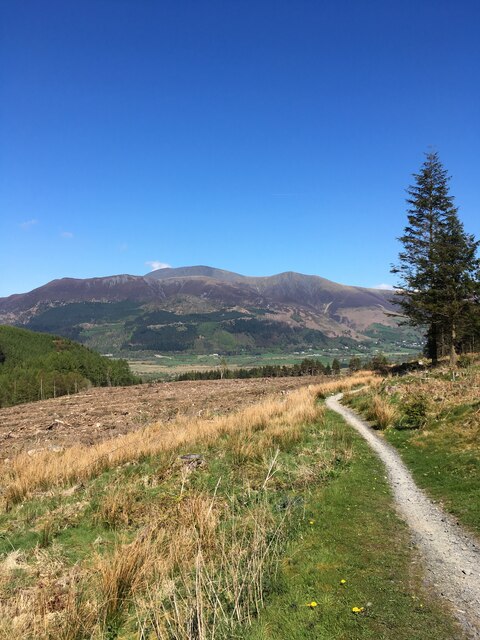
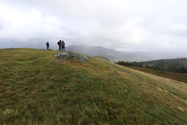
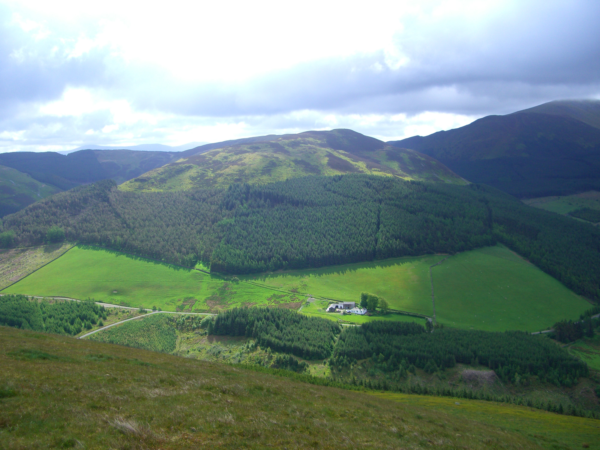
Beckstones Plantation, located in Cumberland, England, is a picturesque woodland area known for its stunning natural beauty and rich biodiversity. Covering an expansive area, the plantation is predominantly made up of dense, ancient woodlands and lush forests.

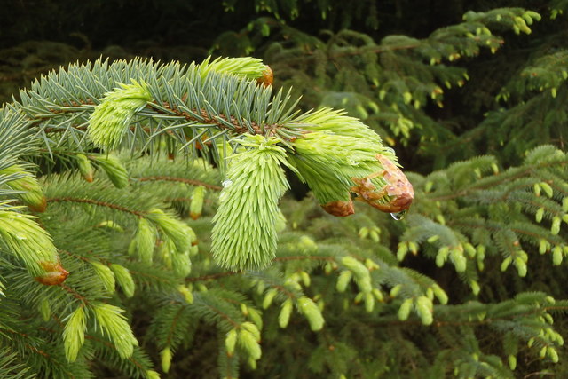
The woodland is home to a diverse range of flora and fauna, with an array of tree species including oak, beech, ash, and birch creating a vibrant and varied landscape. The canopy formed by these towering trees provides a sheltered habitat for a wide range of wildlife, including various bird species, small mammals, and insects.

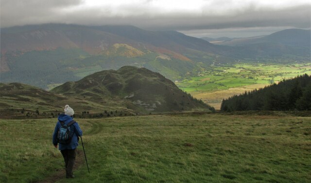
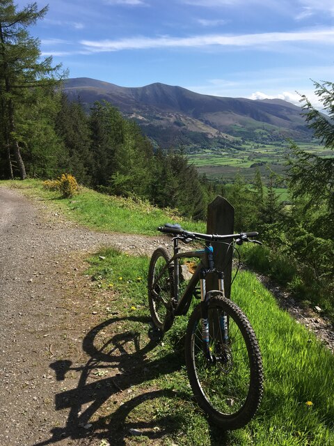
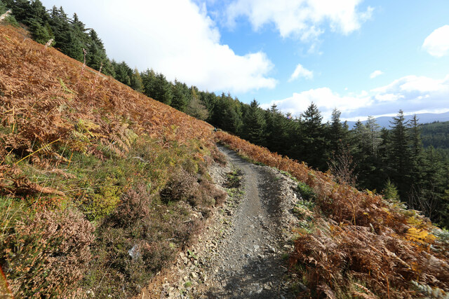
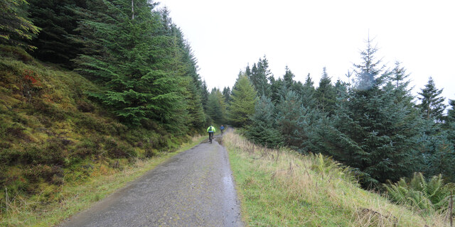
Nature enthusiasts and hikers are drawn to Beckstones Plantation due to its extensive network of well-maintained walking trails. These trails meander through the woodland, offering visitors the chance to explore the plantation's diverse ecosystems up close. The peaceful atmosphere and enchanting surroundings make it an ideal destination for those seeking tranquility and a connection with nature.

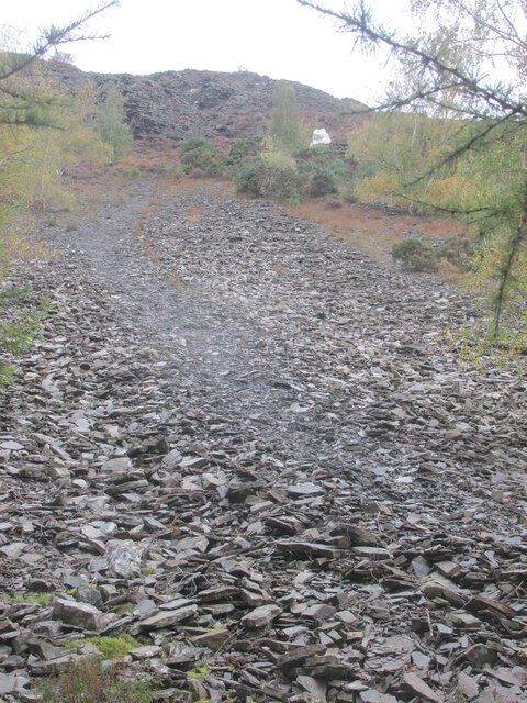
In addition to its natural wonders, Beckstones Plantation also holds historical significance. The plantation has been carefully managed for centuries, and remnants of charcoal production and other traditional woodland activities can still be found within its boundaries.

Overall, Beckstones Plantation is a captivating destination that offers visitors a chance to immerse themselves in the beauty of nature. Whether it's exploring the woodland trails, observing wildlife, or simply enjoying the peaceful surroundings, this enchanting plantation is sure to leave a lasting impression on all who visit.

If you have any feedback on the listing, please let us know in the comments section below.

Beckstones Plantation Images

Images are sourced within 2km of 54.619028/-3.218594 or Grid Reference NY2125. Thanks to Geograph Open Source API. All images are credited.

Whinlatter Top A remarkably well-trodden path leads to this rather undistinguished summit west of Whinlatter Forest, and we weren't the only visitors despite the increasingly unpleasant weather with winds rising towards gale force later in the day.
Whinlatter Top
A remarkably well-trodden path leads to this rather undistinguished summit west of Whinlatter Forest, and we weren't the only visitors despite the increasingly unpleasant weather with winds rising towards gale force later in the day.
Escapee trees on the shoulder of Whinlatter Top Although introduced plantation trees seed freely, they don't often establish among the sedges and grasses which are grazed by sheep as well as native wildlife. This one seems to be doing well, west of the forest, so it had the extra good fortune to have been blown here against the prevailing wind.
Escapee trees on the shoulder of Whinlatter Top
Although introduced plantation trees seed freely, they don't often establish among the sedges and grasses which are grazed by sheep as well as native wildlife. This one seems to be doing well, west of the forest, so it had the extra good fortune to have been blown here against the prevailing wind.
Dripping Spruce Bud New buds on the pines are quite attractive
Dripping Spruce Bud
New buds on the pines are quite attractive
Below Todd Fell
Below Todd Fell
On Whinlatter Looking towards Grisedale Pike
On Whinlatter
Looking towards Grisedale Pike
The summit of Whinlatter The summit of Whinlatter, adorned with a small cairn. In his Pictorial Guides Alfred Wainwright indicates that the highest point at the west end of ridge is the summit. However the Ordnance Survey suggest that this point is 8 metres higher than the western top.
The summit of Whinlatter
The summit of Whinlatter, adorned with a small cairn. In his Pictorial Guides Alfred Wainwright indicates that the highest point at the west end of ridge is the summit. However the Ordnance Survey suggest that this point is 8 metres higher than the western top.
Stone wall crossing Whinlatter This stone wall crosses Whinlatter in north to south direction a few metres west of the summit.
Stone wall crossing Whinlatter
This stone wall crosses Whinlatter in north to south direction a few metres west of the summit.
A66 near Powter How
A66 near Powter How
Swan House Former public house?
Swan House
Former public house?
Path up scree to The  Bishop It's a rough path.
Path up scree to The Bishop
It's a rough path.
The path from Lord's Seat Walking back downhill with great views over Barf.
The path from Lord's Seat
Walking back downhill with great views over Barf.
Mountain bike track, Whinlatter
Mountain bike track, Hospital Plantation, Whinlatter Forest Park
Benchmark on Thornthwaite Chapel, Thornwaite Benchmark description <span class="nowrap"><a title="https://www.bench-marks.org.uk/bm123734" rel="nofollow ugc noopener" href="https://www.bench-marks.org.uk/bm123734">Link</a><img style="margin-left:2px;" alt="External link" title="External link - shift click to open in new window" src="https://s1.geograph.org.uk/img/external.png" width="10" height="10"/></span>
Benchmark on Thornthwaite Chapel, Thornwaite
Benchmark description LinkExternal link
North Loop bike trail coming out of Whinlatter forest onto the open fell This mountain bike trail is supposed to be for bikes only and one-way, downhill. However signposting and trail marking is not all it could be, and we found ourselves walking uphill from a grassy forest ride onto the trail and were not prepared to lose a load of height to find our way back to a more suitable route. Fortunately, walkers are up and about earlier than bikers and we had the trail to ourselves until it rejoined the main forestry track. No bikes or riders were harmed by us or the dog... nor vice versa.
North Loop bike trail coming out of Whinlatter forest onto the open fell
This mountain bike trail is supposed to be for bikes only and one-way, downhill. However signposting and trail marking is not all it could be, and we found ourselves walking uphill from a grassy forest ride onto the trail and were not prepared to lose a load of height to find our way back to a more suitable route. Fortunately, walkers are up and about earlier than bikers and we had the trail to ourselves until it rejoined the main forestry track. No bikes or riders were harmed by us or the dog... nor vice versa.
Boggy path heads for Tarbarrel Moss Although no footpaths are marked on the map, there seem to be several forming enough of a network to link up various points of interest outside the Whinlatter Forest itself. This one headed back to the forest from Whinlatter top, crossing a very boggy area before climbing to duck through into the forest where it continued, apparently well-trodden to join one of the main tracks.
Boggy path heads for Tarbarrel Moss
Although no footpaths are marked on the map, there seem to be several forming enough of a network to link up various points of interest outside the Whinlatter Forest itself. This one headed back to the forest from Whinlatter top, crossing a very boggy area before climbing to duck through into the forest where it continued, apparently well-trodden to join one of the main tracks.
Not ideal weather for seated Lords It was a bit of a struggle to get to the top of Lord's Seat and definitely not a place for sitting down as the wind was rising towards a gale. Both ourselves and the folk we met on top had decided that it really was a bit too rough to continue the traverse to Barf, just visible ahead. Almost obscured by fast moving cloud, the Skiddaw group is in the far distance.
Not ideal weather for seated Lords
It was a bit of a struggle to get to the top of Lord's Seat and definitely not a place for sitting down as the wind was rising towards a gale. Both ourselves and the folk we met on top had decided that it really was a bit too rough to continue the traverse to Barf, just visible ahead. Almost obscured by fast moving cloud, the Skiddaw group is in the far distance.
Mountain bikers keeping out of the wind in Whinlatter Forest Definitely not a day to be riding out in the open as the wind was getting up towards gale force and gusty with it. Fortunately, Whinlatter Forest provides a lot of relatively sheltered trails.
Mountain bikers keeping out of the wind in Whinlatter Forest
Definitely not a day to be riding out in the open as the wind was getting up towards gale force and gusty with it. Fortunately, Whinlatter Forest provides a lot of relatively sheltered trails.
Show me another place!

Beckstones Plantation is located at Grid Ref: NY2125 (Lat: 54.619028, Lng: -3.218594)

Administrative County: Cumbria

District: Allerdale

Police Authority: Cumbria

What 3 Words

///sample.adjusted.rucksack. Near Keswick, Cumbria

Related Wikis

Thornthwaite

Thornthwaite is a village in Cumbria, England. Historically in Cumberland, it is just off the A66 road, south of Bassenthwaite Lake and within the Lake...

Barf (Lake District)

Barf is a fell in the north-western Lake District in Cumbria, UK. It stands on the south-western shore of Bassenthwaite Lake. Barf is well known for a...

Lord's Seat

Lord's Seat is a fell in the English Lake District. It is the highest of the group of hills north of Whinlatter Pass in the North Western Fells. The slopes...

Newlands Beck

Newlands Beck is a minor river of Cumbria in England. The beck rises on Dale Head and flows northwards through the picturesque Newlands Valley, past the...

Chapel Beck

Chapel Beck is a minor river in the county of Cumbria in England. The beck rises in the Whinlatter Forest in the Lake District at the confluence of Grisedale...
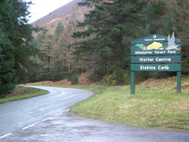
Whinlatter Pass

The Whinlatter Pass is a mountain pass in the Lake District in Cumbria, England. It is located on the B5292 road linking Braithwaite, to the west of Keswick...

Whinlatter

Whinlatter is a small fell in the north west of the English Lake District, just north of the Whinlatter Pass. It is easily climbed from the top of the...

Broom Fell

Broom Fell is a small hill in the English Lake District. It lies on a ridge connecting Lord's Seat and Graystones, but is rarely climbed. Alfred Wainwright...

Nearby Amenities

Located within 500m of 54.619028,-3.218594
Created By: Merkaartor 0.12
Lat/Long: 54.6220127/-3.2228802
Created By: Merkaartor 0.12
Lat/Long: 54.6220485/-3.222808
Created By: Merkaartor 0.12
Lat/Long: 54.622036/-3.2225837
Created By: Merkaartor 0.12
Lat/Long: 54.621813/-3.221888
Created By: Merkaartor 0.12
Lat/Long: 54.6216985/-3.2218141
Created By: Merkaartor 0.12
Lat/Long: 54.6215237/-3.2218105
Created By: Merkaartor 0.12
Lat/Long: 54.6214006/-3.2217473
Created By: Merkaartor 0.12
Lat/Long: 54.6212939/-3.2217393
Created By: Merkaartor 0.12
Lat/Long: 54.6211686/-3.2218546
Created By: Merkaartor 0.12
Lat/Long: 54.6210953/-3.2218963
Created By: Merkaartor 0.12
Lat/Long: 54.6209718/-3.2217432
Created By: Merkaartor 0.12
Lat/Long: 54.6208699/-3.2216495
Created By: Merkaartor 0.12
Lat/Long: 54.6208112/-3.2214681
Created By: Merkaartor 0.12
Lat/Long: 54.6207539/-3.221191
Created By: Merkaartor 0.12
Lat/Long: 54.6206461/-3.2210245
Created By: Merkaartor 0.12
Lat/Long: 54.6205605/-3.2210092
Created By: Merkaartor 0.12
Lat/Long: 54.6204689/-3.2208667
Created By: Merkaartor 0.12
Lat/Long: 54.6200028/-3.2192655
Created By: Merkaartor 0.12
Lat/Long: 54.6201953/-3.2192623
Created By: Merkaartor 0.12
Lat/Long: 54.6203357/-3.219141
Created By: Merkaartor 0.12
Lat/Long: 54.6204815/-3.2189416
Created By: Merkaartor 0.12
Lat/Long: 54.6206984/-3.2186266
Created By: Merkaartor 0.12
Lat/Long: 54.6206447/-3.2185367
Created By: Merkaartor 0.12
Lat/Long: 54.6204742/-3.2184191
Created By: Merkaartor 0.12
Lat/Long: 54.6203289/-3.218278
Created By: Merkaartor 0.12
Lat/Long: 54.6202265/-3.2183082
Created By: Merkaartor 0.12
Lat/Long: 54.6200798/-3.2182218
Created By: Merkaartor 0.12
Lat/Long: 54.6198847/-3.2180103
Created By: Merkaartor 0.12
Lat/Long: 54.6197238/-3.2176354
Created By: Merkaartor 0.12
Lat/Long: 54.619859/-3.2172933
Created By: Merkaartor 0.12
Lat/Long: 54.6198753/-3.2171798
Created By: Merkaartor 0.12
Lat/Long: 54.6200349/-3.2162146
Created By: Merkaartor 0.12
Lat/Long: 54.6201611/-3.2161586
Created By: Merkaartor 0.12
Lat/Long: 54.6202886/-3.2161513
Created By: Merkaartor 0.12
Lat/Long: 54.6203533/-3.2163129
Created By: Merkaartor 0.12
Lat/Long: 54.6204498/-3.2163693
Created By: Merkaartor 0.12
Lat/Long: 54.6205296/-3.2163471
Created By: Merkaartor 0.12
Lat/Long: 54.6206021/-3.2161905
Created By: Merkaartor 0.12
Lat/Long: 54.6185461/-3.2125443
Created By: Merkaartor 0.12
Lat/Long: 54.6180393/-3.2125822
Created By: Merkaartor 0.12
Lat/Long: 54.6178005/-3.2129038
Beckstones Plantation
Natural: wood
Source: Os OPenData StreetView
Lat/Long: 54.6218849/-3.213204
Turning Circle
Lat/Long: 54.6190528/-3.2130672
Seat How
Tourism: viewpoint
Wheelchair: no
Lat/Long: 54.6195977/-3.2199174
Thwaitehill Knotts
Place: locality
Lat/Long: 54.6159256/-3.214234
Bench
Lat/Long: 54.6184297/-3.2124012
Bench
Lat/Long: 54.615658/-3.2155515
The data included in this document is from www.openstreetmap.org. The data is made available under ODbL.

Have you been to Beckstones Plantation?

Leave your review of Beckstones Plantation below (or comments, questions and feedback).