Boghouse Great Wood

Wood, Forest in Cumberland Copeland

England

Boghouse Great Wood

A595 at Buckman Brow
A595 at Buckman Brow Credit: Colin Pyle

Boghouse Great Wood, located in Cumberland, is a magnificent forest that covers a vast area of land and is known for its breathtaking natural beauty and diverse wildlife. With an approximate size of several thousand hectares, this ancient woodland is a haven for nature enthusiasts and outdoor adventurers alike.

The forest is characterized by its dense canopies of towering trees, predominantly consisting of oak, beech, and ash. These mature trees provide a rich habitat for a variety of bird species, such as woodpeckers, owls, and thrushes. Additionally, the undergrowth is abundant with ferns, mosses, and wildflowers, which add to the enchanting atmosphere of the woodland.

Boghouse Great Wood is crisscrossed by several well-marked trails, allowing visitors to explore the forest on foot or by bike. These paths wind through the forest, offering glimpses of picturesque streams, small waterfalls, and tranquil ponds along the way. The forest also boasts a network of bridges and boardwalks that guide visitors through wetland areas, providing unique views of the diverse plant and animal life that thrive in these habitats.

Nature enthusiasts will find plenty to admire in Boghouse Great Wood, including rare species of butterflies, dragonflies, and wild deer that roam freely throughout the forest. The woodland is also home to a rich assortment of fungi, making it a popular spot for foragers and mushroom enthusiasts.

Overall, Boghouse Great Wood in Cumberland is a true natural gem, offering visitors a chance to immerse themselves in the serene beauty of an ancient forest while enjoying the sights and sounds of its abundant wildlife.

If you have any feedback on the listing, please let us know in the comments section below.

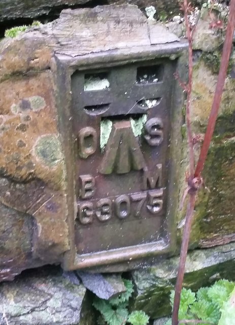
Boghouse Great Wood Images

Images are sourced within 2km of 54.269546/-3.2385554 or Grid Reference SD1986. Thanks to Geograph Open Source API. All images are credited.

A595 at Buckman Brow
Recent felling on Coops Wood has opened up a view of the bridge over the Duddon
Ordnance Survey Cut Mark This OS cut mark can be found adjacent to the letter box at Broadgate. It marks a point 107.274m above mean sea level.
Ordnance Survey Cut Mark
This OS cut mark can be found adjacent to the letter box at Broadgate. It marks a point 107.274m above mean sea level.
Ordnance Survey Cut Mark This OS cut mark can be found on Old Hall Cottage. It marks a point 39.156m above mean sea level.
Ordnance Survey Cut Mark
This OS cut mark can be found on Old Hall Cottage. It marks a point 39.156m above mean sea level.
Ordnance Survey Cut Mark This OS cut mark can be found on a large rock to the west of the track.
Ordnance Survey Cut Mark
This OS cut mark can be found on a large rock to the west of the track.
Bluebells, Furnace Wood In deepest Duddon
Bluebells, Furnace Wood
In deepest Duddon
Ascending Barrow Looking towards the Duddon estuary
Ascending Barrow
Looking towards the Duddon estuary
Duddon iron furnace (disused) A charcoal burning blast furnace dating from 1736. Isaac Wilkinson's cylinder bellows powered by water were first applied here. It is a Scheduled Ancient Monument but is temporarily closed to the public while structural issues are considered. There is a good view from the bridleway that goes past the site.
Duddon iron furnace (disused)
A charcoal burning blast furnace dating from 1736. Isaac Wilkinson's cylinder bellows powered by water were first applied here. It is a Scheduled Ancient Monument but is temporarily closed to the public while structural issues are considered. There is a good view from the bridleway that goes past the site.
Pivot type mark This Pivot style mark can be found on the SE parapet of the bridge.
Pivot type mark
This Pivot style mark can be found on the SE parapet of the bridge.
Start of the track to the Swinside Stone Circle The track branching off to the left leads to the Stone Circle and Swinside Farm.
Start of the track to the Swinside Stone Circle
The track branching off to the left leads to the Stone Circle and Swinside Farm.
SRPS Cumbrian Coast Railtour 2018 : Signal Post Before Duddon Viaduct
SRPS Cumbrian Coast Railtour 2018 : Approaching Duddon Viaduct
Ordnance Survey Flush Bracket (G3075) This OS Flush Bracket can be found on a roadside building at Duddon Bridge Farm. It marks a point 10.398m above mean sea level.
Ordnance Survey Flush Bracket (G3075)
This OS Flush Bracket can be found on a roadside building at Duddon Bridge Farm. It marks a point 10.398m above mean sea level.
Ordnance Survey Cut Mark This OS cut mark can be found on a rock face west side of the road. It marks a point 31.425m above mean sea level.
Ordnance Survey Cut Mark
This OS cut mark can be found on a rock face west side of the road. It marks a point 31.425m above mean sea level.
Ordnance Survey Cut Mark This OS cut mark can be found on the large boulder in the wall SE side of the road. It marks a point 99.048m above mean sea level.
Ordnance Survey Cut Mark
This OS cut mark can be found on the large boulder in the wall SE side of the road. It marks a point 99.048m above mean sea level.
Ordnance Survey OSBM Bolt This OS Bolt can be found on the large boulder at the side of the barn at Low Broadgate. It marks a point 81.764m above mean sea level.
Ordnance Survey OSBM Bolt
This OS Bolt can be found on the large boulder at the side of the barn at Low Broadgate. It marks a point 81.764m above mean sea level.
Ordnance Survey Cut Mark This OS cut mark can be found on the wall NW side of the road. It marks a point 98.207m above mean sea level.
Ordnance Survey Cut Mark
This OS cut mark can be found on the wall NW side of the road. It marks a point 98.207m above mean sea level.
Ordnance Survey Cut Mark This OS cut mark can be found on the west parapet of Waughfoot Bridge. It marks a point 132.683m above mean sea level.
Ordnance Survey Cut Mark
This OS cut mark can be found on the west parapet of Waughfoot Bridge. It marks a point 132.683m above mean sea level.
Show me another place!

Boghouse Great Wood is located at Grid Ref: SD1986 (Lat: 54.269546, Lng: -3.2385554)

Administrative County: Cumbria

District: Copeland

Police Authority: Cumbria

What 3 Words

///mouse.bead.relating. Near Millom, Cumbria

Related Wikis

Duddon Bridge

Duddon Bridge is a hamlet in Cumbria, England. == References ==

Duddon furnace

The Duddon furnace (Grid Reference SD 197883) is a surviving charcoal-fuelled blast furnace near Broughton-in-Furness in Cumbria. It is on the west side...

St Mary Magdalene's Church, Broughton-in-Furness

St Mary Magdalene's Church is in Broughton-in-Furness, Cumbria, England. It is an active Anglican parish church in the deanery of Furness, the archdeaconry...

Eccle Riggs

Eccle Riggs is a country house located on Eccle Riggs, a ridge of land about 0.75 miles (1.2 km) to the south of Broughton-in-Furness, Cumbria, England...

Broughton-in-Furness

Broughton in Furness is a market town in the civil parish of Broughton West in the Westmorland and Furness district of Cumbria, England. It had a population...

Broughton-in-Furness railway station

Broughton-in-Furness railway station served the market town of Broughton-in-Furness, in Lancashire, England (now in Cumbria). It was on the branch line...

Foxfield railway station

Foxfield is a railway station on the Cumbrian Coast Line, which runs between Carlisle and Barrow-in-Furness. The station, situated 11+1⁄2 miles (19 km...

Thwaites, Cumbria

Thwaites is a small village near Duddon Valley and on the edge of the Duddon Estuary in the Lake District National Park in the Borough of Copeland, Cumbria...

Nearby Amenities

Located within 500m of 54.269546,-3.2385554
Barrier: cattle_grid
Lat/Long: 54.2722542/-3.2398603
Material: wood
Power: pole
Lat/Long: 54.2737342/-3.2357459
Power: pole
Lat/Long: 54.270177/-3.2373226
Power: pole
Lat/Long: 54.2705061/-3.2372646
Power: pole
Lat/Long: 54.2708958/-3.2373525
Power: pole
Lat/Long: 54.2712476/-3.2374403
Power: pole
Lat/Long: 54.2715972/-3.2375087
Power: pole
Lat/Long: 54.2719828/-3.237579
Power: pole
Lat/Long: 54.268168/-3.2448684
Power: pole
Lat/Long: 54.2688059/-3.2445664
Power: pole
Lat/Long: 54.2694099/-3.2442363
Power: pole
Lat/Long: 54.2698683/-3.242849
Power: pole
Lat/Long: 54.2702785/-3.2415495
Power: pole
Lat/Long: 54.2706589/-3.2402763
Power: pole
Lat/Long: 54.2708661/-3.2395879
Power: pole
Lat/Long: 54.2712876/-3.238299
Power: pole
Lat/Long: 54.2694089/-3.2442468
Power: pole
Lat/Long: 54.269815/-3.245671
Power: pole
Lat/Long: 54.2729316/-3.2366118
The data included in this document is from www.openstreetmap.org. The data is made available under ODbL.

Have you been to Boghouse Great Wood?

Leave your review of Boghouse Great Wood below (or comments, questions and feedback).