Bishpool Covert

Wood, Forest in Somerset Somerset West and Taunton

England

Bishpool Covert

Old Direction Sign - Signpost near the Travellers Rest Located close to the Travellers Rest public house, in the centre of the T junction of Merridge Hill and Enmore Lane. On the boundary of Broomfield and Spaxton parishes. 3 arms and pyramid finial. See <a title="https://www.geograph.org.uk/photo/6045235" href="https://www.geograph.org.uk/photo/6045235">Link</a> for an older photo and <a title="https://www.geograph.org.uk/photo/5113858" href="https://www.geograph.org.uk/photo/5113858">Link</a>.

Milestone Society National ID: SO_ST2133
Old Direction Sign - Signpost near the Travellers Rest Credit: J Dowding

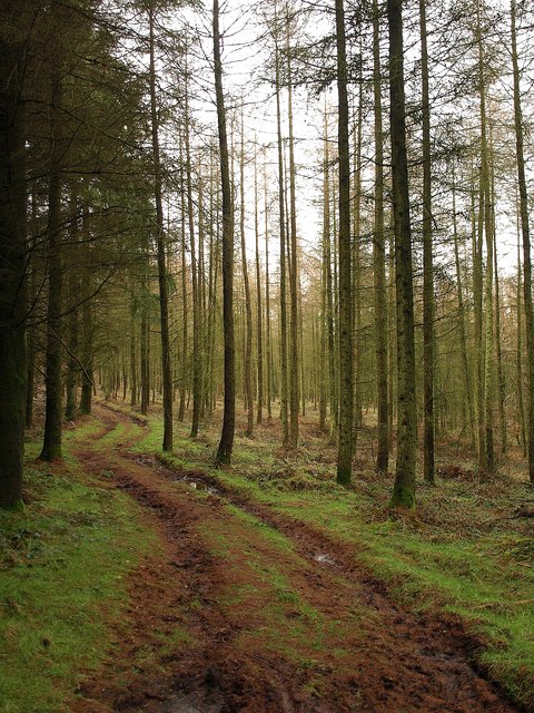
Bishpool Covert is a picturesque woodland located in Somerset, England. Situated in the county's rural area, the woodland is known for its natural beauty and serene atmosphere. Bishpool Covert is part of the larger Somerset Levels and Moors, an area renowned for its diverse wildlife and lush vegetation.

Covering a significant area, Bishpool Covert is a mix of deciduous and coniferous trees, creating a harmonious blend of colors throughout the year. The woodland is particularly enchanting in the autumn, when the leaves change to vibrant shades of red, orange, and gold. Visitors can enjoy leisurely walks along the well-maintained trails that wind through the forest, taking in the tranquil surroundings and inhaling the fresh scent of the trees.

Bishpool Covert is also home to a variety of wildlife species. Birdwatchers will delight in the opportunity to spot rare and native birds, such as woodpeckers, owls, and various species of warblers. The woodland's diverse ecosystem also supports a range of mammals, including deer, foxes, and badgers. Nature enthusiasts can explore the woodland's nooks and crannies, hoping to catch a glimpse of these elusive creatures.

For those seeking a peaceful retreat in nature, Bishpool Covert is an ideal destination. Whether it's a leisurely stroll, birdwatching, or simply enjoying the tranquillity of the forest, this woodland offers a respite from the hustle and bustle of everyday life. Bishpool Covert truly showcases the natural beauty that Somerset has to offer.

If you have any feedback on the listing, please let us know in the comments section below.

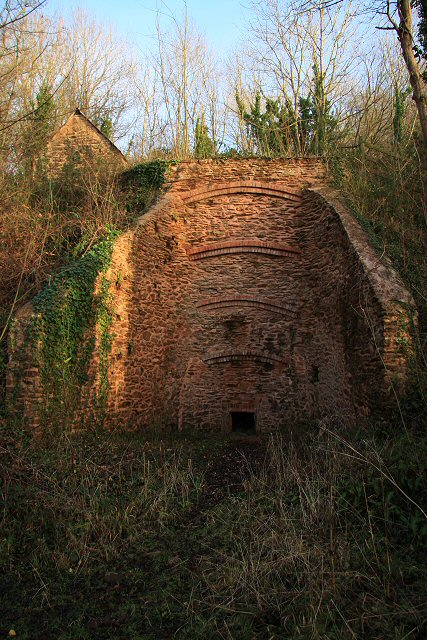
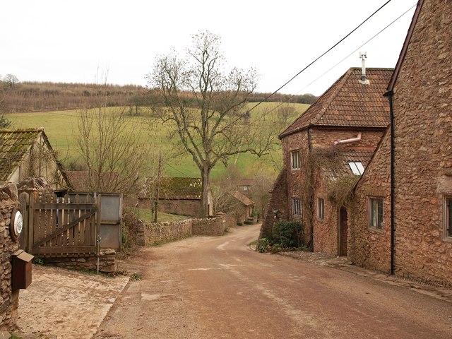
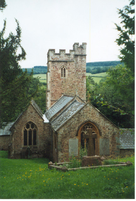
Bishpool Covert Images

Images are sourced within 2km of 51.099412/-3.1550525 or Grid Reference ST1933. Thanks to Geograph Open Source API. All images are credited.

Old Direction Sign - Signpost near the Travellers Rest Located close to the Travellers Rest public house, in the centre of the T junction of Merridge Hill and Enmore Lane. On the boundary of Broomfield and Spaxton parishes. 3 arms and pyramid finial. See <a title="https://www.geograph.org.uk/photo/6045235" href="https://www.geograph.org.uk/photo/6045235">Link</a> for an older photo and <a title="https://www.geograph.org.uk/photo/5113858" href="https://www.geograph.org.uk/photo/5113858">Link</a>.

Milestone Society National ID: SO_ST2133
Old Direction Sign - Signpost near the Travellers Rest
Located close to the Travellers Rest public house, in the centre of the T junction of Merridge Hill and Enmore Lane. On the boundary of Broomfield and Spaxton parishes. 3 arms and pyramid finial. See Link for an older photo and Link. Milestone Society National ID: SO_ST2133
The Travellers Rest near Buncombe, Quantock hills Some of the 60s film "Tom Jones" was filmed here. Looking SW towards the crossroads known locally as the Pines.
The Travellers Rest near Buncombe, Quantock hills
Some of the 60s film "Tom Jones" was filmed here. Looking SW towards the crossroads known locally as the Pines.
Aisholt and Merridge Village Hall This little village hall stands on its own away from both Aisholt and Merridge.
Aisholt and Merridge Village Hall
This little village hall stands on its own away from both Aisholt and Merridge.
Cottage at Courtway This cottage lies on the south eastern edge of the Quantocks but only about five miles north of Taunton.
Cottage at Courtway
This cottage lies on the south eastern edge of the Quantocks but only about five miles north of Taunton.
Limekiln above Hawkridge Reservoir Following its demise in the 1930s, this limekiln was restored in 1997, using traditional materials including lime mortar and reclaimed stone and bricks from the site. In its time it would have produced between five and eight tons of lime a day. The kiln faces into the prevailing wind and has ‘wings’ in order to catch maximum draught.
Limekiln above Hawkridge Reservoir
Following its demise in the 1930s, this limekiln was restored in 1997, using traditional materials including lime mortar and reclaimed stone and bricks from the site. In its time it would have produced between five and eight tons of lime a day. The kiln faces into the prevailing wind and has ‘wings’ in order to catch maximum draught.
The Traveller's Rest,  near Broomfield
The Traveller's Rest, near Broomfield
Quiet valley in the Quantocks
Footpath in Buncombe Wood Broomfield footpath 3, which has climbed very steeply out of the head of the Kingston Stream valley, runs almost level through conifer woodland towards the Merridge Hill / Buncombe -  Cothelstone county road.
Footpath in Buncombe Wood
Broomfield footpath 3, which has climbed very steeply out of the head of the Kingston Stream valley, runs almost level through conifer woodland towards the Merridge Hill / Buncombe - Cothelstone county road.
The Pines cafe A spot for refreshments at a little col in the eastern Quantocks. Seen from the lane approaching from Broomfield. The principal road runs along a ridge between Enmore and Cothelstone Hill. Roads drop on either side to Kingston St Mary (left) and Nether Stowey (right).
The Pines cafe
A spot for refreshments at a little col in the eastern Quantocks. Seen from the lane approaching from Broomfield. The principal road runs along a ridge between Enmore and Cothelstone Hill. Roads drop on either side to Kingston St Mary (left) and Nether Stowey (right).
Lane, Lower Aisholt The little lane from Bishpool approaches the valley floor at Lower Aisholt.
Lane, Lower Aisholt
The little lane from Bishpool approaches the valley floor at Lower Aisholt.
Lower Aisholt On the right is Lower Aisholt Farmhouse, described at <span class="nowrap"><a title="http://www.imagesofengland.org.uk/Details/Default.aspx?id=269413&mode=adv" rel="nofollow ugc noopener" href="http://www.imagesofengland.org.uk/Details/Default.aspx?id=269413&mode=adv">Link</a><img style="margin-left:2px;" alt="External link" title="External link - shift click to open in new window" src="https://s1.geograph.org.uk/img/external.png" width="10" height="10"/></span> . The lane, which is from Aisholt, descends to the valley floor to meet the lane from Courtway to Hawkridge Reservoir.
Lower Aisholt
On the right is Lower Aisholt Farmhouse, described at LinkExternal link . The lane, which is from Aisholt, descends to the valley floor to meet the lane from Courtway to Hawkridge Reservoir.
Junction at the Pines Café
Lane through Merridge
Lambridge Farm The buildings to the left of the farmhouse in the valley bottom are in <a href="https://www.geograph.org.uk/gridref/SS1933">SS1933</a>. Beyond is Bishpool Farm, in <a href="https://www.geograph.org.uk/gridref/ST1934">ST1934</a>. Taken from the Samaritans Way South West as it follows Bridleway BW 30/30.
Lambridge Farm
The buildings to the left of the farmhouse in the valley bottom are in SS1933. Beyond is Bishpool Farm, in ST1934. Taken from the Samaritans Way South West as it follows Bridleway BW 30/30.
Field north of Buncombe Wood A field on the upper slopes of the Quantocks, with woods on either side of it. Buncombe Wood is ahead on the crest of the hills. View from the Samaritans Way South West as it follows Bridleway BW 30/30.
Field north of Buncombe Wood
A field on the upper slopes of the Quantocks, with woods on either side of it. Buncombe Wood is ahead on the crest of the hills. View from the Samaritans Way South West as it follows Bridleway BW 30/30.
Manor Farm Two farms sit on opposite sides of this lane at the head of a valley (shown in <a href="https://www.geograph.org.uk/photo/1077104">ST2033 : Quiet valley in the Quantocks</a>) that descends the Quantocks to Courtway. This is Manor Farm; on the right side is Waterpits Farm.
Manor Farm
Two farms sit on opposite sides of this lane at the head of a valley (shown in ST2033 : Quiet valley in the Quantocks) that descends the Quantocks to Courtway. This is Manor Farm; on the right side is Waterpits Farm.
Manor Farm A view from the other side of <a href="https://www.geograph.org.uk/photo/1828387">ST2033 : Manor Farm</a>; the lane dips across the valley, linking The Travellers Rest with Three Horseshoes Hill.
Manor Farm
A view from the other side of ST2033 : Manor Farm; the lane dips across the valley, linking The Travellers Rest with Three Horseshoes Hill.
The Travellers Rest The pub bears a name with no apostrophe, so it's not clear how many travellers are having a breather on this hill. An easting gridline runs through the building, somewhere around the "bar food" sign, so most of what's visible here is in <a href="https://www.geograph.org.uk/gridref/ST2133">ST2133</a>.
The Travellers Rest
The pub bears a name with no apostrophe, so it's not clear how many travellers are having a breather on this hill. An easting gridline runs through the building, somewhere around the "bar food" sign, so most of what's visible here is in ST2133.
Show me another place!

Bishpool Covert is located at Grid Ref: ST1933 (Lat: 51.099412, Lng: -3.1550525)

Administrative County: Somerset

District: Somerset West and Taunton

Police Authority: Avon and Somerset

What 3 Words

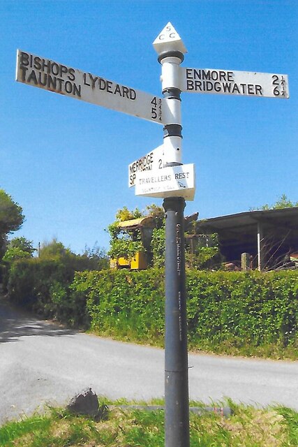
///obeyed.kettles.inserting. Near Bishops Lydeard, Somerset

Related Wikis

Seven Sisters (Quantock Hills)

The Seven Sisters is a clump of beech trees on Cothelstone Hill in the Quantock Hills, England. Originally planted in the 18th century, they form a well...

Church of All Saints, Aisholt

All Saints Church in Aisholt, Somerset, England, is the Anglican parish church for the ancient parish of Aisholt, now part of the Quantock Villages Benefice...

West Bagborough Hoard

The West Bagborough Hoard is a hoard of 670 Roman coins and 72 pieces of hacksilver found in October 2001 by metal detectorist James Hawkesworth near...

West Bagborough

West Bagborough is a village and civil parish in Somerset, England, about 5 miles (8.0 km) north of Taunton. In 2011, the village had a population of 358...

Bagborough House

Bagborough House in West Bagborough, Somerset, England was built circa 1730. It was designated a Grade II* listed building on 4 May 1984.Bagborough House...

Church of St Pancras, West Bagborough

The Anglican Church of St Pancras in West Bagborough, Somerset, England was built in the 15th century. It is a Grade II* listed building. == History... ==

Cothelstone Manor

Cothelstone Manor in Cothelstone, Somerset, England was built in the mid-16th century, largely demolished by the parliamentary troops in 1646 and rebuilt...

Plainsfield Camp

Plainsfield Camp (or Park Plantation or Cockercombe Castle) is a possible Iron Age earthwork on the Quantock Hills near Aisholt in Somerset, England.The...

Nearby Amenities

Located within 500m of 51.099412,-3.1550525
The data included in this document is from www.openstreetmap.org. The data is made available under ODbL.

Have you been to Bishpool Covert?

Leave your review of Bishpool Covert below (or comments, questions and feedback).