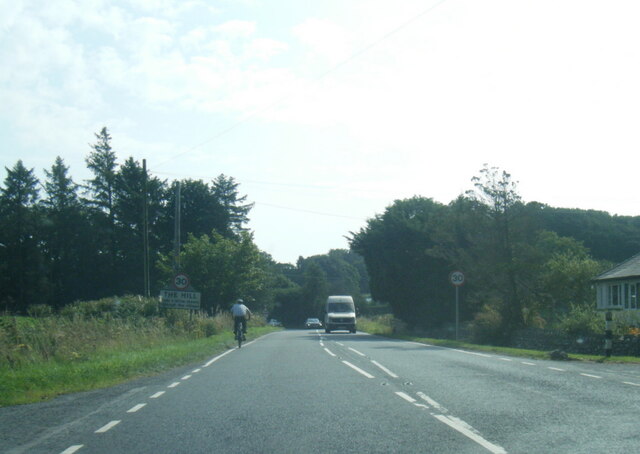
Haws Wood

Wood, Forest in Cumberland Copeland

England

Haws Wood

A5093 at The Green village boundary
A5093 at The Green village boundary Credit: Colin Pyle

Haws Wood, located in Cumberland, is a picturesque woodland that covers a vast area of the region. This enchanting forest is renowned for its natural beauty and diverse ecosystem, attracting nature enthusiasts and outdoor adventurers alike.

The wood is primarily composed of native broadleaf trees such as oak, beech, and birch, which create a dense canopy overhead and provide a haven for wildlife. The forest floor is adorned with a rich carpet of ferns, mosses, and wildflowers, adding to the area's allure. Haws Wood is also intersected by a meandering stream, enhancing its tranquility and offering a refreshing spot for visitors to rest and connect with nature.

The wood is home to a wide variety of fauna, including deer, squirrels, badgers, and a plethora of bird species. Ornithologists will be delighted to spot woodpeckers, thrushes, and owls among the trees. The forest's diverse habitat also supports a vibrant insect population, with butterflies, dragonflies, and bees buzzing around the wildflowers during the warmer months.

Haws Wood offers numerous walking trails and paths, allowing visitors to explore its beauty at their leisure. These trails cater to all levels of fitness and offer stunning views of the surrounding countryside. Nature lovers can also indulge in birdwatching, photography, and picnicking in designated areas.

Managed by local authorities, Haws Wood is a cherished natural resource in Cumberland. Its preservation and conservation efforts ensure that this woodland remains a thriving and enchanting destination for generations to come.

If you have any feedback on the listing, please let us know in the comments section below.
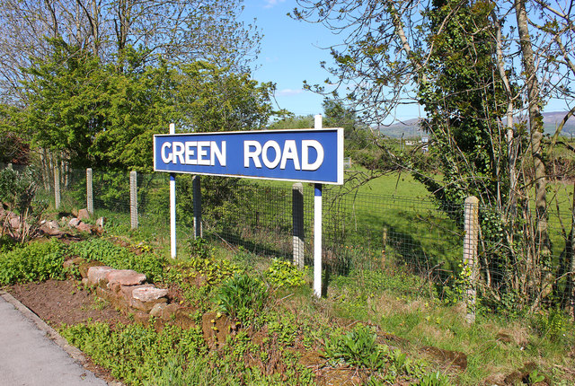
Haws Wood Images

Images are sourced within 2km of 54.244206/-3.2571323 or Grid Reference SD1883. Thanks to Geograph Open Source API. All images are credited.

A5093 at The Green village boundary
A5093 at The Hill village boundary
A5093 south of The Hill
The Punch Bowl Inn, The Green, Millom
Ordnance Survey Cut Mark This OS cut mark can be found on Old Hall Cottage. It marks a point 39.156m above mean sea level.
Ordnance Survey Cut Mark
This OS cut mark can be found on Old Hall Cottage. It marks a point 39.156m above mean sea level.
Ordnance Survey Cut Mark This OS cut mark can be found on Briar Dene. It marks a point 19.020m above mean sea level.
Ordnance Survey Cut Mark
This OS cut mark can be found on Briar Dene. It marks a point 19.020m above mean sea level.
SRPS Cumbrian Coast Railtour 2018 : Green Road Station
Boundary Stone Toppled and damaged, over stream, south side of the A595.
Boundary Stone
Toppled and damaged, over stream, south side of the A595.
Ordnance Survey Cut Mark This OS cut mark can be found on the wall south side of the road. It marks a point 54.724m above mean sea level.
Ordnance Survey Cut Mark
This OS cut mark can be found on the wall south side of the road. It marks a point 54.724m above mean sea level.
Ordnance Survey Cut Mark This OS cut mark can be found on the rock face NE side of the road. It marks a point 56.565m above mean sea level.
Ordnance Survey Cut Mark
This OS cut mark can be found on the rock face NE side of the road. It marks a point 56.565m above mean sea level.
Ordnance Survey Cut Mark This OS cut mark can be found on the Village Hall SE side of the road. It marks a point 51.075m above mean sea level.
Ordnance Survey Cut Mark
This OS cut mark can be found on the Village Hall SE side of the road. It marks a point 51.075m above mean sea level.
Ordnance Survey Cut Mark This OS cut mark can be found on the gatepost south side of the road. It marks a point 59.576m above mean sea level.
Ordnance Survey Cut Mark
This OS cut mark can be found on the gatepost south side of the road. It marks a point 59.576m above mean sea level.
Ordnance Survey Flush Bracket (G3081) This OS Flush Bracket can be found on Hall Bank. It marks a point 28.226m above mean sea level.
Ordnance Survey Flush Bracket (G3081)
This OS Flush Bracket can be found on Hall Bank. It marks a point 28.226m above mean sea level.
Ordnance Survey Cut Mark This OS cut mark can be found on the brick building at Waltham Nursery. It marks a point 5.925m above mean sea level.
Ordnance Survey Cut Mark
This OS cut mark can be found on the brick building at Waltham Nursery. It marks a point 5.925m above mean sea level.
Ordnance Survey Cut Mark This OS cut mark can be found on a gatepost SE side of the track. It marks a point 6.172m above mean sea level.
Ordnance Survey Cut Mark
This OS cut mark can be found on a gatepost SE side of the track. It marks a point 6.172m above mean sea level.
Ordnance Survey Flush Bracket (G3077) This OS Flush Bracket can be found on The Oaks. It marks a point 35.752m above mean sea level.
Ordnance Survey Flush Bracket (G3077)
This OS Flush Bracket can be found on The Oaks. It marks a point 35.752m above mean sea level.
Ordnance Survey Cut Mark This OS cut mark can be found on the gatepost NE side of the road. It marks a point 59.489m above mean sea level.
Ordnance Survey Cut Mark
This OS cut mark can be found on the gatepost NE side of the road. It marks a point 59.489m above mean sea level.
Green Road Station sign at Green Road, Cumbria.
Green Road
Station sign at Green Road, Cumbria.
Show me another place!

Haws Wood is located at Grid Ref: SD1883 (Lat: 54.244206, Lng: -3.2571323)

Administrative County: Cumbria

District: Copeland

Police Authority: Cumbria

What 3 Words

///zone.singers.wimp. Near Millom, Cumbria

Related Wikis

Arnaby

Arnaby is a village in Cumbria, England.

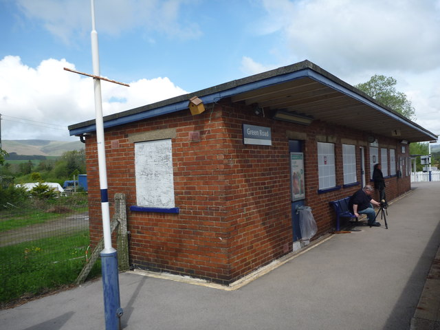
Green Road railway station

Green Road is a railway station on the Cumbrian Coast Line, which runs between Carlisle and Barrow-in-Furness. The station, situated 13+1⁄2 miles (22 km...

Millom Without

Millom Without is a civil parish in the county of Cumbria, England. It had a population of 1,638 in 2001, decreasing to 859 at the 2011 Census. Millom...

Thwaites, Cumbria

Thwaites is a small village near Duddon Valley and on the edge of the Duddon Estuary in the Lake District National Park in the Borough of Copeland, Cumbria...

St Anne's Church, Thwaites

St Anne's Church is in the village of Thwaites, Cumbria, England. It is an active Anglican parish church in the deanery of Millom, the archdeaconry of...

St Peter, Drigg

St Peter, Drigg is in Drigg, Cumbria, England. It is an active Anglican parish church in the deanery of Calder, and the diocese of Carlisle. Its benefice...

Millom Castle

Millom Castle is an ancient building at Millom in Cumbria. It is a Grade I listed building and scheduled ancient monument. == History == A manor on the...

Holy Trinity Church, Millom

Holy Trinity Church is a medieval building situated next to Millom Castle near the town of Millom, Cumbria, England. It is an active Anglican parish church...

Nearby Amenities

Located within 500m of 54.244206,-3.2571323
Post Box
Lat/Long: 54.2469767/-3.2529564
Power: pole
Lat/Long: 54.2415327/-3.2614357
Power: pole
Lat/Long: 54.2438653/-3.2594985
Power: pole
Lat/Long: 54.2436972/-3.2577433
Power: pole
Lat/Long: 54.243488/-3.2543855
Material: wood
Power: pole
Lat/Long: 54.2437693/-3.2603027
Material: wood
Power: pole
Lat/Long: 54.2435017/-3.2621871
Power: pole
Lat/Long: 54.2459199/-3.2558472
Power: pole
Lat/Long: 54.2451859/-3.2549902
Power: pole
Lat/Long: 54.2444038/-3.2541331
Power: pole
Lat/Long: 54.2446645/-3.2527712
Power: pole
Lat/Long: 54.2451379/-3.250399
Power: pole
Lat/Long: 54.2473168/-3.2574872
Power: pole
Lat/Long: 54.2480948/-3.2583151
Power: pole
Lat/Long: 54.2405062/-3.2572983
Power: pole
Lat/Long: 54.2435356/-3.2559448
Barrier: cattle_grid
Lat/Long: 54.246222/-3.2508386
Barrier: cattle_grid
Lat/Long: 54.2415899/-3.2607946
Barrier: cattle_grid
Lat/Long: 54.2409285/-3.2591585
Power: pole
Lat/Long: 54.2408455/-3.2536729
Power: pole
Lat/Long: 54.2411076/-3.2547442
Power: pole
Lat/Long: 54.2412351/-3.2552579
Power: pole
Lat/Long: 54.2404769/-3.255615
Power: pole
Lat/Long: 54.2398349/-3.2559317
Power: pole
Lat/Long: 54.2420904/-3.2548726
Power: pole
Lat/Long: 54.2431266/-3.2544909
Power: pole
Lat/Long: 54.2405453/-3.2585598
Power: pole
Lat/Long: 54.2425006/-3.2628416
The data included in this document is from www.openstreetmap.org. The data is made available under ODbL.

Have you been to Haws Wood?

Leave your review of Haws Wood below (or comments, questions and feedback).