Hagg Plantation

Wood, Forest in Cumberland Copeland

England

Hagg Plantation

A595 at Buckman Brow
A595 at Buckman Brow Credit: Colin Pyle

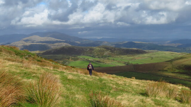
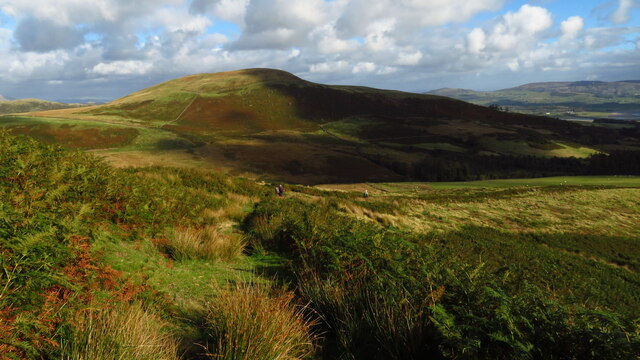
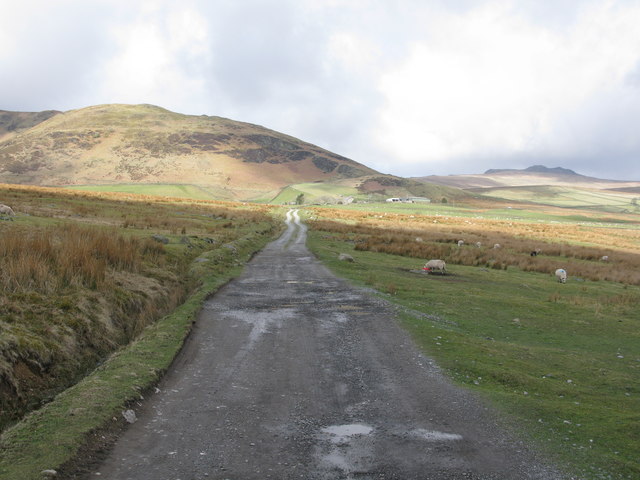
Hagg Plantation is a picturesque woodland situated in Cumberland, England, known for its natural beauty and diverse ecosystem. Covering an expansive area, this enchanting forest is a popular destination for nature enthusiasts and hikers seeking tranquility and a connection with the outdoors.

The plantation boasts a rich variety of tree species, including oak, beech, and pine, which create a vibrant tapestry of colors throughout the seasons. The dense canopy provides a haven for an array of wildlife, such as deer, foxes, badgers, and numerous bird species, making it a haven for wildlife enthusiasts and birdwatchers.

Traversing the plantation, visitors can enjoy a network of well-maintained trails that wind their way through the woodland, providing opportunities to explore its hidden corners and discover its hidden treasures. The paths are suitable for all levels of fitness, with options for leisurely strolls or more challenging hikes for the adventurous.

Hagg Plantation also offers various amenities to enhance visitors' experiences. Picnic areas are scattered throughout the forest, inviting families and friends to relax and enjoy the surrounding natural serenity. Additionally, guided nature walks and educational programs are available for those interested in learning more about the plantation's flora and fauna.

For those seeking a break from the hustle and bustle of city life, Hagg Plantation in Cumberland offers a tranquil retreat, where the majesty of nature can be experienced and appreciated. Whether it's a leisurely walk, birdwatching, or simply immersing oneself in the beauty of the woodland, this plantation provides an escape into nature's embrace.

If you have any feedback on the listing, please let us know in the comments section below.

Hagg Plantation Images

Images are sourced within 2km of 54.264688/-3.2641736 or Grid Reference SD1786. Thanks to Geograph Open Source API. All images are credited.

A595 at Buckman Brow
A5093 at The Green village boundary
The Punch Bowl Inn, The Green, Millom
Descending on path below Gray Stones, Black Combe
Descending on path below Grey Stones - view towards Knott Hill
Ordnance Survey Cut Mark This OS cut mark can be found adjacent to the letter box at Broadgate. It marks a point 107.274m above mean sea level.
Ordnance Survey Cut Mark
This OS cut mark can be found adjacent to the letter box at Broadgate. It marks a point 107.274m above mean sea level.
Ordnance Survey Cut Mark This OS cut mark can be found on Old Hall Cottage. It marks a point 39.156m above mean sea level.
Ordnance Survey Cut Mark
This OS cut mark can be found on Old Hall Cottage. It marks a point 39.156m above mean sea level.
Ordnance Survey Cut Mark This OS cut mark can be found on Briar Dene. It marks a point 19.020m above mean sea level.
Ordnance Survey Cut Mark
This OS cut mark can be found on Briar Dene. It marks a point 19.020m above mean sea level.
Ordnance Survey Cut Mark This OS cut mark can be found on a large rock to the west of the track.
Ordnance Survey Cut Mark
This OS cut mark can be found on a large rock to the west of the track.
Start of the track to the Swinside Stone Circle The track branching off to the left leads to the Stone Circle and Swinside Farm.
Start of the track to the Swinside Stone Circle
The track branching off to the left leads to the Stone Circle and Swinside Farm.
Track to the Swinside Stone Circle A rough track which also leads to Swinside Farm. Swinside Fell is in the background.
Track to the Swinside Stone Circle
A rough track which also leads to Swinside Farm. Swinside Fell is in the background.
Boundary Stone Toppled and damaged, over stream, south side of the A595.
Boundary Stone
Toppled and damaged, over stream, south side of the A595.
Ordnance Survey Cut Mark This OS cut mark can be found on the gatepost south side of the road. It marks a point 59.576m above mean sea level.
Ordnance Survey Cut Mark
This OS cut mark can be found on the gatepost south side of the road. It marks a point 59.576m above mean sea level.
Ordnance Survey Cut Mark This OS cut mark can be found on the large boulder in the wall SE side of the road. It marks a point 99.048m above mean sea level.
Ordnance Survey Cut Mark
This OS cut mark can be found on the large boulder in the wall SE side of the road. It marks a point 99.048m above mean sea level.
Ordnance Survey OSBM Bolt This OS Bolt can be found on the large boulder at the side of the barn at Low Broadgate. It marks a point 81.764m above mean sea level.
Ordnance Survey OSBM Bolt
This OS Bolt can be found on the large boulder at the side of the barn at Low Broadgate. It marks a point 81.764m above mean sea level.
Ordnance Survey Cut Mark This OS cut mark can be found on the wall NW side of the road. It marks a point 98.207m above mean sea level.
Ordnance Survey Cut Mark
This OS cut mark can be found on the wall NW side of the road. It marks a point 98.207m above mean sea level.
Ordnance Survey Cut Mark This OS cut mark can be found on the west parapet of Waughfoot Bridge. It marks a point 132.683m above mean sea level.
Ordnance Survey Cut Mark
This OS cut mark can be found on the west parapet of Waughfoot Bridge. It marks a point 132.683m above mean sea level.
Ordnance Survey Rivet This OS rivet can be found on the wall west side of the road. It marks a point 175.230m above mean sea level.
Ordnance Survey Rivet
This OS rivet can be found on the wall west side of the road. It marks a point 175.230m above mean sea level.
Show me another place!

Hagg Plantation is located at Grid Ref: SD1786 (Lat: 54.264688, Lng: -3.2641736)

Administrative County: Cumbria

District: Copeland

Police Authority: Cumbria

What 3 Words

///overpaid.wanting.cracker. Near Millom, Cumbria

Related Wikis

St Anne's Church, Thwaites

St Anne's Church is in the village of Thwaites, Cumbria, England. It is an active Anglican parish church in the deanery of Millom, the archdeaconry of...

Thwaites, Cumbria

Thwaites is a small village near Duddon Valley and on the edge of the Duddon Estuary in the Lake District National Park in the Borough of Copeland, Cumbria...

Millom Without

Millom Without is a civil parish in the county of Cumbria, England. It had a population of 1,638 in 2001, decreasing to 859 at the 2011 Census. Millom...

Swinside

Swinside, which is also known as Sunkenkirk and Swineshead, is a stone circle lying beside Swinside Fell, part of Black Combe in southern Cumbria, North...

Green Road railway station

Green Road is a railway station on the Cumbrian Coast Line, which runs between Carlisle and Barrow-in-Furness. The station, situated 13+1⁄2 miles (22 km...

Arnaby

Arnaby is a village in Cumbria, England.

Duddon furnace

The Duddon furnace (Grid Reference SD 197883) is a surviving charcoal-fuelled blast furnace near Broughton-in-Furness in Cumbria. It is on the west side...

Duddon Bridge

Duddon Bridge is a hamlet in Cumbria, England. == References ==

Nearby Amenities

Located within 500m of 54.264688,-3.2641736
Power: pole
Lat/Long: 54.2657941/-3.2573688
Power: pole
Lat/Long: 54.2652505/-3.2574376
Power: pole
Lat/Long: 54.2640215/-3.2575711
Power: pole
Lat/Long: 54.263485/-3.257644
Power: pole
Lat/Long: 54.2646998/-3.2575064
Power: pole
Lat/Long: 54.2629484/-3.2577087
Power: pole
Lat/Long: 54.2623906/-3.2577856
Cherrytree Brest
Place: locality
Lat/Long: 54.2665426/-3.2645247
The data included in this document is from www.openstreetmap.org. The data is made available under ODbL.

Have you been to Hagg Plantation?

Leave your review of Hagg Plantation below (or comments, questions and feedback).