Brimley Copse

Wood, Forest in Devon Somerset West and Taunton

England

Brimley Copse

Clayhidon: the Half Moon Inn Looking north-north-east. The inn stands close to Clayhidon church
Clayhidon: the Half Moon Inn Credit: Martin Bodman

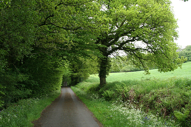
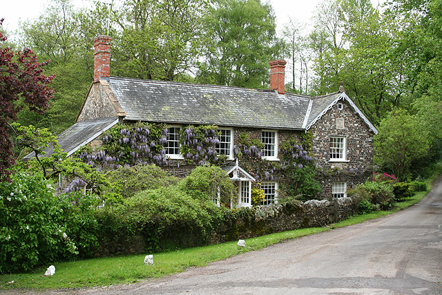
Brimley Copse is a charming woodland located in the county of Devon, England. Covering an area of approximately 20 hectares, it is nestled in the heart of the picturesque countryside, providing a tranquil escape from the hustle and bustle of everyday life.

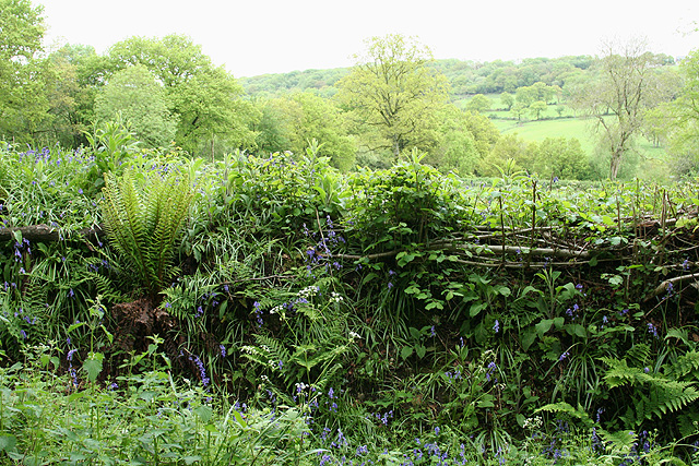
The copse is predominantly made up of native broadleaf trees, including oak, beech, and ash, which create a rich and diverse habitat for a variety of wildlife. The dense canopy allows only dappled sunlight to filter through, casting enchanting shadows on the forest floor.

Walking through Brimley Copse, visitors are greeted with a carpet of vibrant wildflowers in the spring and summer months, including bluebells, primroses, and foxgloves. The woodland is also home to numerous species of birds, such as woodpeckers, thrushes, and owls, which can be heard singing their melodious tunes.

Tranquil streams meander through the copse, adding to the idyllic atmosphere. These water sources provide a habitat for small aquatic creatures, including frogs, newts, and dragonflies.

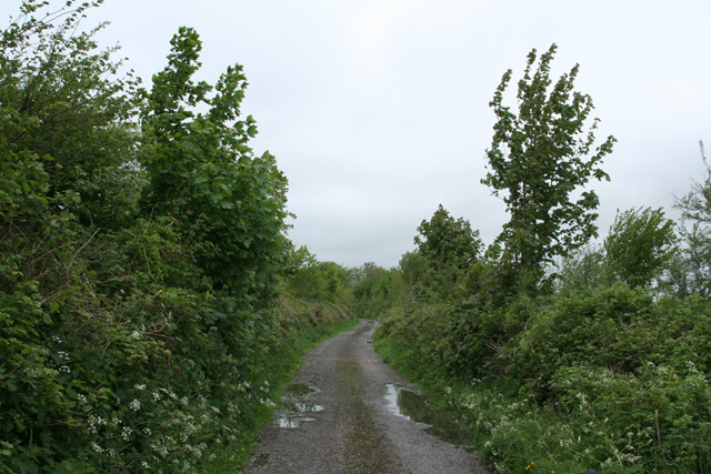
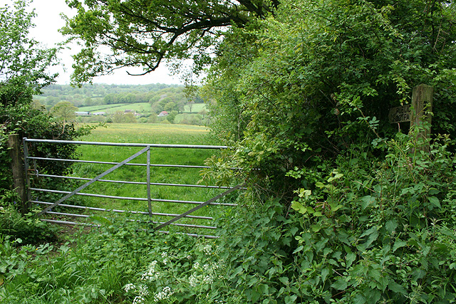
Brimley Copse offers a network of well-maintained footpaths, allowing visitors to explore its beauty at their own pace. It is a popular destination for nature enthusiasts, hikers, and families looking to enjoy a peaceful day out in nature.

Managed by the local conservation trust, Brimley Copse is dedicated to preserving the natural ecosystem and promoting biodiversity. The copse serves as an important educational resource, with guided nature walks and workshops organized throughout the year.

In summary, Brimley Copse is a picturesque woodland in Devon, offering a haven of tranquility, rich biodiversity, and opportunities for outdoor exploration and education.

If you have any feedback on the listing, please let us know in the comments section below.

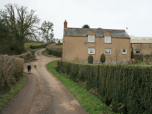
Brimley Copse Images

Images are sourced within 2km of 50.920996/-3.1759667 or Grid Reference ST1714. Thanks to Geograph Open Source API. All images are credited.

Clayhidon: the Half Moon Inn Looking north-north-east. The inn stands close to Clayhidon church
Clayhidon: the Half Moon Inn
Looking north-north-east. The inn stands close to Clayhidon church
Clayhidon: Hidon Mill The mill, now a private residence, retained a waterwheel when offered for sale in 2002. It was powered by leats from the Culm and a stream running down from Gollick Park
Clayhidon: Hidon Mill
The mill, now a private residence, retained a waterwheel when offered for sale in 2002. It was powered by leats from the Culm and a stream running down from Gollick Park
Clayhidon: parish hall The hall stands by a T-junction
Clayhidon: parish hall
The hall stands by a T-junction
Clayhidon: view from Half Moon car park Looking south-south-east towards the Culm valley
Clayhidon: view from Half Moon car park
Looking south-south-east towards the Culm valley
Clayhidon: St Andrew’s church
Clayhidon: nearing Lillycombe Farm Looking south west. The signpost at Lillycombe Cross can just be seen. After rain
Clayhidon: nearing Lillycombe Farm
Looking south west. The signpost at Lillycombe Cross can just be seen. After rain
Clayhidon: Lillycombe Farm Looking north west on the road to Hemyock. At Lillycombe Cross the signpost carries the alternative spelling ‘Lilycombe’
Clayhidon: Lillycombe Farm
Looking north west on the road to Hemyock. At Lillycombe Cross the signpost carries the alternative spelling ‘Lilycombe’
Clayhidon: lane from Lilycombe Cross Looking south on the way to Biscombe Cross.
Clayhidon: lane from Lilycombe Cross
Looking south on the way to Biscombe Cross.
Clayhidon: towards Grants Farm Looking east-south-east from the lane between Lilycombe Cross and Biscombe Cross
Clayhidon: towards Grants Farm
Looking east-south-east from the lane between Lilycombe Cross and Biscombe Cross
Churchstanton: lane to Biscombe Looking east-south-east
Churchstanton: lane to Biscombe
Looking east-south-east
Churchstanton: hedgebank near Biscombe Looking north-north-east
Churchstanton: hedgebank near Biscombe
Looking north-north-east
Churchstanton: Stapley Mill A 19th century watermill and millers house now combined in one residence. The course of the leat is still evident in the garden. Looking north east
Churchstanton: Stapley Mill
A 19th century watermill and millers house now combined in one residence. The course of the leat is still evident in the garden. Looking north east
Churchstanton: Rainbow Lane Near its junction with Broad Street on the Blackdowns. The lane or track runs to Biscombe. Looking north-north-west
Churchstanton: Rainbow Lane
Near its junction with Broad Street on the Blackdowns. The lane or track runs to Biscombe. Looking north-north-west
Churchstanton: lane to Court Farm Looking west-north-west
Churchstanton: lane to Court Farm
Looking west-north-west
Churchstanton: near Courtsmoor Farm Start of a public footpath providing a shortcut across fields. Lear’s Farm in the distance. The public footpath sign is almost lost amongst the foliage
Churchstanton: near Courtsmoor Farm
Start of a public footpath providing a shortcut across fields. Lear’s Farm in the distance. The public footpath sign is almost lost amongst the foliage
Churchstanton: Ringdown Nature Reserve A 59-acre site acquired by the Somerset Wildlife Trust in 1998. It runs down to a tributary of the river Culm. The estate includes wet woodland, marshy grassland, spring line mire and improved grassland. Orchids and butterwort feature together with devils bit scabious and bog asphodel. Woodcock and snipe can be seen here in the winter
Churchstanton: Ringdown Nature Reserve
A 59-acre site acquired by the Somerset Wildlife Trust in 1998. It runs down to a tributary of the river Culm. The estate includes wet woodland, marshy grassland, spring line mire and improved grassland. Orchids and butterwort feature together with devils bit scabious and bog asphodel. Woodcock and snipe can be seen here in the winter
Churchstanton: Downlands Lane Looking north
Churchstanton: Downlands Lane
Looking north
Clayhidon: Shackles Cross Signpost by the turning to Bolham Water. Note the Ordnance Survey map – Pathfinder 1277 of 1987 – has a spelling in the singular: ‘Shackel Cross’. Looking north east
Clayhidon: Shackles Cross
Signpost by the turning to Bolham Water. Note the Ordnance Survey map – Pathfinder 1277 of 1987 – has a spelling in the singular: ‘Shackel Cross’. Looking north east
Show me another place!

Brimley Copse is located at Grid Ref: ST1714 (Lat: 50.920996, Lng: -3.1759667)

Administrative County: Somerset

District: Somerset West and Taunton

Police Authority: Avon and Somerset

What 3 Words

///adapt.cleanser.packing. Near Hemyock, Devon

Nearby Locations

Brimley Copse

Related Wikis

Ringdown SSSI, Somerset

Ringdown (grid reference ST178155) is a 4.0 hectare (9.9 acre) biological Site of Special Scientific Interest west of Burnworthy in the Blackdown Hills...
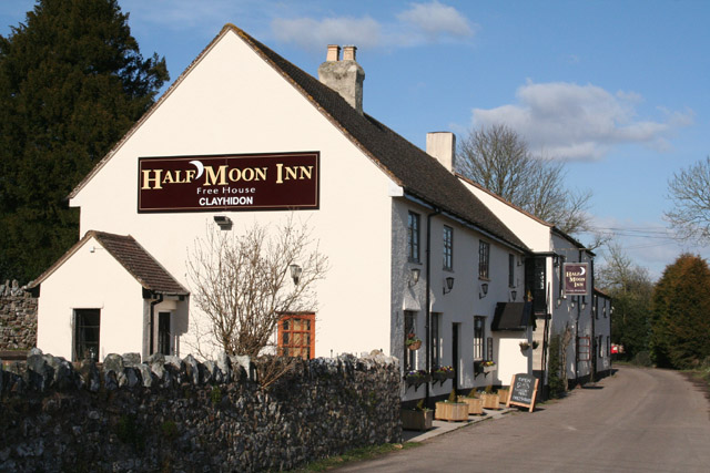
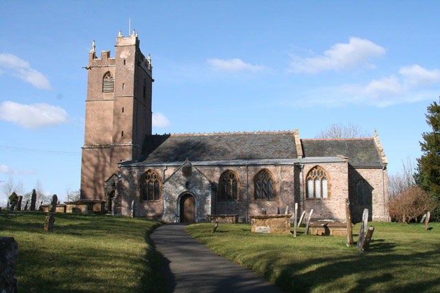
Clayhidon

Clayhidon () is a village and civil parish in Mid Devon, England. The parish church is St. Andrews. The parish is in the Blackdown Hills and its northern...

Churchstanton

Churchstanton is a village and civil parish in Somerset, England, situated within the Blackdown Hills Area of Outstanding Natural Beauty, on the River...

Ashculme

Ashculme is a village in Devon, England.

Nearby Amenities

Located within 500m of 50.920996,-3.1759667
Ford: yes
Lat/Long: 50.9244759/-3.1750286
The data included in this document is from www.openstreetmap.org. The data is made available under ODbL.

Have you been to Brimley Copse?

Leave your review of Brimley Copse below (or comments, questions and feedback).