Bullhall Copse

Wood, Forest in Devon East Devon

England

Bullhall Copse

Sand Farm at Cotford This large range of farm buildings is almost certainly associated with the large house nearby of Sand Barton , the barton of which appears to have been demolished some time ago.
Sand Farm at Cotford Credit: Nigel Mykura

Bullhall Copse is a charming woodland area located in the county of Devon, England. Covering an approximate area of 10 acres, this copse is situated near the village of Bullhall and is a popular destination for nature enthusiasts and hikers alike.

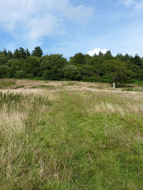
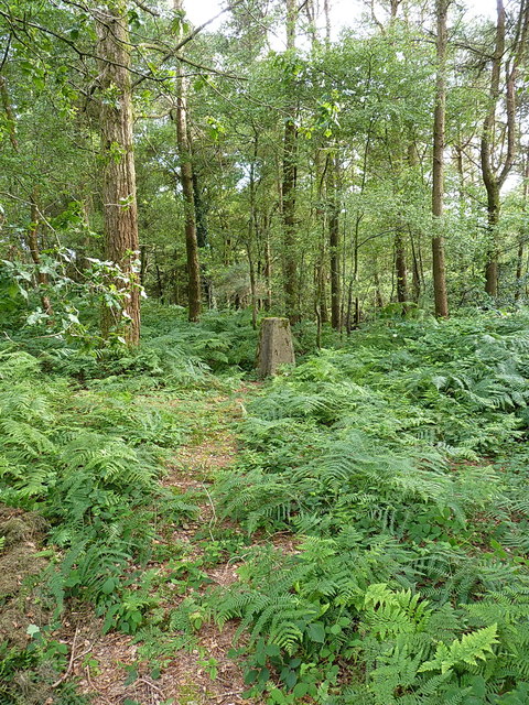
The copse is characterized by its dense and diverse vegetation, consisting primarily of a mix of deciduous and coniferous trees. Towering oak and beech trees dominate the landscape, while spruce and pine trees provide a contrasting green backdrop. The forest floor is covered in a thick carpet of mosses, ferns, and wildflowers, creating a beautiful tapestry of colors during the spring and summer months.

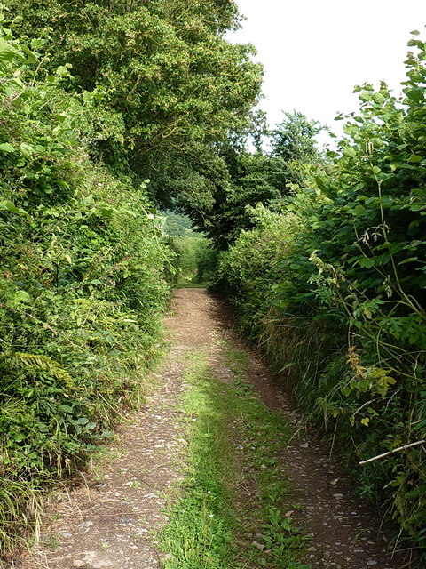
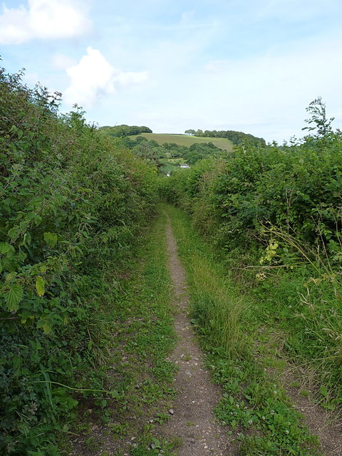
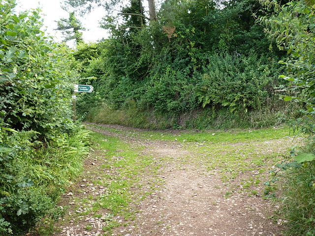
Within Bullhall Copse, visitors can explore a network of well-maintained trails that wind through the woodland, allowing for leisurely strolls or more adventurous hikes. These paths lead to a tranquil pond, where visitors can often spot an array of wildlife, including birds, squirrels, and even the occasional deer.

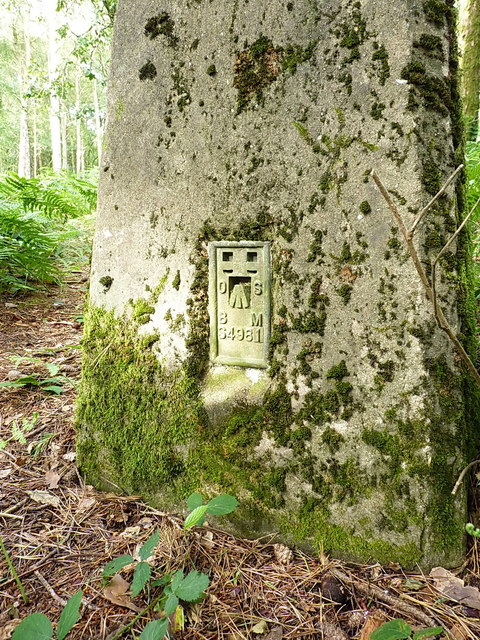
The copse also offers several designated picnic areas, providing visitors with a chance to relax and enjoy the peaceful surroundings. Additionally, there are information boards strategically placed throughout the copse, providing interesting facts about the local flora and fauna, as well as the history of the area.

Overall, Bullhall Copse in Devon is a picturesque woodland destination that offers a serene escape from the hustle and bustle of everyday life. With its beautiful trees, diverse wildlife, and well-maintained trails, it is a must-visit location for any nature lover or those seeking a tranquil retreat.

If you have any feedback on the listing, please let us know in the comments section below.

Bullhall Copse Images

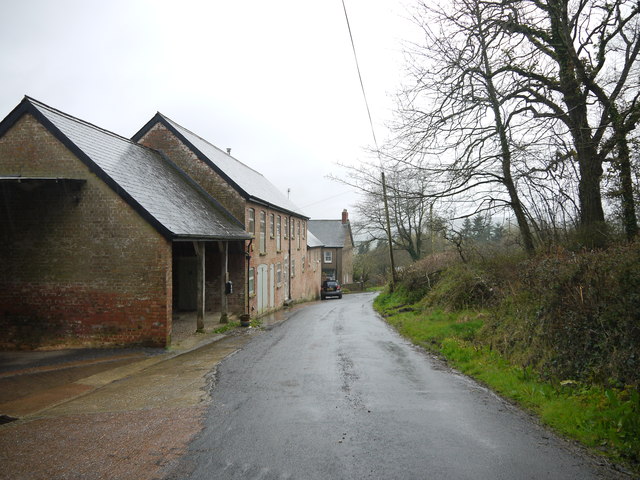
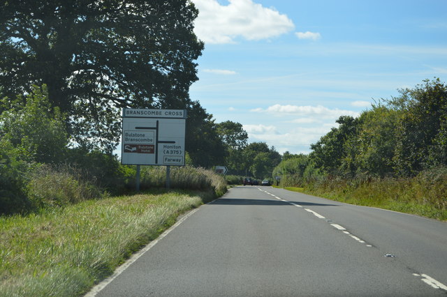
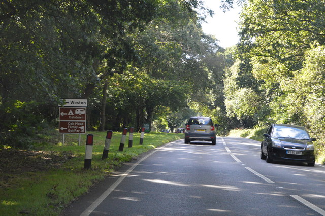
Images are sourced within 2km of 50.720474/-3.1934922 or Grid Reference SY1591. Thanks to Geograph Open Source API. All images are credited.

Sand Farm at Cotford This large range of farm buildings is almost certainly associated with the large house nearby of Sand Barton , the barton of which appears to have been demolished some time ago.
Sand Farm at Cotford
This large range of farm buildings is almost certainly associated with the large house nearby of Sand Barton , the barton of which appears to have been demolished some time ago.
A3052, Branscombe Cross The A3052 Road runs 27 miles from Charnmouth to Clyst St Mary. It runs parallel to the East Devon coastline, but inland.
<span class="nowrap"><a title="http://www.sabre-roads.org.uk/wiki/index.php?title=A3052" rel="nofollow ugc noopener" href="http://www.sabre-roads.org.uk/wiki/index.php?title=A3052">Link</a><img style="margin-left:2px;" alt="External link" title="External link - shift click to open in new window" src="https://s1.geograph.org.uk/img/external.png" width="10" height="10"/></span>
A3052, Branscombe Cross
The A3052 Road runs 27 miles from Charnmouth to Clyst St Mary. It runs parallel to the East Devon coastline, but inland. LinkExternal link
A3052 The A3052 Road runs 27 miles from Charnmouth to Clyst St Mary. It runs parallel to the East Devon coastline, but inland.
<span class="nowrap"><a title="http://www.sabre-roads.org.uk/wiki/index.php?title=A3052" rel="nofollow ugc noopener" href="http://www.sabre-roads.org.uk/wiki/index.php?title=A3052">Link</a><img style="margin-left:2px;" alt="External link" title="External link - shift click to open in new window" src="https://s1.geograph.org.uk/img/external.png" width="10" height="10"/></span>
A3052
The A3052 Road runs 27 miles from Charnmouth to Clyst St Mary. It runs parallel to the East Devon coastline, but inland. LinkExternal link
Bridleway onto Buckton Hill
Buckton Hill trig Lonely and somewhat unloved in the woods on Buckton Hill, the visit descriptions on <span class="nowrap"><a title="http://trigpointing.uk/trig/1751" rel="nofollow ugc noopener" href="http://trigpointing.uk/trig/1751">Link</a><img style="margin-left:2px;" alt="External link" title="External link - shift click to open in new window" src="https://s1.geograph.org.uk/img/external.png" width="10" height="10"/></span> don't exactly make you want to bother with this one! In fairness, it's not as overgrown as it once was, and provided the horseflies don't get you, the woods are quite pleasant.
Buckton Hill trig
Lonely and somewhat unloved in the woods on Buckton Hill, the visit descriptions on LinkExternal link don't exactly make you want to bother with this one! In fairness, it's not as overgrown as it once was, and provided the horseflies don't get you, the woods are quite pleasant.
OS Flush Bracket S4981 Fitted into Buckton Hill trig, the FB was levelled in 1948 at 180.203m above Ordnance Datum Newlyn.
OS Flush Bracket S4981
Fitted into Buckton Hill trig, the FB was levelled in 1948 at 180.203m above Ordnance Datum Newlyn.
Track on Buckley Plain There is a smallholding (just visible) at the far end of the field, and the track runs more or less along the length of Buckton Hill, past that and into the woods behind me.
Track on Buckley Plain
There is a smallholding (just visible) at the far end of the field, and the track runs more or less along the length of Buckton Hill, past that and into the woods behind me.
Open field on Buckley Plain Surrounded by woodland, with Buckley Plantation to the west and Buddle Wood to the east.
Open field on Buckley Plain
Surrounded by woodland, with Buckley Plantation to the west and Buddle Wood to the east.
Buckton Lane east of Buckton Farm Barely wide enough to get a horse or cycle along, this track is not marked as a dedicated right of way on the maps, but is used as a concessionary route between Buckton and Harecombe Farms.
Buckton Lane east of Buckton Farm
Barely wide enough to get a horse or cycle along, this track is not marked as a dedicated right of way on the maps, but is used as a concessionary route between Buckton and Harecombe Farms.
Buckton Lane near Harecombe Farm A narrow, concessionary path across the lower parts of Buckton Hill.
Buckton Lane near Harecombe Farm
A narrow, concessionary path across the lower parts of Buckton Hill.
Path junction near Harecombe Farm The sign saying 'To Public footpath' is the clue here. None of the tracks in the shot are recorded as true rights of way, but they are permitted as concessionary paths to join a network of bridleways and footpaths in the area. And occasionally used by agricultural vehicles, by the look of things.
Path junction near Harecombe Farm
The sign saying 'To Public footpath' is the clue here. None of the tracks in the shot are recorded as true rights of way, but they are permitted as concessionary paths to join a network of bridleways and footpaths in the area. And occasionally used by agricultural vehicles, by the look of things.
Harecombe or Harcombe Farm cottage The spellings vary according to the scale of the map, but regardless, this is a late 17th or early 18th Century, Grade II listed building <span class="nowrap"><a title="https://www.britishlistedbuildings.co.uk/101228397-harcombe-farm-cottage-sidmouth#.WY2Sx9QrLGg" rel="nofollow ugc noopener" href="https://www.britishlistedbuildings.co.uk/101228397-harcombe-farm-cottage-sidmouth#.WY2Sx9QrLGg">Link</a><img style="margin-left:2px;" alt="External link" title="External link - shift click to open in new window" src="https://s1.geograph.org.uk/img/external.png" width="10" height="10"/></span> sporting a good example of the local chimney type.
Harecombe or Harcombe Farm cottage
The spellings vary according to the scale of the map, but regardless, this is a late 17th or early 18th Century, Grade II listed building LinkExternal link sporting a good example of the local chimney type.
Barns at Harecombe Farm A row of converted barns and outbuildings at the side of Chelson Lane.
Barns at Harecombe Farm
A row of converted barns and outbuildings at the side of Chelson Lane.
Pillar Box cottage The reason for the current name is pretty obvious, although the postbox is Victorian, so it may well have been known as something else prior to the installation of that. The cottage itself dates from the 17th Century, and was Grade II listed <span class="nowrap"><a title="https://www.britishlistedbuildings.co.uk/101097980-pillar-box-sidmouth#.WY2UtNQrLGg" rel="nofollow ugc noopener" href="https://www.britishlistedbuildings.co.uk/101097980-pillar-box-sidmouth#.WY2UtNQrLGg">Link</a><img style="margin-left:2px;" alt="External link" title="External link - shift click to open in new window" src="https://s1.geograph.org.uk/img/external.png" width="10" height="10"/></span> in 1973.
Pillar Box cottage
The reason for the current name is pretty obvious, although the postbox is Victorian, so it may well have been known as something else prior to the installation of that. The cottage itself dates from the 17th Century, and was Grade II listed LinkExternal link in 1973.
Victorian postbox at Harcombe Wallbox EX10 88, installed in a cottage wall just east of the bridge over the brook. The box looks very similar to a type made by W T Allen of London in the 1890s, but they normally cast their name at the base, which makes me think this may not actually be one of theirs.
Victorian postbox at Harcombe
Wallbox EX10 88, installed in a cottage wall just east of the bridge over the brook. The box looks very similar to a type made by W T Allen of London in the 1890s, but they normally cast their name at the base, which makes me think this may not actually be one of theirs.
Chapel Cottage, Harcombe Set slightly back from the lane up towards Harcombe, Chapel Cottage was Grade II listed <span class="nowrap"><a title="https://www.britishlistedbuildings.co.uk/101097981-chapel-cottage-sidmouth#.WY2Xg9QrLGg" rel="nofollow ugc noopener" href="https://www.britishlistedbuildings.co.uk/101097981-chapel-cottage-sidmouth#.WY2Xg9QrLGg">Link</a><img style="margin-left:2px;" alt="External link" title="External link - shift click to open in new window" src="https://s1.geograph.org.uk/img/external.png" width="10" height="10"/></span> in 1973, and dates back to the 17th Century.
Chapel Cottage, Harcombe
Set slightly back from the lane up towards Harcombe, Chapel Cottage was Grade II listed LinkExternal link in 1973, and dates back to the 17th Century.
Quickways Cottages - Westcott The western lefthand half of a pair of Grade II listed <span class="nowrap"><a title="https://www.britishlistedbuildings.co.uk/101212862-quickwayswest-cottage-sidmouth#.WY2aq9QrLGg" rel="nofollow ugc noopener" href="https://www.britishlistedbuildings.co.uk/101212862-quickwayswest-cottage-sidmouth#.WY2aq9QrLGg">Link</a><img style="margin-left:2px;" alt="External link" title="External link - shift click to open in new window" src="https://s1.geograph.org.uk/img/external.png" width="10" height="10"/></span> 18th Century listed cottages. The other half is <a href="https://www.geograph.org.uk/photo/5493353">SY1590 : Quickways Cottages - Quietways</a>
Quickways Cottages - Westcott
The western lefthand half of a pair of Grade II listed LinkExternal link 18th Century listed cottages. The other half is SY1590 : Quickways Cottages - Quietways
Quickways Cottages - Quietways The righthand and eastern half of a pair of Grade II listed <span class="nowrap"><a title="https://www.britishlistedbuildings.co.uk/101212862-quickwayswest-cottage-sidmouth#.WY2aq9QrLGg" rel="nofollow ugc noopener" href="https://www.britishlistedbuildings.co.uk/101212862-quickwayswest-cottage-sidmouth#.WY2aq9QrLGg">Link</a><img style="margin-left:2px;" alt="External link" title="External link - shift click to open in new window" src="https://s1.geograph.org.uk/img/external.png" width="10" height="10"/></span> 18th Century cottages in Harcombe. The other one of the pair is <a href="https://www.geograph.org.uk/photo/5493351">SY1590 : Quickways Cottages - Westcott</a>
Quickways Cottages - Quietways
The righthand and eastern half of a pair of Grade II listed LinkExternal link 18th Century cottages in Harcombe. The other one of the pair is SY1590 : Quickways Cottages - Westcott
Show me another place!

Bullhall Copse is located at Grid Ref: SY1591 (Lat: 50.720474, Lng: -3.1934922)

Administrative County: Devon

District: East Devon

Police Authority: Devon and Cornwall

What 3 Words

///dined.brain.challenge. Near Sidmouth, Devon

Related Wikis

Sidbury

Sidbury is a large village and former civil parish north of Sidmouth, now in the parish of Sidmouth, in the East Devon district, in the county of Devon...

The Donkey Sanctuary

The Donkey Sanctuary is a British charitable organisation devoted to the welfare of donkeys. The charity, which is based near Sidmouth in Devon, England...

Sidbury Manor

Sidbury Manor is a privately owned 19th-century country mansion situated at Sidbury, Sidmouth, East Devon. It is a Grade II listed building. Built in 1879...

Weston, Devon

Weston is a small hamlet near Sidmouth in East Devon, England. It is near the Donkey Sanctuary and less than a mile from the beach at Branscombe; footpaths...

Nearby Amenities

Located within 500m of 50.720474,-3.1934922
Harombe Hill
Place: locality
Lat/Long: 50.7161023/-3.1924955
The data included in this document is from www.openstreetmap.org. The data is made available under ODbL.

Have you been to Bullhall Copse?

Leave your review of Bullhall Copse below (or comments, questions and feedback).