Lady's Wood

Wood, Forest in Somerset Somerset West and Taunton

England

Lady's Wood

Pool Below Woodlands Hill
Pool Below Woodlands Hill Credit: Chris Andrews

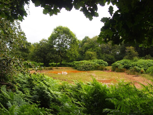
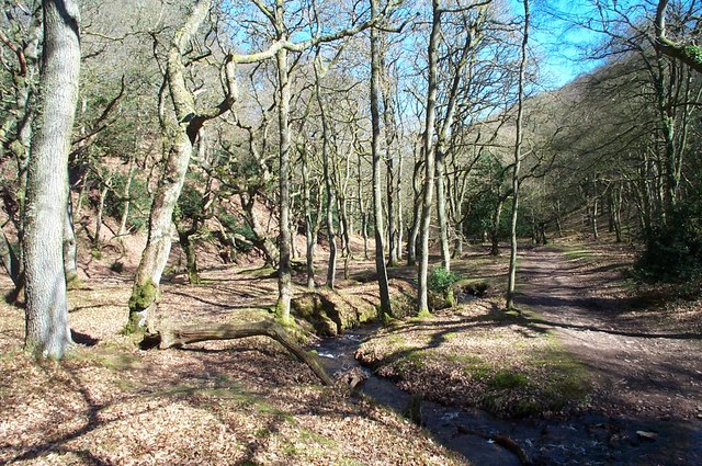
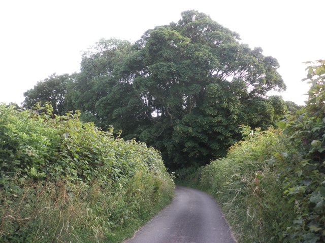
Lady's Wood is a picturesque woodland located in the county of Somerset, England. Nestled amidst the rolling hills and charming countryside, this ancient woodland is a haven for nature lovers and outdoor enthusiasts. Spanning over a vast expanse of approximately 500 acres, Lady's Wood offers a serene and tranquil escape from the hustle and bustle of modern life.

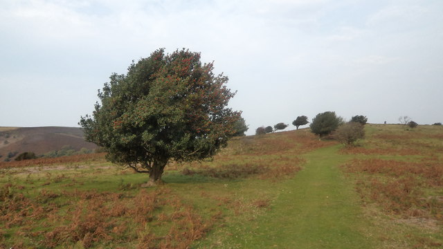
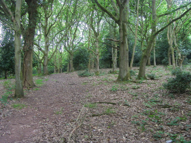
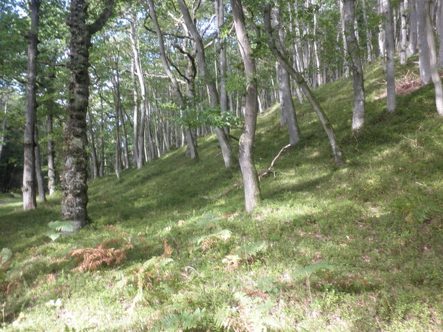
The woodland is home to a diverse range of flora and fauna, making it an important ecological site. Visitors can expect to see a variety of tree species, including oak, beech, ash, and birch, creating a rich and vibrant tapestry of colors throughout the seasons. The forest floor is adorned with wildflowers and ferns, adding to the enchanting atmosphere.

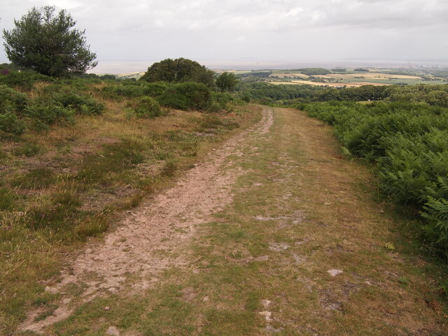
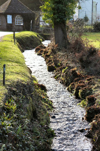
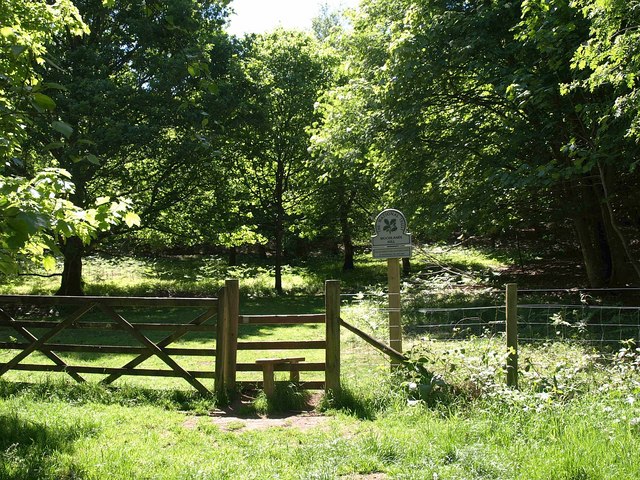
For those seeking outdoor activities, Lady's Wood provides ample opportunities for walking, hiking, and wildlife spotting. A network of well-maintained trails crisscross the woodland, allowing visitors to explore its hidden gems. The paths lead to secluded clearings, ancient trees, and babbling brooks that add to the magical ambiance.

The woodland is also home to a diverse range of wildlife. Keen-eyed visitors may catch a glimpse of deer, badgers, foxes, and an array of bird species, including woodpeckers, owls, and songbirds. The serene surroundings make it an ideal spot for birdwatching and photography.

Additionally, Lady's Wood offers educational programs and guided tours for those interested in learning more about the local ecology and conservation efforts. The knowledgeable staff ensures a memorable and informative experience for visitors of all ages.

Overall, Lady's Wood is a natural treasure, offering a peaceful retreat and the opportunity to appreciate the beauty of Somerset's countryside.

If you have any feedback on the listing, please let us know in the comments section below.
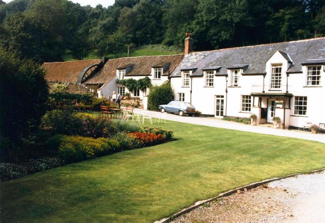
Lady's Wood Images

Images are sourced within 2km of 51.141775/-3.2076004 or Grid Reference ST1538. Thanks to Geograph Open Source API. All images are credited.

Pool Below Woodlands Hill
Track on Lower Hare Knap
Holford: waterwheel at Combe House Hotel The 26’ diameter overshot waterwheel was cast by Bridgwater ironfounder H Culverwell & Co in 1892 to replace an earlier wheel. It was used to grind oak bark for the tannery complex established here in the 1840s by James Hayman. When the tannery closed in 1900 the waterwheel was adapted to other uses such as grinding grain for grist, cutting chaff, chopping apples for the cider press and generating electricity. It also cracked stones in a nearby quarry. The gearing survives too. Combe House Hotel is open to non residents for lunches and teas
Holford: waterwheel at Combe House Hotel
The 26’ diameter overshot waterwheel was cast by Bridgwater ironfounder H Culverwell & Co in 1892 to replace an earlier wheel. It was used to grind oak bark for the tannery complex established here in the 1840s by James Hayman. When the tannery closed in 1900 the waterwheel was adapted to other uses such as grinding grain for grist, cutting chaff, chopping apples for the cider press and generating electricity. It also cracked stones in a nearby quarry. The gearing survives too. Combe House Hotel is open to non residents for lunches and teas
Dodington, Somerset View from S of the village towards the 'Castle of Comfort' Hotel beside the A39, with the Quantock Hills in the background.
Dodington, Somerset
View from S of the village towards the 'Castle of Comfort' Hotel beside the A39, with the Quantock Hills in the background.
Hodder's Combe. Ancient oak woodland lines the combe bottom.
Hodder's Combe.
Ancient oak woodland lines the combe bottom.
Entrance to Combe House Hotel Looking back towards the road from the front of the hotel.
Entrance to Combe House Hotel
Looking back towards the road from the front of the hotel.
Stream in Holford Combe This stream used to drive the watermill at what is now Castle Combe Hotel.
Stream in Holford Combe
This stream used to drive the watermill at what is now Castle Combe Hotel.
Woodlands Hill A stile from the car park by the A39 into the oak woodland owned by the National Trust, although their website has nothing to say about the place, perhaps because there is no tearoom.
Woodlands Hill
A stile from the car park by the A39 into the oak woodland owned by the National Trust, although their website has nothing to say about the place, perhaps because there is no tearoom.
Combe House Hotel, Holford, in 1986
Holly Tree A fine example of a mature and healthy holly tree, on Lower Hare Knap, on the Quantocks. I soon discovered a proliferation of healthy holly trees as I walked over the knap to Holford.
Holly Tree
A fine example of a mature and healthy holly tree, on Lower Hare Knap, on the Quantocks. I soon discovered a proliferation of healthy holly trees as I walked over the knap to Holford.
Path on Woodlands Hill Off the A39 path on Woodlands Hill
Path on Woodlands Hill
Off the A39 path on Woodlands Hill
Wooded hillside, Hodder's Combe
Coewell Lane
Coewell Lane
Crash Scene The view of an accident scene on the A39 near Holford, Somerset.
Crash Scene
The view of an accident scene on the A39 near Holford, Somerset.
Crash Clean Up The view of the road clean after an accident on the A39 near Holford, Somerset.
Crash Clean Up
The view of the road clean after an accident on the A39 near Holford, Somerset.
Mill wheel at Combe House Hotel
Reservoir in Holford Combe Seems to be disused. Probably one used to control water to the mill downstream.
Reservoir in Holford Combe
Seems to be disused. Probably one used to control water to the mill downstream.
Heathland on Woodlands Hill More information here;    <span class="nowrap"><a title="http://www.nationaltrust.org.uk/article-1356405391274/" rel="nofollow ugc noopener" href="http://www.nationaltrust.org.uk/article-1356405391274/">Link</a><img style="margin-left:2px;" alt="External link" title="External link - shift click to open in new window" src="https://s1.geograph.org.uk/img/external.png" width="10" height="10"/></span>
Heathland on Woodlands Hill
More information here; LinkExternal link
Show me another place!

Lady's Wood is located at Grid Ref: ST1538 (Lat: 51.141775, Lng: -3.2076004)

Administrative County: Somerset

District: Somerset West and Taunton

Police Authority: Avon and Somerset

What 3 Words

///hexes.glosses.prettiest. Near Nether Stowey, Somerset

Related Wikis

Dowsborough

Dowsborough Camp (or Danesborough or Dawesbury) is an Iron Age hill fort on the Quantock Hills near Nether Stowey in Somerset, England. It has been designated...

Dead Woman's Ditch

Dead Woman's Ditch is an earthwork which has been scheduled as an ancient monument in Over Stowey, Somerset, England situated on the Quantock Hills. A...

Quantock Hills

The Quantock Hills west of Bridgwater in Somerset, England, consist of heathland, oak woodlands, ancient parklands and agricultural land. They were England...

Dodington Hall

Dodington Hall in Dodington, within the English county of Somerset, was built in the 15th century. It is a Grade II* listed building.The house is built...

Crowcombe

Crowcombe is a village and civil parish under the Quantock Hills in Somerset, England, 5.5 miles (9 km) southeast of Watchet, and 8 miles (13 km) from...

All Saints Church, Dodington

All Saints Church at Dodington in the parish of Holford, Somerset, England was rebuilt and enlarged in the 15th century. It has been designated by English...

Holford

Holford is a village and civil parish in West Somerset within the Quantock Hills Area of Outstanding Natural Beauty. It is located about 10 miles (16 km...

Crowcombe Court

Crowcombe Court in Crowcombe, Somerset, England is a large country house dating from 1724 to 1739. It is Grade I listed.It was built, in English regional...

Nearby Amenities

Located within 500m of 51.141775,-3.2076004
Lady's Fountain
Natural: spring
Lat/Long: 51.1407839/-3.203129
The data included in this document is from www.openstreetmap.org. The data is made available under ODbL.

Have you been to Lady's Wood?

Leave your review of Lady's Wood below (or comments, questions and feedback).