Clephanton

Settlement in Nairnshire

Scotland

Clephanton

Field at Old Newton of Budgate
Field at Old Newton of Budgate Credit: Douglas Nelson

Clephanton is a small village located in the county of Nairnshire, Scotland. Situated in the Highland region, this picturesque settlement is surrounded by stunning natural landscapes and is known for its tranquility and beauty.

With a population of around 300 residents, Clephanton is a close-knit community that prides itself on its strong sense of community spirit. The village is characterized by its well-preserved traditional Scottish architecture, with many stone-built houses and cottages dotting the landscape.

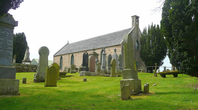
Clephanton is blessed with a rich history, dating back to ancient times. The area is home to a number of archaeological sites, including prehistoric burial mounds and standing stones, which serve as a reminder of the village's past. The village also boasts a beautiful old church, adding to its historical charm.

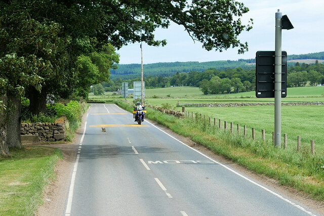
Nature lovers will find Clephanton to be a paradise, as it is surrounded by breathtaking scenery. The village is nestled amidst rolling hills and lush green fields, providing ample opportunities for outdoor activities such as hiking, cycling, and birdwatching. There are also several well-maintained walking trails that lead to nearby forests and rivers, allowing visitors to immerse themselves in the beauty of the Scottish countryside.

While Clephanton is a peaceful rural village, it is conveniently located near the town of Nairn, which offers a range of amenities including shops, restaurants, and schools. Additionally, the city of Inverness is just a short drive away, providing residents with access to further services and entertainment options.

In conclusion, Clephanton is a charming village in Nairnshire, Scotland, known for its tight-knit community, stunning natural surroundings, and rich history. It is an ideal destination for those seeking a tranquil and picturesque retreat in the Scottish Highlands.

If you have any feedback on the listing, please let us know in the comments section below.

Clephanton Images

Images are sourced within 2km of 57.529499/-3.977467 or Grid Reference NH8150. Thanks to Geograph Open Source API. All images are credited.

Field at Old Newton of Budgate
Farmland at Old Newton of Budgate
Cyclist on the B9091 near Croy
Motor Cycle on the B9090 at Newton of Budgate
B9090 Old military Road towards Cawdor
B9090 near Newton of Budgate
Forestry track, Dallaschyle Wood
Overgrown track, Dallaschyle Wood
Overgrown track towards Holme Bridge
Holme Bridge above the River Nairn
Track near Holme Bridge
Ruined building near Dallaschyle This may have been a gatehouse at one time.
Ruined building near Dallaschyle
This may have been a gatehouse at one time.
Dallaschyle A glimpse of the house at Dallaschyle from the roadside.
Dallaschyle
A glimpse of the house at Dallaschyle from the roadside.
Old Newton of Budgate Looking across the fields towards the farm buildings at Old Newton of Budgate.
Old Newton of Budgate
Looking across the fields towards the farm buildings at Old Newton of Budgate.
Near Kilravock This track leads round through the woods at Dallaschyle to reach Kilravock Castle via Holme Bridge.
Near Kilravock
This track leads round through the woods at Dallaschyle to reach Kilravock Castle via Holme Bridge.
Sheep and straw bales At Newton of Budgate.
Sheep and straw bales
At Newton of Budgate.
Grazing land Near Old Newton of Budgate.
Grazing land
Near Old Newton of Budgate.
Run in, Dallaschyle The first day of the 2003 Scottish 6 days orienteering event. The race took place in Dallaschyle Woods which also hosted one of the races at the 1999 World Championships.
Run in, Dallaschyle
The first day of the 2003 Scottish 6 days orienteering event. The race took place in Dallaschyle Woods which also hosted one of the races at the 1999 World Championships.
Show me another place!

Clephanton is located at Grid Ref: NH8150 (Lat: 57.529499, Lng: -3.977467)

Unitary Authority: Highland

Police Authority: Highlands and Islands

What 3 Words

///slogans.rezoning.puzzle. Near Ardersier, Highland

Nearby Locations

Clephanton

Related Wikis

Clephanton

Clephanton is a small hamlet 2 miles south-east from Ardersier and 7 miles south-west of Nairn in Inverness-shire, Scottish Highlands. It is in the Scottish...
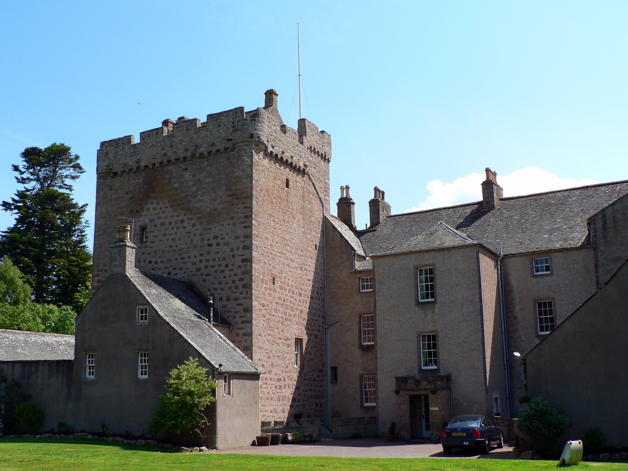
Kilravock Castle

Kilravock Castle (pronounced Kilrawk) is located near the village of Croy, between Inverness and Nairn, in the council area of Highland, Scotland. It was...

Croy, Highland

Croy (Gaelic: Crothaigh) is a village between Inverness and Nairn, in the Highland council area in Scotland. The village looks over the Moray Firth and...

Cawdor (Roman fort)

Cawdor (Roman Fort), located near the small village of Easter Galcantray (15 miles or 24 kilometres east of Inverness), is suspected of being one of the...

Nearby Amenities

Located within 500m of 57.529499,-3.977467
Clephanton
Place: hamlet
Wikidata: Q5131778
Wikipedia: en:Clephanton
Lat/Long: 57.529984/-3.9764477
Bus Stop
Clephanton
Naptan AtcoCode: 670030046
Naptan Bearing: S
Naptan CommonName: Clephanton
Naptan Indicator: at Junction towards Cawdor
Naptan Landmark: B9091
Naptan NaptanCode: 45326548
Naptan Street: B9090
Naptan Verified: no
Source: naptan_import
Lat/Long: 57.5295954/-3.9775243
Bus Stop
Clephanton
Naptan AtcoCode: 670030046A
Naptan Bearing: NW
Naptan CommonName: Clephanton
Naptan Indicator: at Junction towards Croy
Naptan Landmark: B9091
Naptan NaptanCode: 45326563
Naptan Street: B9090
Naptan Verified: no
Source: naptan_import
Lat/Long: 57.529274/-3.97739
Power: tower
Lat/Long: 57.5261321/-3.9740343
Power: pole
Lat/Long: 57.5310213/-3.9703697
Power: pole
Lat/Long: 57.5311574/-3.9714439
Power: pole
Lat/Long: 57.5313155/-3.9725453
Power: pole
Lat/Long: 57.5315116/-3.9737013
Power: pole
Lat/Long: 57.5317414/-3.9741593
Power: pole
Lat/Long: 57.5320122/-3.9747264
Power: pole
Lat/Long: 57.5314962/-3.9753452
Power: pole
Lat/Long: 57.5309781/-3.9759668
Power: pole
Lat/Long: 57.530479/-3.9765884
Power: pole
Lat/Long: 57.530482/-3.9775644
Power: pole
Lat/Long: 57.5304959/-3.978914
Power: pole
Lat/Long: 57.5302837/-3.9698872
Power: pole
Lat/Long: 57.5298007/-3.9705006
Power: pole
Lat/Long: 57.5292913/-3.9711522
Power: pole
Lat/Long: 57.5287761/-3.9718447
The data included in this document is from www.openstreetmap.org. The data is made available under ODbL.

Have you been to Clephanton?

Leave your review of Clephanton below (or comments, questions and feedback).