Crofthill Wood

Wood, Forest in Cumberland Copeland

England

Crofthill Wood

A camping field at Church Stile site
A camping field at Church Stile site Credit: David Medcalf

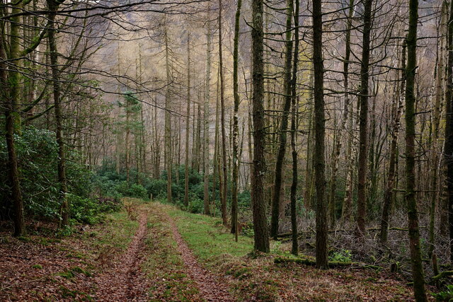
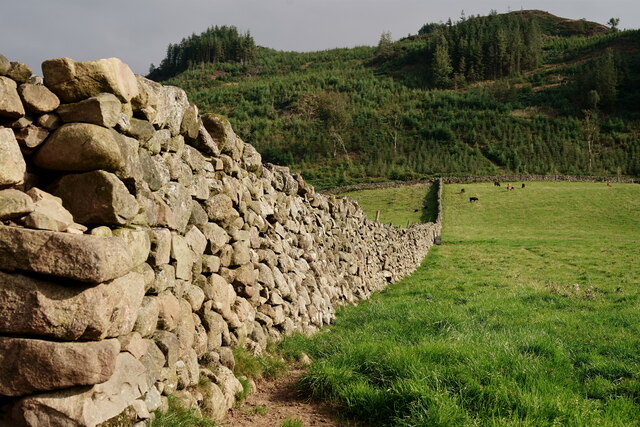
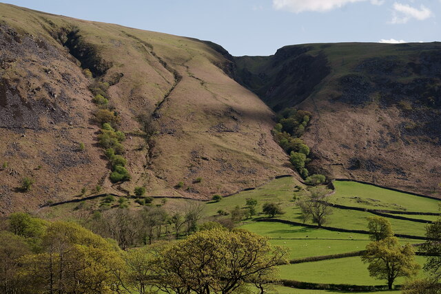
Crofthill Wood, located in Cumberland, is a picturesque forest renowned for its natural beauty and rich biodiversity. Spread across a sprawling area, this wood encompasses a variety of habitats, including ancient woodland, open glades, and a small stream.

The wood is predominantly composed of broadleaf species, such as oak, ash, beech, and birch, which create a dense canopy, providing shelter and a thriving environment for numerous flora and fauna. The forest floor is covered with a carpet of ferns, bluebells, and wild garlic during spring, adding vibrant colors to the landscape.

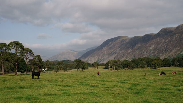
Crofthill Wood is not only a haven for plant life, but also a sanctuary for a diverse range of wildlife. The forest is home to a plethora of bird species, including great spotted woodpeckers, tawny owls, and various warblers. Mammals such as red squirrels, badgers, and foxes can also be spotted within the wood, as well as a variety of insects and butterflies.

The forest offers several walking trails, allowing visitors to explore its enchanting beauty. These trails wind through the woodland, offering glimpses of hidden glades and tranquil spots perfect for picnics. The peaceful ambiance of Crofthill Wood makes it a popular destination for nature lovers, hikers, and photographers alike.

Managed by a local conservation organization, the wood is carefully preserved to ensure the maintenance of its natural habitats and the protection of its diverse wildlife. Crofthill Wood stands as a testament to the beauty and importance of preserving natural landscapes for future generations to enjoy.

If you have any feedback on the listing, please let us know in the comments section below.

Crofthill Wood Images

Images are sourced within 2km of 54.425301/-3.3310162 or Grid Reference NY1304. Thanks to Geograph Open Source API. All images are credited.

A camping field at Church Stile site
Wasdale Woodland Private woodland. Sadly, due to disease, all rhododendron, larch and sweet chestnut in the wood have to be felled by May 2022.
Wasdale Woodland
Private woodland. Sadly, due to disease, all rhododendron, larch and sweet chestnut in the wood have to be felled by May 2022.
Wasdale View Looking towards The Screes from behind the wall boundary.
Wasdale View
Looking towards The Screes from behind the wall boundary.
Wasdale View Looking towards The Screes from behind the wall boundary.
Wasdale View
Looking towards The Screes from behind the wall boundary.
Wasdale View Looking towards The Screes from behind the wall boundary.
Wasdale View
Looking towards The Screes from behind the wall boundary.
Wasdale Wall Looking towards the road which leads to Nether Wasdale.
Wasdale Wall
Looking towards the road which leads to Nether Wasdale.
Wasdale Wall Looking in the direction of Latterbarrow. A plantation of diseased larch was felled in 2013 and subsequently re-planted (probably spruce).
Wasdale Wall
Looking in the direction of Latterbarrow. A plantation of diseased larch was felled in 2013 and subsequently re-planted (probably spruce).
Wasdale View from a footpath in Nether Wasdale, with Great Gable in the centre of picture.
Wasdale
View from a footpath in Nether Wasdale, with Great Gable in the centre of picture.
Wasdale View from a footpath in Nether Wasdale, with The Screes to the right of picture.
Wasdale
View from a footpath in Nether Wasdale, with The Screes to the right of picture.
Wasdale View from a footpath in Nether Wasdale, with Great Gable towards the right of picture.
Wasdale
View from a footpath in Nether Wasdale, with Great Gable towards the right of picture.
Wasdale View towards Yewbarrow, from the path at the base of Latterbarrow.
Wasdale
View towards Yewbarrow, from the path at the base of Latterbarrow.
Wasdale View from a footpath in Nether Wasdale. Great Gable is to the right of picture and 'The Flass' is the white building to the extreme left.
Wasdale
View from a footpath in Nether Wasdale. Great Gable is to the right of picture and 'The Flass' is the white building to the extreme left.
Wasdale View towards The Screes, from a footpath in Nether Wasdale.
Wasdale
View towards The Screes, from a footpath in Nether Wasdale.
Wasdale Looking along the road to Nether Wasdale.
Wasdale
Looking along the road to Nether Wasdale.
Road near Low Wood The roadside verge beside the Nether Wasdale to Gosforth road is so overgrown with rhododendrons and brambles that it is difficult to pick out the roadside wall.
There is an Ordnance Survey fundamental benchmark hidden under the rhododendron bush nearest to the road (photographs <a href="https://www.geograph.org.uk/photo/7131793">NY1204 : Wasdale Fundamental Benchmark</a> and <a href="https://www.geograph.org.uk/photo/7132882">NY1204 : Wasdale Fundamental Benchmark</a>).
Road near Low Wood
The roadside verge beside the Nether Wasdale to Gosforth road is so overgrown with rhododendrons and brambles that it is difficult to pick out the roadside wall. There is an Ordnance Survey fundamental benchmark hidden under the rhododendron bush nearest to the road (photographs NY1204 : Wasdale Fundamental Benchmark and NY1204 : Wasdale Fundamental Benchmark).
Wasdale Fundamental Benchmark Almost hidden under a rhododendron and protected by brambles, the Wasdale Fundamental Bench Mark marks a height of 79.5882m above sea level (Ordnance Datum Newlyn) and is a GPS network passive station (location photograph <a href="https://www.geograph.org.uk/photo/7124832">NY1204 : Road near Low Wood</a>, detail photograph <a href="https://www.geograph.org.uk/photo/7132882">NY1204 : Wasdale Fundamental Benchmark</a>).
The plate on the front reads: Ordnance Survey B M
Wasdale Fundamental Benchmark
Almost hidden under a rhododendron and protected by brambles, the Wasdale Fundamental Bench Mark marks a height of 79.5882m above sea level (Ordnance Datum Newlyn) and is a GPS network passive station (location photograph NY1204 : Road near Low Wood, detail photograph NY1204 : Wasdale Fundamental Benchmark). The plate on the front reads: Ordnance Survey B M
Wasdale Fundamental Benchmark Detail of the top of the Wasdale Fundamental Benchmark.  The height tag is missing, but the benchmark marks a height of 79.5882m above sea level (Ordnance Datum Newlyn) last levelled and verified in 1952 (location photographs <a href="https://www.geograph.org.uk/photo/7131793">NY1204 : Wasdale Fundamental Benchmark</a> and <a href="https://www.geograph.org.uk/photo/7124832">NY1204 : Road near Low Wood</a>).
The benchmark is a GPS network passive station.
Wasdale Fundamental Benchmark
Detail of the top of the Wasdale Fundamental Benchmark. The height tag is missing, but the benchmark marks a height of 79.5882m above sea level (Ordnance Datum Newlyn) last levelled and verified in 1952 (location photographs NY1204 : Wasdale Fundamental Benchmark and NY1204 : Road near Low Wood). The benchmark is a GPS network passive station.
View Towards Greathall Gill Seen from the road outside Woodhow Farm.
View Towards Greathall Gill
Seen from the road outside Woodhow Farm.
Show me another place!

Crofthill Wood is located at Grid Ref: NY1304 (Lat: 54.425301, Lng: -3.3310162)

Administrative County: Cumbria

District: Copeland

Police Authority: Cumbria

What 3 Words

///homework.repaid.following. Near Seascale, Cumbria

Related Wikis

Wasdale, Eskdale and Duddon

Wasdale, Eskdale and Duddon is an area of protected countryside, now held as National Trust property: it is part of the Lake District, located in south...

Wasdale

Wasdale (; traditionally ) is a valley and civil parish in the western part of the Lake District National Park in Cumbria, England. The River Irt flows...

St Michael & All Angels, Nether Wasdale

St Michael & All Angels' Church in Nether Wasdale, Cumbria, England, is an active Anglican parish church in the deanery of Calder, and the diocese of Carlisle...

Nether Wasdale

Nether Wasdale is a village in Cumbria, England, located in the valley and civil parish of Wasdale, near the River Irt and just over a mile to the west...

Nearby Amenities

Located within 500m of 54.425301,-3.3310162
Barrier: kissing_gate
Source: survey;bing;gps
Lat/Long: 54.4232762/-3.3242156
Barrier: stile
Material: wood
Source: survey;bing;gps
Stile: stepover
Lat/Long: 54.4263507/-3.3370705
Woodhow
Place: locality
Lat/Long: 54.4262282/-3.3275496
Ashness How
Place: locality
Lat/Long: 54.4288274/-3.3315882
Power: pole
Lat/Long: 54.4220803/-3.3350134
Power: pole
Lat/Long: 54.4217899/-3.3341312
Power: pole
Lat/Long: 54.4214994/-3.3329688
Power: pole
Lat/Long: 54.4219617/-3.3303372
Power: pole
Lat/Long: 54.4224573/-3.3296951
Power: pole
Lat/Long: 54.4231945/-3.3288776
Power: pole
Lat/Long: 54.4237411/-3.3278505
Power: pole
Lat/Long: 54.4242876/-3.326812
Power: pole
Lat/Long: 54.4247843/-3.3260402
Power: pole
Lat/Long: 54.4251933/-3.3263623
The data included in this document is from www.openstreetmap.org. The data is made available under ODbL.

Have you been to Crofthill Wood?

Leave your review of Crofthill Wood below (or comments, questions and feedback).