Clegyrnant

Settlement in Montgomeryshire

Wales

Clegyrnant

Gate into woodland Despite being not that old, the gate is buried in undergrowth and clearly hasn't been opened for some time.
Gate into woodland Credit: Nigel Brown

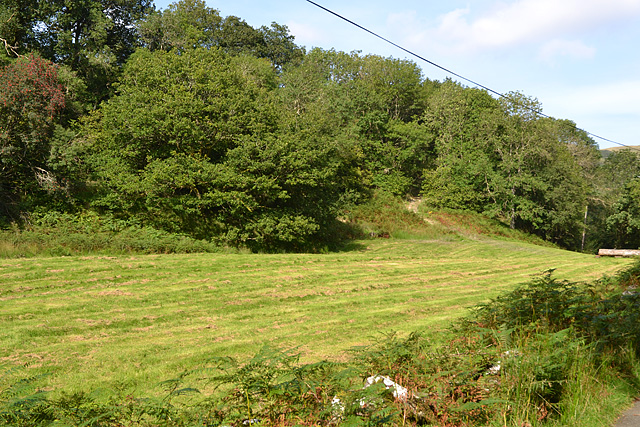
Clegyrnant is a small village located in the county of Montgomeryshire, Wales. Situated in the beautiful countryside, the village is surrounded by rolling hills and lush green fields. It is part of the wider community of Llanfyllin and is approximately 5 miles north-east of the town.

The village itself is characterized by its tranquil ambiance and close-knit community. It is home to a population of around 200 residents who take great pride in their village and its heritage. The architecture of Clegyrnant is predominantly traditional, with quaint cottages and farmhouses dotting the landscape.

One of the notable features of Clegyrnant is the picturesque St. Beuno's Church, which dates back to the 13th century and is a Grade II listed building. The church serves as a focal point for the community and holds regular services, as well as hosting various cultural and social events throughout the year.

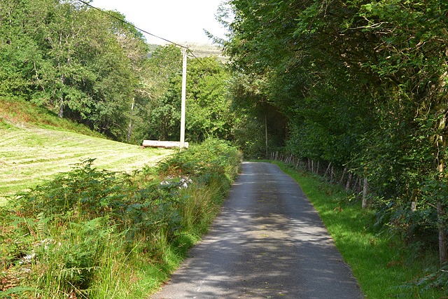
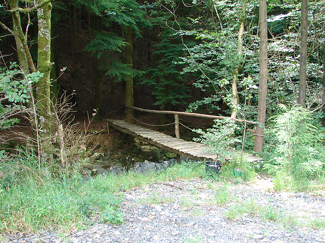
The surrounding countryside offers a plethora of outdoor activities for residents and visitors alike. There are numerous walking trails and hiking routes that provide breathtaking views of the Montgomeryshire countryside. The nearby Lake Vyrnwy is a popular destination for fishing and boating enthusiasts.

Although Clegyrnant is a small village, it benefits from its proximity to larger towns such as Llanfyllin and Welshpool, which offer a wider range of amenities including shops, schools, and healthcare facilities. Overall, Clegyrnant provides a peaceful and picturesque retreat for those seeking a slower pace of life in the heart of rural Wales.

If you have any feedback on the listing, please let us know in the comments section below.

Clegyrnant Images

Images are sourced within 2km of 52.655413/-3.597354 or Grid Reference SH9207. Thanks to Geograph Open Source API. All images are credited.

Gate into woodland Despite being not that old, the gate is buried in undergrowth and clearly hasn't been opened for some time.
Gate into woodland
Despite being not that old, the gate is buried in undergrowth and clearly hasn't been opened for some time.
Mown field Obviously being brought back into use from the state seen in <a href="https://www.geograph.org.uk/photo/520613">SH9106 : Fallow Land</a>.
Mown field
Obviously being brought back into use from the state seen in SH9106 : Fallow Land.
Minor road heading up Cwm Clegyrnant In quite a good state, despite serving only a few farms and dwellings up the valley.
Minor road heading up Cwm Clegyrnant
In quite a good state, despite serving only a few farms and dwellings up the valley.
Footpath marker post Flagging the footpath which follows the narrow strip of land between road and stream.
Footpath marker post
Flagging the footpath which follows the narrow strip of land between road and stream.
Road by the Clegyrnant
Bridge over the Clegyrnant From the general style, it appears to be of fairly recent construction.
Bridge over the Clegyrnant
From the general style, it appears to be of fairly recent construction.
Gate and track to Blaen y Cwm farm With the steep slopes of Moel Blaen-y-cwm in the distance.
Gate and track to Blaen y Cwm farm
With the steep slopes of Moel Blaen-y-cwm in the distance.
Field below Clegyrnant farm With Moel Blaen-y-cwm in the distance.
Field below Clegyrnant farm
With Moel Blaen-y-cwm in the distance.
Clegyrnant farm At the end of the public road up the valley.
Clegyrnant farm
At the end of the public road up the valley.
The Clegyrnant by Rhyd-y-meirch
The road past Rhyd-y-meirch farm
Ordnance Survey Cut Mark This OS cut mark can be found on the NE angle of a barn at Blaen-y-cwm Farm. It marks a point 271.4m above mean sea level.
Ordnance Survey Cut Mark
This OS cut mark can be found on the NE angle of a barn at Blaen-y-cwm Farm. It marks a point 271.4m above mean sea level.
Llyn Gwyddior
Llyn Gwyddior
Llyn Gwyddior Useful trout fishing in this upland lake.
Llyn Gwyddior
Useful trout fishing in this upland lake.
Coed yr Allt and Mynydd Rhiw-Saeson Viewed from the south east of the square.
Coed yr Allt and Mynydd Rhiw-Saeson
Viewed from the south east of the square.
Lane through Cwm Clegyrnant An area of mixed farming and forestry. Taken in the south east corner of the square where the lane just clips the corner.
Lane through Cwm Clegyrnant
An area of mixed farming and forestry. Taken in the south east corner of the square where the lane just clips the corner.
Bridge to the forest This bridge over Clegyrnant is for local estate use as it does not form part of a public footpath. It is not shown on current 1:50000 or 1:25000 maps.
Bridge to the forest
This bridge over Clegyrnant is for local estate use as it does not form part of a public footpath. It is not shown on current 1:50000 or 1:25000 maps.
Fallow Land Little use is being made of this land near Rhyd-yr-meirch. It is possibly being grown for pasture.
Fallow Land
Little use is being made of this land near Rhyd-yr-meirch. It is possibly being grown for pasture.
Show me another place!

Clegyrnant is located at Grid Ref: SH9207 (Lat: 52.655413, Lng: -3.597354)

Unitary Authority: Powys

Police Authority: Dyfed Powys

What 3 Words

///smoke.crispy.wrist. Near Cwm-Llinau, Powys

Nearby Locations

Clegyrnant

Related Wikis

Pandy, Powys

Pandy is a small village in Powys, Wales located off the main A470 road near Llanbrynmair.

Llanbrynmair railway station

Llanbrynmair railway station was a railway station on the Newtown and Machynlleth Railway (N&MR) in Mid-Wales, serving the village of Llanbrynmair. After...

Llanbrynmair

Llanbrynmair or Llanbryn-mair () is a village, community and electoral ward in Montgomeryshire, Powys, on the A470 road between Caersws and Machynlleth...

Domen Fawr, Tafolwern

Domen Fawr, or Tafolwern Castle was a motte-and-bailey castle of the Middle Ages. It is situated in Tafolwern, near Llanbrynmair in Powys. It is registered...

Nearby Amenities

Located within 500m of 52.655413,-3.597354
Building: yes
Lat/Long: 52.6578596/-3.6026838
Place: farm
Lat/Long: 52.6556078/-3.595989
Building: yes
Lat/Long: 52.6554126/-3.5947659
SK53 Solar: missing_building
Building: yes
Fixme: building area needed
Lat/Long: 52.6556341/-3.596212
Direction: 125
Generator Method: photovoltaic
Generator Output Electricity: yes
Generator Solar Modules: 16
Generator Source: solar
Generator Type: solar_photovoltaic_panel
Location: roof
Power: generator
Lat/Long: 52.6556109/-3.5961624
The data included in this document is from www.openstreetmap.org. The data is made available under ODbL.

Have you been to Clegyrnant?

Leave your review of Clegyrnant below (or comments, questions and feedback).