Cob Castle Copse

Wood, Forest in Somerset Somerset West and Taunton

England

Cob Castle Copse

Fitzhead: St James the Great In 1791 the church was dedicated to St Mary Magdalene. Until 1755 this was a daughter church or chapelry of Wiveliscombe; it was rebuilt in 1849. A new north aisle was added in 1887. The west tower survives from the earlier church and is 15th century
Fitzhead: St James the Great Credit: Martin Bodman

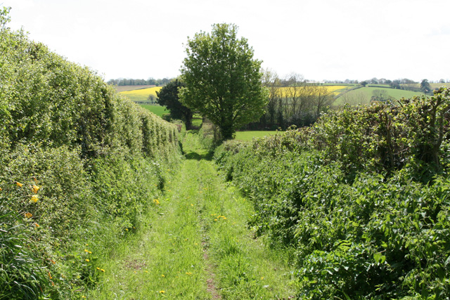
Cob Castle Copse is a picturesque wood located in the county of Somerset, England. Spanning over an area of approximately 50 hectares, this enchanting forest is renowned for its natural beauty and diverse flora and fauna.

The copse derives its name from the presence of cob, a local term for clay soil, which is abundant in the area. This unique soil composition contributes to the growth of a variety of tree species, including oak, beech, and ash. The towering trees create a dense canopy that provides shade and shelter to the woodland floor.

Walking through Cob Castle Copse, one is immediately struck by the tranquility and serenity of the surroundings. The air is filled with the earthy scent of damp leaves and the gentle rustling of wildlife. The forest floor is carpeted with a vibrant display of wildflowers, such as bluebells and primroses, which bloom in the springtime.

The copse is a haven for wildlife, offering a habitat for a wide range of creatures. Deer, badgers, and foxes can be spotted roaming among the trees, while various bird species, including woodpeckers and owls, make their homes in the treetops.

Cob Castle Copse is a popular destination for nature lovers, hikers, and photographers who seek solace in its peaceful surroundings. The forest is crisscrossed with well-maintained footpaths, allowing visitors to explore its hidden corners and discover its natural treasures.

In summary, Cob Castle Copse is a captivating woodland in Somerset, boasting a rich variety of trees, colorful wildflowers, and a thriving wildlife population. It is a true gem for those seeking a nature-filled escape in the heart of England.

If you have any feedback on the listing, please let us know in the comments section below.

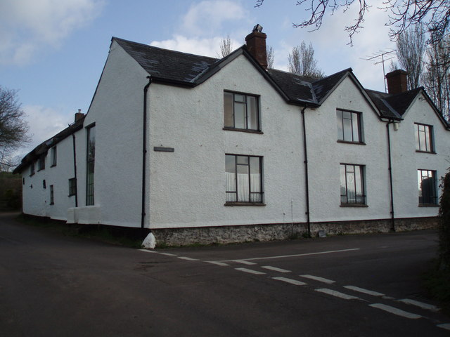
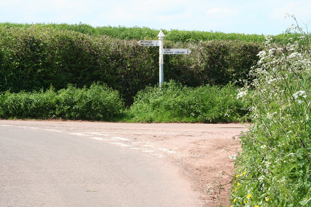
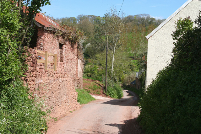
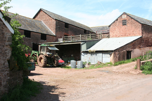
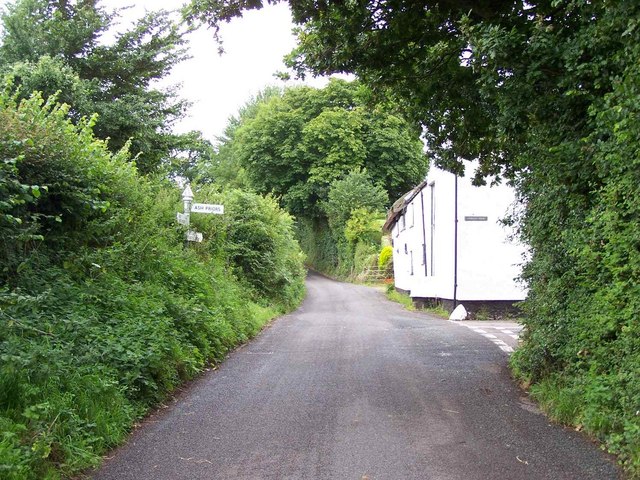
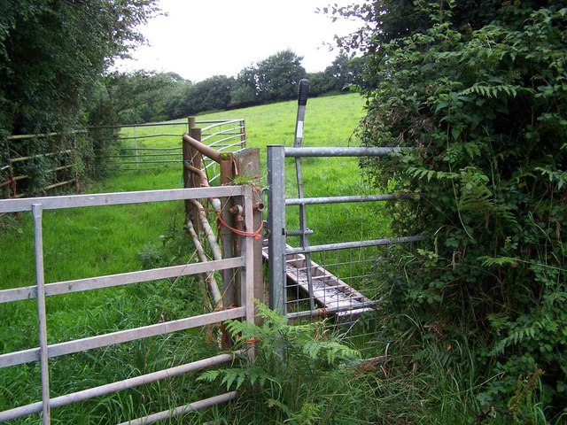
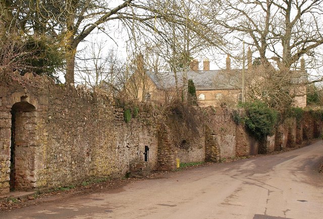
Cob Castle Copse Images

Images are sourced within 2km of 51.062638/-3.2421439 or Grid Reference ST1329. Thanks to Geograph Open Source API. All images are credited.

Fitzhead: St James the Great In 1791 the church was dedicated to St Mary Magdalene. Until 1755 this was a daughter church or chapelry of Wiveliscombe; it was rebuilt in 1849. A new north aisle was added in 1887. The west tower survives from the earlier church and is 15th century
Fitzhead: St James the Great
In 1791 the church was dedicated to St Mary Magdalene. Until 1755 this was a daughter church or chapelry of Wiveliscombe; it was rebuilt in 1849. A new north aisle was added in 1887. The west tower survives from the earlier church and is 15th century
Fitzhead: St James the Great The 15th century west tower, the survivor from the medieval church
Fitzhead: St James the Great
The 15th century west tower, the survivor from the medieval church
Fitzhead: north west from the village Landscape with woods and fields. Looking north towards the Quantocks
Fitzhead: north west from the village
Landscape with woods and fields. Looking north towards the Quantocks
Former Inn? This large house on the edge of Ash Priors could well have been the Inn marked on old maps.
Former Inn?
This large house on the edge of Ash Priors could well have been the Inn marked on old maps.
Halse: Combe Cross Looking north west
Halse: Combe Cross
Looking north west
Fitzhead: near Brownsells Footpath to Dean Farm. Looking south-south-west
Fitzhead: near Brownsells
Footpath to Dean Farm. Looking south-south-west
Lydeard St Lawrence: Chapel Leigh Chapel Leigh is a hamlet consisting of two farms and a number of cottages. Looking east-north-east
Lydeard St Lawrence: Chapel Leigh
Chapel Leigh is a hamlet consisting of two farms and a number of cottages. Looking east-north-east
Halse: barns at Northway Farm Looking north-north-west
Halse: barns at Northway Farm
Looking north-north-west
Hoccombe Farm Hoccombe Farm seen from the meadow behind it. Leat running in the foreground. Date: 22/04/2006.
Hoccombe Farm
Hoccombe Farm seen from the meadow behind it. Leat running in the foreground. Date: 22/04/2006.
Hoccombe Farm Hoccombe Farm and buildings, seen from the orchard.
Hoccombe Farm
Hoccombe Farm and buildings, seen from the orchard.
Lane Junction in Ash Priors
Footpath Near Ash Priors
Lower Stoford Seen across fields and a valley from Ash Priors Common. The thatched Stoford Farm (left of centre) may date from the C13 or C14 <span class="nowrap"><a title="http://webapp1.somerset.gov.uk/her/details.asp?prn=44073" rel="nofollow ugc noopener" href="http://webapp1.somerset.gov.uk/her/details.asp?prn=44073">Link</a><img style="margin-left:2px;" alt="External link" title="External link - shift click to open in new window" src="https://s1.geograph.org.uk/img/external.png" width="10" height="10"/></span> .
Lower Stoford
Seen across fields and a valley from Ash Priors Common. The thatched Stoford Farm (left of centre) may date from the C13 or C14 LinkExternal link .
Lane at Ash Priors The footpath sign indicates footpath T1/11 leaving on the right. The road junction further on is with the lane leading into the village centre.
Lane at Ash Priors
The footpath sign indicates footpath T1/11 leaving on the right. The road junction further on is with the lane leading into the village centre.
Field near Ash Priors A bridleway crosses the right side of this field and enters the small wood, where it crosses a footpath. The valley to the left is of a tributary of the Halse Water.
Field near Ash Priors
A bridleway crosses the right side of this field and enters the small wood, where it crosses a footpath. The valley to the left is of a tributary of the Halse Water.
Road to Northway Climbing away from the valley at Queensbridge, this is the C18 turnpike road from Bishop's Lydeard to Wiveliscombe, which here also forms the parish boundary between Halse (left) and Ash Priors.
Road to Northway
Climbing away from the valley at Queensbridge, this is the C18 turnpike road from Bishop's Lydeard to Wiveliscombe, which here also forms the parish boundary between Halse (left) and Ash Priors.
Road to Ash Priors The reverse view of <a href="https://www.geograph.org.uk/photo/1594159">ST1429 : Road to Northway</a>, looking down the turnpike beneath overhanging trees.
Road to Ash Priors
The reverse view of ST1429 : Road to Northway, looking down the turnpike beneath overhanging trees.
Road approaching Northway Farm The road from Ash Priors, still following the C18 turnpike from Bishop's Lydeard to Wiveliscombe shown in <a href="https://www.geograph.org.uk/photo/1594159">ST1429 : Road to Northway</a>, is dropping into the Halse Water valley. One of the barns at Northway Farm can be glimpsed around the bend.
Road approaching Northway Farm
The road from Ash Priors, still following the C18 turnpike from Bishop's Lydeard to Wiveliscombe shown in ST1429 : Road to Northway, is dropping into the Halse Water valley. One of the barns at Northway Farm can be glimpsed around the bend.
Show me another place!

Cob Castle Copse is located at Grid Ref: ST1329 (Lat: 51.062638, Lng: -3.2421439)

Administrative County: Somerset

District: Somerset West and Taunton

Police Authority: Avon and Somerset

What 3 Words

///shoppers.conquest.insisting. Near Bishops Lydeard, Somerset

Nearby Locations

Cob Castle Copse Northway

Related Wikis

Fitzhead Court and The Manor

Fitzhead Court and The Manor in Fitzhead, Somerset, England was built in the late 16th century and has now been split into two buildings. It is a Grade...

Church of St James the Great, Fitzhead

The Anglican Church of St James the Great in Fitzhead, Somerset, England was built in the 15th century. It is a Grade II* listed building. == History... ==

Fitzhead

Fitzhead is a village and civil parish in Somerset, England, situated approximately 6 miles (9.7 km) north west of Taunton. The village has an estimated...

Church of the Holy Trinity, Ash Priors

The Church of the Holy Trinity in Ash Priors, Somerset, England was built in the 15th century. It is a Grade II* listed building. == History == In the...

Ash Priors

Ash Priors is a village and parish in Somerset, England, situated 5 miles (8.0 km) north west of Taunton. The village has a population of 155. == History... ==

Halse, Somerset

Halse is a village and civil parish in Somerset, England, situated 6 miles (9.7 km) north west of Taunton. The village has a population of 290. == History... ==

Combe Florey House

Combe Florey House in Combe Florey, Somerset, England is a country house dating from the early 18th century. It replaced an Elizabethan manor house which...

Lydeard St Lawrence

Lydeard St Lawrence or St Lawrence Lydiard is a village and civil parish in Somerset, England, situated 7 miles (11.3 km) north west of Taunton. The village...

Nearby Amenities

Located within 500m of 51.062638,-3.2421439
Chapel Leigh
Is In: Somerset, England, United Kingdom
Place: hamlet
Postal Code: TA4 3RB
Lat/Long: 51.0594707/-3.2457179
Give Way
Direction: backward
Lat/Long: 51.0645811/-3.2401345
Give Way
Direction: forward
Lat/Long: 51.064552/-3.2401456
Access: private
Door: overhead
Entrance: yes
Motorcar: private
Lat/Long: 51.0630764/-3.239377
Chapel Leigh
Ele: 169
Man Made: survey_point
Ref: S3731
Type: benchmark
Lat/Long: 51.0619623/-3.2394776
Ele: 90
Lat/Long: 51.0620942/-3.246081
Barrier: stile
Bicycle: no
Foot: yes
Material: wood
Ref: 43271
Stile: stepover
Lat/Long: 51.0665695/-3.245211
Brand: National Grid
Brand Wikidata: Q1465461
Devices: 1
Frequency: 50
Material: wood
Operator: National Grid Electricity Distribution Plc
Operator Old: Western Power Distribution
Operator Wikidata: Q7988183
Owner: National Grid Electricity Distribution (South West) Plc
Owner Wikidata: Q114397866
Phases: 1
Power: pole
Transformer: distribution
Lat/Long: 51.0644735/-3.2406219
Brand: National Grid
Brand Wikidata: Q1465461
Material: wood
Operator: National Grid Electricity Distribution Plc
Operator Old: Western Power Distribution
Operator Wikidata: Q7988183
Owner: National Grid Electricity Distribution (South West) Plc
Owner Wikidata: Q114397866
Power: pole
Lat/Long: 51.0648374/-3.2401097
Brand: National Grid
Brand Wikidata: Q1465461
Guyed: yes
Line Management: branch
Material: wood
Operator: National Grid Electricity Distribution Plc
Operator Old: Western Power Distribution
Operator Wikidata: Q7988183
Owner: National Grid Electricity Distribution (South West) Plc
Owner Wikidata: Q114397866
Power: pole
Lat/Long: 51.0653685/-3.2394227
Brand: National Grid
Brand Wikidata: Q1465461
Guyed: yes
Line Management: branch
Material: wood
Operator: National Grid Electricity Distribution Plc
Operator Old: Western Power Distribution
Operator Wikidata: Q7988183
Owner: National Grid Electricity Distribution (South West) Plc
Owner Wikidata: Q114397866
Power: pole
Lat/Long: 51.0652115/-3.2390664
Brand: National Grid
Brand Wikidata: Q1465461
Material: wood
Operator: National Grid Electricity Distribution Plc
Operator Old: Western Power Distribution
Operator Wikidata: Q7988183
Owner: National Grid Electricity Distribution (South West) Plc
Owner Wikidata: Q114397866
Power: pole
Lat/Long: 51.064641/-3.2381531
Brand: National Grid
Brand Wikidata: Q1465461
Material: wood
Operator: National Grid Electricity Distribution Plc
Operator Old: Western Power Distribution
Operator Wikidata: Q7988183
Owner: National Grid Electricity Distribution (South West) Plc
Owner Wikidata: Q114397866
Power: pole
Lat/Long: 51.064083/-3.2372331
Brand: National Grid
Brand Wikidata: Q1465461
Material: wood
Operator: National Grid Electricity Distribution Plc
Operator Old: Western Power Distribution
Operator Wikidata: Q7988183
Owner: National Grid Electricity Distribution (South West) Plc
Owner Wikidata: Q114397866
Power: pole
Lat/Long: 51.063772/-3.2367436
Brand: National Grid
Brand Wikidata: Q1465461
Material: wood
Operator: National Grid Electricity Distribution Plc
Operator Old: Western Power Distribution
Operator Wikidata: Q7988183
Owner: National Grid Electricity Distribution (South West) Plc
Owner Wikidata: Q114397866
Power: pole
Lat/Long: 51.0631627/-3.2357686
Brand: National Grid
Brand Wikidata: Q1465461
Location Transition: yes
Material: wood
Operator: National Grid Electricity Distribution Plc
Operator Old: Western Power Distribution
Operator Wikidata: Q7988183
Owner: National Grid Electricity Distribution (South West) Plc
Owner Wikidata: Q114397866
Power: pole
Lat/Long: 51.0633116/-3.2395595
Brand: National Grid
Brand Wikidata: Q1465461
Material: wood
Operator: National Grid Electricity Distribution Plc
Operator Old: Western Power Distribution
Operator Wikidata: Q7988183
Owner: National Grid Electricity Distribution (South West) Plc
Owner Wikidata: Q114397866
Power: pole
Lat/Long: 51.0637517/-3.2397724
Brand: National Grid
Brand Wikidata: Q1465461
Material: wood
Operator: National Grid Electricity Distribution Plc
Operator Old: Western Power Distribution
Operator Wikidata: Q7988183
Owner: National Grid Electricity Distribution (South West) Plc
Owner Wikidata: Q114397866
Power: pole
Lat/Long: 51.0641114/-3.2400282
Brand: National Grid
Brand Wikidata: Q1465461
Guyed: yes
Material: wood
Operator: National Grid Electricity Distribution Plc
Operator Old: Western Power Distribution
Operator Wikidata: Q7988183
Owner: National Grid Electricity Distribution (South West) Plc
Owner Wikidata: Q114397866
Power: pole
Lat/Long: 51.0661538/-3.2410111
Brand: National Grid
Brand Wikidata: Q1465461
Guyed: yes
Material: wood
Operator: National Grid Electricity Distribution Plc
Operator Old: Western Power Distribution
Operator Wikidata: Q7988183
Owner: National Grid Electricity Distribution (South West) Plc
Owner Wikidata: Q114397866
Power: pole
Lat/Long: 51.0668036/-3.2423294
Common Down
Place: locality
Lat/Long: 51.0636347/-3.2405216
Brand: National Grid
Brand Wikidata: Q1465461
Layer: 1
Operator: National Grid Electricity Distribution Plc
Operator Old: Western Power Distribution
Operator Wikidata: Q7988183
Owner: National Grid Electricity Distribution (South West) Plc
Owner Wikidata: Q114397866
Power: terminal
Lat/Long: 51.0640537/-3.2428679
Brand: National Grid
Brand Wikidata: Q1465461
Guyed: yes
Material: wood
Operator: National Grid Electricity Distribution Plc
Operator Old: Western Power Distribution
Operator Wikidata: Q7988183
Owner: National Grid Electricity Distribution (South West) Plc
Owner Wikidata: Q114397866
Power: pole
Lat/Long: 51.0640831/-3.2423267
Brand: National Grid
Brand Wikidata: Q1465461
Guyed: yes
Material: wood
Operator: National Grid Electricity Distribution Plc
Operator Old: Western Power Distribution
Operator Wikidata: Q7988183
Owner: National Grid Electricity Distribution (South West) Plc
Owner Wikidata: Q114397866
Power: pole
Lat/Long: 51.0641657/-3.2415743
Brand: National Grid
Brand Wikidata: Q1465461
Material: wood
Operator: National Grid Electricity Distribution Plc
Operator Old: Western Power Distribution
Operator Wikidata: Q7988183
Owner: National Grid Electricity Distribution (South West) Plc
Owner Wikidata: Q114397866
Power: pole
Lat/Long: 51.0590984/-3.2449821
Brand: National Grid
Brand Wikidata: Q1465461
Material: wood
Operator: National Grid Electricity Distribution Plc
Operator Old: Western Power Distribution
Operator Wikidata: Q7988183
Owner: National Grid Electricity Distribution (South West) Plc
Owner Wikidata: Q114397866
Power: pole
Lat/Long: 51.0586516/-3.2447816
Brand: National Grid
Brand Wikidata: Q1465461
Material: wood
Operator: National Grid Electricity Distribution Plc
Operator Old: Western Power Distribution
Operator Wikidata: Q7988183
Owner: National Grid Electricity Distribution (South West) Plc
Owner Wikidata: Q114397866
Power: pole
Lat/Long: 51.059825/-3.2457143
Access: private
Door: overhead
Entrance: yes
Motorcar: private
Lat/Long: 51.0597367/-3.2457979
Access: private
Door: hinged
Door Type: double
Entrance: yes
Material: wood
Motorcar: private
Lat/Long: 51.059074/-3.2460469
Fire Hydrant
Emergency: fire_hydrant
Fire Hydrant Count: 1
Fire Hydrant Position: lane
Fire Hydrant Type: underground
Operator: Wessex Water
Lat/Long: 51.0594406/-3.2459188
Brand: National Grid
Brand Wikidata: Q1465461
Material: wood
Operator: National Grid Electricity Distribution Plc
Operator Old: Western Power Distribution
Operator Wikidata: Q7988183
Owner: National Grid Electricity Distribution (South West) Plc
Owner Wikidata: Q114397866
Power: pole
Lat/Long: 51.0595038/-3.24681
Brand: National Grid
Brand Wikidata: Q1465461
Devices: 1
Frequency: 50
Material: wood
Operator: National Grid Electricity Distribution Plc
Operator Old: Western Power Distribution
Operator Wikidata: Q7988183
Owner: National Grid Electricity Distribution (South West) Plc
Owner Wikidata: Q114397866
Phases: 1
Power: pole
Transformer: distribution
Lat/Long: 51.0595417/-3.2451846
Brand: National Grid
Brand Wikidata: Q1465461
Layer: 1
Operator: National Grid Electricity Distribution Plc
Operator Old: Western Power Distribution
Operator Wikidata: Q7988183
Owner: National Grid Electricity Distribution (South West) Plc
Owner Wikidata: Q114397866
Power: terminal
Lat/Long: 51.059377/-3.2460109
Brand: National Grid
Brand Wikidata: Q1465461
Line Management: branch
Material: wood
Operator: National Grid Electricity Distribution Plc
Operator Old: Western Power Distribution
Operator Wikidata: Q7988183
Owner: National Grid Electricity Distribution (South West) Plc
Owner Wikidata: Q114397866
Power: pole
Lat/Long: 51.0595308/-3.2456969
Communication: pole
Material: wood
Operator: British Telecommunications PLC
Telephone: pole
Lat/Long: 51.059476/-3.2459946
Brand: National Grid
Brand Wikidata: Q1465461
Material: wood
Operator: National Grid Electricity Distribution Plc
Operator Old: Western Power Distribution
Operator Wikidata: Q7988183
Owner: National Grid Electricity Distribution (South West) Plc
Owner Wikidata: Q114397866
Power: pole
Lat/Long: 51.0595274/-3.2462065
Brand: National Grid
Brand Wikidata: Q1465461
Material: wood
Operator: National Grid Electricity Distribution Plc
Operator Old: Western Power Distribution
Operator Wikidata: Q7988183
Owner: National Grid Electricity Distribution (South West) Plc
Owner Wikidata: Q114397866
Power: pole
Lat/Long: 51.0597356/-3.2467014
Common Down
Colour: white;black
Description: Roadside signpost.
Foot: yes
Horse: yes
Information: guidepost
Material: metal
Operator: Somerset County Council
Tourism: information
Vehicle: yes
Lat/Long: 51.0646061/-3.2402045
Access: private
Door: sliding
Door Type: double
Entrance: main
Foot: private
Horse: no
Vehicle: private
Lat/Long: 51.0624901/-3.23995
Access: private
Door: no
Entrance: main
Lat/Long: 51.0650553/-3.2390096
Access: private
Door: overhead
Entrance: yes
Motorcar: private
Lat/Long: 51.0648119/-3.2393911
Brand: National Grid
Brand Wikidata: Q1465461
Layer: 1
Operator: National Grid Electricity Distribution Plc
Operator Old: Western Power Distribution
Operator Wikidata: Q7988183
Owner: National Grid Electricity Distribution (South West) Plc
Owner Wikidata: Q114397866
Power: terminal
Lat/Long: 51.0646085/-3.239834
Access: private
Door: hinged
Door Type: single
Entrance: yes
Foot: yes
Horse: yes
Vehicle: no
Lat/Long: 51.0630787/-3.2401748
Access: private
Door: hinged
Door Type: single
Entrance: yes
Foot: yes
Horse: yes
Vehicle: no
Lat/Long: 51.0630745/-3.2401228
Access: private
Door: hinged
Door Type: single
Entrance: yes
Foot: yes
Horse: yes
Vehicle: no
Lat/Long: 51.0630698/-3.2400638
Watering Place
Access: private
Lat/Long: 51.0632213/-3.2398039
Brand: National Grid
Brand Wikidata: Q1465461
Line Management: split
Material: wood
Operator: National Grid Electricity Distribution Plc
Operator Old: Western Power Distribution
Operator Wikidata: Q7988183
Owner: National Grid Electricity Distribution (South West) Plc
Owner Wikidata: Q114397866
Power: pole
Lat/Long: 51.0644667/-3.2406098
Brand: National Grid
Brand Wikidata: Q1465461
Material: wood
Operator: National Grid Electricity Distribution Plc
Operator Old: Western Power Distribution
Operator Wikidata: Q7988183
Owner: National Grid Electricity Distribution (South West) Plc
Owner Wikidata: Q114397866
Power: pole
Lat/Long: 51.064644/-3.2399549
Brand: National Grid
Brand Wikidata: Q1465461
Guyed: yes
Material: wood
Operator: National Grid Electricity Distribution Plc
Operator Old: Western Power Distribution
Operator Wikidata: Q7988183
Owner: National Grid Electricity Distribution (South West) Plc
Owner Wikidata: Q114397866
Power: pole
Lat/Long: 51.0654493/-3.2383193
The data included in this document is from www.openstreetmap.org. The data is made available under ODbL.

Have you been to Cob Castle Copse?

Leave your review of Cob Castle Copse below (or comments, questions and feedback).