High Dyke Wood
Wood, Forest in Cumberland Copeland
England
High Dyke Wood

High Dyke Wood is a picturesque forest located in Cumberland, England. It covers an area of approximately 500 acres, making it one of the largest woodlands in the region. The wood is situated on the eastern slopes of the Pennines, providing stunning views of the surrounding countryside.
The forest is primarily composed of mixed deciduous and coniferous trees, creating a diverse and vibrant ecosystem. Oak, beech, and birch trees dominate the wood, interspersed with spruce and pine. This variety of tree species ensures that the woodland is rich in biodiversity, providing a habitat for numerous plants, birds, and mammals.
A network of well-maintained paths and trails wind through High Dyke Wood, allowing visitors to explore its natural beauty at their own pace. Nature enthusiasts can enjoy leisurely walks, birdwatching, or simply immerse themselves in the tranquil surroundings. The wood is particularly popular during the spring season when the forest floor bursts into color with a carpet of wildflowers.
High Dyke Wood is also home to several archaeological sites, including ancient stone circles and burial mounds. These remnants of the past add a sense of history and intrigue to the woodland, attracting both history buffs and curious visitors.
The forest is managed by a local conservation organization, which ensures the preservation of its natural features and wildlife. It offers educational programs and guided tours to promote awareness and appreciation for the woodland's ecological significance.
Overall, High Dyke Wood is a stunning natural haven, offering a peaceful escape from the hustle and bustle of modern life. Its diverse flora and fauna, combined with its rich historical heritage, make it a must-visit destination for nature lovers and history enthusiasts alike.
If you have any feedback on the listing, please let us know in the comments section below.
High Dyke Wood Images
Images are sourced within 2km of 54.344694/-3.3572236 or Grid Reference SD1195. Thanks to Geograph Open Source API. All images are credited.


High Dyke Wood is located at Grid Ref: SD1195 (Lat: 54.344694, Lng: -3.3572236)
Administrative County: Cumbria
District: Copeland
Police Authority: Cumbria
What 3 Words
///takeovers.openly.surprised. Near Seascale, Cumbria
Nearby Locations
Related Wikis

Broad Oak, Cumbria
Broad Oak is a hamlet in Cumbria, England. It is located along the A595 road, 14.4 miles (23.2 km) by road south of Egremont. == See also == List of places...

Waberthwaite
Waberthwaite is a small, former rural civil parish (about 4 square miles in area) on the south bank of the estuary of the River Esk, in Copeland, Cumbria...

St John's Church, Waberthwaite
St John's Church is situated on the south bank of the River Esk in the hamlet of Hall Waberthwaite in the former civil parish of Waberthwaite (now part...

Muncaster Castle
Muncaster Castle is a privately owned castle overlooking the River Esk, about a mile east of the west-coastal town of Ravenglass in Cumbria, England. It...

Muncaster
Muncaster is a civil parish in Cumbria, North West England. The parish is 41 miles (66 km) south west of the city of Carlisle, in the Copeland district...

St Michael's Church, Muncaster
St Michael's Church is in the grounds of Muncaster Castle, near Ravenglass, Cumbria, England. It is an active Anglican parish church in the deanery of...
Glannoventa
Glannoventa is a Roman fort associated with the Roman naval base at Ravenglass in Cumbria, England. Its name is derived from the Latin place-name Clanoventa...
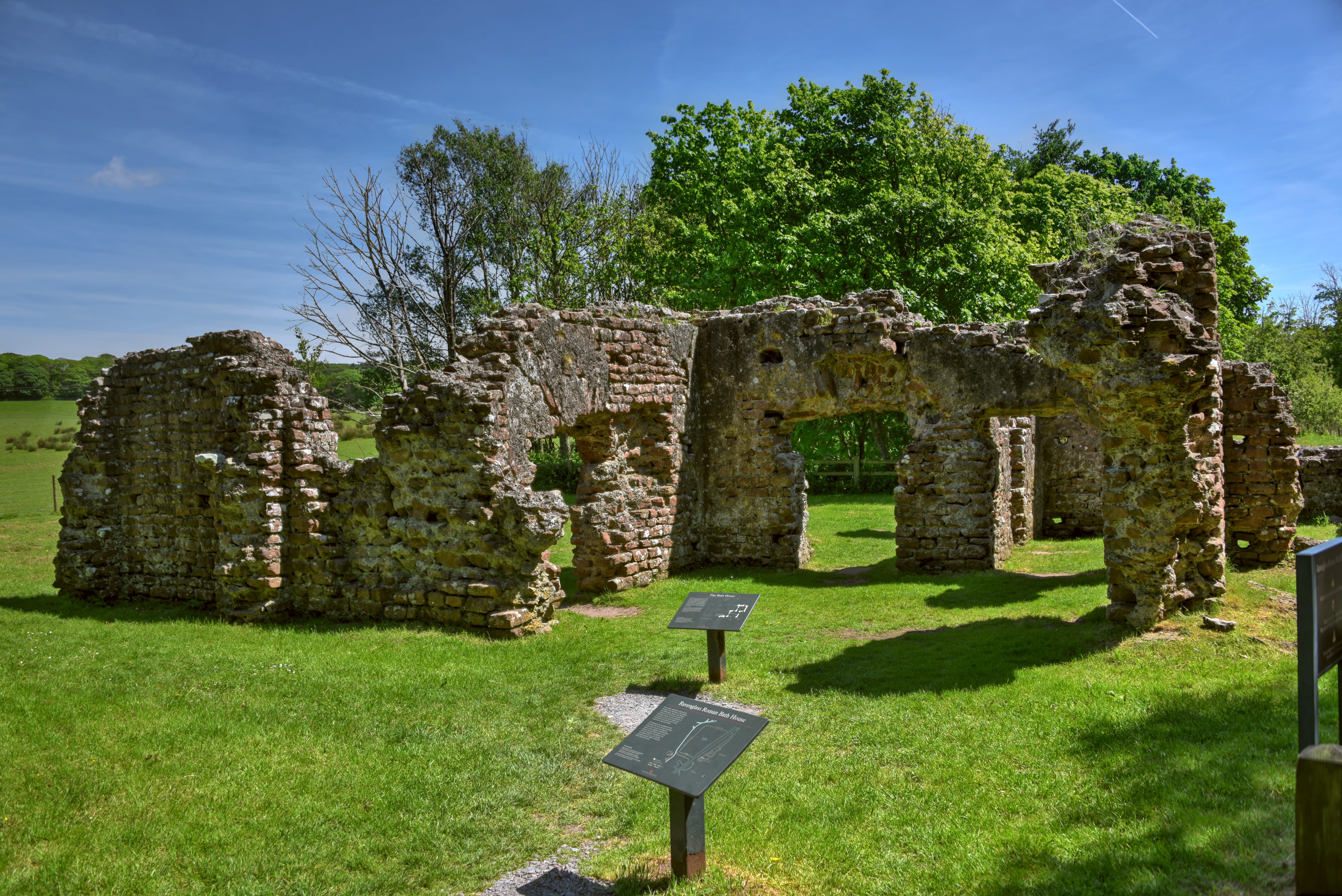
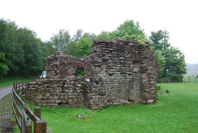
Ravenglass Roman Bath House
Ravenglass Roman Bath House (also known as Walls Castle) is a ruined ancient Roman bath house at Ravenglass, Cumbria, England. Belonging to a 2nd-century...
Nearby Amenities
Located within 500m of 54.344694,-3.3572236Have you been to High Dyke Wood?
Leave your review of High Dyke Wood below (or comments, questions and feedback).