Bleabank Wood

Wood, Forest in Cumberland Allerdale

England

Bleabank Wood

Lane north-north-west of Hatteringill Head The hill road runs west to east between Mosser and Low Lorton; the view is towards Mosser. The image was recorded a few minutes after cloud cover had lifted and falling snow had ceased.
Hatteringill Head is a minor top of the low hill Fellbarrow.
Lane north-north-west of Hatteringill Head Credit: Trevor Littlewood

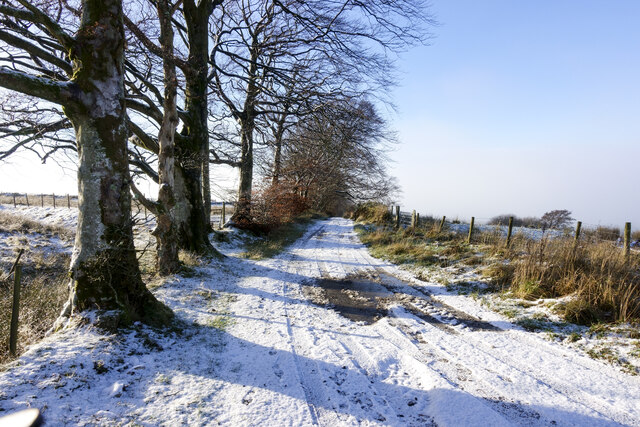
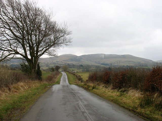
Bleabank Wood is a stunning natural gem located in the county of Cumberland, England. As part of the larger Cumbrian Forest, this wood is nestled within the picturesque landscape of the Lake District National Park. The wood spans an area of approximately 200 acres and is renowned for its diverse range of flora and fauna.

Characterized by its lush greenery and dense foliage, Bleabank Wood offers a tranquil retreat for nature lovers and outdoor enthusiasts alike. The wood is predominantly composed of broadleaf trees such as oak, ash, and birch, which provide a rich and vibrant canopy during the warmer months. In spring, the woodland floor becomes a tapestry of colorful wildflowers, including bluebells, primroses, and wood anemones.

The wood is a haven for wildlife, attracting a wide array of species. It supports a thriving bird population, with common sightings including woodpeckers, owls, and various songbirds. Mammals such as deer, foxes, and badgers also call Bleabank Wood their home, adding to the diversity of the ecosystem.

Visitors to Bleabank Wood can enjoy a range of activities, from peaceful walks along its well-maintained trails to birdwatching and photography. The wood offers a perfect setting for picnics and family outings, with designated areas for relaxation and recreation.

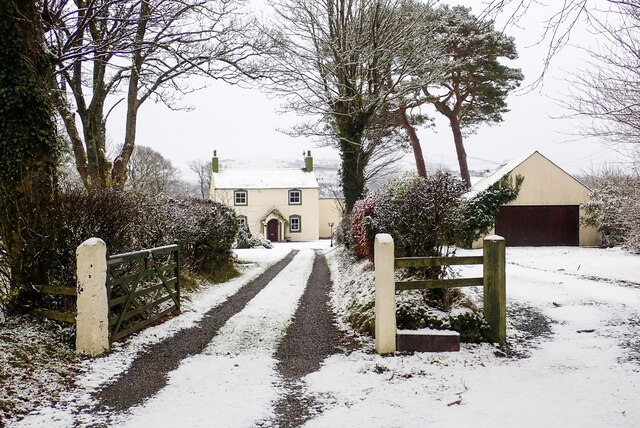
Bleabank Wood is easily accessible, with ample parking and well-marked paths. Its serene atmosphere and natural beauty make it a popular destination for both locals and tourists, providing a much-needed escape from the hustle and bustle of everyday life.

If you have any feedback on the listing, please let us know in the comments section below.

Bleabank Wood Images

Images are sourced within 2km of 54.622032/-3.3680838 or Grid Reference NY1126. Thanks to Geograph Open Source API. All images are credited.

Lane north-north-west of Hatteringill Head The hill road runs west to east between Mosser and Low Lorton; the view is towards Mosser. The image was recorded a few minutes after cloud cover had lifted and falling snow had ceased.
Hatteringill Head is a minor top of the low hill Fellbarrow.
Lane north-north-west of Hatteringill Head
The hill road runs west to east between Mosser and Low Lorton; the view is towards Mosser. The image was recorded a few minutes after cloud cover had lifted and falling snow had ceased. Hatteringill Head is a minor top of the low hill Fellbarrow.
Mirk Lane heading north-east The minor public road, north of Fellbarrow, with a light snow covering following the crossing of Storm Arwen the night before.
Mirk Lane heading north-east
The minor public road, north of Fellbarrow, with a light snow covering following the crossing of Storm Arwen the night before.
House at Greentrees Greentrees with a light snow covering on the ground and with flakes still falling on the day after the passing of the weather event, Storm Arwen.
House at Greentrees
Greentrees with a light snow covering on the ground and with flakes still falling on the day after the passing of the weather event, Storm Arwen.
Wooden pens beside hill lane The hill road runs west to east between Mosser and Low Lorton; the pens are on its northern side. The image was recorded a few minutes after cloud cover had lifted and falling snow had ended.
The hill dome seen through the residual mist is the minor feature, Whin Fell, part of Fellbarrow.
Wooden pens beside hill lane
The hill road runs west to east between Mosser and Low Lorton; the pens are on its northern side. The image was recorded a few minutes after cloud cover had lifted and falling snow had ended. The hill dome seen through the residual mist is the minor feature, Whin Fell, part of Fellbarrow.
Direction Sign - Signpost Located on the north side of the junction at Randle Cross, in Blindbothel parish. 1 arm and pawn finial. See also <span class="nowrap"><a title="http://www.geog.port.ac.uk/webmap/thelakes/photos/bwc51.jpg" rel="nofollow ugc noopener" href="http://www.geog.port.ac.uk/webmap/thelakes/photos/bwc51.jpg">Link</a><img style="margin-left:2px;" alt="External link" title="External link - shift click to open in new window" src="https://s1.geograph.org.uk/img/external.png" width="10" height="10"/></span> and <a title="https://www.geograph.org.uk/photo/78535" href="https://www.geograph.org.uk/photo/78535">Link</a>.

Milestone Society National ID: CU_NY1127
Direction Sign - Signpost
Located on the north side of the junction at Randle Cross, in Blindbothel parish. 1 arm and pawn finial. See also LinkExternal link and Link. Milestone Society National ID: CU_NY1127
Track junction, High Mosser
Direction Sign – Signpost Located on the northeast side of the T junction at Aikbank Mill in Blindbothel parish. 3 arms and pawn finial. See also <span class="nowrap"><a title="http://www.geog.port.ac.uk/webmap/thelakes/photos/bwc41.jpg" rel="nofollow ugc noopener" href="http://www.geog.port.ac.uk/webmap/thelakes/photos/bwc41.jpg">Link</a><img style="margin-left:2px;" alt="External link" title="External link - shift click to open in new window" src="https://s1.geograph.org.uk/img/external.png" width="10" height="10"/></span>.

Milestone Society National ID: CU_NY1125
Direction Sign – Signpost
Located on the northeast side of the T junction at Aikbank Mill in Blindbothel parish. 3 arms and pawn finial. See also LinkExternal link. Milestone Society National ID: CU_NY1125
Staggered crossroads on the A5086 The A road marks the boundary of the Lake District National Park, and some of the western fells are visible here.
Staggered crossroads on the A5086
The A road marks the boundary of the Lake District National Park, and some of the western fells are visible here.
Mosser Road Looking along the road towards Mosser.
Mosser Road
Looking along the road towards Mosser.
Lane leading to Cockermouth
The drive to Low Hall This is also a public bridleway, leading to Brandlingill <a href="https://www.geograph.org.uk/gridref/NY1226">NY1226</a>.
The drive to Low Hall
This is also a public bridleway, leading to Brandlingill NY1226.
Country at Randle Cross The small tarn may be temporary: at least, it is not shown on the maps.
Country at Randle Cross
The small tarn may be temporary: at least, it is not shown on the maps.
The lane to Brandlingill
The lane to Brandlingill The Fellbarrow / Low Fell range is seen in the distance. (This range is sometimes called 'Loweswater Fell', but as there is another Loweswater Fell to the south, that name is best avoided.)
The lane to Brandlingill
The Fellbarrow / Low Fell range is seen in the distance. (This range is sometimes called 'Loweswater Fell', but as there is another Loweswater Fell to the south, that name is best avoided.)
Fields opposite Aikbank Mill
On the track to Hatteringill
On the Old Mosser Road The old road from Low Lorton to Mosser
On the Old Mosser Road
The old road from Low Lorton to Mosser
The road to Brandlingill
Show me another place!

Bleabank Wood is located at Grid Ref: NY1126 (Lat: 54.622032, Lng: -3.3680838)

Administrative County: Cumbria

District: Allerdale

Police Authority: Cumbria

What 3 Words

///watch.betraying.rezoning. Near Cockermouth, Cumbria

Related Wikis

Brandlingill

Brandlingill is a village in Cumbria, England.

Mosser

Mosser is a village and former civil parish, 26 miles (42 km) south west of Carlisle, now in the parish of Blindbothel, in Allerdale district, in the county...

Blindbothel

Blindbothel is a village and civil parish in Cumbria, England. It is on the edge of the Lake District National Park, and is a couple of miles south of...

Deanscales

Deanscales is a hamlet in the county of Cumbria, England. Nearby settlements include the village of Dean and the town of Cockermouth. Deanscales is on...

Fellbarrow

Fellbarrow is a low hill in the north west of the English Lake District. It is not far from the town of Cockermouth, near to Loweswater and can most easily...

Eaglesfield, Cumbria

Eaglesfield is a village in the parish of Dean in Cumberland in Cumbria, England. It is near the A5086 road, 2.5 miles (4 km) southwest of Cockermouth...

Allerdale

Allerdale was a non-metropolitan district of Cumbria, England, with borough status. Its council was based in Workington and the borough has a population...

Armaside

Armaside is an agricultural village in Cumbria, England, situated north of Low Lorton, south west of the River Cocker, and south east from Cockermouth...

Nearby Amenities

Located within 500m of 54.622032,-3.3680838
Power: tower
Lat/Long: 54.6252348/-3.3728762
Power: tower
Lat/Long: 54.6222623/-3.3758379
Power: tower
Lat/Long: 54.6238273/-3.3742786
Power: tower
Lat/Long: 54.626164/-3.3705642
Blea Bank
Place: locality
Lat/Long: 54.622184/-3.3695695
Aikbank Mill
Place: locality
Lat/Long: 54.6213576/-3.3695741
Barrier: stile
Lat/Long: 54.6262934/-3.365707
Barrier: stile
Lat/Long: 54.6262951/-3.3657844
Barrier: stile
Lat/Long: 54.6260651/-3.3679037
Barrier: stile
Lat/Long: 54.6251242/-3.3682698
Barrier: stile
Lat/Long: 54.6246832/-3.3691321
Barrier: stile
Lat/Long: 54.6219559/-3.371003
Power: pole
Lat/Long: 54.6226789/-3.3647407
Power: pole
Lat/Long: 54.6218849/-3.3652755
Power: pole
Lat/Long: 54.6209948/-3.365871
Power: pole
Lat/Long: 54.6195358/-3.3668595
Power: pole
Lat/Long: 54.6199744/-3.3684334
Power: pole
Lat/Long: 54.6206195/-3.368952
Power: pole
Lat/Long: 54.6176157/-3.368478
Power: pole
Lat/Long: 54.6185881/-3.3676556
Power: pole
Lat/Long: 54.6254149/-3.3684213
Power: pole
Lat/Long: 54.6256565/-3.3667501
Power: pole
Lat/Long: 54.6259508/-3.364769
The data included in this document is from www.openstreetmap.org. The data is made available under ODbL.

Have you been to Bleabank Wood?

Leave your review of Bleabank Wood below (or comments, questions and feedback).