Gaulden Wood
Wood, Forest in Somerset Somerset West and Taunton
England
Gaulden Wood

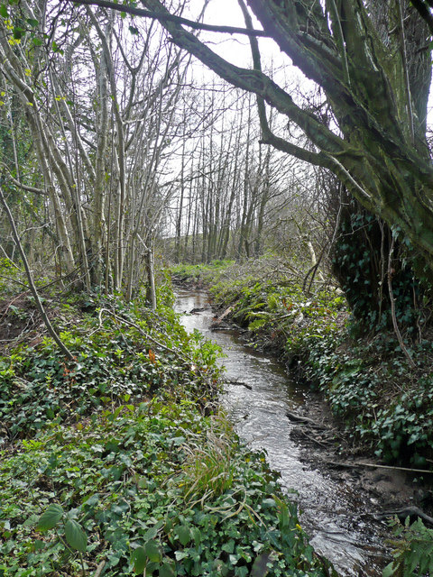
Gaulden Wood, located in Somerset, England, is a picturesque forest that spans over a vast area. It is a well-preserved woodland, known for its natural beauty and diverse ecosystem. The wood is situated in the heart of the countryside, offering visitors a peaceful and serene environment to connect with nature.
The forest is home to a wide variety of flora and fauna, with ancient oak and beech trees dominating the landscape. These majestic trees provide shade and shelter for numerous species of birds, insects, and mammals that inhabit the wood. The forest floor is carpeted with a rich carpet of wildflowers, creating a vibrant and colorful display during the spring and summer months.
Gaulden Wood is a popular destination for nature lovers, hikers, and birdwatchers who enjoy exploring its numerous trails and paths. The forest boasts several well-marked routes that cater to different levels of difficulty, allowing visitors to choose the one that suits their preferences and fitness levels.
In addition to its natural beauty, the wood also holds historical significance. It is believed that Gaulden Wood has been in existence for hundreds of years and has witnessed many historical events. The area is dotted with ancient burial mounds and remnants of old settlements, providing a glimpse into the region's rich past.
Overall, Gaulden Wood in Somerset is a haven for nature enthusiasts and history buffs alike. Its stunning scenery, diverse wildlife, and historical significance make it a must-visit destination for anyone seeking a tranquil escape into the great outdoors.
If you have any feedback on the listing, please let us know in the comments section below.
Gaulden Wood Images
Images are sourced within 2km of 51.077547/-3.2657263 or Grid Reference ST1131. Thanks to Geograph Open Source API. All images are credited.


Gaulden Wood is located at Grid Ref: ST1131 (Lat: 51.077547, Lng: -3.2657263)
Administrative County: Somerset
District: Somerset West and Taunton
Police Authority: Avon and Somerset
What 3 Words
///basics.immediate.eyelashes. Near Wiveliscombe, Somerset
Nearby Locations
Related Wikis

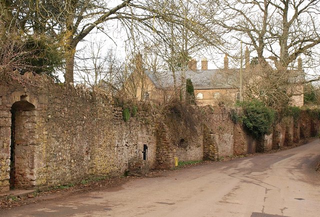
Gaulden Manor
Gaulden Manor (also Gavelden or Gaveldene) is a Grade II* listed country house to the southeast of Tolland, Somerset, England. It is a double storied building...

Tolland, Somerset
Tolland is a village and civil parish in Somerset, England, situated 9 miles (14.5 km) north west of Taunton, between the Brendon Hills and Quantock Hills...
Ruby Country
Ruby Country is the name given to the rural inland hinterland of north-west Devon, UK. It covers 45 parishes around the market towns of Holsworthy and...

Lydeard St Lawrence
Lydeard St Lawrence or St Lawrence Lydiard is a village and civil parish in Somerset, England, situated 7 miles (11.3 km) north west of Taunton. The village...

Church of St Mary, Brompton Ralph
The Anglican Church of St Mary in Brompton Ralph, Somerset, England was built in the 15th century. It is a Grade II* listed building. == History == Parts...

Brompton Ralph
Brompton Ralph is a village and civil parish in the Somerset West and Taunton district of Somerset, England, about 11 miles (18 km) west of Taunton, and...

Fitzhead
Fitzhead is a village and civil parish in Somerset, England, situated approximately 6 miles (9.7 km) north west of Taunton. The village has an estimated...
Fitzhead Court and The Manor
Fitzhead Court and The Manor in Fitzhead, Somerset, England was built in the late 16th century and has now been split into two buildings. It is a Grade...
Nearby Amenities
Located within 500m of 51.077547,-3.2657263Have you been to Gaulden Wood?
Leave your review of Gaulden Wood below (or comments, questions and feedback).