Cleeve Copse

Wood, Forest in Somerset Somerset West and Taunton

England

Cleeve Copse

Wiveliscombe Without: bridleway at Oakhampton Farm Looking south east
Wiveliscombe Without: bridleway at Oakhampton Farm Credit: Martin Bodman

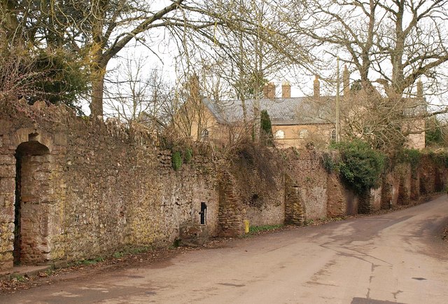
Cleeve Copse is a charming woodland area located in Somerset, England. Nestled within the picturesque landscape of the Mendip Hills, this forested area covers approximately 100 hectares and is a popular destination for nature lovers and outdoor enthusiasts.

The copse is predominantly composed of broadleaf trees, including oak, beech, and ash, which create a dense canopy overhead. This provides a cool and shaded environment, making it an ideal place for leisurely walks and picnics on hot summer days. The forest floor is carpeted with a rich diversity of flora, such as bluebells, wood anemones, and wild garlic, adding to its natural beauty.

Cleeve Copse is also home to a wide variety of wildlife. Visitors can spot numerous bird species, including woodpeckers, cuckoos, and tawny owls, flitting amongst the treetops. Squirrels and badgers can be seen scurrying through the undergrowth, while deer can occasionally be spotted grazing in the open glades.

For those interested in history, Cleeve Copse holds some archaeological significance. The remains of an Iron Age hillfort, known as Dolebury Warren, can be found within the woodland. This ancient site offers a glimpse into the area's past and provides an interesting backdrop for exploration.

With its tranquil ambiance, scenic beauty, and rich biodiversity, Cleeve Copse offers a wonderful escape from the hustle and bustle of everyday life. Whether you are seeking a peaceful walk, a chance to observe wildlife, or an opportunity to immerse yourself in nature, this enchanting woodland is sure to captivate visitors of all ages.

If you have any feedback on the listing, please let us know in the comments section below.

Cleeve Copse Images

Images are sourced within 2km of 51.066157/-3.2736361 or Grid Reference ST1030. Thanks to Geograph Open Source API. All images are credited.

Wiveliscombe Without: bridleway at Oakhampton Farm Looking south east
Wiveliscombe Without: bridleway at Oakhampton Farm
Looking south east
White House above Ford
Pastures at Western Goulds View east of the B3188.
Pastures at Western Goulds
View east of the B3188.
Somerset Hills View west of the B3188 towards the south-eastern edge of the Brendon Hills.
Somerset Hills
View west of the B3188 towards the south-eastern edge of the Brendon Hills.
Sheep pastures East of Oakhampton Farm to the north of Wiveliscombe.
Sheep pastures
East of Oakhampton Farm to the north of Wiveliscombe.
Valley near Ford From the same spot as <a href="https://www.geograph.org.uk/photo/1716296">ST0928 : Valley at Ford</a>, looking directly across the valley between Castle Hill and Tipnoller Hill. The left side of the wood, in <a href="https://www.geograph.org.uk/gridref/ST0929">ST0929</a>, hides the disused Tipnoller Quarry and a couple of lime kilns. Visible is Tipnoller Cottage.
Valley near Ford
From the same spot as ST0928 : Valley at Ford, looking directly across the valley between Castle Hill and Tipnoller Hill. The left side of the wood, in ST0929, hides the disused Tipnoller Quarry and a couple of lime kilns. Visible is Tipnoller Cottage.
The Mount, Ford
The Mount, Ford
Maize near Ford Seen from the B3188 on Tipnoller Hill, this field of maize slopes down towards the hamlet of Ford.
Maize near Ford
Seen from the B3188 on Tipnoller Hill, this field of maize slopes down towards the hamlet of Ford.
Track to Courtland Farm
Gandstone Cross
Gandstone Cross
Pitsford Hill
Pitsford Hill
Road to Pitsford Hill
Field next to the B3188
B3188 heading south to Pitsford Hill
View SE from Oakhampton Quarries Slate was quarried here .
View SE from Oakhampton Quarries
Slate was quarried here .
Wiveliscombe Without: hedging on Thorny Down Near Oakhampton Farm; looking south east with the Blackdowns on the horizon
Wiveliscombe Without: hedging on Thorny Down
Near Oakhampton Farm; looking south east with the Blackdowns on the horizon
Brompton Ralph: Looking north on the B3188 Near Courtland Farm, with Willett Hill ahead
Brompton Ralph: Looking north on the B3188
Near Courtland Farm, with Willett Hill ahead
View west of Pitsford Hill Looking up a small valley from the B3188.
View west of Pitsford Hill
Looking up a small valley from the B3188.
Show me another place!

Cleeve Copse is located at Grid Ref: ST1030 (Lat: 51.066157, Lng: -3.2736361)

Administrative County: Somerset

District: Somerset West and Taunton

Police Authority: Avon and Somerset

What 3 Words

///gobbling.dart.lied. Near Wiveliscombe, Somerset

Related Wikis

Ruby Country

Ruby Country is the name given to the rural inland hinterland of north-west Devon, UK. It covers 45 parishes around the market towns of Holsworthy and...

Gaulden Manor

Gaulden Manor (also Gavelden or Gaveldene) is a Grade II* listed country house to the southeast of Tolland, Somerset, England. It is a double storied building...

Fitzhead

Fitzhead is a village and civil parish in Somerset, England, situated approximately 6 miles (9.7 km) north west of Taunton. The village has an estimated...

Tolland, Somerset

Tolland is a village and civil parish in Somerset, England, situated 9 miles (14.5 km) north west of Taunton, between the Brendon Hills and Quantock Hills...

Church of St James the Great, Fitzhead

The Anglican Church of St James the Great in Fitzhead, Somerset, England was built in the 15th century. It is a Grade II* listed building. == History... ==

Fitzhead Court and The Manor

Fitzhead Court and The Manor in Fitzhead, Somerset, England was built in the late 16th century and has now been split into two buildings. It is a Grade...

King's Castle, Wiveliscombe

King's Castle is an Iron Age Hillfort 1 kilometre (0.62 mi) east of Wiveliscombe in Somerset, England. It is surrounded by two banks with a ditch between...

Lydeard St Lawrence

Lydeard St Lawrence or St Lawrence Lydiard is a village and civil parish in Somerset, England, situated 7 miles (11.3 km) north west of Taunton. The village...

Nearby Amenities

Located within 500m of 51.066157,-3.2736361
Tarr
Is In: Somerset, England, UK
Place: hamlet
Lat/Long: 51.0673471/-3.2757089
Post Box
Scarr
Collection Times: Mo-Fr 10:30; Sa 10:00
Colour: red
Operator: Royal Mail
Operator Wikidata: Q638098
Post Box Type: lamp
Postal Code: TA4 3RQ
Ref: TA4 504
Royal Cypher: EIIR
Royal Cypher Wikidata: Q33102113
Lat/Long: 51.0671981/-3.2756372
Give Way
Direction: forward
Lat/Long: 51.0672519/-3.2756413
Brand: National Grid
Brand Wikidata: Q1465461
Material: wood
Operator: National Grid Electricity Distribution Plc
Operator Old: Western Power Distribution
Operator Wikidata: Q7988183
Owner: National Grid Electricity Distribution (South West) Plc
Owner Wikidata: Q114397866
Power: pole
Lat/Long: 51.0651855/-3.2768574
Brand: National Grid
Brand Wikidata: Q1465461
Material: wood
Operator: National Grid Electricity Distribution Plc
Operator Old: Western Power Distribution
Operator Wikidata: Q7988183
Owner: National Grid Electricity Distribution (South West) Plc
Owner Wikidata: Q114397866
Power: pole
Lat/Long: 51.0654518/-3.2781362
Brand: National Grid
Brand Wikidata: Q1465461
Material: wood
Operator: National Grid Electricity Distribution Plc
Operator Old: Western Power Distribution
Operator Wikidata: Q7988183
Owner: National Grid Electricity Distribution (South West) Plc
Owner Wikidata: Q114397866
Power: pole
Lat/Long: 51.0644775/-3.2737595
Brand: National Grid
Brand Wikidata: Q1465461
Material: wood
Operator: National Grid Electricity Distribution Plc
Operator Old: Western Power Distribution
Operator Wikidata: Q7988183
Owner: National Grid Electricity Distribution (South West) Plc
Owner Wikidata: Q114397866
Power: pole
Lat/Long: 51.0649242/-3.2756209
Brand: National Grid
Brand Wikidata: Q1465461
Material: wood
Operator: National Grid Electricity Distribution Plc
Operator Old: Western Power Distribution
Operator Wikidata: Q7988183
Owner: National Grid Electricity Distribution (South West) Plc
Owner Wikidata: Q114397866
Power: pole
Lat/Long: 51.0657029/-3.2793412
Brand: National Grid
Brand Wikidata: Q1465461
Material: wood
Operator: National Grid Electricity Distribution Plc
Operator Old: Western Power Distribution
Operator Wikidata: Q7988183
Owner: National Grid Electricity Distribution (South West) Plc
Owner Wikidata: Q114397866
Power: pole
Lat/Long: 51.0641606/-3.2726115
Brand: National Grid
Brand Wikidata: Q1465461
Material: wood
Operator: National Grid Electricity Distribution Plc
Operator Old: Western Power Distribution
Operator Wikidata: Q7988183
Owner: National Grid Electricity Distribution (South West) Plc
Owner Wikidata: Q114397866
Power: pole
Lat/Long: 51.0647051/-3.274599
Brand: National Grid
Brand Wikidata: Q1465461
Material: wood
Operator: National Grid Electricity Distribution Plc
Operator Old: Western Power Distribution
Operator Wikidata: Q7988183
Owner: National Grid Electricity Distribution (South West) Plc
Owner Wikidata: Q114397866
Power: pole
Lat/Long: 51.0659794/-3.2806756
The data included in this document is from www.openstreetmap.org. The data is made available under ODbL.

Have you been to Cleeve Copse?

Leave your review of Cleeve Copse below (or comments, questions and feedback).