Clayton-Le-Moors

Settlement in Lancashire Hyndburn

England

Clayton-Le-Moors

Empress Garage
Empress Garage Credit: Anthony Parkes

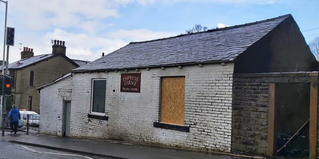
Clayton-Le-Moors is a small town located in the Hyndburn district of Lancashire, England. Situated approximately two miles north of Accrington, the town has a population of around 8,000 residents. It is known for its rich industrial heritage and picturesque surroundings.

The town's history dates back to the medieval period when it was primarily an agricultural community. However, with the advent of the Industrial Revolution, Clayton-Le-Moors became a center for textile manufacturing. Cotton mills were established, and the town experienced rapid growth and prosperity during the late 18th and early 19th centuries.

Today, remnants of the town's industrial past can still be seen in the form of old mill buildings and chimneys. However, Clayton-Le-Moors has diversified its economy, and industries such as retail, healthcare, and services now play a significant role in the local economy.

The town is known for its close-knit community and friendly atmosphere. It offers a range of amenities, including shops, pubs, restaurants, and recreational facilities. The nearby countryside provides ample opportunities for outdoor activities, with beautiful walking trails and parks.

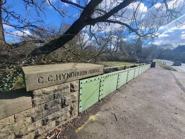
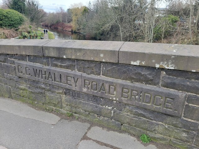
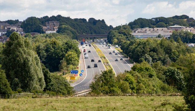
Clayton-Le-Moors is well-connected to other parts of Lancashire and the United Kingdom. It has good transport links, with easy access to the M65 motorway and regular bus services. The nearby railway stations of Accrington and Huncoat provide connections to major cities such as Manchester and Preston.

Overall, Clayton-Le-Moors is a charming town that seamlessly blends its industrial past with modern amenities, making it an attractive place to live and visit in Lancashire.

If you have any feedback on the listing, please let us know in the comments section below.

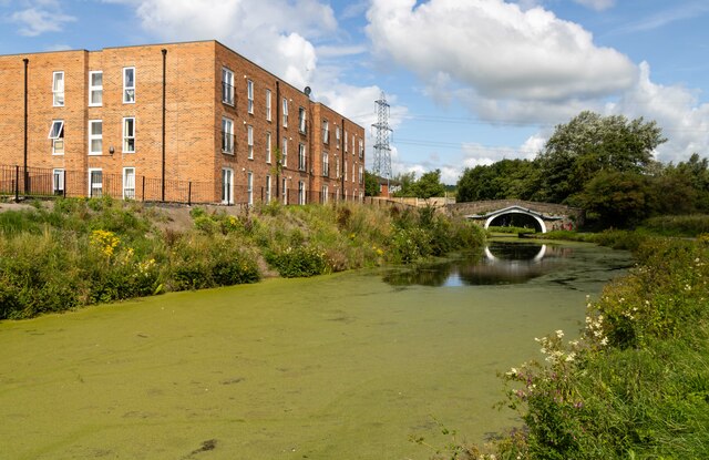
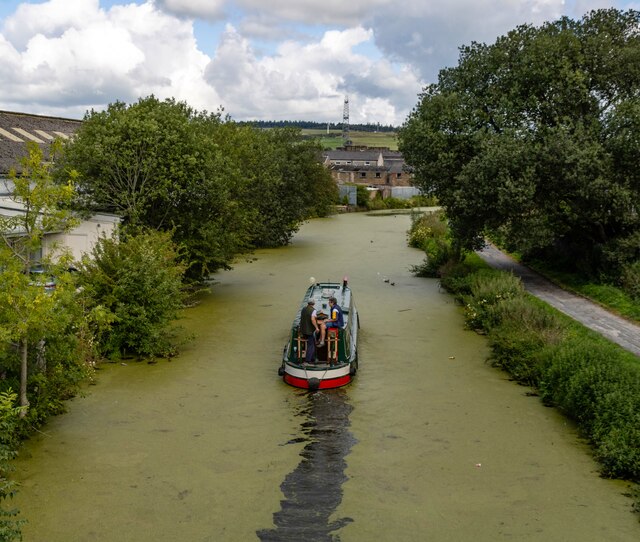
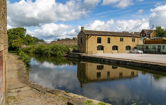
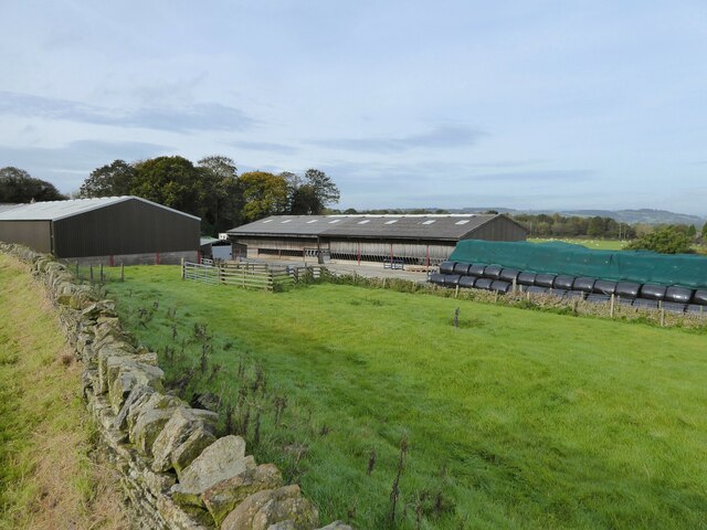
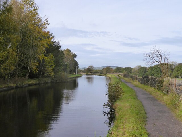
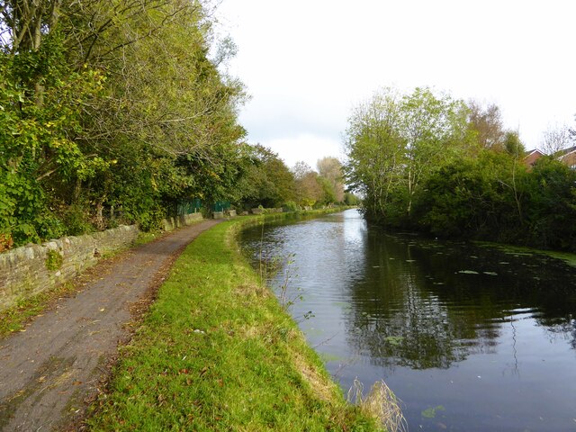
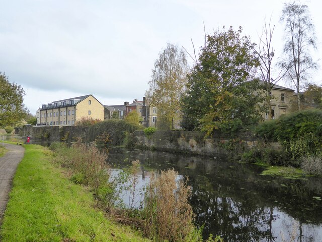
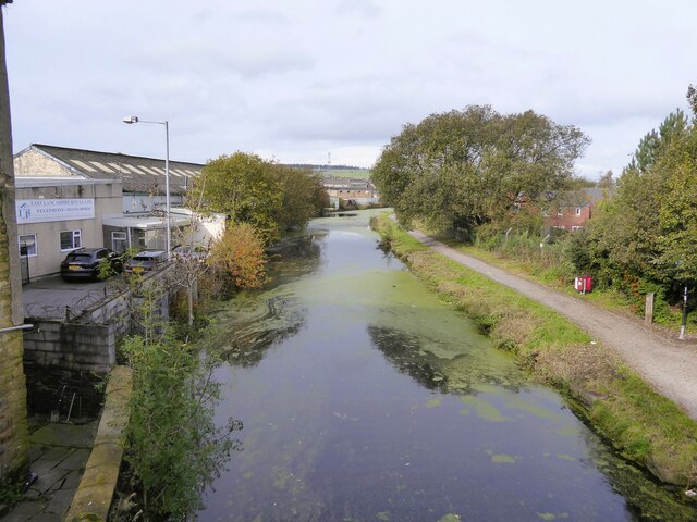
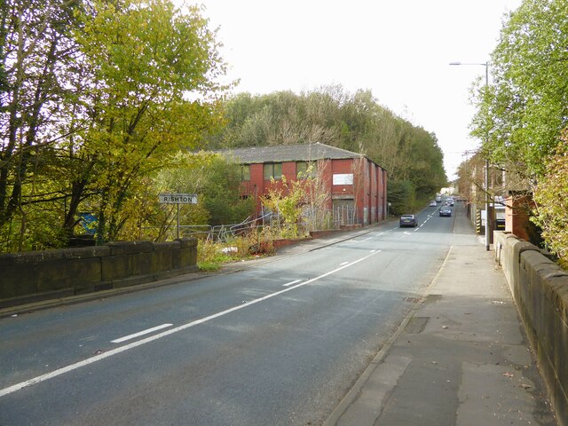
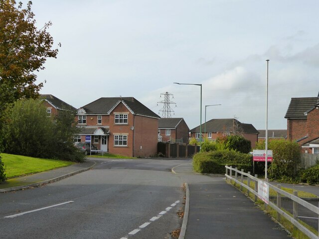
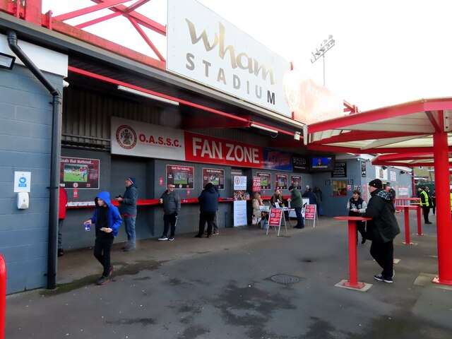
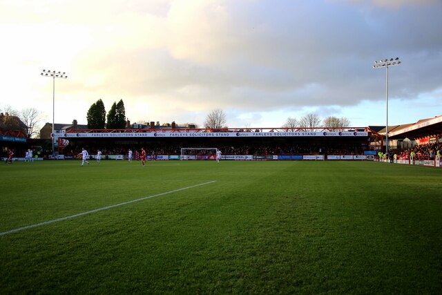
Clayton-Le-Moors Images

Images are sourced within 2km of 53.775598/-2.38994 or Grid Reference SD7431. Thanks to Geograph Open Source API. All images are credited.

Empress Garage
Empress Garage
Gated Track near Hyndburn Bridge
Old Bridge Marker on the A680 Whalley Road Bridge Marker inscribed in the capstone of the north pier of Hyndburn Bridge, Hyndburn Brook, on the east side of the A680 Whalley Road. On the boundary of Great Harwood and Clayton le Moors parishes until 1974 when both were abolished. REBUILT 1930 in inscribed on the capstone of the south pier on the east side of the road.

Milestone Society National ID: LA_GHACLM01br
Old Bridge Marker on the A680 Whalley Road
Bridge Marker inscribed in the capstone of the north pier of Hyndburn Bridge, Hyndburn Brook, on the east side of the A680 Whalley Road. On the boundary of Great Harwood and Clayton le Moors parishes until 1974 when both were abolished. REBUILT 1930 in inscribed on the capstone of the south pier on the east side of the road. Milestone Society National ID: LA_GHACLM01br
Old Bridge Marker on the A680 Whalley Road Bridge Marker inscribed on two stones in the parapet of Whalley Road Bridge, Leeds and Liverpool Canal, on the east side of the A680 Whalley Road. In Clayton le Moors parish until 1974 when it was abolished.

Milestone Society National ID: LA_CLAYLM01br
Old Bridge Marker on the A680 Whalley Road
Bridge Marker inscribed on two stones in the parapet of Whalley Road Bridge, Leeds and Liverpool Canal, on the east side of the A680 Whalley Road. In Clayton le Moors parish until 1974 when it was abolished. Milestone Society National ID: LA_CLAYLM01br
Melrose House Melrose House in Rishton, alongside the Leeds & Liverpool Canal.
Melrose House
Melrose House in Rishton, alongside the Leeds & Liverpool Canal.
Leeds & Liverpool Canal The Leeds and Liverpool Canal is the longest canal in Northern England at 127 miles long. The first of the trans-Pennine canals it took 46 years to build at a cost of five times the original budget, mainly because of the length and complexity of the route. It passes through 91 locks with a summit level of 487 feet at Foulridge near Nelson and Colne. It was originally conceived in the 18th century to carry woollen goods from Leeds and Bradford and limestone from Skipton but in its 19th century heyday it carried stone, coal and many other goods. The impact of the railways was not as great as with other canals and commercial traffic continued along the main canal until 1964. Regular work stopped in 1972 when the movement of coal to Wigan Power Station ceased. In the latter part of the 20th century the leisure potential of the canal was developed and it is now a popular destination for cruising, fishing, walking and cycling. See <span class="nowrap"><a title="http://www.penninewaterways.co.uk/ll/index.htm" rel="nofollow ugc noopener" href="http://www.penninewaterways.co.uk/ll/index.htm">Link</a><img style="margin-left:2px;" alt="External link" title="External link - shift click to open in new window" src="https://s1.geograph.org.uk/img/external.png" width="10" height="10"/></span> for detailed information.
Leeds & Liverpool Canal
The Leeds and Liverpool Canal is the longest canal in Northern England at 127 miles long. The first of the trans-Pennine canals it took 46 years to build at a cost of five times the original budget, mainly because of the length and complexity of the route. It passes through 91 locks with a summit level of 487 feet at Foulridge near Nelson and Colne. It was originally conceived in the 18th century to carry woollen goods from Leeds and Bradford and limestone from Skipton but in its 19th century heyday it carried stone, coal and many other goods. The impact of the railways was not as great as with other canals and commercial traffic continued along the main canal until 1964. Regular work stopped in 1972 when the movement of coal to Wigan Power Station ceased. In the latter part of the 20th century the leisure potential of the canal was developed and it is now a popular destination for cruising, fishing, walking and cycling. See LinkExternal link for detailed information.
Leeds & Liverpool Canal The Leeds & Liverpool Canal at Enfield.
Leeds & Liverpool Canal
The Leeds & Liverpool Canal at Enfield.
M65 The M65 Motorway seen from the Leeds & Liverpool Canal.
M65
The M65 Motorway seen from the Leeds & Liverpool Canal.
Livestock Barn At Moorside Farm with plenty of winter feed adjacent
Livestock Barn
At Moorside Farm with plenty of winter feed adjacent
Leeds and Liverpool Canal Just after passing Pilkington Canal Bridge. The towpath now has competition from an illuminated housing estate path that follows the other bank.
Leeds and Liverpool Canal
Just after passing Pilkington Canal Bridge. The towpath now has competition from an illuminated housing estate path that follows the other bank.
Leeds and Liverpool Canal The towpath is approaching some green security fencing that comes down to the canal from the local school.
Leeds and Liverpool Canal
The towpath is approaching some green security fencing that comes down to the canal from the local school.
Leeds and Liverpool Canal Approaching Whalley Road Bridge with some old mill walling on the bank opposite the towpath
Leeds and Liverpool Canal
Approaching Whalley Road Bridge with some old mill walling on the bank opposite the towpath
Leeds and Liverpool Canal View from the bridge on Hermitage Street
Leeds and Liverpool Canal
View from the bridge on Hermitage Street
Entering Rishton on Hermitage Street At the end of Holt Mill Bridge with the former Rishton Paper Mill ahead and the climb up into Rishton
Entering Rishton on Hermitage Street
At the end of Holt Mill Bridge with the former Rishton Paper Mill ahead and the climb up into Rishton
Modern housing estate On Bold Venture Way near the boundary with Altham
Modern housing estate
On Bold Venture Way near the boundary with Altham
The Fan Zone at the Wham Stadium The Wham Stadium is home to Accrington Stanley.
The Fan Zone at the Wham Stadium
The Wham Stadium is home to Accrington Stanley.
The dressing rooms at the Wham Stadium The Wham Stadium is home to Accrington Stanley.
The dressing rooms at the Wham Stadium
The Wham Stadium is home to Accrington Stanley.
The Farleys Solicitors Stand at the Wham Stadium The Wham Stadium is home to Accrington Stanley.
The Farleys Solicitors Stand at the Wham Stadium
The Wham Stadium is home to Accrington Stanley.
Show me another place!

Clayton-Le-Moors is located at Grid Ref: SD7431 (Lat: 53.775598, Lng: -2.38994)

Administrative County: Lancashire

District: Hyndburn

Police Authority: Lancashire

What 3 Words

///epic.kite.trucks. Near Clayton le Moors, Lancashire

Nearby Locations

Clayton-Le-Moors Oakenshaw

Related Wikis

Oakenshaw, Lancashire

Oakenshaw is part of Clayton-le-Moors in Lancashire, England. Thomas de Clayton was the first grantee of Oakenshaw in the middle of the 11th-century. A...

Clayton-le-Moors

Clayton-le-Moors is an industrial town in the borough of Hyndburn in the county of Lancashire, England. located two miles north of Accrington. The town...

The Bee (radio station)

The Bee was an Independent Local Radio station serving southern and eastern parts of Lancashire, England. On Friday 27 May 2016, The Bee merged with its...

Hyndburn (UK Parliament constituency)

Hyndburn is a constituency in Lancashire represented in the House of Commons of the UK Parliament since 2019 by Sara Britcliffe of the Conservative Party...

Nearby Amenities

Located within 500m of 53.775598,-2.38994
Waterway: weir
Lat/Long: 53.7785931/-2.3944631
Mini Roundabout
Direction: clockwise
Lat/Long: 53.7771223/-2.3891094
Clayton-le-Moors
Place: town
Population: 8522
Population Date: 2011
Source Population: wikipedia
Wikidata: Q927181
Wikipedia: en:Clayton-le-Moors
Lat/Long: 53.7734032/-2.3892947
Power: tower
Source: OS 1:25k
Lat/Long: 53.7741577/-2.3834031
Power: tower
Source: OS 1:25k
Lat/Long: 53.7727154/-2.3850089
Power: tower
Lat/Long: 53.7722324/-2.3884433
Place Of Worship
Saint Marys
Denomination: catholic
Religion: christian
Lat/Long: 53.7760267/-2.3825319
Bus Stop
Bus: yes
Public Transport: platform
Lat/Long: 53.7773468/-2.3889377
Pub
Forts Arms
Addr City: Accrington
Addr Postcode: BB5 5TA
Addr Street: Barnes Street
Addr Suburb: Clayton-le-Moors
Fhrs Id: 851846
Source Addr: FHRS Open Data
Lat/Long: 53.7771346/-2.3893903
Co-op Food
Addr City: Accrington
Addr Housenumber: 19-21
Addr Postcode: BB5 5NS
Addr Street: Pickup Street
Addr Suburb: Clayton-le-Moors
Brand: Co-op Food
Brand Wikidata: Q3277439
Brand Wikipedia: en:Co-op Food
Fhrs Id: 91263
Operator: The Co-operative Group
Operator Wikidata: Q117202
Shop: supermarket
Source Addr: FHRS Open Data
Website: https://www.coop.co.uk/store-finder/BB5-5NS/19-21-pickup-street
Lat/Long: 53.7748628/-2.3843302
Place Of Worship
New Jerusalem Church
Religion: christian
Lat/Long: 53.7760551/-2.3842532
Health Centre
Healthcare: centre
Lat/Long: 53.7747238/-2.3838892
Pub
Wellington
Lat/Long: 53.7746826/-2.38475
Cafe
Katies Cafe and Take away
Lat/Long: 53.7747705/-2.3852931
Fast Food
Barnes Square Chippy
Addr City: Accrington
Addr Housenumber: 9
Addr Postcode: BB5 5NX
Addr Street: Barnes Square
Addr Suburb: Clayton-le-Moors
Fhrs Id: 80924
Source Addr: FHRS Open Data
Lat/Long: 53.7747994/-2.3848264
Post Box
Lat/Long: 53.7762669/-2.3831535
Pub
Oddfellows Arms
Lat/Long: 53.7760615/-2.3835237
Library
Clayton Library
Lat/Long: 53.7751464/-2.3840387
Normans
Shop: hairdresser
Lat/Long: 53.774796/-2.3831964
Londis
Brand: Londis
Brand Wikidata: Q21008564
Brand Wikipedia: en:Londis (United Kingdom)
Shop: convenience
Lat/Long: 53.7761435/-2.3878056
Hairways
Shop: hairdresser
Lat/Long: 53.7763242/-2.3874838
Dentist
Healthcare: dentist
Lat/Long: 53.7747428/-2.3863139
Stylebar
Shop: hairdresser
Lat/Long: 53.7749187/-2.3864846
Clayton Hardware
Shop: doityourself
Lat/Long: 53.7753438/-2.3855855
Restaurant
Sparth Manor
Addr City: Accrington
Addr Postcode: BB5 5QA
Addr Street: Sparth Road
Addr Suburb: Clayton-le-Moors
Fhrs Id: 1135244
Source Addr: FHRS Open Data
Lat/Long: 53.7789018/-2.3865438
Bus Stop
Bus: yes
Naptan AtcoCode: 2500762
Naptan NaptanCode: lanawtwj
Public Transport: platform
Lat/Long: 53.7786634/-2.3848701
Fast Food
Milton Street Chippy
Addr City: Accrington
Addr Housenumber: 4
Addr Postcode: BB5 5QE
Addr Street: Milton Street
Addr Suburb: Clayton-le-Moors
Fhrs Id: 111449
Source Addr: FHRS Open Data
Lat/Long: 53.7784352/-2.3844624
B. Hodder
Addr City: Accrington
Addr Housenumber: 101
Addr Postcode: BB5 5PG
Addr Street: Barnes Street
Addr Suburb: Clayton-le-Moors
Fhrs Id: 85069
Shop: butcher
Source Addr: FHRS Open Data
Lat/Long: 53.7765556/-2.3884816
Place Of Worship
Clayton Baptist Church
Denomination: baptist
Religion: christian
Lat/Long: 53.7780042/-2.3878637
Post Office
Clayton Le Moors Post Office
Addr City: Accrington
Addr Housenumber: 38
Addr Postcode: BB5 5NS
Addr Street: Pickup Street
Addr Village: Clayton Le Moors
Brand: Post Office
Brand Wikidata: Q1783168
Opening Hours: Mo-Fr 09:00-17:30; Sa 09:00-14:30
Ref Pol Id: 13026
Website: https://www.postoffice.co.uk/branch-finder/3304272/clayton-le-moors
Lat/Long: 53.7750551/-2.3852918
Barrier: bollard
Motor Vehicle: no
Lat/Long: 53.7749629/-2.3850352
Pharmacy
Well Pharmacy
Addr City: Accrington
Addr Housenumber: 36
Addr Postcode: BB5 5NS
Addr Street: Pickup Street
Addr Suburb: Clayton-le-Moors
Brand: Well Pharmacy
Brand Wikidata: Q7726524
Brand Wikipedia: en:Well Pharmacy
Dispensing: yes
Fhrs Id: 1025634
Healthcare: pharmacy
Source Addr: FHRS Open Data
Website: https://finder.well.co.uk/store/accrington-pickup-street
Lat/Long: 53.7750647/-2.3848082
Spar
Brand: Spar
Brand Wikidata: Q610492
Brand Wikipedia: en:SPAR (retailer)
Shop: convenience
Lat/Long: 53.7748486/-2.384813
Shop: hairdresser
Lat/Long: 53.7750876/-2.3846628
Post Box
Collection Times: Mo-Fr 16:45; Sa 12:15
Post Box Type: pillar
Royal Cypher: EIIR
Royal Cypher Wikidata: Q33102113
Lat/Long: 53.7749693/-2.3851746
Pub
The Albion
Addr City: Accrington
Addr Housenumber: 243
Addr Postcode: BB5 5HD
Addr Street: Whalley Road
Addr Suburb: Clayton-le-Moors
Fhrs Id: 459401
Source Addr: FHRS Open Data
Lat/Long: 53.7738093/-2.3829829
Pub
Park View WMC
Addr City: Accrington
Addr Postcode: BB5 5PR
Addr Street: Bayley Street
Addr Suburb: Clayton-le-Moors
Fhrs Id: 86694
Source Addr: FHRS Open Data
Lat/Long: 53.777252/-2.3909804
Post Box
Collection Times: Mo-Fr 16:45; Sa 12:15
Post Box Type: pillar
Royal Cypher: EIIR
Royal Cypher Wikidata: Q33102113
Lat/Long: 53.7749652/-2.385211
Disused Amenity: post_box
Post Box Type: wall
Royal Cypher: VR
Lat/Long: 53.7769202/-2.3889692
Crossing
Crossing: traffic_signals
Crossing Ref: pelican
Kerb: lowered
Tactile Paving: yes
Lat/Long: 53.7752721/-2.3831135
Generator Method: photovoltaic
Generator Output Electricity: yes
Generator Source: solar
Generator Type: solar_photovoltaic_panel
Location: roof
Power: generator
Lat/Long: 53.7800513/-2.3888792
Historic: memorial
Memorial: war_memorial
Wikimedia Commons: File:War Memorial, Mercer Park, Clayton-le-Moors - geograph.org.uk - 658686.jpg
Lat/Long: 53.774471/-2.3892606
The data included in this document is from www.openstreetmap.org. The data is made available under ODbL.

Have you been to Clayton-Le-Moors?

Leave your review of Clayton-Le-Moors below (or comments, questions and feedback).