Clayton Green

Settlement in Lancashire Chorley

England

Clayton Green

M69 bridge - northbound M6
M69 bridge - northbound M6 Credit: Dave Thompson

Clayton Green is a small village located in the borough of Chorley, Lancashire, England. Situated approximately 2 miles southeast of the town of Leyland, Clayton Green is a quaint and peaceful residential area.

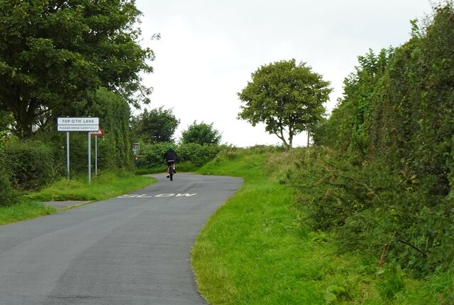
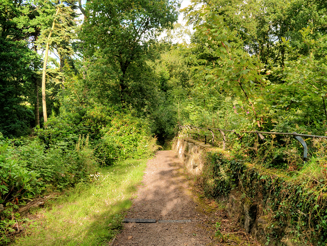
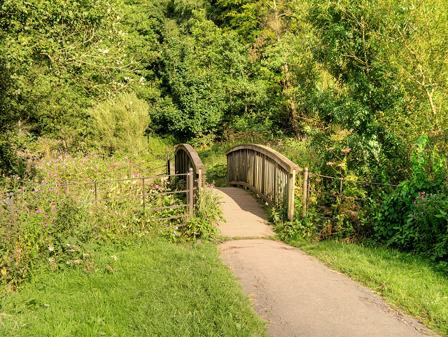
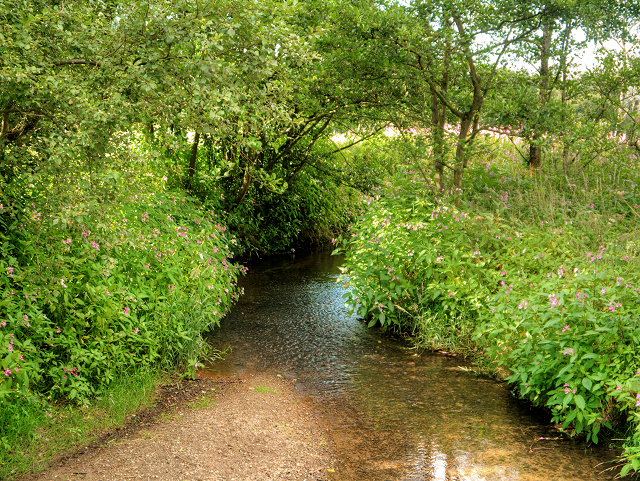
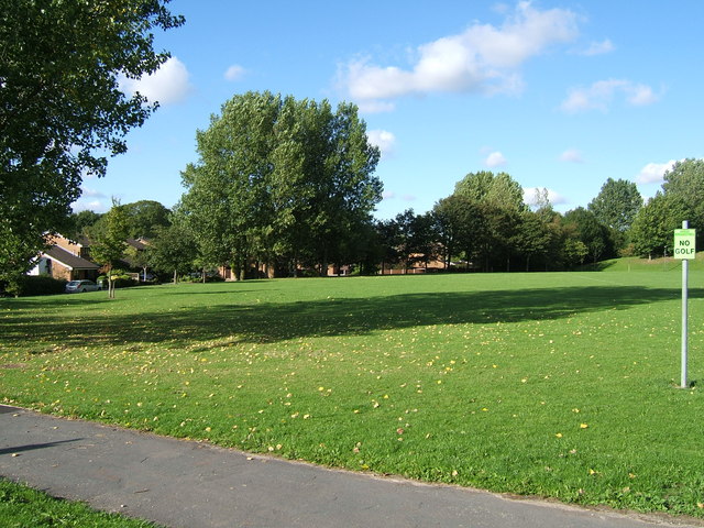
The village is surrounded by picturesque countryside and offers a tranquil atmosphere, making it an ideal place for those seeking a quiet and peaceful lifestyle away from the hustle and bustle of the city. The area is known for its beautiful green spaces, with several parks and open fields that provide ample opportunities for outdoor activities such as walking, cycling, and picnicking.

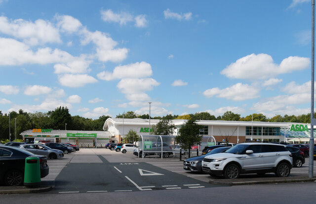
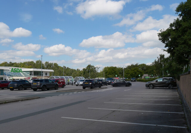
In terms of amenities, Clayton Green offers a range of local shops, including convenience stores, a post office, and a few small businesses. For more extensive shopping needs, residents have easy access to nearby Leyland or Chorley, where they can find supermarkets, retail outlets, and a variety of services.

The village is also well-connected in terms of transportation. The M6 motorway is just a short drive away, providing access to major cities such as Manchester and Liverpool. Additionally, there are regular bus services that run through Clayton Green, connecting it to surrounding towns and villages.

Overall, Clayton Green is a charming and peaceful village that offers a close-knit community and a serene rural setting. Its proximity to larger towns and excellent transport links make it a desirable place to live for those seeking a balance between a quiet countryside lifestyle and access to urban amenities.

If you have any feedback on the listing, please let us know in the comments section below.

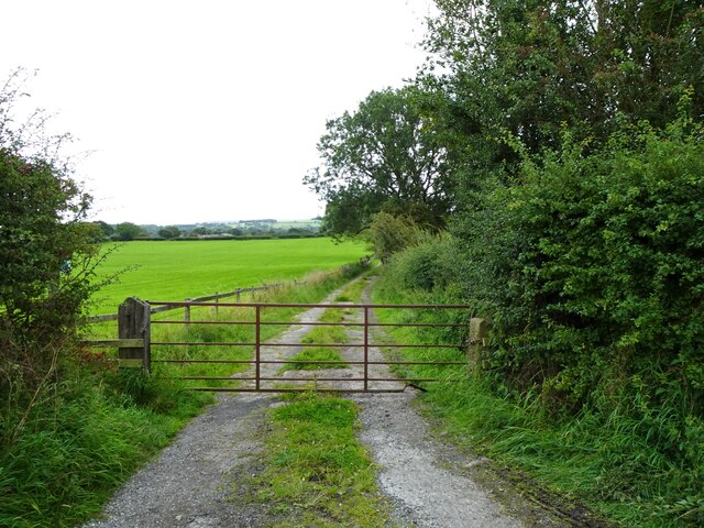
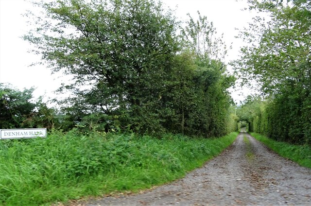
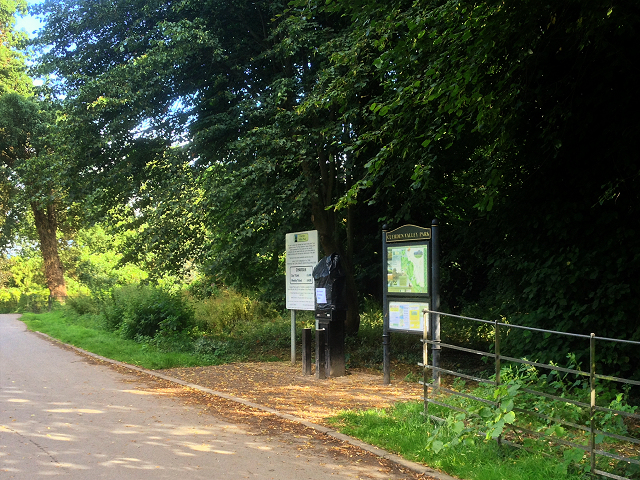
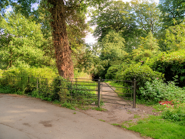
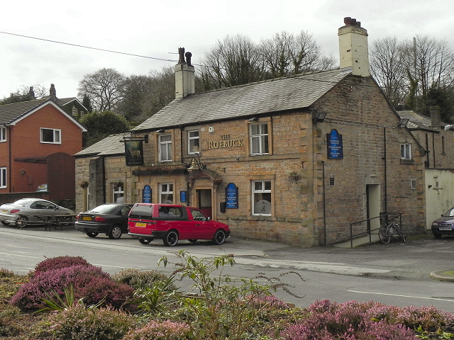
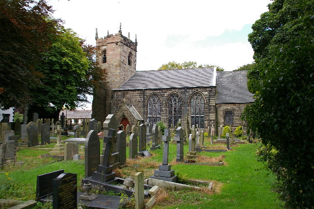
Clayton Green Images

Images are sourced within 2km of 53.705775/-2.637739 or Grid Reference SD5823. Thanks to Geograph Open Source API. All images are credited.

M69 bridge - northbound M6
A6 bridge - northbound M6
Clayton Brook Road At its junction with Preston Road (A6).
Clayton Brook Road
At its junction with Preston Road (A6).
Pippin Street At its junction with Sandy Lane near Thorpe Green.
Pippin Street
At its junction with Sandy Lane near Thorpe Green.
Approaching Brindle The church is St. James' and the pub to the right of the church tower is The Cavendish Arms.
Approaching Brindle
The church is St. James' and the pub to the right of the church tower is The Cavendish Arms.
Canal Milestone, Lord Nelson Pub, Clayton-le-Woods Originally located on the Lancaster Canal (South End) probably about 320m to the East of the pub at what was then Radburn Bridge. Now between Westwood Road and the M61.

Inscription: Walton / Summit / 1 / Miles // Junctᴺ / L & L C / 2 / Miles

Milestone National ID: tbc
Canal Milestone, Lord Nelson Pub, Clayton-le-Woods
Originally located on the Lancaster Canal (South End) probably about 320m to the East of the pub at what was then Radburn Bridge. Now between Westwood Road and the M61. Inscription: Walton / Summit / 1 / Miles // Junctᴺ / L & L C / 2 / Miles Milestone National ID: tbc
Asda, Clayton Green
Asda, Clayton Green
Asda, Clayton Green
Asda, Clayton Green
Approaching Top o'th' Lane A small hamlet near Brindle in Lancashire.
Approaching Top o'th' Lane
A small hamlet near Brindle in Lancashire.
Track off Denham Lane Also a public footpath leading to Breworth Fold Farm and beyond.
Track off Denham Lane
Also a public footpath leading to Breworth Fold Farm and beyond.
Track leading to Denham Hall Leading off Denham Lane.
Track leading to Denham Hall
Leading off Denham Lane.
Cuerden Valley Park Near the Cuerden Hall car park.
Cuerden Valley Park
Near the Cuerden Hall car park.
Sundial at Cuerden Valley Park The park was once part of the estate of Cuerden Hall. This column, with sundials on each of its four faces, is near to the site of the Hall.
Sundial at Cuerden Valley Park
The park was once part of the estate of Cuerden Hall. This column, with sundials on each of its four faces, is near to the site of the Hall.
Gated Path in Cuerden Valley Park Cuerden Valley Park, south of the M1 and M65 junction, is a pleasant 650-acre country park following the scenic valley of the River Lostock within easy reach of Preston, Leyland and Chorley. It was set up in 1986 by the Commission for New Towns. Approximately half of the area is used for agriculture but car parks and picnic areas have been provided along with a 10-mile network of footpaths, cycle path and bridleways and a fishing lake/reservoir. The scenery is varied, including river banks, parkland, agricultural land, bluebell woods and wildflower meadows. Wildlife includes woodpeckers, kingfishers, great crested newts and dragonflies. 

Since 1992, the Park has owned and managed by an independent registered charity, Cuerden Valley Park Trust, rather than by the Local Authority.  It is open all year; entrance is free, although a parking charge of £1 per day applies in the five car parks.

<span class="nowrap"><a title="http://www.lancashirewildlife.org.uk/leaflets/Cuerden-Valley-Park.pdf" rel="nofollow ugc noopener" href="http://www.lancashirewildlife.org.uk/leaflets/Cuerden-Valley-Park.pdf">Link</a><img style="margin-left:2px;" alt="External link" title="External link - shift click to open in new window" src="https://s1.geograph.org.uk/img/external.png" width="10" height="10"/></span>  map of the park
Gated Path in Cuerden Valley Park
Cuerden Valley Park, south of the M1 and M65 junction, is a pleasant 650-acre country park following the scenic valley of the River Lostock within easy reach of Preston, Leyland and Chorley. It was set up in 1986 by the Commission for New Towns. Approximately half of the area is used for agriculture but car parks and picnic areas have been provided along with a 10-mile network of footpaths, cycle path and bridleways and a fishing lake/reservoir. The scenery is varied, including river banks, parkland, agricultural land, bluebell woods and wildflower meadows. Wildlife includes woodpeckers, kingfishers, great crested newts and dragonflies. Since 1992, the Park has owned and managed by an independent registered charity, Cuerden Valley Park Trust, rather than by the Local Authority. It is open all year; entrance is free, although a parking charge of £1 per day applies in the five car parks. LinkExternal link map of the park
Steep Path, Cuerden Valley Park Cuerden Valley Park, south of the M1 and M65 junction, is a pleasant 650-acre country park following the scenic valley of the River Lostock within easy reach of Preston, Leyland and Chorley. It was set up in 1986 by the Commission for New Towns. Approximately half of the area is used for agriculture but car parks and picnic areas have been provided along with a 10-mile network of footpaths, cycle path and bridleways and a fishing lake/reservoir. The scenery is varied, including river banks, parkland, agricultural land, bluebell woods and wildflower meadows. Wildlife includes woodpeckers, kingfishers, great crested newts and dragonflies. 

Since 1992, the Park has owned and managed by an independent registered charity, Cuerden Valley Park Trust, rather than by the Local Authority.  It is open all year; entrance is free, although a parking charge of £1 per day applies in the five car parks.

<span class="nowrap"><a title="http://www.lancashirewildlife.org.uk/leaflets/Cuerden-Valley-Park.pdf" rel="nofollow ugc noopener" href="http://www.lancashirewildlife.org.uk/leaflets/Cuerden-Valley-Park.pdf">Link</a><img style="margin-left:2px;" alt="External link" title="External link - shift click to open in new window" src="https://s1.geograph.org.uk/img/external.png" width="10" height="10"/></span>  map of the park
Steep Path, Cuerden Valley Park
Cuerden Valley Park, south of the M1 and M65 junction, is a pleasant 650-acre country park following the scenic valley of the River Lostock within easy reach of Preston, Leyland and Chorley. It was set up in 1986 by the Commission for New Towns. Approximately half of the area is used for agriculture but car parks and picnic areas have been provided along with a 10-mile network of footpaths, cycle path and bridleways and a fishing lake/reservoir. The scenery is varied, including river banks, parkland, agricultural land, bluebell woods and wildflower meadows. Wildlife includes woodpeckers, kingfishers, great crested newts and dragonflies. Since 1992, the Park has owned and managed by an independent registered charity, Cuerden Valley Park Trust, rather than by the Local Authority. It is open all year; entrance is free, although a parking charge of £1 per day applies in the five car parks. LinkExternal link map of the park
Cuerden Park, Bridge over River Lostock Cuerden Valley Park, south of the M1 and M65 junction, is a pleasant 650-acre country park following the scenic valley of the River Lostock within easy reach of Preston, Leyland and Chorley. It was set up in 1986 by the Commission for New Towns. Approximately half of the area is used for agriculture but car parks and picnic areas have been provided along with a 10-mile network of footpaths, cycle path and bridleways and a fishing lake/reservoir. The scenery is varied, including river banks, parkland, agricultural land, bluebell woods and wildflower meadows. Wildlife includes woodpeckers, kingfishers, great crested newts and dragonflies. 

Since 1992, the Park has owned and managed by an independent registered charity, Cuerden Valley Park Trust, rather than by the Local Authority.  It is open all year; entrance is free, although a parking charge of £1 per day applies in the five car parks.

<span class="nowrap"><a title="http://www.lancashirewildlife.org.uk/leaflets/Cuerden-Valley-Park.pdf" rel="nofollow ugc noopener" href="http://www.lancashirewildlife.org.uk/leaflets/Cuerden-Valley-Park.pdf">Link</a><img style="margin-left:2px;" alt="External link" title="External link - shift click to open in new window" src="https://s1.geograph.org.uk/img/external.png" width="10" height="10"/></span>  map of the park
Cuerden Park, Bridge over River Lostock
Cuerden Valley Park, south of the M1 and M65 junction, is a pleasant 650-acre country park following the scenic valley of the River Lostock within easy reach of Preston, Leyland and Chorley. It was set up in 1986 by the Commission for New Towns. Approximately half of the area is used for agriculture but car parks and picnic areas have been provided along with a 10-mile network of footpaths, cycle path and bridleways and a fishing lake/reservoir. The scenery is varied, including river banks, parkland, agricultural land, bluebell woods and wildflower meadows. Wildlife includes woodpeckers, kingfishers, great crested newts and dragonflies. Since 1992, the Park has owned and managed by an independent registered charity, Cuerden Valley Park Trust, rather than by the Local Authority. It is open all year; entrance is free, although a parking charge of £1 per day applies in the five car parks. LinkExternal link map of the park
Cuerden Valley Park, River Lostock Cuerden Valley Park, south of the M1 and M65 junction, is a pleasant 650-acre country park following the scenic valley of the River Lostock within easy reach of Preston, Leyland and Chorley. It was set up in 1986 by the Commission for New Towns. Approximately half of the area is used for agriculture but car parks and picnic areas have been provided along with a 10-mile network of footpaths, cycle path and bridleways and a fishing lake/reservoir. The scenery is varied, including river banks, parkland, agricultural land, bluebell woods and wildflower meadows. Wildlife includes woodpeckers, kingfishers, great crested newts and dragonflies. 

Since 1992, the Park has owned and managed by an independent registered charity, Cuerden Valley Park Trust, rather than by the Local Authority.  It is open all year; entrance is free, although a parking charge of £1 per day applies in the five car parks.

<span class="nowrap"><a title="http://www.lancashirewildlife.org.uk/leaflets/Cuerden-Valley-Park.pdf" rel="nofollow ugc noopener" href="http://www.lancashirewildlife.org.uk/leaflets/Cuerden-Valley-Park.pdf">Link</a><img style="margin-left:2px;" alt="External link" title="External link - shift click to open in new window" src="https://s1.geograph.org.uk/img/external.png" width="10" height="10"/></span>  map of the park
Cuerden Valley Park, River Lostock
Cuerden Valley Park, south of the M1 and M65 junction, is a pleasant 650-acre country park following the scenic valley of the River Lostock within easy reach of Preston, Leyland and Chorley. It was set up in 1986 by the Commission for New Towns. Approximately half of the area is used for agriculture but car parks and picnic areas have been provided along with a 10-mile network of footpaths, cycle path and bridleways and a fishing lake/reservoir. The scenery is varied, including river banks, parkland, agricultural land, bluebell woods and wildflower meadows. Wildlife includes woodpeckers, kingfishers, great crested newts and dragonflies. Since 1992, the Park has owned and managed by an independent registered charity, Cuerden Valley Park Trust, rather than by the Local Authority. It is open all year; entrance is free, although a parking charge of £1 per day applies in the five car parks. LinkExternal link map of the park
Path in Cuerden Valley Park Cuerden Valley Park, south of the M1 and M65 junction, is a pleasant 650-acre country park following the scenic valley of the River Lostock within easy reach of Preston, Leyland and Chorley. It was set up in 1986 by the Commission for New Towns. Approximately half of the area is used for agriculture but car parks and picnic areas have been provided along with a 10-mile network of footpaths, cycle path and bridleways and a fishing lake/reservoir. The scenery is varied, including river banks, parkland, agricultural land, bluebell woods and wildflower meadows. Wildlife includes woodpeckers, kingfishers, great crested newts and dragonflies. 

Since 1992, the Park has owned and managed by an independent registered charity, Cuerden Valley Park Trust, rather than by the Local Authority.  It is open all year; entrance is free, although a parking charge of £1 per day applies in the five car parks.

<span class="nowrap"><a title="http://www.lancashirewildlife.org.uk/leaflets/Cuerden-Valley-Park.pdf" rel="nofollow ugc noopener" href="http://www.lancashirewildlife.org.uk/leaflets/Cuerden-Valley-Park.pdf">Link</a><img style="margin-left:2px;" alt="External link" title="External link - shift click to open in new window" src="https://s1.geograph.org.uk/img/external.png" width="10" height="10"/></span>  map of the park
Path in Cuerden Valley Park
Cuerden Valley Park, south of the M1 and M65 junction, is a pleasant 650-acre country park following the scenic valley of the River Lostock within easy reach of Preston, Leyland and Chorley. It was set up in 1986 by the Commission for New Towns. Approximately half of the area is used for agriculture but car parks and picnic areas have been provided along with a 10-mile network of footpaths, cycle path and bridleways and a fishing lake/reservoir. The scenery is varied, including river banks, parkland, agricultural land, bluebell woods and wildflower meadows. Wildlife includes woodpeckers, kingfishers, great crested newts and dragonflies. Since 1992, the Park has owned and managed by an independent registered charity, Cuerden Valley Park Trust, rather than by the Local Authority. It is open all year; entrance is free, although a parking charge of £1 per day applies in the five car parks. LinkExternal link map of the park
Show me another place!

Clayton Green is located at Grid Ref: SD5823 (Lat: 53.705775, Lng: -2.637739)

Administrative County: Lancashire

District: Chorley

Police Authority: Lancashire

What 3 Words

///smiling.influence.spacing. Near Clayton-le-Woods, Lancashire

Nearby Locations

Clayton Green Bury Fm

Related Wikis

Clayton Brook

Clayton Brook is a large residential estate in Lancashire, between the city of Preston and the town of Chorley. It forms part of the Clayton-le-Woods civil...

Central Lancashire

Central Lancashire is an area of Lancashire, England. == Central Lancashire New Town == Central Lancashire New Town was the largest of the post-war English...

Cuerden

Cuerden is a village and civil parish of the Borough of Chorley, in Lancashire, England. It is situated between Bamber Bridge and Leyland, and had a population...

Whittle-le-Woods

Whittle-le-Woods (commonly shortened to Whittle) is a village and civil parish of the Borough of Chorley in Lancashire, England. The population of the...

Cuerden Hall

Cuerden Hall is a country mansion in the village of Cuerden near Preston, Lancashire, England. It is a Grade II* listed building. The Hall was formerly...

Clayton-le-Woods

Clayton-le-Woods (Commonly shortened to Clayton) is a large village and civil parish of the Borough of Chorley, in Lancashire, England. According to the...

Brindle, Lancashire

Brindle is a small village and civil parish of the borough of Chorley, Lancashire, England. The population of the civil parish at the 2011 census was...
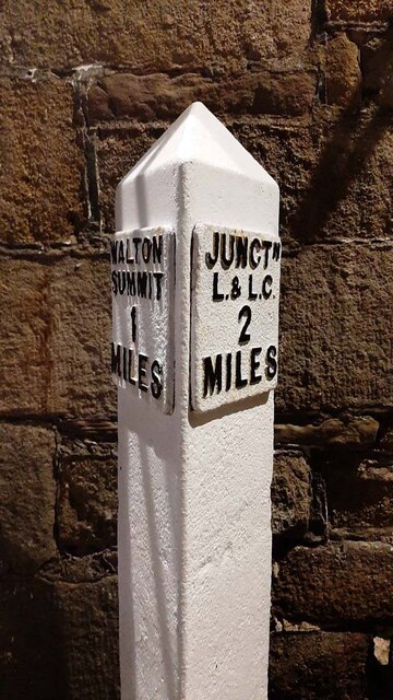
Walton Summit

Walton Summit is an industrial area between Clayton Brook and Bamber Bridge, near Preston in Lancashire, England. It is in the South Ribble district. It...

Nearby Amenities

Located within 500m of 53.705775,-2.637739
Clayton Green
Place: village
Source: npe
Lat/Long: 53.7058061/-2.6433248
Pub
Halfway House
Addr City: Chorley
Addr Housenumber: 470
Addr Postcode: PR6 7JB
Addr Street: Preston Road
Addr Subdistrict: Clayton-le-Woods
Fhrs Id: 1048520
Outdoor Seating: yes
Lat/Long: 53.7016579/-2.639291
Fuel
Shell
Addr City: Chorley
Addr Postcode: PR6 7JD
Addr Street: Preston Road
Brand: Shell
Brand Wikidata: Q110716465
Operator: Motor Fuel Group
Operator Website: https://www.motorfuelgroup.com/locations/clayton-green-fs410/
Operator Wikidata: Q107271358
Phone: +44 1772 695870
Ref Navads: NVDS353_10019256
Self Service: yes
Website: https://find.shell.com/gb/fuel/10019256-mfg-clayton-green
Lat/Long: 53.7021597/-2.6398593
Library
Clayton Green Library
Addr City: Chorley
Addr Postcode: PR6 7EN
Addr Street: Library Road
Addr Suburb: Clayton Brook
Internet Access: wlan
Internet Access Fee: customers
Operator: Lancashire County Council
Operator Type: public
Lat/Long: 53.7070605/-2.6406692
Bus Stop
Pines Close
Bin: yes
Bus: yes
Naptan AtcoCode: 2500IMG2400
Naptan CommonName: Pines Close
Naptan Indicator: opp
Naptan NaptanCode: langawgw
Naptan Verified: no
Public Transport: platform
Shelter: yes
Source: survey
Lat/Long: 53.7084902/-2.6339923
Mini Roundabout
Direction: clockwise
Lat/Long: 53.707747/-2.6437563
Turning Circle
Lat/Long: 53.7027021/-2.6385326
Turning Circle
Lat/Long: 53.70513/-2.6372453
Turning Circle
Lat/Long: 53.7045227/-2.6377301
Turning Circle
Lat/Long: 53.7034429/-2.6343145
Turning Circle
Lat/Long: 53.7029809/-2.634623
Turning Circle
Lat/Long: 53.7036278/-2.6364241
Turning Circle
Lat/Long: 53.7021764/-2.633443
Bus Stop
Halfway House
Bus: yes
Naptan AtcoCode: 2500DCL3049
Naptan CommonName: Halfway House
Naptan Indicator: opp
Naptan NaptanCode: landgjwj
Naptan Verified: no
Public Transport: platform
Lat/Long: 53.7016068/-2.6397484
Restaurant
Dante's
Lat/Long: 53.7017976/-2.6393017
Bus Stop
Sheep Hill Lane
Bus: yes
Naptan AtcoCode: 250011173
Naptan CommonName: Sheep Hill Lane
Naptan Indicator: opp
Naptan NaptanCode: lanadwtj
Naptan Verified: no
Public Transport: platform
Lat/Long: 53.7040079/-2.6395273
Telephone
Booth: KX100
Covered: booth
Lat/Long: 53.7043164/-2.6395534
Post Box
Collection Times: Mo-Fr 09:00; Sa 07:00
Operator: Royal Mail
Post Box Type: lamp
Ref: PR6 58
Royal Cypher: EIIR
Royal Cypher Wikidata: Q33102113
Lat/Long: 53.7036509/-2.6397298
Travelodge Preston Chorley
Brand: Travelodge
Brand Wikidata: Q9361374
Brand Wikipedia: en:Travelodge UK
Tourism: hotel
Website: https://www.travelodge.co.uk/hotels/170/Preston-Chorley-hotel
Lat/Long: 53.7015753/-2.6385239
Turning Circle
Lat/Long: 53.7022497/-2.6380357
Turning Circle
Lat/Long: 53.7051138/-2.6437777
Turning Circle
Lat/Long: 53.7060046/-2.6410285
Turning Circle
Lat/Long: 53.7056235/-2.6409588
Turning Circle
Lat/Long: 53.7028942/-2.6412538
Turning Circle
Lat/Long: 53.7034183/-2.6440554
Recycling
Lat/Long: 53.7081565/-2.6437019
Fuel
Asda
Brand: Asda
Brand Wikidata: Q297410
Brand Wikipedia: en:Asda
Contact Website: https://storelocator.asda.com/north-west/chorley/clayton-green-centre-sheephill-lane
Operator: Asda Stores Ltd
Lat/Long: 53.7069752/-2.6430807
Bus Stop
Asda
Bus: yes
Naptan AtcoCode: 25001483
Naptan Bearing: N
Naptan BusStopType: MKD
Naptan CommonName: Asda
Naptan Indicator: o/s
Naptan Landmark: Asda
Naptan LocalityCode: E0015778
Naptan NaptanCode: lanapamw
Naptan Street: Asda Service Road
Naptan Verified: no
Public Transport: platform
Ref: lanapamw
Lat/Long: 53.7074913/-2.6436402
Pub
The Beaumont
Addr City: Chorley
Addr Postcode: PR6 7TY
Addr Street: Woodale Road
Addr Suburb: Clayton-le-Woods
Outdoor Seating: yes
Lat/Long: 53.7064831/-2.6429734
Bus Stop
Sports Centre
Bus: yes
Naptan AtcoCode: 2500DCL3334
Naptan CommonName: Sports Centre
Naptan Indicator: opp
Naptan NaptanCode: landjdjm
Naptan Verified: no
Public Transport: platform
Lat/Long: 53.7059702/-2.6429924
Leisure: sports_centre
Lat/Long: 53.7079564/-2.6431129
Turning Circle
Lat/Long: 53.704868/-2.6407344
Speed Camera
Lat/Long: 53.7048261/-2.6399232
Place Of Worship
St Bede's RC Church
Denomination: roman_catholic
Religion: christian
Lat/Long: 53.7077643/-2.6390094
Turning Circle
Lat/Long: 53.7073802/-2.63429
Turning Circle
Lat/Long: 53.710048/-2.6356538
Turning Circle
Lat/Long: 53.7094313/-2.6362736
Turning Circle
Lat/Long: 53.7095361/-2.6372794
Turning Circle
Lat/Long: 53.7093742/-2.6384515
Turning Circle
Lat/Long: 53.709771/-2.6384516
Turning Circle
Lat/Long: 53.70882/-2.6325185
Parking
Lat/Long: 53.7073079/-2.6379667
Turning Circle
Lat/Long: 53.7040774/-2.6358621
Pub
Lord Nelson
Addr City: Chorley
Addr Postcode: PR6 7RD
Addr Street: Sandy Lane
Addr Subdistrict: Clayton-le-Woods
Lat/Long: 53.7041283/-2.6365633
Turning Circle
Lat/Long: 53.7048965/-2.6340058
Post Box
Collection Times: Mo-Fr 09:00; Sa 07:00
Mapillary: 482102146399832
Operator: Royal Mail
Post Box Type: lamp
Ref: PR5 220
Royal Cypher: EIIR
Royal Cypher Wikidata: Q33102113
Lat/Long: 53.7082959/-2.6341714
Barrier: cycle_barrier
Bicycle: yes
Foot: yes
Motor Vehicle: no
Lat/Long: 53.703251/-2.6372918
Give Way
Direction: forward
Lat/Long: 53.707095/-2.6352051
Give Way
Direction: forward
Lat/Long: 53.7044332/-2.6396532
Give Way
Direction: forward
Lat/Long: 53.7046839/-2.6399284
Give Way
Direction: forward
Lat/Long: 53.7037929/-2.6361081
Entrance: main
Wheelchair: yes
Lat/Long: 53.7076921/-2.6427491
Brindle Distillery
Addr City: Chorley
Addr Housename: Holmes Farm
Addr Postcode: PR6 8LZ
Addr Street: Sandy Lane
Addr Suburb: Clayton Brook
Craft: distillery
Fhrs Id: 1043969
Operator: Brindle Distillery
Lat/Long: 53.705839/-2.6310566
Bar
Cuckoo's Nest
Addr City: Chorley
Addr Housename: Holmes Farm
Addr Postcode: PR6 8LZ
Addr Street: Sandy Lane
Addr Suburb: Clayton Brook
Craft: brewery
Operator: Brindle Distillery
Lat/Long: 53.7057858/-2.6310968
Parking
Holmes Farm
Access: customers
Fee: no
Parking: surface
Surface: gravel
Lat/Long: 53.705562/-2.6310807
Parking
Access: customers
Capacity: 15
Capacity Disabled: 3
Fee: no
Parking: surface
Smoothness: good
Surface: asphalt
Lat/Long: 53.7072433/-2.6408064
Parking
Access: private
Parking: surface
Lat/Long: 53.707537/-2.6409325
Parking
Access: private
Parking: surface
Lat/Long: 53.7078053/-2.6418123
Parking
Lidl
Access: customers
Capacity: 100
Capacity Disabled: 5
Fee: no
Lit: yes
Operator: Lidl
Parking: surface
Smoothness: good
Surface: asphalt
Lat/Long: 53.7063527/-2.6388323
HW Technology
Addr City: Chorley
Addr Postcode: PR6 7EN
Addr Street: Library Road
Addr Suburb: Clayton-le-Woods
Office: it
Lat/Long: 53.7075323/-2.6417559
Direction: SW
Generator Method: photovoltaic
Generator Output Electricity: yes
Generator Solar Modules: 20
Generator Source: solar
Generator Type: solar_photovoltaic_panel
Location: roof
Power: generator
Lat/Long: 53.7086999/-2.6415803
Direction: SE
Generator Method: photovoltaic
Generator Output Electricity: yes
Generator Solar Modules: 50
Generator Source: solar
Generator Type: solar_photovoltaic_panel
Location: roof
Power: generator
Lat/Long: 53.7086888/-2.6413228
Direction: SW
Generator Method: photovoltaic
Generator Output Electricity: yes
Generator Solar Modules: 20
Generator Source: solar
Generator Type: solar_photovoltaic_panel
Location: roof
Power: generator
Lat/Long: 53.7093358/-2.6416621
Direction: SW
Generator Method: photovoltaic
Generator Output Electricity: yes
Generator Solar Modules: 20
Generator Source: solar
Generator Type: solar_photovoltaic_panel
Location: roof
Power: generator
Lat/Long: 53.7092461/-2.6420242
Direction: SE
Generator Method: photovoltaic
Generator Output Electricity: yes
Generator Solar Modules: 50
Generator Source: solar
Generator Type: solar_photovoltaic_panel
Location: roof
Power: generator
Lat/Long: 53.709354/-2.641878
Bus Stop
The Beeches
Bus: yes
Naptan AtcoCode: 2500LAA16305
Naptan CommonName: The Beeches
Naptan Indicator: opp
Naptan NaptanCode: lanpadmg
Naptan Verified: no
Public Transport: platform
Lat/Long: 53.7033012/-2.6355175
Bus Stop
Pines Close
Bus: yes
Naptan AtcoCode: 2500IMG2399
Naptan CommonName: Pines Close
Naptan Indicator: by
Naptan NaptanCode: langawgt
Naptan Verified: no
Public Transport: platform
Lat/Long: 53.7086498/-2.6341377
Bus Stop
St Bedes Church
Bus: yes
Naptan AtcoCode: 2500DCL3051
Naptan CommonName: St Bedes Church
Naptan Indicator: opp
Naptan NaptanCode: landgjwp
Naptan Verified: no
Public Transport: platform
Lat/Long: 53.7079597/-2.6400872
Bus Stop
St Bedes Church
Bus: yes
Naptan AtcoCode: 2500IMG1239
Naptan CommonName: St Bedes Church
Naptan Indicator: by
Naptan NaptanCode: landpmpd
Naptan Verified: no
Public Transport: platform
Lat/Long: 53.7080593/-2.6399523
Bus Stop
Barleyfield
Bus: yes
Naptan AtcoCode: 2500LA00141
Naptan CommonName: Barleyfield
Naptan Indicator: opp
Naptan NaptanCode: langpdmj
Naptan Verified: no
Public Transport: platform
Lat/Long: 53.706736/-2.6335696
Bus Stop
Barleyfield
Bus: yes
Naptan AtcoCode: 2500LA00140
Naptan CommonName: Barleyfield
Naptan Indicator: by
Naptan NaptanCode: langpdmg
Naptan Verified: no
Public Transport: platform
Lat/Long: 53.7064936/-2.6335205
Bus Stop
St Bedes RCPS
Bus: yes
Naptan AtcoCode: 2500LA00143
Naptan CommonName: St Bedes RCPS
Naptan Indicator: opp
Naptan NaptanCode: langpdmt
Naptan Verified: no
Public Transport: platform
Lat/Long: 53.7069466/-2.6379206
Bus Stop
Library
Bus: yes
Naptan AtcoCode: 2500LA00134
Naptan CommonName: Library
Naptan Indicator: o/s
Naptan NaptanCode: langpdjt
Naptan Verified: no
Public Transport: platform
Lat/Long: 53.7070222/-2.6422847
Bus Stop
Pines Hotel
Bus: yes
Naptan AtcoCode: 25001484
Naptan CommonName: Pines Hotel
Naptan Indicator: opp
Naptan NaptanCode: lanapapt
Naptan Verified: no
Public Transport: platform
Lat/Long: 53.7053085/-2.6400318
Turning Circle
Lat/Long: 53.7047601/-2.6449003
Crossing
Bicycle: yes
Crossing: unmarked
Crossing Island: yes
Kerb: lowered
Tactile Paving: yes
Lat/Long: 53.7061422/-2.6394273
Turning Circle
Lat/Long: 53.7077339/-2.6356432
Fast Food
Subway
Addr City: Chorley
Addr Housename: Clayton Green Centre
Addr Postcode: PR6 7JY
Addr Street: Centre Drive
Addr Suburb: Clayton-Le-Woods
Brand: Subway
Brand Wikidata: Q244457
Cuisine: sandwich
Fhrs Id: 1279687
Source Addr: FHRS Open Data
Takeaway: yes
Lat/Long: 53.7066257/-2.6448941
Turning Circle
Lat/Long: 53.7031708/-2.643258
Turning Circle
Lat/Long: 53.7016979/-2.6374782
Communication Mobile Phone: yes
Man Made: mast
Tower Construction: monopole
Tower Type: communication
Lat/Long: 53.7068939/-2.6401765
Turning Circle
Lat/Long: 53.7059789/-2.6356291
Crossing
Crossing: unmarked
Crossing Island: yes
Tactile Paving: yes
Lat/Long: 53.7063466/-2.6395366
Crossing
Crossing: unmarked
Crossing Island: yes
Tactile Paving: yes
Lat/Long: 53.7069667/-2.6392094
Crossing
Crossing: unmarked
Crossing Island: yes
Tactile Paving: yes
Lat/Long: 53.7069037/-2.6392017
Crossing
Crossing: unmarked
Crossing Island: yes
Tactile Paving: no
Lat/Long: 53.7070639/-2.6394968
Crossing
Crossing: unmarked
Crossing Island: yes
Tactile Paving: no
Lat/Long: 53.7070545/-2.6396562
Crossing
Crossing: unmarked
Lat/Long: 53.706833/-2.6397846
Crossing
Crossing: unmarked
Lat/Long: 53.7069007/-2.6398299
Direction: SW
Generator Method: photovoltaic
Generator Output Electricity: yes
Generator Solar Modules: 20
Generator Source: solar
Generator Type: solar_photovoltaic_panel
Location: roof
Power: generator
Lat/Long: 53.7078426/-2.633877
Bus Stop
Bus: yes
Naptan AtcoCode: 2500LA00142
Naptan NaptanCode: langpdmp
Public Transport: platform
Lat/Long: 53.7070429/-2.6378013
Direction: S
Generator Method: photovoltaic
Generator Output Electricity: yes
Generator Solar Modules: 14
Generator Source: solar
Generator Type: solar_photovoltaic_panel
Location: roof
Power: generator
Lat/Long: 53.7101978/-2.638265
Direction: SW
Generator Method: photovoltaic
Generator Output Electricity: yes
Generator Solar Modules: 16
Generator Source: solar
Generator Type: solar_photovoltaic_panel
Location: roof
Power: generator
Lat/Long: 53.7091468/-2.6381041
Direction: S
Generator Method: photovoltaic
Generator Output Electricity: yes
Generator Solar Modules: 14
Generator Source: solar
Generator Type: solar_photovoltaic_panel
Location: roof
Power: generator
Lat/Long: 53.7091651/-2.6382771
Direction: S
Generator Method: photovoltaic
Generator Output Electricity: yes
Generator Solar Modules: 14
Generator Source: solar
Generator Type: solar_photovoltaic_panel
Location: roof
Power: generator
Lat/Long: 53.7048372/-2.6358752
Direction: S
Generator Method: photovoltaic
Generator Output Electricity: yes
Generator Solar Modules: 14
Generator Source: solar
Generator Type: solar_photovoltaic_panel
Location: roof
Power: generator
Lat/Long: 53.7048769/-2.6362252
Direction: SE
Generator Method: photovoltaic
Generator Output Electricity: yes
Generator Source: solar
Generator Type: solar_photovoltaic_panel
Location: roof
Power: generator
Lat/Long: 53.7027231/-2.6336449
Direction: SW
Generator Method: photovoltaic
Generator Output Electricity: yes
Generator Source: solar
Generator Type: solar_photovoltaic_panel
Location: roof
Power: generator
Lat/Long: 53.7032121/-2.6335497
Cafe
Starbucks
Lat/Long: 53.7081066/-2.643957
The data included in this document is from www.openstreetmap.org. The data is made available under ODbL.

Have you been to Clayton Green?

Leave your review of Clayton Green below (or comments, questions and feedback).