Alder Grove

Wood, Forest in Devon East Devon

England

Alder Grove

Ottery St Mary - The London Inn The London Inn on Silver Street is an historic coaching inn.
<span class="nowrap"><a title="www.thelondoninnottery.com" rel="nofollow ugc noopener" href="http://www.thelondoninnottery.com">Link</a><img style="margin-left:2px;" alt="External link" title="External link - shift click to open in new window" src="https://s1.geograph.org.uk/img/external.png" width="10" height="10"/></span>
Ottery St Mary - The London Inn Credit: Colin Smith

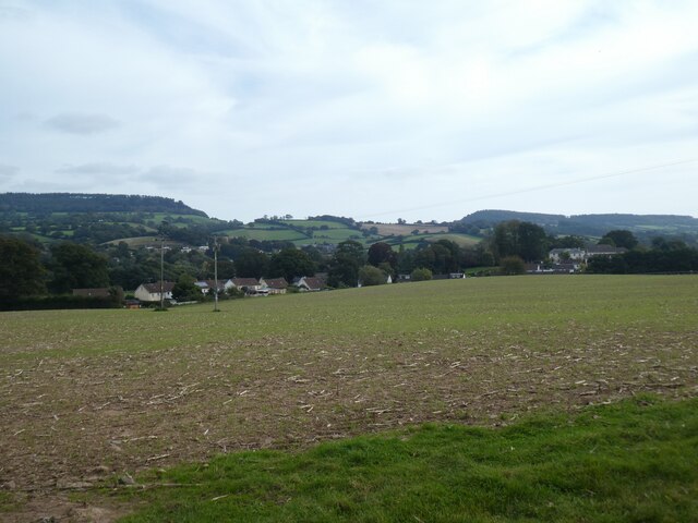
Alder Grove, located in Devon, England, is a pristine wood or forest known for its natural beauty and diverse ecosystem. Spanning approximately 100 acres, this enchanting grove is home to a plethora of alder trees, which give it its name and lend a sense of tranquility to the surroundings.

The grove is characterized by its lush greenery, with the alder trees standing tall, their slender trunks reaching towards the sky. The dense foliage creates a shaded canopy, providing a cool and peaceful ambiance within. The forest floor is covered with an array of wildflowers, mosses, and ferns, adding to the overall beauty of the grove.

Alder Grove is also blessed with a small stream that meanders through its heart, further enhancing its charm. The babbling brook not only adds to the serenity of the place but also serves as a water source for various animal species that call this grove their home.

Speaking of wildlife, Alder Grove is a haven for a wide range of fauna. From birds chirping melodiously in the treetops to small mammals scurrying amidst the undergrowth, the grove is teeming with life. Visitors may even catch a glimpse of elusive creatures like badgers, foxes, and deer if they are lucky enough.

Nature enthusiasts and hikers are drawn to Alder Grove for its picturesque trails, which allow one to explore the grove's nooks and crannies. The peaceful atmosphere and breathtaking scenery make it an ideal spot for meditation, photography, and simply reconnecting with nature.

Overall, Alder Grove in Devon is a captivating wood that encapsulates the essence of natural beauty. Its abundant flora and fauna, along with its tranquil ambiance, make it a must-visit destination for anyone seeking solace in the midst of nature.

If you have any feedback on the listing, please let us know in the comments section below.

Alder Grove Images

Images are sourced within 2km of 50.738627/-3.2901529 or Grid Reference SY0994. Thanks to Geograph Open Source API. All images are credited.

Ottery St Mary - The London Inn The London Inn on Silver Street is an historic coaching inn.
<span class="nowrap"><a title="www.thelondoninnottery.com" rel="nofollow ugc noopener" href="http://www.thelondoninnottery.com">Link</a><img style="margin-left:2px;" alt="External link" title="External link - shift click to open in new window" src="https://s1.geograph.org.uk/img/external.png" width="10" height="10"/></span>
Ottery St Mary - The London Inn
The London Inn on Silver Street is an historic coaching inn. LinkExternal link
Ottery St Mary - The Volunteer Inn Traditional pub in the centre of Ottery St Mary, a market town.
<span class="nowrap"><a title="www.volunteerinnottery.co.uk" rel="nofollow ugc noopener" href="http://www.volunteerinnottery.co.uk">Link</a><img style="margin-left:2px;" alt="External link" title="External link - shift click to open in new window" src="https://s1.geograph.org.uk/img/external.png" width="10" height="10"/></span>
Ottery St Mary - The Volunteer Inn
Traditional pub in the centre of Ottery St Mary, a market town. LinkExternal link
Ottery St Mary - Jubilee Memorial Built to commemorate Queen Victoria's Diamond Jubilee (1897), copy of a gatepost at Kensington Palace. In the background is St Mary's Church.
<span class="nowrap"><a title="www.otterystmary-tc.gov.uk" rel="nofollow ugc noopener" href="http://www.otterystmary-tc.gov.uk">Link</a><img style="margin-left:2px;" alt="External link" title="External link - shift click to open in new window" src="https://s1.geograph.org.uk/img/external.png" width="10" height="10"/></span>
Ottery St Mary - Jubilee Memorial
Built to commemorate Queen Victoria's Diamond Jubilee (1897), copy of a gatepost at Kensington Palace. In the background is St Mary's Church. LinkExternal link
Ottery St Mary - Stocks Two seater stocks in St Mary's churchyard - at least any miscreants may have stayed dry.
<span class="nowrap"><a title="www.otterystmary-tc.gov.uk" rel="nofollow ugc noopener" href="http://www.otterystmary-tc.gov.uk">Link</a><img style="margin-left:2px;" alt="External link" title="External link - shift click to open in new window" src="https://s1.geograph.org.uk/img/external.png" width="10" height="10"/></span>
Ottery St Mary - Stocks
Two seater stocks in St Mary's churchyard - at least any miscreants may have stayed dry. LinkExternal link
Ottery - St Mary Ottery St Mary's parish church, originally Norman, was modified in 1337 by the Bishop of Exeter, making a small replica of Exeter Cathedral. The weathercock is over 500 years old and believed to be Europe's oldest.
<span class="nowrap"><a title="www.otterystmary.org.uk" rel="nofollow ugc noopener" href="http://www.otterystmary.org.uk">Link</a><img style="margin-left:2px;" alt="External link" title="External link - shift click to open in new window" src="https://s1.geograph.org.uk/img/external.png" width="10" height="10"/></span>
Ottery - St Mary
Ottery St Mary's parish church, originally Norman, was modified in 1337 by the Bishop of Exeter, making a small replica of Exeter Cathedral. The weathercock is over 500 years old and believed to be Europe's oldest. LinkExternal link
Ottery St Mary - Paternoster Row Georgian buildings opposite St Mary's churchyard.
<span class="nowrap"><a title="www.otterystmary-tc.gov.uk" rel="nofollow ugc noopener" href="http://www.otterystmary-tc.gov.uk">Link</a><img style="margin-left:2px;" alt="External link" title="External link - shift click to open in new window" src="https://s1.geograph.org.uk/img/external.png" width="10" height="10"/></span>
Ottery St Mary - Paternoster Row
Georgian buildings opposite St Mary's churchyard. LinkExternal link
Ottery St Mary : The Square Looking across The Square.
Ottery St Mary : The Square
Looking across The Square.
Ottery St Mary : Eco Baby Box A baby boutique and gift shop.
Ottery St Mary : Eco Baby Box
A baby boutique and gift shop.
Ottery St Mary : Gold Street Looking up Gold Street.
Ottery St Mary : Gold Street
Looking up Gold Street.
Ottery St Mary : Prospect Place Looking along the road.
Ottery St Mary : Prospect Place
Looking along the road.
Ottery St Mary : Car Park A car park at the Sainsbury's store.
Ottery St Mary : Car Park
A car park at the Sainsbury's store.
Former leat north of Tipton St John A footpath leads through the trees on the right
Former leat north of Tipton St John
A footpath leads through the trees on the right
Sewage works by footpath, Fkuxton
Wallbox in Fluxton This is a little unusual, in that the wallbox is located overlooking a grassed area, not a road or pavement
Wallbox in Fluxton
This is a little unusual, in that the wallbox is located overlooking a grassed area, not a road or pavement
Field west of Tipton St John The view stretches past the village to the ridge around Bowd
Field west of Tipton St John
The view stretches past the village to the ridge around Bowd
St Mary's Church in Ottery St Mary St Mary's Church in Ottery St Mary, Devon as viewed from the B3117 that passes through the town and past the churchyard.
St Mary's Church in Ottery St Mary
St Mary's Church in Ottery St Mary, Devon as viewed from the B3117 that passes through the town and past the churchyard.
St Mary's Church in Ottery St Mary St Mary's Church in Ottery St Mary, Devon as viewed from the churchyard.
St Mary's Church in Ottery St Mary
St Mary's Church in Ottery St Mary, Devon as viewed from the churchyard.
Ottery St Mary A view down Silver Street of Ottery St Mary in Devon as viewed from the higher grounds of St Mary's Church.
Ottery St Mary
A view down Silver Street of Ottery St Mary in Devon as viewed from the higher grounds of St Mary's Church.
Show me another place!

Alder Grove is located at Grid Ref: SY0994 (Lat: 50.738627, Lng: -3.2901529)

Administrative County: Devon

District: East Devon

Police Authority: Devon and Cornwall

What 3 Words

///drift.heartened.mobile. Near Ottery St Mary, Devon

Nearby Locations

Alder Grove

Related Wikis

St Edward's Church, Wiggaton

St Edward's Church is a Church of England church in Wiggaton, Devon, England. It was constructed in 1892–93 and designed by the Exeter architect Edward...

Ottery St Mary railway station

Ottery St Mary railway station is a closed railway station that served the town of Ottery St Mary, in Devon, England. It was opened in 1874 on the Sidmouth...

Fluxton

Fluxton is a hamlet situated in the Otter Valley, East Devon. It is made up predominantly of old farmhouses and new barn conversions and has a population...

The King's School, Ottery St Mary

The King's School is a secondary school and sixth form located in Ottery St Mary, Devon, England. It was established as a choir school by the bishop John...
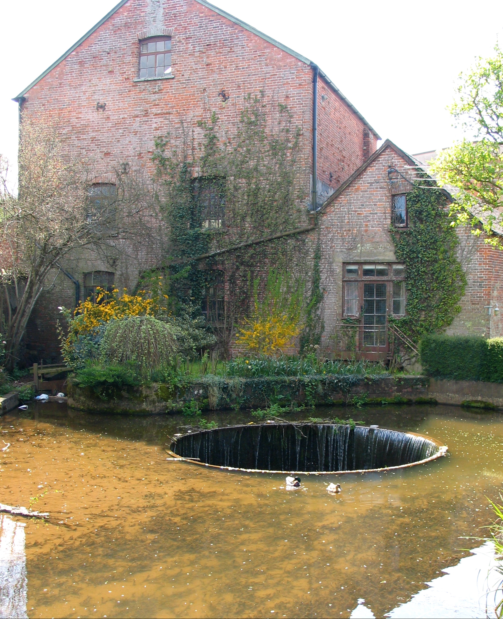
Tumbling Weir

The Tumbling Weir is a circular weir in the town of Ottery St. Mary, Devon, England that allows water from a leat or man-made stream to reach the River...

Belbury Castle

Belbury Castle is the name given to an Iron Age earthwork, probably a hill fort or livestock enclosure, close to Ottery St Mary in Devon, England. The...
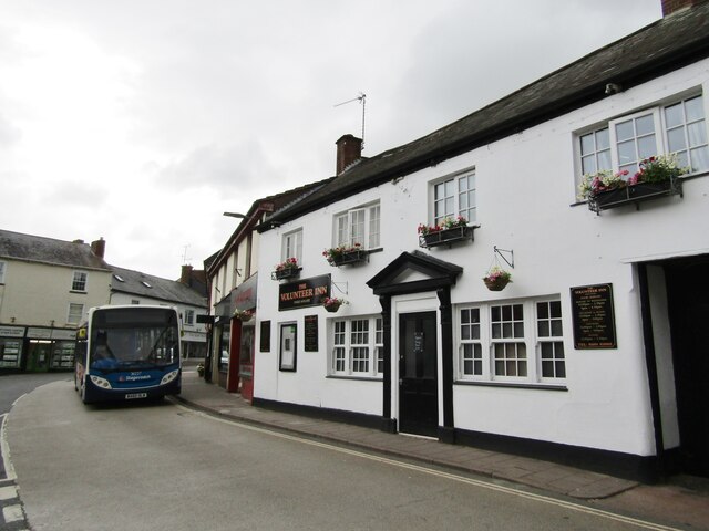
Ottery St Mary

Ottery St Mary, known as "Ottery", is a town and civil parish in the East Devon district of Devon, England, on the River Otter, about 10 miles (16 km)...

St Mary's Church, Ottery St Mary

St Mary's Church is a Grade I listed building, a parish church in the Church of England in Ottery St Mary, Devon. The church is part of "Churches Together...

Nearby Amenities

Located within 500m of 50.738627,-3.2901529
Power: pole
Lat/Long: 50.7412657/-3.2880423
Power: pole
Lat/Long: 50.7428343/-3.288491
Power: pole
Lat/Long: 50.7421113/-3.2882872
Historic: crash_site
Note: place of impact of G-ARBY 17/7/1980 (HDG 074)
Lat/Long: 50.7360094/-3.2898571
The data included in this document is from www.openstreetmap.org. The data is made available under ODbL.

Have you been to Alder Grove?

Leave your review of Alder Grove below (or comments, questions and feedback).