Longmire Wood

Wood, Forest in Cumberland Copeland

England

Longmire Wood

Graveyard Of St Paul's Church The graveyard contains the historic Irton High Cross and a copy in the form of the Brocklebank Memorial
Graveyard Of St Paul's Church Credit: Kevin Waterhouse

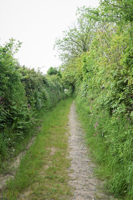
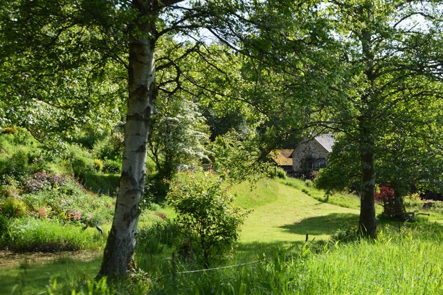
Longmire Wood, located in Cumberland, is a serene and picturesque forest that covers a vast area of land. The wood is known for its dense vegetation, towering trees, and diverse wildlife, making it a popular destination for nature enthusiasts and hikers alike.

The wood is primarily composed of various species of oak, beech, and pine trees, creating a breathtaking canopy that provides shade and shelter to the many creatures that inhabit the area. The forest floor is covered in a lush carpet of moss, ferns, and wildflowers, enhancing the wood's natural beauty.

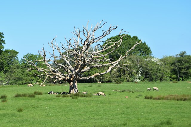
Longmire Wood is home to an array of wildlife, including deer, foxes, squirrels, and a variety of bird species. It is not uncommon to spot these animals as you wander through the trails, adding to the enchanting experience of being in the wood.

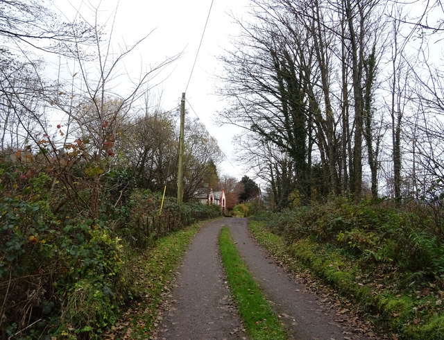
The wood offers an extensive network of well-maintained walking trails, allowing visitors to explore its hidden treasures at their own pace. These trails meander through the forest, providing stunning views of the surrounding landscape and opportunities to observe the local flora and fauna up close.

Longmire Wood is a designated nature reserve, ensuring the preservation and protection of its unique ecosystem. It serves as an important habitat for rare and endangered species, contributing to the overall biodiversity of the Cumberland region.

Whether you are seeking solace in nature or looking to immerse yourself in the wonders of the woodland, Longmire Wood provides a tranquil and captivating experience for all who visit.

If you have any feedback on the listing, please let us know in the comments section below.

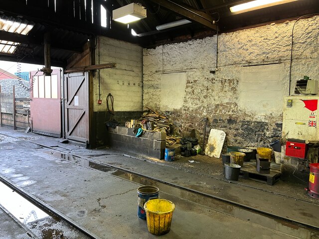
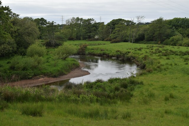
Longmire Wood Images

Images are sourced within 2km of 54.374383/-3.4049578 or Grid Reference SD0898. Thanks to Geograph Open Source API. All images are credited.

Graveyard Of St Paul's Church The graveyard contains the historic Irton High Cross and a copy in the form of the Brocklebank Memorial
Graveyard Of St Paul's Church
The graveyard contains the historic Irton High Cross and a copy in the form of the Brocklebank Memorial
Loco Shed, Ravenglass Interior of the Ravenglass and Eskdale Railway steam locomotive shed near the Ravenglass terminus of the line.
The wood piled in the corner is scrap used as kindling when the steam locomotives are being prepared and the fires are being lit.
Loco Shed, Ravenglass
Interior of the Ravenglass and Eskdale Railway steam locomotive shed near the Ravenglass terminus of the line. The wood piled in the corner is scrap used as kindling when the steam locomotives are being prepared and the fires are being lit.
Water Tank Mounted on the rear corner of the Diesel Shed and conveniently sited outside the (steam) Loco Shed, the water tank is used for replenishment of the Ravenglass and Eskdale Railway’s fleet of steam locomotives.
The horizontal boards supporting the stone heap are kept in place by old rails.
The dirty, oily ground is very typical of that found in railway installations where steam locomotives have been serviced over a long period of time.
Water Tank
Mounted on the rear corner of the Diesel Shed and conveniently sited outside the (steam) Loco Shed, the water tank is used for replenishment of the Ravenglass and Eskdale Railway’s fleet of steam locomotives. The horizontal boards supporting the stone heap are kept in place by old rails. The dirty, oily ground is very typical of that found in railway installations where steam locomotives have been serviced over a long period of time.
Common Spotted Orchid, Dactylorhiza fuchsii Very large numbers of this orchid growing in the meadow near  the Packhorse Bridge
Common Spotted Orchid, Dactylorhiza fuchsii
Very large numbers of this orchid growing in the meadow near the Packhorse Bridge
Overlooking the River Irt
Bridleway toward St. Peter, Drigg
Dead tree from the train Sheep grazing  in a meadow between the River Mite and the track of the Ravenglass  and Eskdale railway
Dead tree from the train
Sheep grazing in a meadow between the River Mite and the track of the Ravenglass and Eskdale railway
Approaching Muncaster Mill On the Ravenglass and Eskdale Railway
Approaching Muncaster Mill
On the Ravenglass and Eskdale Railway
Cumblands Farm on the top of the rise
Saltcoats crossing Manually operated. There are more trains than vehicles.
Saltcoats crossing
Manually operated. There are more trains than vehicles.
End of the road, Saltcoats
Rail bridge and footpath over the River Mite
Irton Cross Situated in the graveyard of St Paul's Church, the Irton Cross is 10 feet tall and was erected in the early 9th Century. The cross has fine carvings and is one of the most important crosses in Cumbria.
Irton Cross
Situated in the graveyard of St Paul's Church, the Irton Cross is 10 feet tall and was erected in the early 9th Century. The cross has fine carvings and is one of the most important crosses in Cumbria.
Church of St Paul, Irton Built in 1857 with additions in 1866 and 1872, St Paul’s Church stands in an isolated position and is a good example of a small Victorian Church. It is a Grade II* Listed Building. <span class="nowrap"><a title="http://www.britishlistedbuildings.co.uk/101086671-church-of-st-paul-irton-with-santon#.WYzZbTGWw5s" rel="nofollow ugc noopener" href="http://www.britishlistedbuildings.co.uk/101086671-church-of-st-paul-irton-with-santon#.WYzZbTGWw5s">Link</a><img style="margin-left:2px;" alt="External link" title="External link - shift click to open in new window" src="https://s1.geograph.org.uk/img/external.png" width="10" height="10"/></span>
Church of St Paul, Irton
Built in 1857 with additions in 1866 and 1872, St Paul’s Church stands in an isolated position and is a good example of a small Victorian Church. It is a Grade II* Listed Building. LinkExternal link
Old Wayside Cross in St Pauls churchyard, Irton Irton Cross, in St Pauls churchyard, parish of Irton with Santon (Copeland District), South side of church.

Scheduled Monument.
List Entry Number: 1012642 <span class="nowrap"><a title="https://historicengland.org.uk/listing/the-list/list-entry/1012642" rel="nofollow ugc noopener" href="https://historicengland.org.uk/listing/the-list/list-entry/1012642">Link</a><img style="margin-left:2px;" alt="External link" title="External link - shift click to open in new window" src="https://s1.geograph.org.uk/img/external.png" width="10" height="10"/></span>

To be surveyed

Milestone Society National ID: CBCL_IRT
Old Wayside Cross in St Pauls churchyard, Irton
Irton Cross, in St Pauls churchyard, parish of Irton with Santon (Copeland District), South side of church. Scheduled Monument. List Entry Number: 1012642 LinkExternal link To be surveyed Milestone Society National ID: CBCL_IRT
Track (footpath) towards Holmrook Hall
Straight road near Parsonage Field
Ravenglass Railway Train En Route to Muncaster Mill Halt
Show me another place!

Longmire Wood is located at Grid Ref: SD0898 (Lat: 54.374383, Lng: -3.4049578)

Administrative County: Cumbria

District: Copeland

Police Authority: Cumbria

What 3 Words

///rifled.version.failed. Near Seascale, Cumbria

Related Wikis

Muncaster Mill railway station

Muncaster Mill railway station is a railway station on the 15 in (381 mm) gauge Ravenglass & Eskdale Railway in Cumbria, England. The station is located...

River Irt

The River Irt is a river in the county of Cumbria in northern England. It flows for 14 miles (22 km) from the south-western end of Wast Water, the deepest...

Holmrook

Holmrook is a linear village in the English county of Cumbria. It lies along the A595 road on the west banks of the River Irt. The B5344 road connects...

Miteside Halt railway station

Miteside Halt railway station is a railway station on the 15" gauge Ravenglass & Eskdale Railway in Cumbria, England. It is located where public footpath...

Nearby Amenities

Located within 500m of 54.374383,-3.4049578
Power: pole
Lat/Long: 54.3731851/-3.39867
Power: pole
Lat/Long: 54.3730296/-3.4003034
Power: pole
Lat/Long: 54.3728773/-3.4019744
Power: pole
Lat/Long: 54.3727429/-3.4033223
Power: pole
Lat/Long: 54.3751247/-3.4005086
Power: pole
Lat/Long: 54.3742163/-3.4016901
Power: pole
Lat/Long: 54.3732257/-3.4029803
Material: wood
Power: pole
Lat/Long: 54.3725734/-3.4038627
Material: steel
Power: pole
Lat/Long: 54.371868/-3.405413
Power: pole
Lat/Long: 54.3712352/-3.4069285
Power: pole
Lat/Long: 54.3705977/-3.4084547
Generator Source: solar
Power: generator
Lat/Long: 54.3727703/-3.4071229
Power: pole
Lat/Long: 54.3760864/-3.3992413
Power: pole
Lat/Long: 54.3706621/-3.4074614
Power: pole
Lat/Long: 54.3712749/-3.4063004
Power: pole
Lat/Long: 54.3718088/-3.4052818
Power: pole
Lat/Long: 54.3728535/-3.4110939
Power: pole
Lat/Long: 54.372738/-3.4099582
Power: pole
Lat/Long: 54.3724083/-3.408691
Power: pole
Lat/Long: 54.3721053/-3.4075344
Power: pole
Lat/Long: 54.3717779/-3.4063167
The data included in this document is from www.openstreetmap.org. The data is made available under ODbL.

Have you been to Longmire Wood?

Leave your review of Longmire Wood below (or comments, questions and feedback).