Bathealton Lands Covert
Wood, Forest in Somerset Somerset West and Taunton
England
Bathealton Lands Covert

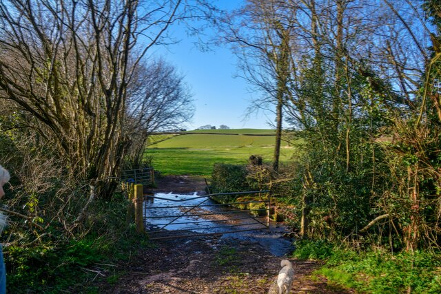
Bathealton Lands Covert, located in Somerset, England, is a picturesque woodland that covers a vast area. This ancient forest is known for its diverse and abundant flora and fauna, making it a popular destination for nature enthusiasts and wildlife lovers. The woodland is situated near the village of Bathealton and is surrounded by rolling hills and meadows, creating a tranquil and serene atmosphere.
The forest is predominantly composed of deciduous trees, such as oak, beech, and ash, which provide a dense canopy that filters sunlight and creates a cool and shaded environment below. The forest floor is covered with a rich carpet of moss, ferns, and wildflowers, adding to the beauty and biodiversity of the area.
Bathealton Lands Covert is home to a wide variety of wildlife, including mammals like deer, badgers, foxes, and squirrels. The forest also serves as a habitat for numerous bird species, such as woodpeckers, owls, and songbirds, which fill the air with their melodious calls. Additionally, the woodland is teeming with small creatures like insects, amphibians, and reptiles, contributing to the intricate web of life within the ecosystem.
Visitors to Bathealton Lands Covert can enjoy a range of recreational activities, including walking, hiking, and birdwatching. The forest is crisscrossed with well-maintained trails, allowing visitors to explore its hidden corners and discover its natural treasures. There are also designated picnic areas and viewpoints that offer breathtaking vistas of the surrounding countryside.
Overall, Bathealton Lands Covert is a haven of natural beauty and biodiversity, providing a peaceful retreat for both humans and wildlife alike.
If you have any feedback on the listing, please let us know in the comments section below.
Bathealton Lands Covert Images
Images are sourced within 2km of 51.01301/-3.3102985 or Grid Reference ST0824. Thanks to Geograph Open Source API. All images are credited.


Bathealton Lands Covert is located at Grid Ref: ST0824 (Lat: 51.01301, Lng: -3.3102985)
Administrative County: Somerset
District: Somerset West and Taunton
Police Authority: Avon and Somerset
What 3 Words
///crouching.remember.beams. Near Wiveliscombe, Somerset
Nearby Locations
Related Wikis

Bathealton Court
Bathealton Court is a Grade II listed country house in Bathealton, Somerset, England. It was built in around 1766 and underwent significant alteration...

Bathealton
Bathealton is a village and civil parish in Somerset, England, situated 3 miles (4.8 km) west of Wellington and 8 miles (12.9 km) west of Taunton. The...

St Bartholomew's Church, Bathealton
St Bartholomew's Church is a Church of England parish church in Bathealton, Somerset, England. It was built in 1854 to the designs of C. E. Giles and is...
Holme Moor & Clean Moor
Holme Moor & Clean Moor (grid reference ST095260) is a 10.8 hectare (26.7 acre) biological Site of Special Scientific Interest south of Wiveliscombe in...

Langford Heathfield
Langford Heathfield (grid reference ST100235) is a 95.4 hectare (235.7 acre) biological Site of Special Scientific Interest at Langford Budville, 3 km...

Kittisford
Kittisford is a village and former civil parish and manor, now in the parish of Stawley in the Somerset district, in the ceremonial county of Somerset...
Church of St Nicholas, Kittisford
The Anglican Church of St Nicholas in Kittisford, Somerset, England was built around 1500. It is a Grade II* listed building. == History == The church...
Castles Camp
Castles Camp is a univallate Iron Age hill fort in the Taunton Deane district of Somerset, England. The hill fort is situated approximately 1 mile (1.6...
Have you been to Bathealton Lands Covert?
Leave your review of Bathealton Lands Covert below (or comments, questions and feedback).