Bitter Cleeve Copse

Wood, Forest in Somerset Somerset West and Taunton

England

Bitter Cleeve Copse

Wedding cake tree This specimen (cornus controversa variegata) is located at Elworthy cottage, in the village of Elworthy in West Somerset. The private garden was opened to the public on 30 May 2023 as part of the National Gardens Scheme which raises money for very worthwhile causes.
Wedding cake tree Credit: Marika Reinholds

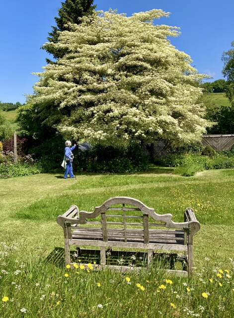
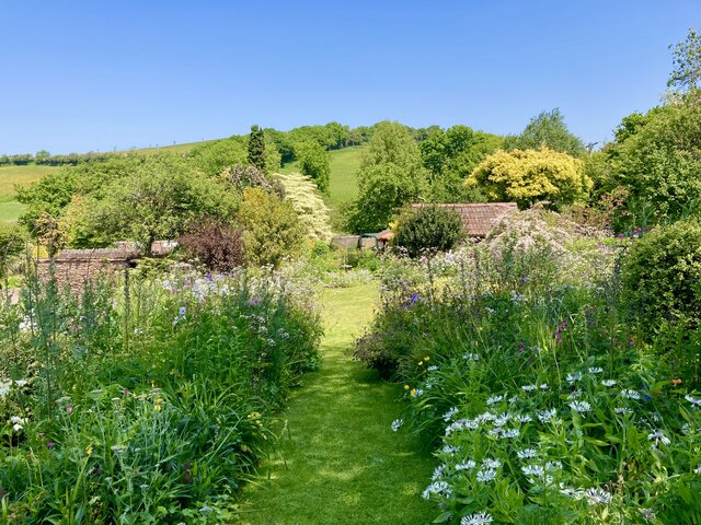
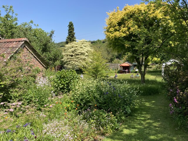
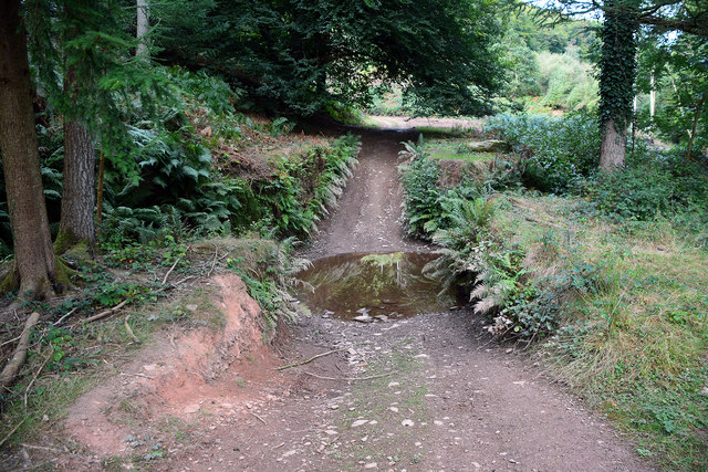
Bitter Cleeve Copse is a picturesque woodland located in the county of Somerset, England. Situated near the village of Bicknoller, this ancient copse covers an area of approximately 15 acres and is known for its diverse flora and fauna.

The copse is predominantly composed of deciduous trees, including oak, ash, beech, and birch, creating a vibrant and ever-changing landscape throughout the seasons. The dense canopy provides a haven for various bird species, such as woodpeckers, nuthatches, and song thrushes, making it a popular spot among birdwatchers.

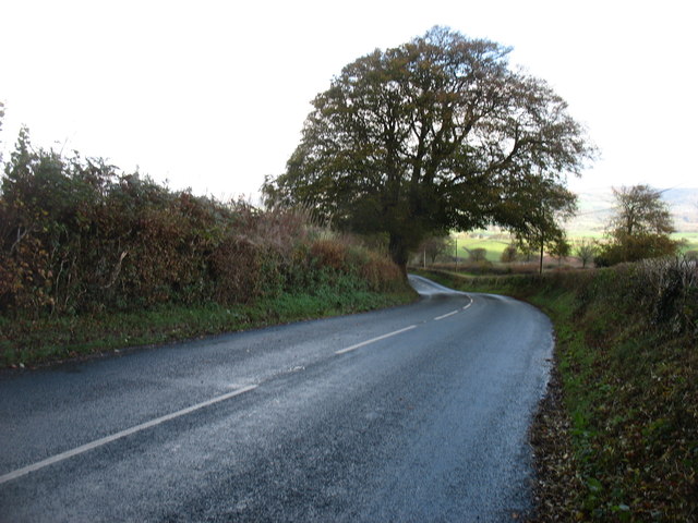
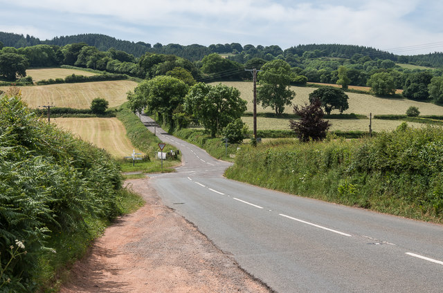
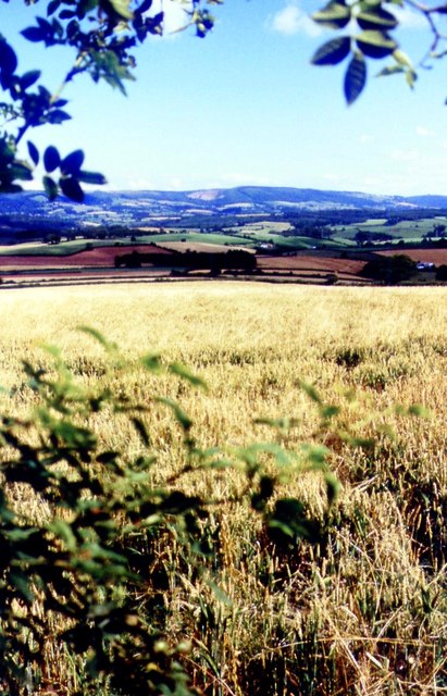
Walking through Bitter Cleeve Copse, visitors can enjoy a network of well-maintained footpaths that wind through the woodland, offering panoramic views of the surrounding countryside. The tranquil atmosphere and the sound of trickling streams make it an ideal destination for nature lovers and those seeking a peaceful escape from the hustle and bustle of everyday life.

The copse is also home to a rich variety of plant life, with carpets of bluebells and wild garlic covering the forest floor during the spring months. In addition, ferns, mosses, and lichens thrive in the damp and shaded areas, adding to the copse's enchanting beauty.

Bitter Cleeve Copse is managed by the Somerset Wildlife Trust, ensuring the conservation and preservation of its natural habitats. The trust organizes guided walks and educational activities to promote awareness and understanding of the copse's ecological importance.

Overall, Bitter Cleeve Copse offers a haven of tranquility and natural beauty, making it a must-visit destination for nature enthusiasts and those seeking to immerse themselves in the beauty of Somerset's woodlands.

If you have any feedback on the listing, please let us know in the comments section below.

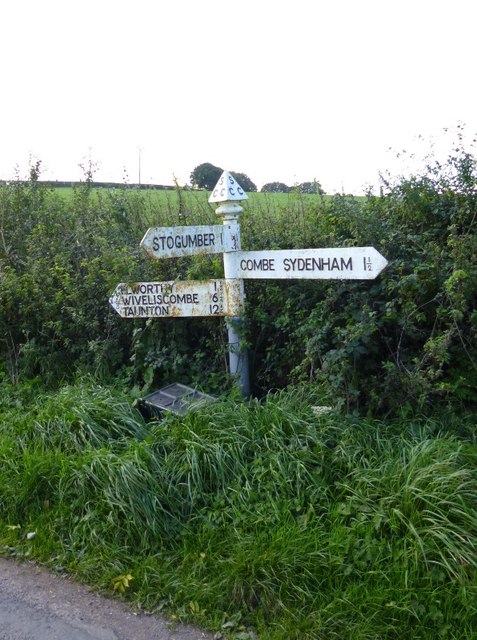
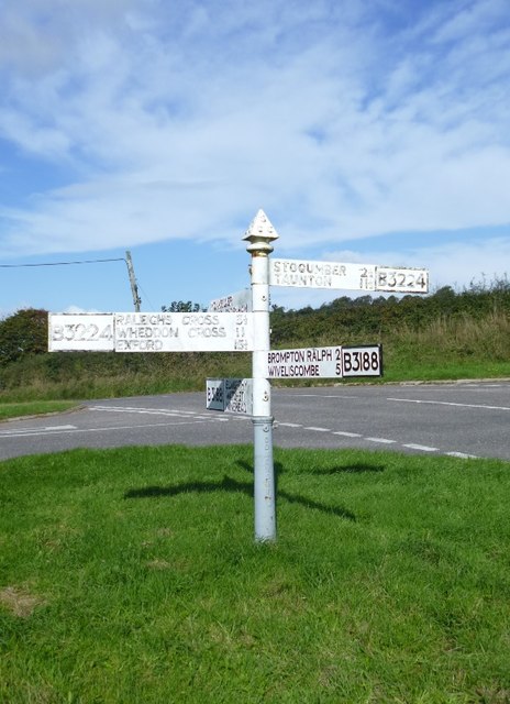
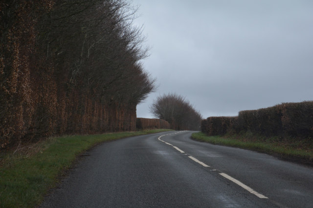
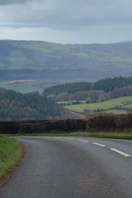
Bitter Cleeve Copse Images

Images are sourced within 2km of 51.110206/-3.3234744 or Grid Reference ST0735. Thanks to Geograph Open Source API. All images are credited.

Wedding cake tree This specimen (cornus controversa variegata) is located at Elworthy cottage, in the village of Elworthy in West Somerset. The private garden was opened to the public on 30 May 2023 as part of the National Gardens Scheme which raises money for very worthwhile causes.
Wedding cake tree
This specimen (cornus controversa variegata) is located at Elworthy cottage, in the village of Elworthy in West Somerset. The private garden was opened to the public on 30 May 2023 as part of the National Gardens Scheme which raises money for very worthwhile causes.
Elworthy cottage gardens (1) The private 1 acre gardens at Elworthy Cottage in the village of Elworthy, West Somerset were opened to the public on 30 May 2023 as part of the National Gardens Scheme which raises money for very worthwhile causes. 

It is planted to encourage birds, bees and butterflies. It is 'cottage garden' in style and has wild flower areas and decorative vegetable gardens.  The owners also raise seedlings and cuttings taken from their plants to sell to visitors.
Elworthy cottage gardens (1)
The private 1 acre gardens at Elworthy Cottage in the village of Elworthy, West Somerset were opened to the public on 30 May 2023 as part of the National Gardens Scheme which raises money for very worthwhile causes. It is planted to encourage birds, bees and butterflies. It is 'cottage garden' in style and has wild flower areas and decorative vegetable gardens. The owners also raise seedlings and cuttings taken from their plants to sell to visitors.
Elworthy cottage gardens (2) The private 1 acre gardens at Elworthy Cottage in the village of Elworthy, West Somerset were opened to the public on 30 May 2023 as part of the National Gardens Scheme which raises money for very worthwhile causes. 

It is planted to encourage birds, bees and butterflies. It is 'cottage garden' in style and has wild flower areas and decorative vegetable gardens.  The owners also raise seedlings and cuttings taken from their plants to sell to visitors.
Elworthy cottage gardens (2)
The private 1 acre gardens at Elworthy Cottage in the village of Elworthy, West Somerset were opened to the public on 30 May 2023 as part of the National Gardens Scheme which raises money for very worthwhile causes. It is planted to encourage birds, bees and butterflies. It is 'cottage garden' in style and has wild flower areas and decorative vegetable gardens. The owners also raise seedlings and cuttings taken from their plants to sell to visitors.
Ordnance Survey Cut Mark This OS cut mark can be found on the SE face of St Martin's Church. It marks a point 198.893m above mean sea level.
Ordnance Survey Cut Mark
This OS cut mark can be found on the SE face of St Martin's Church. It marks a point 198.893m above mean sea level.
Combe Sydenham Ford This ford is found in the Combe Sydenham Country Park. A video of the ford can be seen at:
<span class="nowrap"><a title="https://youtu.be/cX9wiriI6VQ" rel="nofollow ugc noopener" href="https://youtu.be/cX9wiriI6VQ">Link</a><img style="margin-left:2px;" alt="External link" title="External link - shift click to open in new window" src="https://s1.geograph.org.uk/img/external.png" width="10" height="10"/></span>
Combe Sydenham Ford
This ford is found in the Combe Sydenham Country Park. A video of the ford can be seen at: LinkExternal link
The B3224 descending to Elworthy
Combe Sydenham Mill A small grain mill - preserved
Combe Sydenham Mill
A small grain mill - preserved
Combe Sydenham Mill: waterwheel An overshot wheel with wooden buckets and ring gear on the right-hand side. The ring gear is not serving any useful purpose here and indicates that the waterwheel is an import; a replacement for the grain mill's original one
Combe Sydenham Mill: waterwheel
An overshot wheel with wooden buckets and ring gear on the right-hand side. The ring gear is not serving any useful purpose here and indicates that the waterwheel is an import; a replacement for the grain mill's original one
Elworthy Cross Looking along the B3224 to its crossroads with the B3188 at Elworthy Cross.
Elworthy Cross
Looking along the B3224 to its crossroads with the B3188 at Elworthy Cross.
Farmland Above Preston
Old Village Signpost by the B3188, Elworthy Cross, Elworthy Triangular finial - Somerset village sign by the B3188, in parish of Elworthy (West Somerset District), southern approach to Elworthy village, on grassy bank, North of Elworthy Cross.

Grade II Listed. List Entry Number: 1296111
<span class="nowrap"><a title="https://historicengland.org.uk/listing/the-list/list-entry/1296111" rel="nofollow ugc noopener" href="https://historicengland.org.uk/listing/the-list/list-entry/1296111">Link</a><img style="margin-left:2px;" alt="External link" title="External link - shift click to open in new window" src="https://s1.geograph.org.uk/img/external.png" width="10" height="10"/></span>

Surveyed

Milestone Society National ID: SO_ST0834A.
Old Village Signpost by the B3188, Elworthy Cross, Elworthy
Triangular finial - Somerset village sign by the B3188, in parish of Elworthy (West Somerset District), southern approach to Elworthy village, on grassy bank, North of Elworthy Cross. Grade II Listed. List Entry Number: 1296111 LinkExternal link Surveyed Milestone Society National ID: SO_ST0834A.
Old Direction Sign - Signpost by the B3224, Hartrow Gate Cross Pyramid finial - 3 arms; Somerset SCC pyramid by the B3224, in parish of Elworthy (West Somerset District), Hartrow Gate Cross.

To be surveyed

Milestone Society National ID: SO_ST0934.
Old Direction Sign - Signpost by the B3224, Hartrow Gate Cross
Pyramid finial - 3 arms; Somerset SCC pyramid by the B3224, in parish of Elworthy (West Somerset District), Hartrow Gate Cross. To be surveyed Milestone Society National ID: SO_ST0934.
Old Direction Sign - Signpost by Combe Cross, Stogumber Parish Pyramid finial - 3 arms; Somerset SCC pyramid by the UC road, in parish of Stogumber (West Somerset District), Combe Cross, junction of Combe Cross Lane and Silverdown Hill. 

To be surveyed

Milestone Society National ID: SO_ST0837
Old Direction Sign - Signpost by Combe Cross, Stogumber Parish
Pyramid finial - 3 arms; Somerset SCC pyramid by the UC road, in parish of Stogumber (West Somerset District), Combe Cross, junction of Combe Cross Lane and Silverdown Hill. To be surveyed Milestone Society National ID: SO_ST0837
Old Direction Sign - Signpost by Silverdown Hill, Stogumber Parish Pyramid finial - 3 arms; Somerset SCC pyramid by the UC road, in parish of Stogumber (West Somerset District), junction of Silverdown Hill with Ashbeer Hill.

To be surveyed

Milestone Society National ID: SO_ST0836
Old Direction Sign - Signpost by Silverdown Hill, Stogumber Parish
Pyramid finial - 3 arms; Somerset SCC pyramid by the UC road, in parish of Stogumber (West Somerset District), junction of Silverdown Hill with Ashbeer Hill. To be surveyed Milestone Society National ID: SO_ST0836
Old Direction Sign - Signpost by the B3188, Elworthy Cross Pyramid finial - 5 arms; Somerset SCC pyramid by the B3188, in parish of Elworthy (West Somerset District), Elworthy Cross South of Elworthy village.

To be surveyed

Milestone Society National ID: SO_ST0834B
Old Direction Sign - Signpost by the B3188, Elworthy Cross
Pyramid finial - 5 arms; Somerset SCC pyramid by the B3188, in parish of Elworthy (West Somerset District), Elworthy Cross South of Elworthy village. To be surveyed Milestone Society National ID: SO_ST0834B
West Somerset : The B3224 Heading along the B3224.
West Somerset : The B3224
Heading along the B3224.
West Somerset : The B3224 Heading along the B3224.
West Somerset : The B3224
Heading along the B3224.
West Somerset : The B3224 Heading along the B3224.
West Somerset : The B3224
Heading along the B3224.
Show me another place!

Bitter Cleeve Copse is located at Grid Ref: ST0735 (Lat: 51.110206, Lng: -3.3234744)

Administrative County: Somerset

District: Somerset West and Taunton

Police Authority: Avon and Somerset

What 3 Words

///rainfall.nips.clipboard. Near Williton, Somerset

Related Wikis

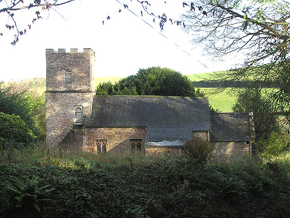
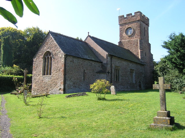
Church of St Martin, Elworthy

The Church of St Martin in Elworthy, Somerset, England, is dedicated to St Martin of Tours. It dates from the 13th century and is recorded in the National...

Elworthy

Elworthy is a small village and civil parish in the Brendon Hills 5 miles (8 km) south-east of Watchet, and 12 miles (19 km) west of Taunton, in the Somerset...
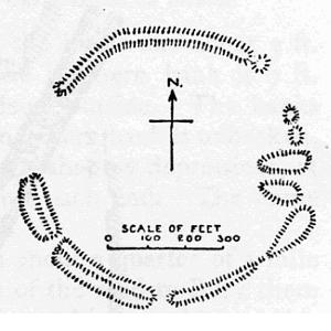
Elworthy Barrows

Elworthy Barrows is an unfinished Iron Age hill fort, rather than Bronze Age barrows, which is designated a scheduled ancient monument (No:188401). It...

Bridgwater and West Somerset (UK Parliament constituency)

Bridgwater and West Somerset is a constituency represented in the House of Commons of the UK Parliament since 2010 by Ian Liddell-Grainger, a Conservative...

Monksilver

Monksilver is a village 3 miles (5 km) west of the town of Williton in Somerset, England, on the eastern flank of the Brendon Hills and the border of the...

Nettlecombe, Somerset

Nettlecombe is a civil parish in the English county of Somerset. The parish covers a rural area below the Brendon Hills, comprising the small hamlets of...

Stogumber

Stogumber () is a village and civil parish in Somerset, England, on the eastern flank of the Brendon Hills. Besides Stogumber village itself, the parish...

Nettlecombe Court

Nettlecombe Court and park is an old estate on the northern fringes of the Brendon Hills, within the Exmoor National Park. They are within the civil parish...

Have you been to Bitter Cleeve Copse?

Leave your review of Bitter Cleeve Copse below (or comments, questions and feedback).