Bitter Cleeve Wood

Wood, Forest in Somerset Somerset West and Taunton

England

Bitter Cleeve Wood

Washbattle Mill Pond Featured here is the mill pond for Washbattle Mill. The Mill is now a pair of Holiday cottages (and very pleasant too)
Washbattle Mill Pond Credit: Dave Smethurst

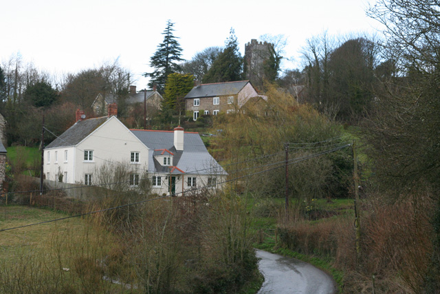
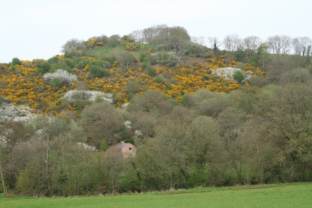
Bitter Cleeve Wood is a picturesque woodland located in Somerset, England. Covering an area of approximately 200 hectares, this ancient forest is a haven for nature enthusiasts and hikers alike. The wood is situated near the village of Porlock, nestled within the Exmoor National Park, and offers visitors a chance to immerse themselves in the beauty of the surrounding countryside.

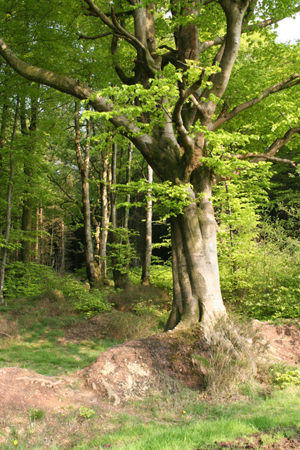
The wood is predominantly composed of native broadleaf trees such as oak, beech, and ash, which create a dense canopy overhead. These towering trees provide a habitat for a variety of wildlife, including deer, badgers, foxes, and numerous bird species. It is not uncommon to hear the enchanting songs of birds echoing through the woodland as you explore its winding trails.

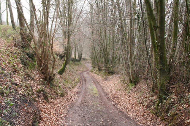
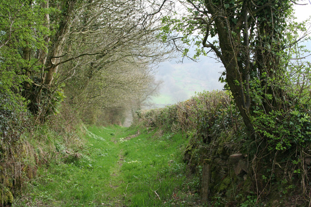
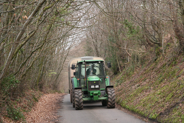
The forest is crisscrossed by a network of footpaths, making it easily accessible for visitors of all abilities. These paths allow visitors to explore the wood at their own pace, taking in the stunning scenery and breathing in the fresh, earthy scent of the forest.

In addition to its natural beauty, Bitter Cleeve Wood is also home to a number of historical sites. The wood contains the remains of an Iron Age hillfort, offering a glimpse into the area's ancient past. These historical features, combined with the tranquil atmosphere and breathtaking scenery, make Bitter Cleeve Wood a must-visit destination for anyone seeking a peaceful retreat in the heart of Somerset's countryside.

If you have any feedback on the listing, please let us know in the comments section below.

Bitter Cleeve Wood Images

Images are sourced within 2km of 51.048563/-3.3563125 or Grid Reference ST0528. Thanks to Geograph Open Source API. All images are credited.

Washbattle Mill Pond Featured here is the mill pond for Washbattle Mill. The Mill is now a pair of Holiday cottages (and very pleasant too)
Washbattle Mill Pond
Featured here is the mill pond for Washbattle Mill. The Mill is now a pair of Holiday cottages (and very pleasant too)
Chipstable: in the Tone valley Woodland seen from the public footpath between Challick Lane and Washbattle Bridge
Chipstable: in the Tone valley
Woodland seen from the public footpath between Challick Lane and Washbattle Bridge
Wiveliscombe: overlooking Challick Cottage In the Tone valley by Bulland Ford; the site of New Mills, one of Wiveliscombe’s fulling mills in 1840. By 1887 the mill was no longer, it’s leat filled in and Challick Cottage was established here
Wiveliscombe: overlooking Challick Cottage
In the Tone valley by Bulland Ford; the site of New Mills, one of Wiveliscombe’s fulling mills in 1840. By 1887 the mill was no longer, it’s leat filled in and Challick Cottage was established here
Chipstable: view from Pitt Lane Looking west
Chipstable: view from Pitt Lane
Looking west
Chipstable: the village Seen from Pitt Lane; looking north west
Chipstable: the village
Seen from Pitt Lane; looking north west
Chipstable: stream to Waterrow Looking north west. At the point where lanes from Dinhill Farm and Chipstable meet
Chipstable: stream to Waterrow
Looking north west. At the point where lanes from Dinhill Farm and Chipstable meet
St. Peter's church, Huish Champflower Looking east from the top of the churchyard.
St. Peter's church, Huish Champflower
Looking east from the top of the churchyard.
Huish Champflower: Heydon Cottage Looking north-north-west over a valley that runs east towards Huish Champlower and Washbattle Bridge. Just west of Shute Copse
Huish Champflower: Heydon Cottage
Looking north-north-west over a valley that runs east towards Huish Champlower and Washbattle Bridge. Just west of Shute Copse
Huish Champflower: footpath at Huish Cleeve Looking west-north-west. The path crosses the valley to link up with the Wiveliscombe – Sperry Cross road
Huish Champflower: footpath at Huish Cleeve
Looking west-north-west. The path crosses the valley to link up with the Wiveliscombe – Sperry Cross road
Huish Champflower: footpath to Huish Cleeve Looking south by the Wiveliscombe – Sperry Cross road
Huish Champflower: footpath to Huish Cleeve
Looking south by the Wiveliscombe – Sperry Cross road
Huish Champflower: lane at Huish Cleeve A tractor heads uphill from Huish Moor with a sheep trailer in tow. Looking east
Huish Champflower: lane at Huish Cleeve
A tractor heads uphill from Huish Moor with a sheep trailer in tow. Looking east
Wiveliscombe: timber yard at Maundown Looking south west
Wiveliscombe: timber yard at Maundown
Looking south west
Wiveliscombe: Tuck Mill Copse The little building half hidden in the trees is on the site of Tuck Mill – probably the cottage associated with it. There is a datestone of 1675 set into the fabric. 'Tuck' or 'tucking' mill is the west-country equivalent of a 'fulling' mill and this was one of a number of  sites in Wiveliscombe parish where cloth was fulled in the 17th and 18th centuries. The fulling stocks in the mill would have been powered by a waterwheel fed from a leat carrying water from a weir on the river Tone; a leat also ran past here to serve Jews Mill further downstream
Wiveliscombe: Tuck Mill Copse
The little building half hidden in the trees is on the site of Tuck Mill – probably the cottage associated with it. There is a datestone of 1675 set into the fabric. 'Tuck' or 'tucking' mill is the west-country equivalent of a 'fulling' mill and this was one of a number of sites in Wiveliscombe parish where cloth was fulled in the 17th and 18th centuries. The fulling stocks in the mill would have been powered by a waterwheel fed from a leat carrying water from a weir on the river Tone; a leat also ran past here to serve Jews Mill further downstream
Wiveliscombe: near Jews Farm Looking south-south-east on the lane leading to Maundown
Wiveliscombe: near Jews Farm
Looking south-south-east on the lane leading to Maundown
Wiveliscombe: footbridge over the Tone Near the ford at Challick Lane. Looking south west
Wiveliscombe: footbridge over the Tone
Near the ford at Challick Lane. Looking south west
Wiveliscombe: Challick Farm On the market with Humberts in May 2006. Looking north-north-west
Wiveliscombe: Challick Farm
On the market with Humberts in May 2006. Looking north-north-west
Chipstable: beech wood at Heydon Hill Looking east from Old Way
Chipstable: beech wood at Heydon Hill
Looking east from Old Way
Wiveliscombe: West Deane Way Looking south east along a bridleway also know as Jews Lane: it leads to Wiveliscombe
Wiveliscombe: West Deane Way
Looking south east along a bridleway also know as Jews Lane: it leads to Wiveliscombe
Show me another place!

Bitter Cleeve Wood is located at Grid Ref: ST0528 (Lat: 51.048563, Lng: -3.3563125)

Administrative County: Somerset

District: Somerset West and Taunton

Police Authority: Avon and Somerset

What 3 Words

///able.uncle.buzz. Near Wiveliscombe, Somerset

Related Wikis

Huish Champflower

Huish Champflower is a village and civil parish in Somerset, England, three miles north-west of Wiveliscombe and ten miles north of Wellington. It has...

Chipstable

Chipstable is a village and civil parish in Somerset, England, situated beside Heydon Hill 10 miles (16.1 km) west of Taunton. The parish has a population...

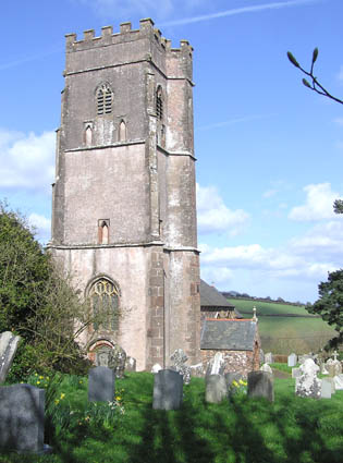
Church of All Saints, Chipstable

The Church of All Saints is an Anglican church in Chipstable, Somerset, England which probably dates from the early 13th century. It is located in the...

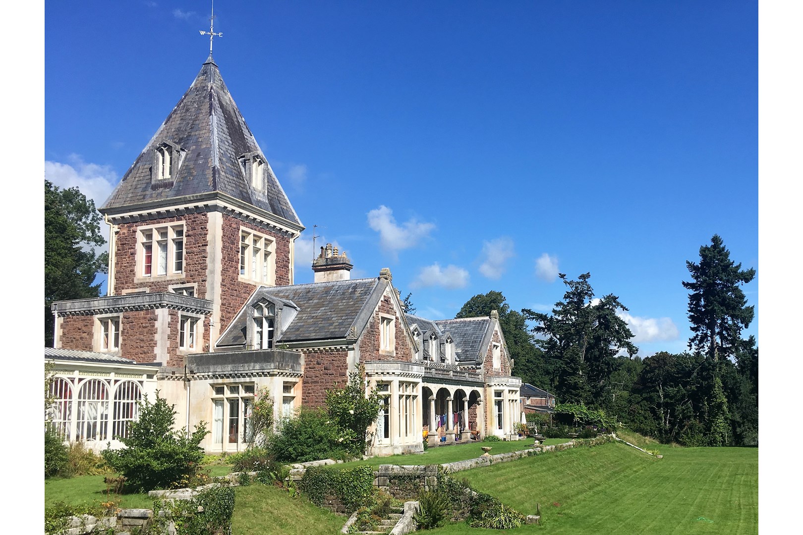
Abbotsfield, Wiveliscombe

Abbotsfield is a country house and farm, to the west of the town of Wiveliscombe, Somerset, England. Built in 1872, it became a Grade II listed building...

Clatworthy

Clatworthy is a village and civil parish in the Somerset West and Taunton district of Somerset, England. It is situated 10 miles (16 km) from Wellington...

Church of St Mary Magdalene, Clatworthy

The Anglican Church of Mary Magdalene in Clatworthy, Somerset, England was built in the 12th century. It is a Grade II* listed building. == History... ==

Clatworthy Reservoir

Clatworthy Reservoir is situated near Clatworthy in the Brendon Hills on the edge of the Exmoor National Park in west Somerset, England. It is run by Wessex...

Clatworthy Camp

Clatworthy Camp is an Iron Age hill fort 3 miles (4.8 km) North West of Wiveliscombe, Somerset, England. It has been scheduled as an Ancient Monument....

Nearby Amenities

Located within 500m of 51.048563,-3.3563125
The data included in this document is from www.openstreetmap.org. The data is made available under ODbL.

Have you been to Bitter Cleeve Wood?

Leave your review of Bitter Cleeve Wood below (or comments, questions and feedback).