Bank Wood

Wood, Forest in Cumberland Allerdale

England

Bank Wood

Mabel Wood Close A new development in Great Clifton.
Mabel Wood Close Credit: Russel Wills

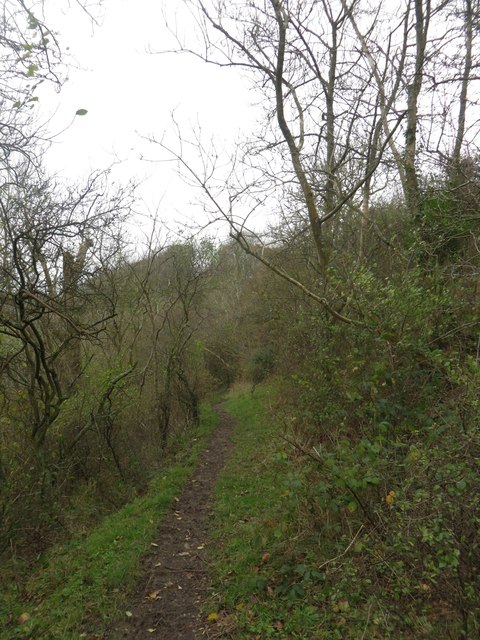
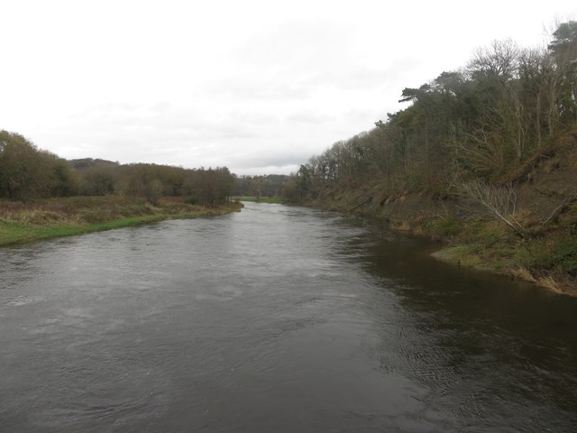
Bank Wood is a beautiful forest located in the county of Cumberland, England. It spans over a vast area, covering several hectares, and is well-known for its diverse range of flora and fauna. The wood is situated on the outskirts of a small village, surrounded by rolling hills and picturesque landscapes.

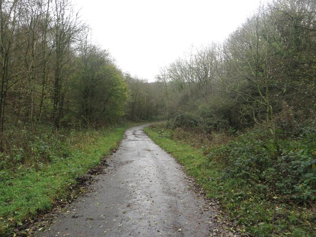
The forest is predominantly composed of a mix of broadleaf trees, including oak, beech, and birch, creating a dense canopy that provides shade and shelter for a variety of wildlife. Walking through the wood, visitors can enjoy the peaceful ambiance and the sounds of birds chirping and leaves rustling underfoot.

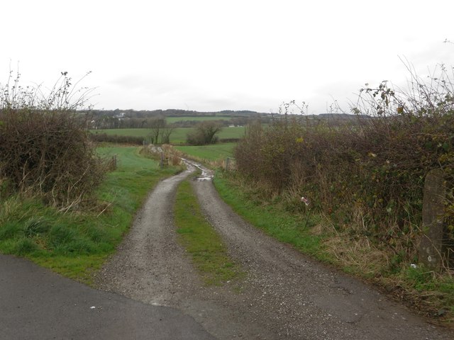
Bank Wood is a popular destination for nature enthusiasts and outdoor adventurers. It offers numerous walking trails, allowing visitors to explore its natural beauty at their own pace. The forest is also home to a rich diversity of wildlife, including deer, foxes, and a wide range of bird species. Bird watchers can often spot woodpeckers, owls, and various songbirds in the area.

For those interested in history, Bank Wood has an intriguing past. It is believed to have been used as a hunting ground for centuries, with evidence of ancient hunting pits and remains of medieval structures still visible today. Archaeological excavations have unearthed artifacts dating back hundreds of years, providing fascinating insights into the wood's historical significance.

In summary, Bank Wood in Cumberland is a captivating forest that offers a peaceful retreat for nature lovers and history enthusiasts alike. With its diverse ecosystem, scenic trails, and glimpses into the past, it is a truly remarkable destination for anyone seeking a connection with nature and a deeper understanding of the region's heritage.

If you have any feedback on the listing, please let us know in the comments section below.
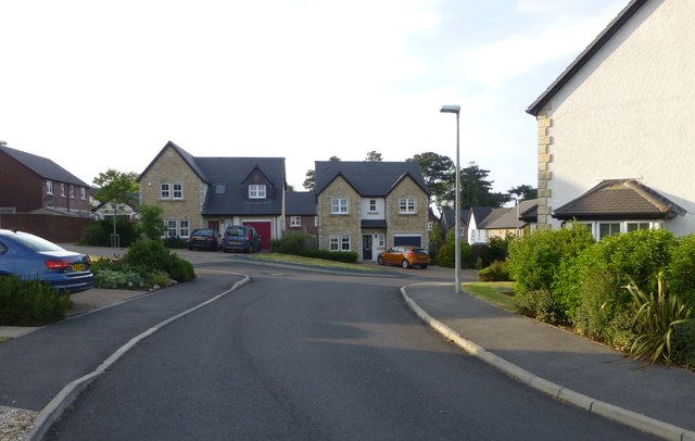
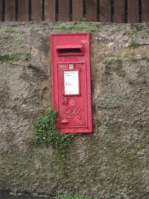
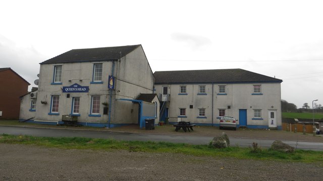
Bank Wood Images

Images are sourced within 2km of 54.663022/-3.4996033 or Grid Reference NY0330. Thanks to Geograph Open Source API. All images are credited.

Mabel Wood Close A new development in Great Clifton.
Mabel Wood Close
A new development in Great Clifton.
Play park on William Street With a memorial to all the miners who worked in local coal mines.
Play park on William Street
With a memorial to all the miners who worked in local coal mines.
Approaching Great Clifton Approaching the village of Great Clifton along the footpath from Little Clifton.
Approaching Great Clifton
Approaching the village of Great Clifton along the footpath from Little Clifton.
The Old Ginn House, Great Clifton The Old Gin House is a pub and hotel located in the centre of Great Clifton.
The Old Ginn House, Great Clifton
The Old Gin House is a pub and hotel located in the centre of Great Clifton.
Post box, Great Clifton A post box located in a garden wall in the centre of Great Clifton.
Post box, Great Clifton
A post box located in a garden wall in the centre of Great Clifton.
The Gavels, Great Clifton A residential street of terraced houses in Great Clifton.
The Gavels, Great Clifton
A residential street of terraced houses in Great Clifton.
The Market Cross Free House, Great Clifton The Market Cross, a small pub in the middle of Great Clifton.
The Market Cross Free House, Great Clifton
The Market Cross, a small pub in the middle of Great Clifton.
Playground, Great Clifton An assortment of play equipment in an enclosed grassed area on the edge of Great Clifton.
Playground, Great Clifton
An assortment of play equipment in an enclosed grassed area on the edge of Great Clifton.
Former Board School, Great Clifton The former Great and Little Clifton Board School. It is now a private house. An inscribed stone <a href="https://www.geograph.org.uk/photo/4252638">NY0429 : Inscribed stone, former Board School in Great Clifton</a> in the right hand gable dates the building to 1883.
Former Board School, Great Clifton
The former Great and Little Clifton Board School. It is now a private house. An inscribed stone NY0429 : Inscribed stone, former Board School in Great Clifton in the right hand gable dates the building to 1883.
Inscribed stone, former Board School in Great Clifton An inscribed stone above the right hand gable in <a href="https://www.geograph.org.uk/photo/4252631">NY0429 : Former Board School, Great Clifton</a>. The building is now a private house, having been converted from a former school. The inscription reads:
GREAT AND LITTLE CLIFTON 
BOARD SCHOOL ERECTED 1883.
Inscribed stone, former Board School in Great Clifton
An inscribed stone above the right hand gable in NY0429 : Former Board School, Great Clifton. The building is now a private house, having been converted from a former school. The inscription reads: GREAT AND LITTLE CLIFTON BOARD SCHOOL ERECTED 1883.
The Queens Head, Great Clifton One of 3 pubs in the village of Great Clifton. It looks as if it is closed however.
The Queens Head, Great Clifton
One of 3 pubs in the village of Great Clifton. It looks as if it is closed however.
Footpath towards Barepot A muddy footpath across a wooded hillside between Low Seaton and Barepot.
Footpath towards Barepot
A muddy footpath across a wooded hillside between Low Seaton and Barepot.
Camerton station (remains), 1986 View eastward, towards Cockermouth and Penrith: ex-LNW Workington - Cockermouth - Penrith line. The line was closed - quite wrongly it is now believed - from 18/4/66, but the station had gone from 3/3/52 so all that can be seen here is some platform. The house on the right with the Ford Cortina might have been the station house, but if so it has been altered.
Camerton station (remains), 1986
View eastward, towards Cockermouth and Penrith: ex-LNW Workington - Cockermouth - Penrith line. The line was closed - quite wrongly it is now believed - from 18/4/66, but the station had gone from 3/3/52 so all that can be seen here is some platform. The house on the right with the Ford Cortina might have been the station house, but if so it has been altered.
Arable field north of Great Clifton An arable field between Great Clifton and the River Eden. A winter cereal crop has been sown in the field.
Arable field north of Great Clifton
An arable field between Great Clifton and the River Eden. A winter cereal crop has been sown in the field.
Farm track near Great Clifton A farm track to the north of Great Clifton providing access to arable fields.
Farm track near Great Clifton
A farm track to the north of Great Clifton providing access to arable fields.
Footpath between Great Clifton and Camerton Looking along the road from Great Clifton to the River Derwent which is also a footpath connecting the village with Camerton across the River Eden.
Footpath between Great Clifton and Camerton
Looking along the road from Great Clifton to the River Derwent which is also a footpath connecting the village with Camerton across the River Eden.
Looking along the River Eden from Camerton Bridge Looking upstream along the River Eden from Camerton Bridge.
Looking along the River Eden from Camerton Bridge
Looking upstream along the River Eden from Camerton Bridge.
Camerton Bridge The footbridge carries a path between Great Clifton and Camerton over the River Eden. A former bridge on the site <a href="https://www.geograph.org.uk/photo/567711">NY0330 : Footbridge over River Derwent</a> was washed away by the floods of November 2009. The new bridge was opened in December 2012. <span class="nowrap"><a title="http://www.timesandstar.co.uk/news/other/new-camerton-bridge-is-putting-communities-back-together-1.1022190" rel="nofollow ugc noopener" href="http://www.timesandstar.co.uk/news/other/new-camerton-bridge-is-putting-communities-back-together-1.1022190">Link</a><img style="margin-left:2px;" alt="External link" title="External link - shift click to open in new window" src="https://s1.geograph.org.uk/img/external.png" width="10" height="10"/></span>
Camerton Bridge
The footbridge carries a path between Great Clifton and Camerton over the River Eden. A former bridge on the site NY0330 : Footbridge over River Derwent was washed away by the floods of November 2009. The new bridge was opened in December 2012. LinkExternal link
Show me another place!

Bank Wood is located at Grid Ref: NY0330 (Lat: 54.663022, Lng: -3.4996033)

Administrative County: Cumbria

District: Allerdale

Police Authority: Cumbria

What 3 Words

///adopt.gong.taxpayers. Near Flimby, Cumbria

Related Wikis

Camerton Colliery Halt railway station

Camerton Colliery Halt railway station was an unadvertised halt for workers at one or both of the collieries at Camerton, near Cockermouth in Cumberland...

Camerton, Cumbria

Camerton is a small village and civil parish in Cumbria, historically part of Cumberland, near the Lake District National Park in England. According to...

Camerton railway station (Cumberland)

Camerton railway station was situated next to the River Derwent on the Cockermouth and Workington Railway. It served the village of Camerton, Cumberland...

St Peter's Church, Camerton

St Peter's Church, Camerton is the Church of England parish church of Camerton, Cumbria. It is about 1⁄2 mile (800 m) south of the village. == History... ==

Seaton, Cumbria

Seaton is a large village and civil parish in Cumbria, England. Historically part of Cumberland, near the Lake District National Park in England. It is...

Seaton railway station (Cumbria)

Seaton railway station served the village of Seaton, near Workington in Cumberland (now in Cumbria), England.The station was opened by the Cleator and...

Great Clifton

Great Clifton is a village and civil parish in the Borough of Allerdale in the English county of Cumbria. In the 2001 census, it has a population of 1...

RNAD Broughton Moor

RNAD Broughton Moor is a decommissioned Royal Naval Armaments Depot located between Great Broughton and Broughton Moor in the County of Cumbria, England...

Nearby Amenities

Located within 500m of 54.663022,-3.4996033
Camerton
Place: village
Source: npe
Wikidata: Q1023946
Wikipedia: en:Camerton, Cumbria
Lat/Long: 54.6640734/-3.4946968
Bus Stop
The Black Tom Inn
Bench: no
Covered: no
Naptan AtcoCode: 090002211146
Naptan Bearing: N
Naptan CommonName: The Black Tom Inn
Naptan Indicator: o/s
Naptan Landmark: Black Tom Inn
Naptan NaptanCode: cumadjwp
Naptan Street: No name
Naptan Verified: no
Shelter: no
Source: naptan_import
Lat/Long: 54.6639058/-3.4940023
Bus Stop
Black Tom Inn
Bench: no
Covered: no
Naptan AtcoCode: 090002213063
Naptan Bearing: W
Naptan CommonName: Black Tom Inn
Naptan Indicator: opp
Naptan Landmark: Black Tom Inn
Naptan NaptanCode: cumadjwt
Naptan Street: No name
Naptan Verified: no
Shelter: no
Source: naptan_import
Lat/Long: 54.6638043/-3.4939715
Power: tower
Source: Bing
Lat/Long: 54.664499/-3.5033812
Power: tower
Source: Bing
Lat/Long: 54.6667838/-3.5035961
Power: tower
Source: Bing
Lat/Long: 54.6627312/-3.5042056
Bench
Lat/Long: 54.6638506/-3.4937858
Waste Basket
Lat/Long: 54.6638506/-3.4938348
Post Box
Post Box Type: wall
Ref: CA14 6
Royal Cypher: GVIR
Royal Cypher Wikidata: Q33102169
Lat/Long: 54.6644058/-3.4933263
Bench
Lat/Long: 54.6645786/-3.4930983
Grit Bin
Lat/Long: 54.6645341/-3.4931044
Telephone
Defibrillator
Booth: KX100
Covered: booth
Defibrillator Location: inside old phone box in Camerton
Emergency: defibrillator
Man Made: telephone_box
Lat/Long: 54.6654586/-3.4940302
Camerton Colliery No.2
Abandoned: yes
Historic: mine
Mineral: coal
Lat/Long: 54.6644423/-3.5042225
Barrier: stile
Lat/Long: 54.6603091/-3.4954399
Generator Method: photovoltaic
Generator Orientation: south_east
Generator Output Electricity: yes
Generator Solar Modules: 18
Generator Source: solar
Generator Type: solar_photovoltaic_panel
Location: roof
Power: generator
Lat/Long: 54.6636828/-3.4954633
Generator Method: photovoltaic
Generator Orientation: south_east
Generator Output Electricity: yes
Generator Solar Modules: 14
Generator Source: solar
Generator Type: solar_photovoltaic_panel
Location: roof
Power: generator
Lat/Long: 54.6639401/-3.49422
Power: tower
Lat/Long: 54.6602187/-3.5053378
Power: pole
Lat/Long: 54.6590362/-3.5030826
Power: pole
Lat/Long: 54.659524/-3.5025349
Power: pole
Lat/Long: 54.6601672/-3.502599
Power: pole
Lat/Long: 54.6607936/-3.5026403
Power: pole
Lat/Long: 54.6616437/-3.5027313
Power: pole
Lat/Long: 54.6628977/-3.5028656
Power: pole
Lat/Long: 54.6639987/-3.5029359
Power: pole
Lat/Long: 54.6647459/-3.5029896
Power: pole
Lat/Long: 54.6655731/-3.503095
Power: pole
Lat/Long: 54.6665736/-3.5031943
Power: pole
Lat/Long: 54.6665563/-3.5030031
Power: pole
Lat/Long: 54.6655629/-3.5029018
Power: pole
Lat/Long: 54.6645839/-3.5028088
Power: pole
Lat/Long: 54.6639563/-3.502753
Power: pole
Lat/Long: 54.6626246/-3.5026476
Power: pole
Lat/Long: 54.6617901/-3.5025504
Power: pole
Lat/Long: 54.6608014/-3.5024533
Power: pole
Lat/Long: 54.6601475/-3.5023871
Power: pole
Lat/Long: 54.6594911/-3.5023396
Power: pole
Lat/Long: 54.6589686/-3.5029266
Power: pole
Lat/Long: 54.6597505/-3.4965171
Power: pole
Lat/Long: 54.6603017/-3.4954548
Power: pole
Lat/Long: 54.6608588/-3.4947954
Power: pole
Lat/Long: 54.6613848/-3.4939666
Power: pole
Lat/Long: 54.6617638/-3.4933734
Power: pole
Lat/Long: 54.6622862/-3.4925053
Power: pole
Lat/Long: 54.6626497/-3.4937041
Power: pole
Lat/Long: 54.6632713/-3.4929889
Power: pole
Lat/Long: 54.6639192/-3.4922614
Power: pole
Lat/Long: 54.663288/-3.4946652
Power: pole
Lat/Long: 54.6642253/-3.4959942
Power: pole
Lat/Long: 54.6649341/-3.4970318
Power: pole
Lat/Long: 54.6655629/-3.497935
Power: pole
Lat/Long: 54.6659299/-3.4947789
Power: pole
Lat/Long: 54.6657614/-3.4962133
Power: pole
Lat/Long: 54.6655569/-3.499479
Power: pole
Lat/Long: 54.6655569/-3.5013371
Power: pole
Lat/Long: 54.6656119/-3.5017092
Power: pole
Lat/Long: 54.666114/-3.5042411
Power: pole
Lat/Long: 54.6662335/-3.5049149
Power: pole
Lat/Long: 54.664505/-3.4983236
Power: pole
Lat/Long: 54.6636371/-3.4986316
Power: pole
Lat/Long: 54.6633084/-3.4987577
Power: pole
Lat/Long: 54.6621679/-3.5001507
The data included in this document is from www.openstreetmap.org. The data is made available under ODbL.

Have you been to Bank Wood?

Leave your review of Bank Wood below (or comments, questions and feedback).