Tutehill Wood

Wood, Forest in Cumberland Copeland

England

Tutehill Wood

Old Boundary Marker on Dubbeck Bridge Township Boundary Marker set on top of the parapet of Dubbeck Bridge, Dub Beck, on the southwest side of the road east of Brownrigg. Inscribed ARLECDON and WHILLIMOOR on opposite faces. On the boundary of Arlecdon and Whillimoor townships in Arlecdon parish, now entirely in Arlecdon and Frizington parish. See also <a title="https://www.geograph.org.uk/photo/4000552" href="https://www.geograph.org.uk/photo/4000552">Link</a> , <a title="https://www.geograph.org.uk/photo/4000502" href="https://www.geograph.org.uk/photo/4000502">Link</a> and <a title="https://www.geograph.org.uk/photo/4000486" href="https://www.geograph.org.uk/photo/4000486">Link</a>.

Milestone Society National ID: CU_ARLFRI02pb
Old Boundary Marker on Dubbeck Bridge Credit: Colin Smith

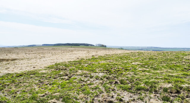
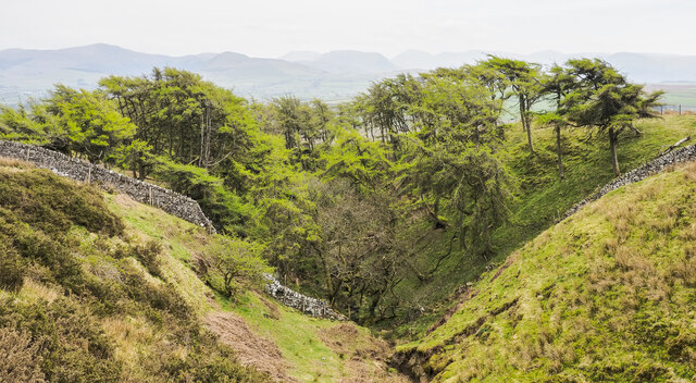
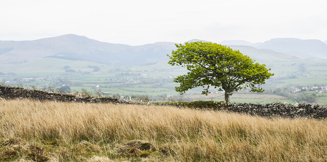
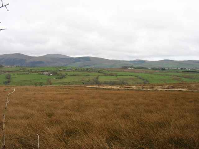
Tutehill Wood, located in Cumberland, is a picturesque woodland covering an area of approximately 100 hectares. Situated in the northwest of England, this forested area is known for its natural beauty and diverse range of flora and fauna. The wood is situated on the slopes of a hill, providing visitors with stunning panoramic views of the surrounding countryside.

The wood is predominantly made up of broadleaf trees, including oak, beech, and birch. These trees create a dense canopy, allowing only dappled sunlight to filter through to the forest floor. This habitat provides an ideal environment for a variety of wildlife species, including deer, badgers, foxes, and a wide range of bird species.

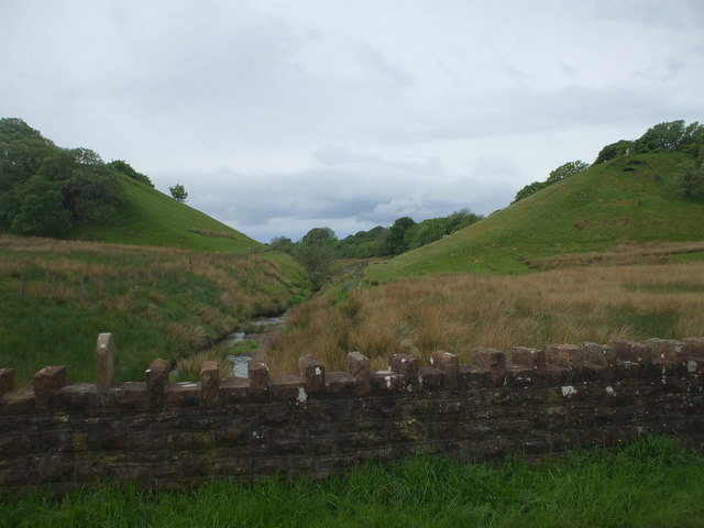
Visitors to Tutehill Wood can enjoy a network of walking trails that wind through the woodland, offering a peaceful and tranquil setting for nature enthusiasts and hikers alike. The trails are well-maintained, providing easy access to explore the wood's various habitats and discover its hidden gems.

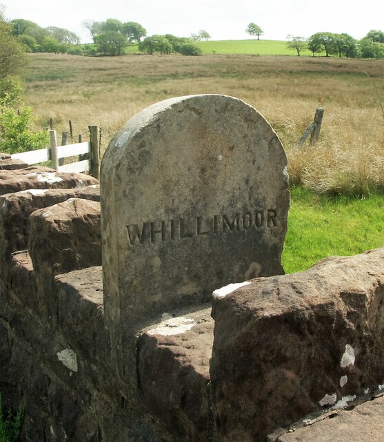
In addition to its natural beauty, Tutehill Wood also has historical significance. The wood was once part of a larger medieval forest that covered the region, and remnants of its past can still be seen today. Ancient boundary markers, known as "deer leaps," serve as reminders of the area's history and add to the overall charm of the wood.

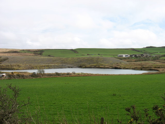
Tutehill Wood is a haven for nature lovers, offering a rich biodiversity and a serene atmosphere. Whether it's exploring the trails, admiring the vibrant colors of the changing seasons, or simply enjoying the peacefulness of the woodland, this forest in Cumberland provides a truly immersive and rewarding experience for all who visit.

If you have any feedback on the listing, please let us know in the comments section below.

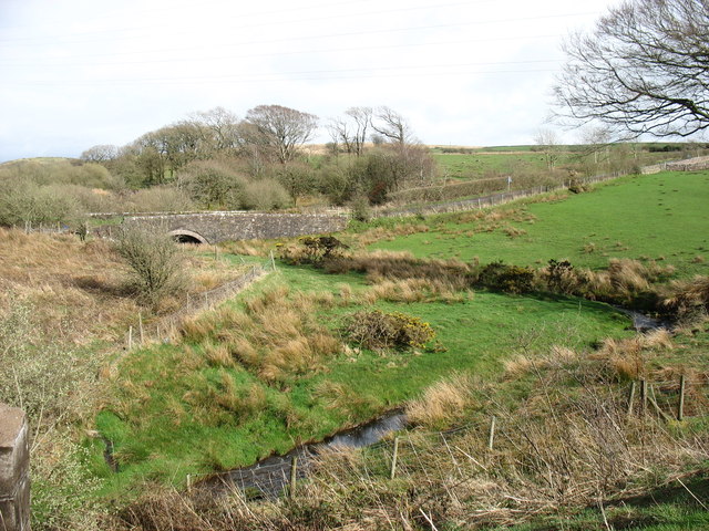
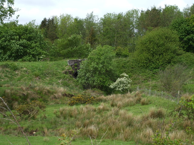
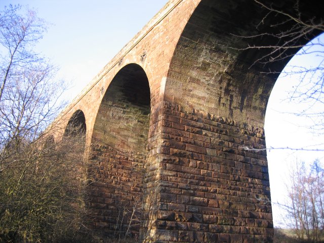
Tutehill Wood Images

Images are sourced within 2km of 54.569931/-3.5007 or Grid Reference NY0320. Thanks to Geograph Open Source API. All images are credited.

Old Boundary Marker on Dubbeck Bridge Township Boundary Marker set on top of the parapet of Dubbeck Bridge, Dub Beck, on the southwest side of the road east of Brownrigg. Inscribed ARLECDON and WHILLIMOOR on opposite faces. On the boundary of Arlecdon and Whillimoor townships in Arlecdon parish, now entirely in Arlecdon and Frizington parish. See also <a title="https://www.geograph.org.uk/photo/4000552" href="https://www.geograph.org.uk/photo/4000552">Link</a> , <a title="https://www.geograph.org.uk/photo/4000502" href="https://www.geograph.org.uk/photo/4000502">Link</a> and <a title="https://www.geograph.org.uk/photo/4000486" href="https://www.geograph.org.uk/photo/4000486">Link</a>.

Milestone Society National ID: CU_ARLFRI02pb
Old Boundary Marker on Dubbeck Bridge
Township Boundary Marker set on top of the parapet of Dubbeck Bridge, Dub Beck, on the southwest side of the road east of Brownrigg. Inscribed ARLECDON and WHILLIMOOR on opposite faces. On the boundary of Arlecdon and Whillimoor townships in Arlecdon parish, now entirely in Arlecdon and Frizington parish. See also Link , Link and Link. Milestone Society National ID: CU_ARLFRI02pb
Field north of minor road close to Friar Bank Wood The ploughed field is close to various small settlements, east of Pica for example; it's also north of the area of relatively low-level moorland at High Park. The notice on the gate declares that the land is private.
Field north of minor road close to Friar Bank Wood
The ploughed field is close to various small settlements, east of Pica for example; it's also north of the area of relatively low-level moorland at High Park. The notice on the gate declares that the land is private.
Lightly burned vegetation at High Park High Park is an area of moorland at a relatively low level - the camera position is at around 220 m. above sea level. An area of vegetation has been burned, presumably purposely and with good intent, in an attempt at some form of control. Similar burning was observed on nearby Lake District hills of the Blake Fell / Gavel Fell group. Periodic burning of heather is practised on moorland managed as grouse moor, but that's surely not what is going on here.
Lightly burned vegetation at High Park
High Park is an area of moorland at a relatively low level - the camera position is at around 220 m. above sea level. An area of vegetation has been burned, presumably purposely and with good intent, in an attempt at some form of control. Similar burning was observed on nearby Lake District hills of the Blake Fell / Gavel Fell group. Periodic burning of heather is practised on moorland managed as grouse moor, but that's surely not what is going on here.
Moorland on High Park High Park is an area of moorland at a relatively low level - the camera position is at around 230 m. above sea level. The nearer vegetation has been burned, presumably purposely and with good intent, in an attempt at some form of control. Similar burning was observed on nearby Lake District hills of the Blake Fell / Gavel Fell group. Periodic burning of heather is practised on moorland managed as grouse moor, but that's surely not what is going on here.
Tutehill Wood is in the distance.
Moorland on High Park
High Park is an area of moorland at a relatively low level - the camera position is at around 230 m. above sea level. The nearer vegetation has been burned, presumably purposely and with good intent, in an attempt at some form of control. Similar burning was observed on nearby Lake District hills of the Blake Fell / Gavel Fell group. Periodic burning of heather is practised on moorland managed as grouse moor, but that's surely not what is going on here. Tutehill Wood is in the distance.
Larch trees in cleft of stream In late April the larches are in 'new leaf'. The cleft is that of a stream which according to OS mapping fades away as do others in the area; it's assumed that the waters somehow enter Dub Beck.
The western hills of the Lake District are seen hazily in the distance.
Larch trees in cleft of stream
In late April the larches are in 'new leaf'. The cleft is that of a stream which according to OS mapping fades away as do others in the area; it's assumed that the waters somehow enter Dub Beck. The western hills of the Lake District are seen hazily in the distance.
Lone tree beyond dry stone wall The wall crosses the High Park area of moorland.
Hills of the western side of the Lake District are in the distance; Blake Fell is to the left.
Lone tree beyond dry stone wall
The wall crosses the High Park area of moorland. Hills of the western side of the Lake District are in the distance; Blake Fell is to the left.
Farmland near Arlecdon The hills south of Ennerdale Water are on the skyline.
Farmland near Arlecdon
The hills south of Ennerdale Water are on the skyline.
Farmland near Frizington
Embankments but no viaduct A section of the Cleator and Workington Junction Railway, built c.1879. It was mainly used for coal, limestone and iron ore traffic for the local industries. Most of the line was taken up in the 1960's; bridges, viaducts & even parts of the trackbed are now lost to history, but some parts of the old network are now cycle ways & footpaths.
Embankments but no viaduct
A section of the Cleator and Workington Junction Railway, built c.1879. It was mainly used for coal, limestone and iron ore traffic for the local industries. Most of the line was taken up in the 1960's; bridges, viaducts & even parts of the trackbed are now lost to history, but some parts of the old network are now cycle ways & footpaths.
High Park
High Park
High Park Climbed from road to SSW via old gate and then over rough vegetation to trig on grey morning.

Name: High Park
Hill number: 5289
Height: 247m / 810ft
Area: 34B: Lake District - Central & Western Fells
Class: Hu
Grid ref: NY 04294 21200
Summit feature: trig point
Drop: 119m
Col: 128m  NY056207
High Park
Climbed from road to SSW via old gate and then over rough vegetation to trig on grey morning. Name: High Park Hill number: 5289 Height: 247m / 810ft Area: 34B: Lake District - Central & Western Fells Class: Hu Grid ref: NY 04294 21200 Summit feature: trig point Drop: 119m Col: 128m NY056207
The lane to Pica
The lane to Pica
The remains of works near Wilson Park
Keekle High Bridge Looking upstream
Keekle High Bridge
Looking upstream
The lane to Arlecdon
Parish Boundary Stone On the southern parapet of Dubbeck Bridge.
Parish Boundary Stone
On the southern parapet of Dubbeck Bridge.
Railway Embankment & Parish Boundary Stone Old Parish Boundary Stone between Weddicar & Arlecdon. I say old because this is now within Arlecdon & Frizington CP.
Railway Embankment & Parish Boundary Stone
Old Parish Boundary Stone between Weddicar & Arlecdon. I say old because this is now within Arlecdon & Frizington CP.
Partially Hidden Railway bridge over the River Keekle, part of the old Cleator & Workington Junction Railway.
Partially Hidden
Railway bridge over the River Keekle, part of the old Cleator & Workington Junction Railway.
Show me another place!

Tutehill Wood is located at Grid Ref: NY0320 (Lat: 54.569931, Lng: -3.5007)

Administrative County: Cumbria

District: Copeland

Police Authority: Cumbria

What 3 Words

///afflicted.hinted.keys. Near Frizington, Cumbria

Nearby Locations

Tutehill Wood

Related Wikis

Oatlands railway station

Oatlands railway station served the village of Pica and Oatlands Colliery in the former English county of Cumberland, now part of Cumbria. == Location... ==

Weddicar

Weddicar is a civil parish in Copeland, Cumbria, England. At the 2011 census it had a population of 451.The parish has an area of 712.98 hectares (1,761...

High Leys

High Leys is located to the south-east of Rowrah in Cumbria (map), along the C2C cycle route prior to Sheriffs Gate. The status of national nature reserve...

Frizington

Frizington is a village in Cumbria, England, historically part of Cumberland, near the Lake District National Park. Historically, it was a collection of...

Nearby Amenities

Located within 500m of 54.569931,-3.5007
Bench
Backrest: yes
Description: Memorial Seat Dedicated to Maisie and Frank Burnell
Lat/Long: 54.5669074/-3.4965191
High Tutehill
Place: locality
Lat/Long: 54.5723762/-3.4993587
Power: pole
Lat/Long: 54.5736945/-3.5043012
Power: pole
Lat/Long: 54.572997/-3.503414
Power: pole
Lat/Long: 54.5723042/-3.5025207
The data included in this document is from www.openstreetmap.org. The data is made available under ODbL.

Have you been to Tutehill Wood?

Leave your review of Tutehill Wood below (or comments, questions and feedback).