Scarbank Wood

Wood, Forest in Cumberland Allerdale

England

Scarbank Wood

Old Milestone by Stainburn road, 75m west of junction with Moor Road The Milestone is located in wall on the North of the road.  Parish of Workington (Allerdale District). Carved stone post, Carlisle red stone design, erected by the Cockermouth & Workington turnpike trust in the 19th Century.  

Inscription reads:-   
Cockermouth / 7 / Workington / 1 

Milestone Society National ID: CU_CMWO07
Old Milestone by Stainburn road, 75m west of junction with Moor Road Credit: Barbara Todd

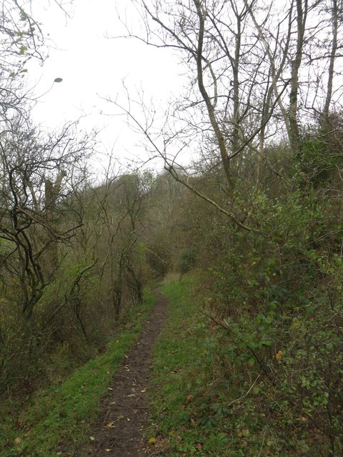
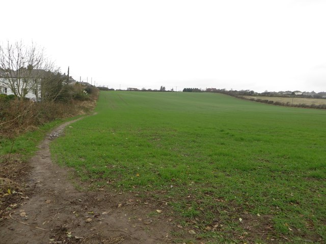
Scarbank Wood is a picturesque forest located in the county of Cumberland, England. Covering an area of approximately 100 acres, this woodland is nestled within the scenic countryside, offering visitors a tranquil and serene environment to explore.

The wood is predominantly made up of a mixture of broadleaf trees, including oak, beech, and ash, creating a diverse and vibrant ecosystem. The canopy of these majestic trees provides ample shade during the summer months, making it an ideal spot for a leisurely walk or a picnic amidst nature's beauty.

Scarbank Wood is home to a variety of wildlife, offering nature enthusiasts a chance to spot some of the region's indigenous species. The forest is known for its diverse bird population, with sightings of species such as woodpeckers, owls, and songbirds being common. Additionally, small mammals like squirrels and rabbits can often be spotted scurrying through the undergrowth.

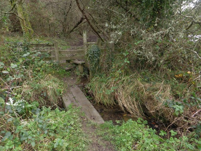
The forest is crisscrossed by a network of well-maintained footpaths, allowing visitors to explore its natural wonders at their own pace. These paths lead to scenic viewpoints, babbling brooks, and small ponds, adding to the charm and allure of the woodland. As visitors meander through the forest, they will come across informative signposts that provide interesting facts about the flora and fauna found within Scarbank Wood.

Scarbank Wood is a popular destination for nature lovers, hikers, and families seeking a peaceful retreat in the heart of the Cumberland countryside. With its picturesque setting, diverse wildlife, and well-marked trails, this woodland offers a delightful escape into nature's embrace.

If you have any feedback on the listing, please let us know in the comments section below.

Scarbank Wood Images

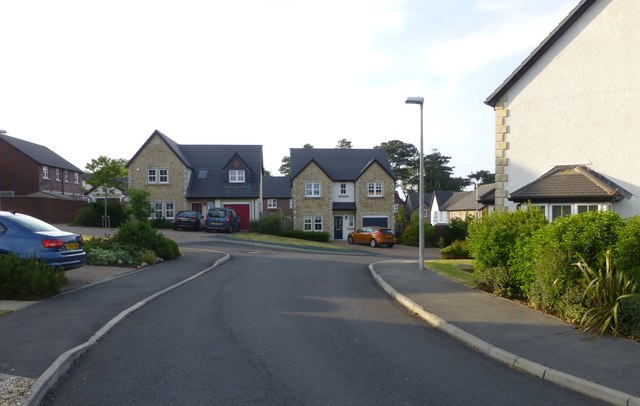
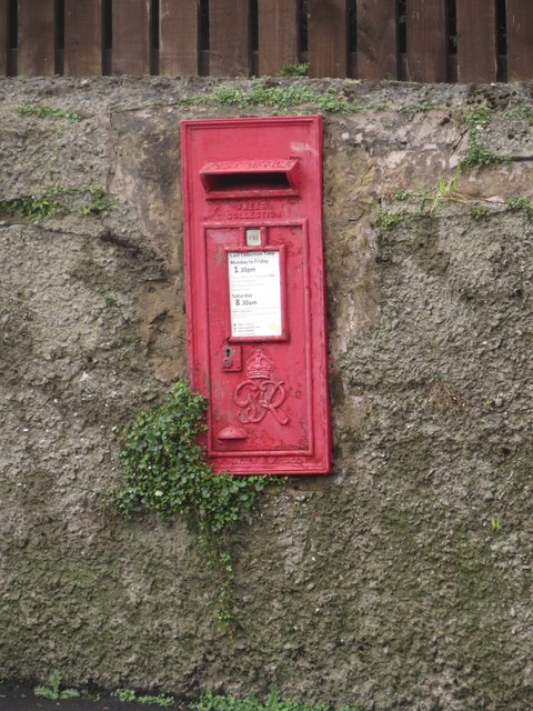
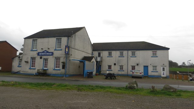
Images are sourced within 2km of 54.659988/-3.5108709 or Grid Reference NY0230. Thanks to Geograph Open Source API. All images are credited.

Old Milestone by Stainburn road, 75m west of junction with Moor Road The Milestone is located in wall on the North of the road.  Parish of Workington (Allerdale District). Carved stone post, Carlisle red stone design, erected by the Cockermouth & Workington turnpike trust in the 19th Century.  

Inscription reads:-   
Cockermouth / 7 / Workington / 1 

Milestone Society National ID: CU_CMWO07
Old Milestone by Stainburn road, 75m west of junction with Moor Road
The Milestone is located in wall on the North of the road.  Parish of Workington (Allerdale District). Carved stone post, Carlisle red stone design, erected by the Cockermouth & Workington turnpike trust in the 19th Century.   Inscription reads:- Cockermouth / 7 / Workington / 1 Milestone Society National ID: CU_CMWO07
Mabel Wood Close A new development in Great Clifton.
Mabel Wood Close
A new development in Great Clifton.
Play park on William Street With a memorial to all the miners who worked in local coal mines.
Play park on William Street
With a memorial to all the miners who worked in local coal mines.
Approaching Great Clifton Approaching the village of Great Clifton along the footpath from Little Clifton.
Approaching Great Clifton
Approaching the village of Great Clifton along the footpath from Little Clifton.
The Old Ginn House, Great Clifton The Old Gin House is a pub and hotel located in the centre of Great Clifton.
The Old Ginn House, Great Clifton
The Old Gin House is a pub and hotel located in the centre of Great Clifton.
Post box, Great Clifton A post box located in a garden wall in the centre of Great Clifton.
Post box, Great Clifton
A post box located in a garden wall in the centre of Great Clifton.
The Gavels, Great Clifton A residential street of terraced houses in Great Clifton.
The Gavels, Great Clifton
A residential street of terraced houses in Great Clifton.
The Market Cross Free House, Great Clifton The Market Cross, a small pub in the middle of Great Clifton.
The Market Cross Free House, Great Clifton
The Market Cross, a small pub in the middle of Great Clifton.
Playground, Great Clifton An assortment of play equipment in an enclosed grassed area on the edge of Great Clifton.
Playground, Great Clifton
An assortment of play equipment in an enclosed grassed area on the edge of Great Clifton.
Former Board School, Great Clifton The former Great and Little Clifton Board School. It is now a private house. An inscribed stone <a href="https://www.geograph.org.uk/photo/4252638">NY0429 : Inscribed stone, former Board School in Great Clifton</a> in the right hand gable dates the building to 1883.
Former Board School, Great Clifton
The former Great and Little Clifton Board School. It is now a private house. An inscribed stone NY0429 : Inscribed stone, former Board School in Great Clifton in the right hand gable dates the building to 1883.
Inscribed stone, former Board School in Great Clifton An inscribed stone above the right hand gable in <a href="https://www.geograph.org.uk/photo/4252631">NY0429 : Former Board School, Great Clifton</a>. The building is now a private house, having been converted from a former school. The inscription reads:
GREAT AND LITTLE CLIFTON 
BOARD SCHOOL ERECTED 1883.
Inscribed stone, former Board School in Great Clifton
An inscribed stone above the right hand gable in NY0429 : Former Board School, Great Clifton. The building is now a private house, having been converted from a former school. The inscription reads: GREAT AND LITTLE CLIFTON BOARD SCHOOL ERECTED 1883.
The Queens Head, Great Clifton One of 3 pubs in the village of Great Clifton. It looks as if it is closed however.
The Queens Head, Great Clifton
One of 3 pubs in the village of Great Clifton. It looks as if it is closed however.
Footpath towards Barepot A muddy footpath across a wooded hillside between Low Seaton and Barepot.
Footpath towards Barepot
A muddy footpath across a wooded hillside between Low Seaton and Barepot.
Footbridge over Gale Brook An old railway sleeper has been used to form a footbridge over Gale Brook.
Footbridge over Gale Brook
An old railway sleeper has been used to form a footbridge over Gale Brook.
Arable field on the edge of Hawk Hill An arable field sown with a winter cereal crop on the edge of Hawk Hill.
Arable field on the edge of Hawk Hill
An arable field sown with a winter cereal crop on the edge of Hawk Hill.
Coronation Avenue, Hawk Hill A quiet residential street of semi detached, houses.
Coronation Avenue, Hawk Hill
A quiet residential street of semi detached, houses.
Princess Avenue, Hawk Hill A quiet residential street in the village on the north bank of the River Derwent.
Princess Avenue, Hawk Hill
A quiet residential street in the village on the north bank of the River Derwent.
Workington Road, Hawk Hill Looking down the hill towards Workington.
Workington Road, Hawk Hill
Looking down the hill towards Workington.
Show me another place!

Scarbank Wood is located at Grid Ref: NY0230 (Lat: 54.659988, Lng: -3.5108709)

Administrative County: Cumbria

District: Allerdale

Police Authority: Cumbria

What 3 Words

///followers.goodnight.dove. Near Workington, Cumbria

Nearby Locations

Scarbank Wood Low Seaton

Related Wikis

Seaton railway station (Cumbria)

Seaton railway station served the village of Seaton, near Workington in Cumberland (now in Cumbria), England.The station was opened by the Cleator and...

Seaton, Cumbria

Seaton is a large village and civil parish in Cumbria, England. Historically part of Cumberland, near the Lake District National Park in England. It is...

St Peter's Church, Camerton

St Peter's Church, Camerton is the Church of England parish church of Camerton, Cumbria. It is about 1⁄2 mile (800 m) south of the village. == History... ==

Camerton Colliery Halt railway station

Camerton Colliery Halt railway station was an unadvertised halt for workers at one or both of the collieries at Camerton, near Cockermouth in Cumberland...

Nearby Amenities

Located within 500m of 54.659988,-3.5108709
Power: tower
Source: Bing
Lat/Long: 54.6603523/-3.5121239
Turning Circle
Lat/Long: 54.6611858/-3.5179104
Power: tower
Lat/Long: 54.656825/-3.5119556
Power: tower
Lat/Long: 54.6622591/-3.5122086
Power: tower
Lat/Long: 54.6641835/-3.5122993
Barrier: kissing_gate
Lat/Long: 54.6619037/-3.5179029
Generator Method: photovoltaic
Generator Orientation: south_east
Generator Output Electricity: yes
Generator Solar Modules: 15
Generator Source: solar
Generator Type: solar_photovoltaic_panel
Location: roof
Power: generator
Lat/Long: 54.6605945/-3.5155865
Power: pole
Lat/Long: 54.6571322/-3.5162498
Power: pole
Lat/Long: 54.6579332/-3.5154355
Power: pole
Lat/Long: 54.6585107/-3.5148505
Power: pole
Lat/Long: 54.6591253/-3.5142429
Power: pole
Lat/Long: 54.6603411/-3.514431
Power: pole
Lat/Long: 54.6608959/-3.5145095
Power: pole
Lat/Long: 54.6613645/-3.5145591
Power: pole
Lat/Long: 54.6619688/-3.5144506
Power: pole
Lat/Long: 54.6627674/-3.5142708
Power: pole
Lat/Long: 54.6634261/-3.514153
Power: tower
Lat/Long: 54.6576295/-3.5065046
Power: tower
Lat/Long: 54.6602187/-3.5053378
Power: pole
Lat/Long: 54.6567143/-3.5056807
Power: pole
Lat/Long: 54.6574807/-3.5048209
Power: pole
Lat/Long: 54.6582854/-3.5039197
Power: pole
Lat/Long: 54.6582214/-3.5037492
Power: pole
Lat/Long: 54.6574215/-3.5046628
The data included in this document is from www.openstreetmap.org. The data is made available under ODbL.

Have you been to Scarbank Wood?

Leave your review of Scarbank Wood below (or comments, questions and feedback).