Down Copse

Wood, Forest in Somerset Somerset West and Taunton

England

Down Copse

Chipstable: south east to the Wellington Monument Seen from a point a little south west of Champion Cross. The National Grid line runs from Taunton towards South Molton
Chipstable: south east to the Wellington Monument Credit: Martin Bodman

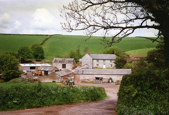
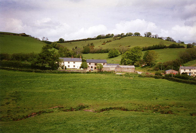
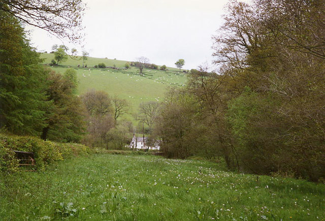
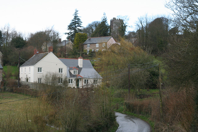
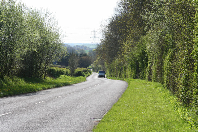
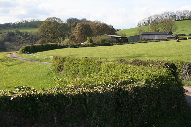
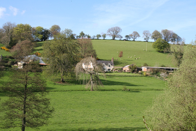
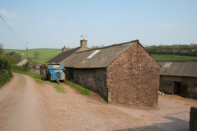
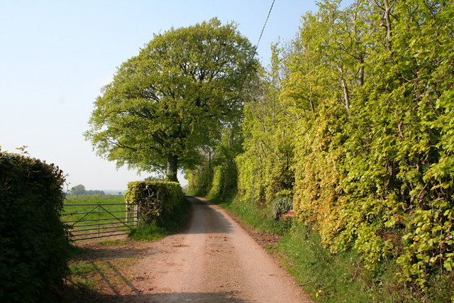
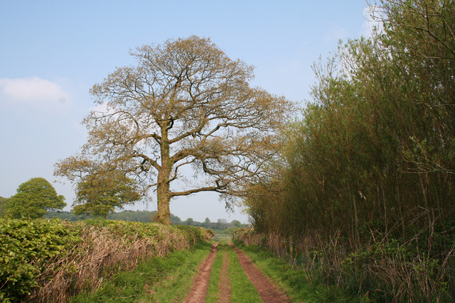
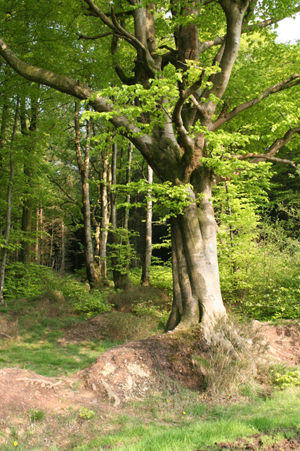
Down Copse is a picturesque woodland located in Somerset, England. It covers an area of approximately 50 acres and is situated near the village of Charterhouse, nestled within the stunning Mendip Hills. The copse is primarily composed of broadleaf trees, including oak, beech, and birch, creating a diverse and vibrant ecosystem.

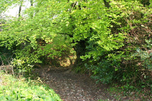
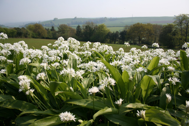
The woodland boasts a rich biodiversity, with a variety of flora and fauna. The forest floor is carpeted with bluebells, wild garlic, and ferns during the spring and summer months, creating a colorful and enchanting landscape. The trees provide a habitat for numerous bird species, such as woodpeckers, thrushes, and warblers, making it a haven for birdwatchers and nature enthusiasts.

Down Copse is also home to several mammals, including deer, foxes, and badgers. These creatures can often be spotted roaming through the peaceful woodland, adding to the natural beauty and charm of the area.

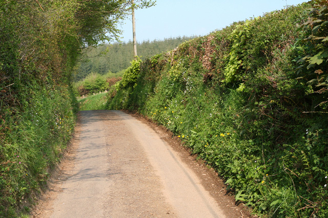
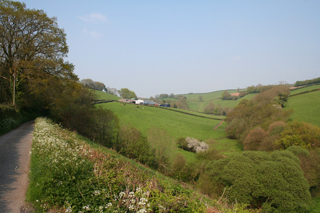
The copse is a popular destination for outdoor activities, such as walking, hiking, and photography. There are well-maintained trails that meander through the woodland, allowing visitors to explore the serene surroundings at their own pace. The tranquil atmosphere and stunning views make it an ideal spot for relaxation and contemplation.

Overall, Down Copse in Somerset is a captivating woodland that showcases the beauty of nature. With its diverse flora and fauna, it offers a serene escape from the hustle and bustle of everyday life, making it a must-visit destination for nature lovers and those seeking tranquility in the heart of the Mendip Hills.

If you have any feedback on the listing, please let us know in the comments section below.

Down Copse Images

Images are sourced within 2km of 51.027599/-3.390167 or Grid Reference ST0226. Thanks to Geograph Open Source API. All images are credited.

Chipstable: south east to the Wellington Monument Seen from a point a little south west of Champion Cross. The National Grid line runs from Taunton towards South Molton
Chipstable: south east to the Wellington Monument
Seen from a point a little south west of Champion Cross. The National Grid line runs from Taunton towards South Molton
Chipstable: Chubworthy Farm The farm here had waterpower in the mid nineteenth century. The 16’ overshot waterwheel is now, in 2005, under restoration at Kelly Mine, Lustleigh, Devon
Chipstable: Chubworthy Farm
The farm here had waterpower in the mid nineteenth century. The 16’ overshot waterwheel is now, in 2005, under restoration at Kelly Mine, Lustleigh, Devon
Chipstable: Kingston Farm and Mill Two spring-fed ponds each provided a mere 20 minutes operation for the 19th century waterwheel at the mill, now a private residence. The mill was purely for the use of the farm: it was not a manor or parish flour mill
Chipstable: Kingston Farm and Mill
Two spring-fed ponds each provided a mere 20 minutes operation for the 19th century waterwheel at the mill, now a private residence. The mill was purely for the use of the farm: it was not a manor or parish flour mill
Bampton: near Raddington In the Batherm valley near Batherm Bridge
Bampton: near Raddington
In the Batherm valley near Batherm Bridge
Chipstable: the village Seen from Pitt Lane; looking north west
Chipstable: the village
Seen from Pitt Lane; looking north west
Clayhanger: the B3227 at Leigh Wood Looking west on the road to Shillingford and Bampton
Clayhanger: the B3227 at Leigh Wood
Looking west on the road to Shillingford and Bampton
Clayhanger: near Berry Farm Farm access road and public footpath – the path runs through to Batherm Bridge. Looking north west from the bridge over the abandoned Taunton – Barnstaple railway, closed in the 1960s
Clayhanger: near Berry Farm
Farm access road and public footpath – the path runs through to Batherm Bridge. Looking north west from the bridge over the abandoned Taunton – Barnstaple railway, closed in the 1960s
Chipstable: Washers Farm Looking north-north-east. The farm faces south in an east-west valley; below it a stream runs westwards from Raddington to join the Batherm near Batherm Bridge
Chipstable: Washers Farm
Looking north-north-east. The farm faces south in an east-west valley; below it a stream runs westwards from Raddington to join the Batherm near Batherm Bridge
Chipstable: track to Meadow Farm Seen from the bend in the road at the foot of Shute Hill. Looking south east
Chipstable: track to Meadow Farm
Seen from the bend in the road at the foot of Shute Hill. Looking south east
Chipstable: wild garlic Looking south towards Combe Downs
Chipstable: wild garlic
Looking south towards Combe Downs
Chipstable: lane at Raddington Bottom Looking north east near Rectory Farm
Chipstable: lane at Raddington Bottom
Looking north east near Rectory Farm
Skilgate: near Bittescombe Hill Farm Looking north east on the lane from Blackwell
Skilgate: near Bittescombe Hill Farm
Looking north east on the lane from Blackwell
Skilgate: Bittescombe Hill Farm Farm buildings by the lane from Blackwell to Heydon Hill. Looking east
Skilgate: Bittescombe Hill Farm
Farm buildings by the lane from Blackwell to Heydon Hill. Looking east
Skilgate: lane with beech tree and hedge Looking north-north-east
Skilgate: lane with beech tree and hedge
Looking north-north-east
Chipstable: Hynicombe Lane A public bridleway between Heydon Farm and Old Way at Heydon Hill
Chipstable: Hynicombe Lane
A public bridleway between Heydon Farm and Old Way at Heydon Hill
Chipstable: beech wood at Heydon Hill Looking east from Old Way
Chipstable: beech wood at Heydon Hill
Looking east from Old Way
Somerset & Devon : County Border & B3227 The county border between Somerset and Devon.
Somerset & Devon : County Border & B3227
The county border between Somerset and Devon.
Devon & Somerset : Welcome to Somerset & B3227 Sign was erected by the Somerset County Council (Somerset is a two tier council) in the year of the Golden Jubilee of Queen Elizabeth II 2002.
Devon & Somerset : Welcome to Somerset & B3227
Sign was erected by the Somerset County Council (Somerset is a two tier council) in the year of the Golden Jubilee of Queen Elizabeth II 2002.
Show me another place!

Down Copse is located at Grid Ref: ST0226 (Lat: 51.027599, Lng: -3.390167)

Administrative County: Somerset

District: Somerset West and Taunton

Police Authority: Avon and Somerset

What 3 Words

///heats.sheep.providing. Near Wiveliscombe, Somerset

Nearby Locations

Ham Copse Down Copse

Related Wikis

Church of All Saints, Chipstable

The Church of All Saints is an Anglican church in Chipstable, Somerset, England which probably dates from the early 13th century. It is located in the...

Chipstable

Chipstable is a village and civil parish in Somerset, England, situated beside Heydon Hill 10 miles (16.1 km) west of Taunton. The parish has a population...

Petton, Devon

Petton, also known as Petton Cross, is an English village in the civil parish of Bampton, the district of Mid Devon, and the county of Devon. It lies on...

Clayhanger, Devon

Clayhanger is a hamlet and civil parish in the Mid Devon district of Devon, England. At the time of the 2011 census it had a population of 127. == Roman... ==

Castles Camp

Castles Camp is a univallate Iron Age hill fort in the Taunton Deane district of Somerset, England. The hill fort is situated approximately 1 mile (1.6...

Huish Champflower

Huish Champflower is a village and civil parish in Somerset, England, three miles north-west of Wiveliscombe and ten miles north of Wellington. It has...

Church of St John, Skilgate

The Anglican Church of St John in Skilgate, Somerset, England was built in the 14th century. It is a Grade II* listed building. == History == The church...

Upton, Somerset

Upton is a village and civil parish north of Skilgate in Somerset, England. It is situated on a hill above the eastern end of Wimbleball Lake. == History... ==

Nearby Amenities

Located within 500m of 51.027599,-3.390167
Power: pole
Lat/Long: 51.0248771/-3.3852965
Power: pole
Lat/Long: 51.0247168/-3.3860877
Power: pole
Lat/Long: 51.0239728/-3.3898482
Power: pole
Lat/Long: 51.0237451/-3.3909586
Raddington Bottom
Place: hamlet
Lat/Long: 51.0262276/-3.3935112
The data included in this document is from www.openstreetmap.org. The data is made available under ODbL.

Have you been to Down Copse?

Leave your review of Down Copse below (or comments, questions and feedback).