Broadfield Wood

Wood, Forest in Somerset Somerset West and Taunton

England

Broadfield Wood

Naked Boy's Stone A Grade II Listed mediaeval boundary stone marking the boundary between the parishes of old Cleeve and Brompton Regis. There is limited parking here for the permissive path to Burrow Farm engine house along the West Somerset Mineral Railway.
Naked Boy's Stone Credit: Chris Allen

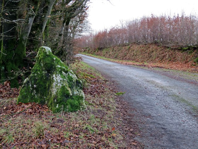
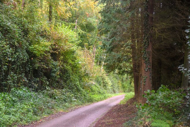
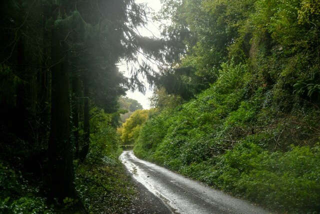
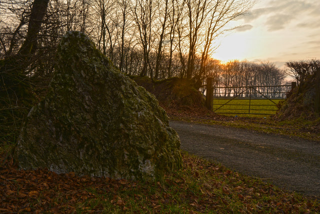
Broadfield Wood is a lush forest located in Somerset, England. Covering a vast expanse of approximately 100 hectares, this woodland is a haven for nature enthusiasts and outdoor lovers alike. The wood is situated just south of the village of Broadfield, and its easy accessibility makes it a popular destination for locals and tourists.

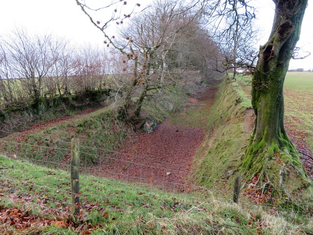
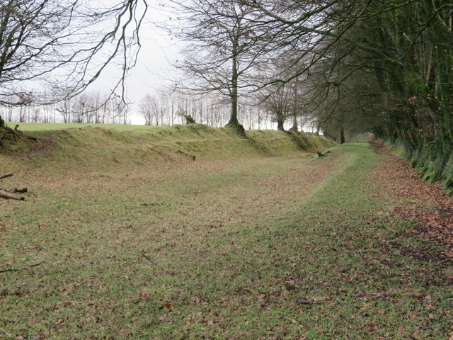
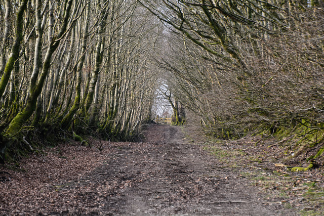
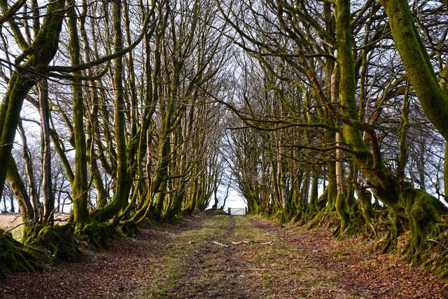
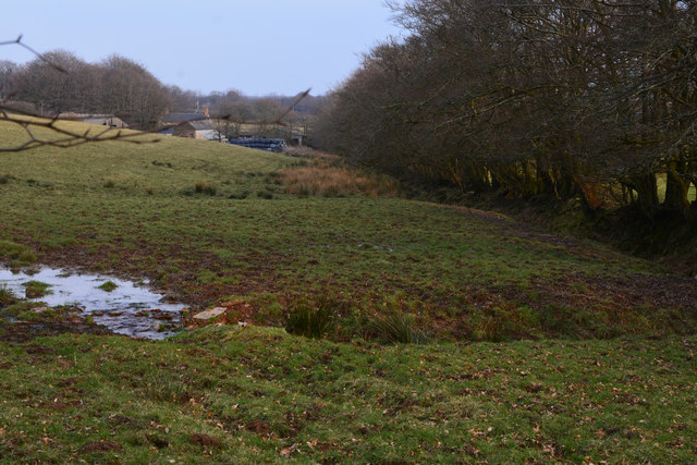
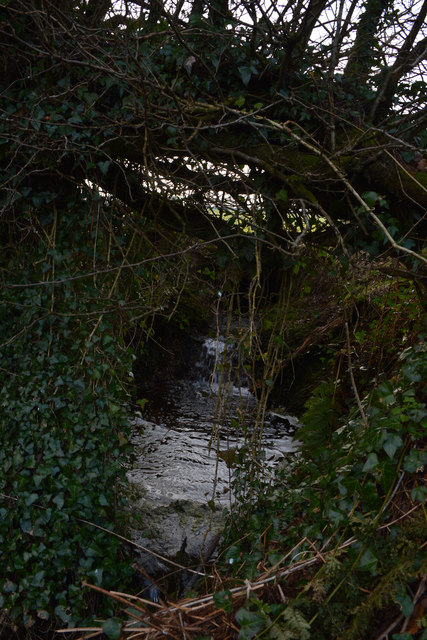
Broadfield Wood is characterized by a diverse range of tree species, including oak, beech, ash, and birch. The dense canopy of these majestic trees provides a tranquil and serene atmosphere, making it an ideal spot for peaceful walks and picnics. The forest floor is carpeted with a rich variety of wildflowers and ferns, adding to the enchanting beauty of the surroundings.

The wood is also home to a thriving ecosystem, with numerous species of birds, mammals, and insects inhabiting the area. Birdwatchers can spot woodland birds such as woodpeckers, owls, and warblers, while nature enthusiasts may come across deer, foxes, and badgers during their visit. The forest also plays host to a diverse range of butterflies and other insects, making it a paradise for insect enthusiasts and photographers.

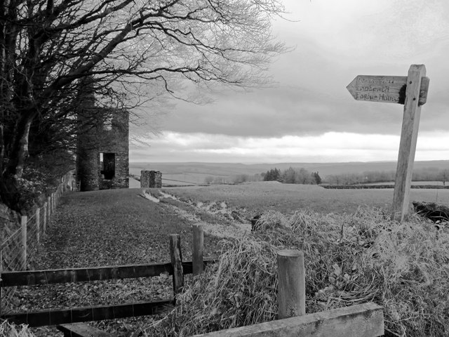
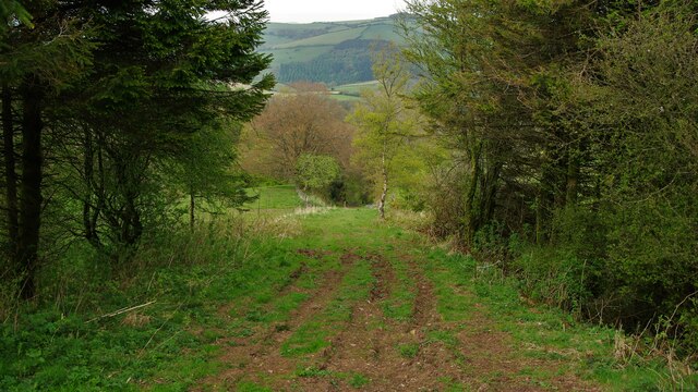
For those seeking more adventurous activities, there are several walking trails and cycling paths that wind their way through the wood, allowing visitors to explore its hidden gems at their own pace. The wood is also a popular spot for nature education programs and outdoor workshops, providing an opportunity for people of all ages to learn about and appreciate the natural world.

Overall, Broadfield Wood in Somerset is a captivating destination that offers a perfect blend of natural beauty, wildlife, and recreational activities, making it a must-visit for anyone seeking a peaceful escape into nature.

If you have any feedback on the listing, please let us know in the comments section below.

Broadfield Wood Images

Images are sourced within 2km of 51.111457/-3.3953395 or Grid Reference ST0235. Thanks to Geograph Open Source API. All images are credited.

Naked Boy's Stone A Grade II Listed mediaeval boundary stone marking the boundary between the parishes of old Cleeve and Brompton Regis. There is limited parking here for the permissive path to Burrow Farm engine house along the West Somerset Mineral Railway.
Naked Boy's Stone
A Grade II Listed mediaeval boundary stone marking the boundary between the parishes of old Cleeve and Brompton Regis. There is limited parking here for the permissive path to Burrow Farm engine house along the West Somerset Mineral Railway.
West Somerset Mineral Railway A long disused railway seen from the infilled Naked Boy Bridge.
West Somerset Mineral Railway
A long disused railway seen from the infilled Naked Boy Bridge.
Burrow Farm engine house The best preserved beam engine house on the Brendon Hills and Listed Grade II. The engine house was erected in 1879 for a third hand engine relocated from Langham Hill Pit and originating in South Wales. The engine was a 25" rotative beam engine for pumping and winding. The mine was for iron ore and closed in 1883 so this engine had a short life on site. The wall to the right is the remaining part of the miner's 'dry' where they would have dried their clothing. The hillock behind the wall is a spoil heap.
Burrow Farm engine house
The best preserved beam engine house on the Brendon Hills and Listed Grade II. The engine house was erected in 1879 for a third hand engine relocated from Langham Hill Pit and originating in South Wales. The engine was a 25" rotative beam engine for pumping and winding. The mine was for iron ore and closed in 1883 so this engine had a short life on site. The wall to the right is the remaining part of the miner's 'dry' where they would have dried their clothing. The hillock behind the wall is a spoil heap.
Burrow Farm engine house The best preserved beam engine house on the Brendon Hills and Listed Grade II. The engine house was erected in 1879 for a third hand engine relocated from Langham Hill Pit and originating in South Wales. The engine was a 25" rotative beam engine for pumping and winding. The mine was for iron ore and closed in 1883 so this engine had a short life on site.
Burrow Farm engine house
The best preserved beam engine house on the Brendon Hills and Listed Grade II. The engine house was erected in 1879 for a third hand engine relocated from Langham Hill Pit and originating in South Wales. The engine was a 25" rotative beam engine for pumping and winding. The mine was for iron ore and closed in 1883 so this engine had a short life on site.
Permissive path to Burrow Farm engine house The best preserved beam engine house on the Brendon Hills and Listed Grade II. The engine house was erected in 1879 for a third hand engine relocated from Langham Hill Pit and originating in South Wales. The engine was a 25" rotative beam engine for pumping and winding. The mine was for iron ore and closed in 1883 so this engine had a short life on site. The freestanding wall to the right is what remains of the miners' dry and is included in the listing.
Permissive path to Burrow Farm engine house
The best preserved beam engine house on the Brendon Hills and Listed Grade II. The engine house was erected in 1879 for a third hand engine relocated from Langham Hill Pit and originating in South Wales. The engine was a 25" rotative beam engine for pumping and winding. The mine was for iron ore and closed in 1883 so this engine had a short life on site. The freestanding wall to the right is what remains of the miners' dry and is included in the listing.
West Somerset Mineral Railway Seen from near Burrow Farm engine house.
West Somerset Mineral Railway
Seen from near Burrow Farm engine house.
Comberow Incline A view down an incline of the West Somerset Mineral Railway below the winch house
Comberow Incline
A view down an incline of the West Somerset Mineral Railway below the winch house
Steps down to the Winch House The winding equipment was below the rail level on the West Somerset Mineral Railway at the top of Comberow Incline
Steps down to the Winch House
The winding equipment was below the rail level on the West Somerset Mineral Railway at the top of Comberow Incline
Old Cleve : Road A small country lane.
Old Cleve : Road
A small country lane.
Old Cleve : Road A road heads through the countryside.
Old Cleve : Road
A road heads through the countryside.
West Somerset : Muddy Track A muddy track heading through the countryside.
West Somerset : Muddy Track
A muddy track heading through the countryside.
West Somerset : Small Track A small track and footpath heading towards the B3224.
West Somerset : Small Track
A small track and footpath heading towards the B3224.
West Somerset : Naked Boy's Stone HE NAKED BOY, SMITHHAYES ST 015 345 is in the corner of a field at the junction of four parishes Line drawings of it, when it was still in one piece, show an oddly curved stone with a large base and smaller top roughly pyramid shaped. It name may come from its status as a boundary stone. Boys were sometimes whipped at the boundaries, so they would never forget them. Possibly they were placed naked on this stone. The Naked Boy goes down to drink at the Beverton pond, the source of the River Tone, at midnight. The Naked Boy, a bronze age standing stone by the roadside. It has been used to mark the point where four parishes meet - Treborough, Old Cleeve, Kings Brompton and Withiel Florey. Leather Barrow, a bronze age round barrow standing about 10 ft high on the line of the boundary of Luxborough and Treborough parishes and adjacent to the Brendon ridgeway.
West Somerset : Naked Boy's Stone
HE NAKED BOY, SMITHHAYES ST 015 345 is in the corner of a field at the junction of four parishes Line drawings of it, when it was still in one piece, show an oddly curved stone with a large base and smaller top roughly pyramid shaped. It name may come from its status as a boundary stone. Boys were sometimes whipped at the boundaries, so they would never forget them. Possibly they were placed naked on this stone. The Naked Boy goes down to drink at the Beverton pond, the source of the River Tone, at midnight. The Naked Boy, a bronze age standing stone by the roadside. It has been used to mark the point where four parishes meet - Treborough, Old Cleeve, Kings Brompton and Withiel Florey. Leather Barrow, a bronze age round barrow standing about 10 ft high on the line of the boundary of Luxborough and Treborough parishes and adjacent to the Brendon ridgeway.
West Somerset : Grassy Field & Trees The sun setting behind the trees.
West Somerset : Grassy Field & Trees
The sun setting behind the trees.
West Somerset : The B3190 A road heading through West Somerset.
West Somerset : The B3190
A road heading through West Somerset.
West Somerset : Grassy Field A grassy field near the source of the River Tone in West Somerset.
West Somerset : Grassy Field
A grassy field near the source of the River Tone in West Somerset.
West Somerset : The River Tone Near the source of the River Tone, the stream heads under the road and through the countryside.
West Somerset : The River Tone
Near the source of the River Tone, the stream heads under the road and through the countryside.
Show me another place!

Broadfield Wood is located at Grid Ref: ST0235 (Lat: 51.111457, Lng: -3.3953395)

Administrative County: Somerset

District: Somerset West and Taunton

Police Authority: Avon and Somerset

What 3 Words

///clogging.confused.roosts. Near Williton, Somerset

Related Wikis

Comberow railway station

Comberow was an intermediate station on the West Somerset Mineral Railway (WSMR), which was built primarily to carry iron ore from mines to Watchet harbour...

Brendon Hill railway station

Brendon Hill (occasionally referred to as "Raleigh's Cross") was an intermediate station on the West Somerset Mineral Railway (WSMR), which was built primarily...

Treborough

Treborough is a small village and civil parish 7 miles (11 km) south of Dunster, lying amongst the Brendon Hills within the Exmoor National Park in the...

St Peter's Church, Treborough

The Anglican St Peter's Church at Treborough within the English county of Somerset dates from the 14th century. It is a Grade II* listed building.Although...

Church of St Peter, Williton

The Anglican Church of St Peter in Williton in the English county of Somerset is recorded in the National Heritage List for England as a designated Grade...

Roadwater railway station

The Roadwater railway station was an intermediate station on the West Somerset Mineral Railway (WSMR), which was built primarily to carry iron ore from...

Roadwater

Roadwater is a village 3 miles (5 km) south-west of Williton, on the northern edge of the Exmoor National Park, in Somerset, England. == History == The...

Clitsome railway station

Clitsome was a recognised stopping place, not a formal station, on the West Somerset Mineral Railway (WSMR). The railway's prime purpose was to carry iron...

Have you been to Broadfield Wood?

Leave your review of Broadfield Wood below (or comments, questions and feedback).