Counterland Copse

Wood, Forest in Devon East Devon

England

Counterland Copse

Footbridge over a Stream A gated footbridge over a stream near the River Clyst in Devon. The foot bridge is part of a public footpath in the Clyst St Lawrence Country Park running from Clyst St Lawrence to Clyst Hydon.
Footbridge over a Stream Credit: John P Reeves

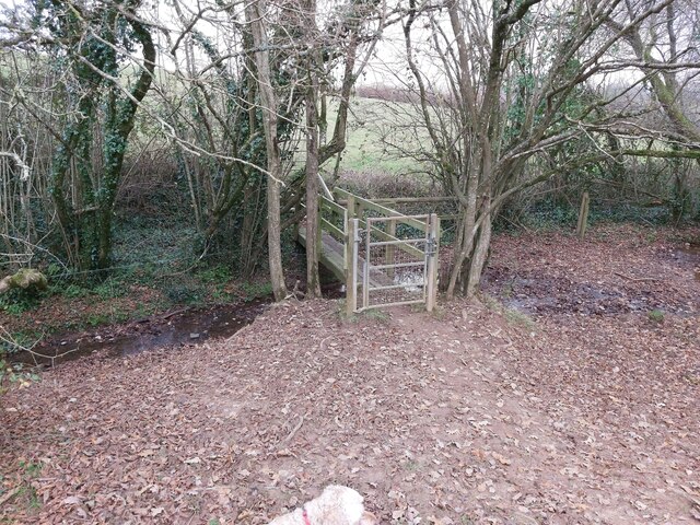
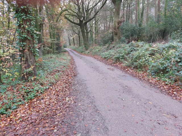
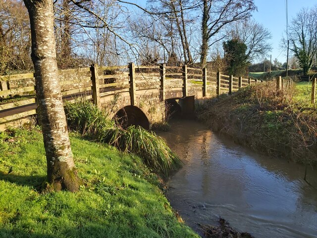
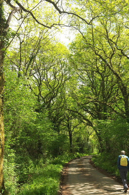
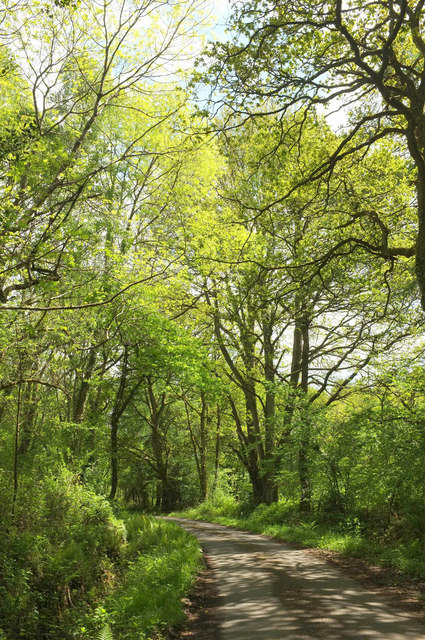
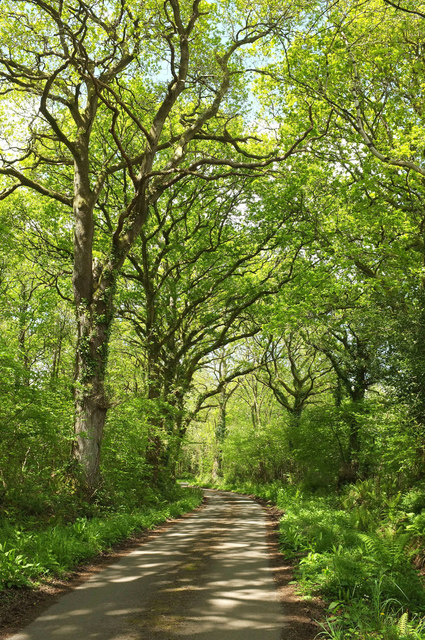
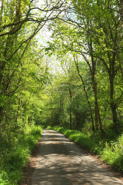
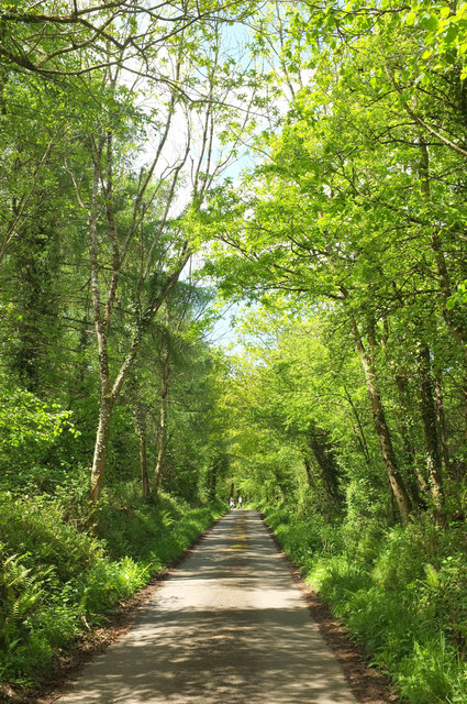
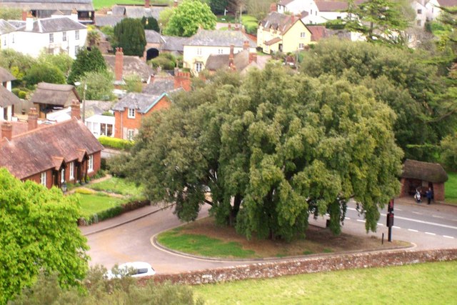
Counterland Copse is a picturesque woodland located in the county of Devon, in southwestern England. Situated near the village of Counterland, this enchanting forest covers an area of approximately 100 acres, making it a significant natural landmark in the region.

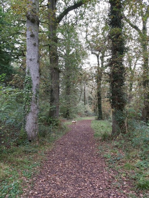
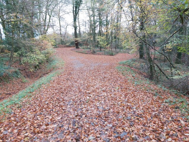
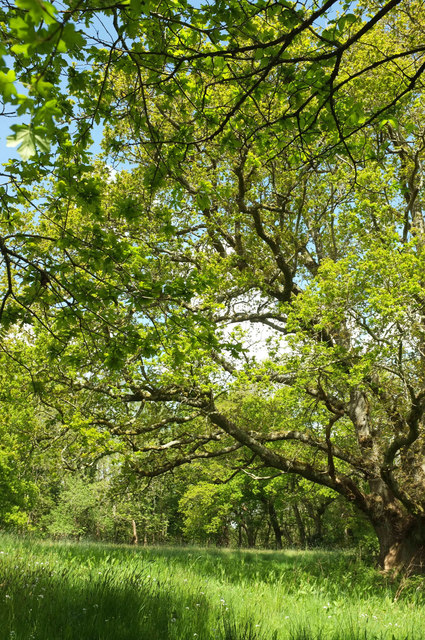
The copse is characterized by a rich diversity of tree species, including oak, beech, birch, and ash. The dense vegetation creates a lush and vibrant environment, providing a habitat for various wildlife species such as deer, rabbits, squirrels, and a wide array of bird species. The forest floor is carpeted with a myriad of wildflowers and ferns, adding to its natural beauty.

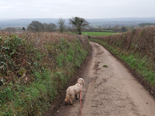
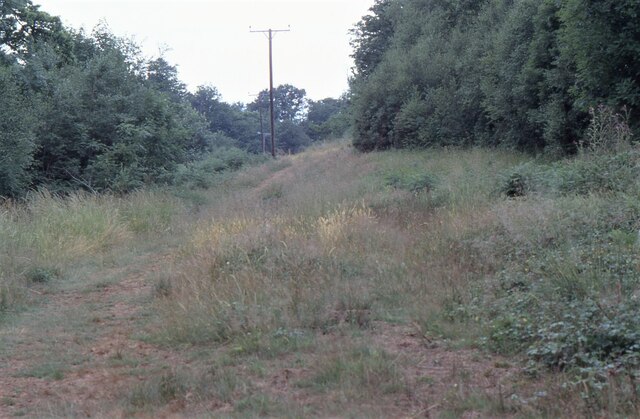
Visitors to Counterland Copse can enjoy a tranquil and serene experience, as the woodland is relatively untouched by human activity. It offers numerous walking trails, allowing nature enthusiasts to explore its hidden treasures and discover its unique flora and fauna. The dense foliage also provides shade and shelter, making it an ideal spot for picnics and nature walks, especially during the warmer months.

The copse is also steeped in history, with remnants of ancient settlements and burial grounds found within its boundaries. It is believed that the area has been inhabited for centuries, and the copse itself holds significant cultural and archaeological value.

Counterland Copse is a true gem of Devon, offering visitors a chance to immerse themselves in the beauty of nature, explore its rich biodiversity, and appreciate the historical significance of the area.

If you have any feedback on the listing, please let us know in the comments section below.

Counterland Copse Images

Images are sourced within 2km of 50.790092/-3.4010129 or Grid Reference SY0199. Thanks to Geograph Open Source API. All images are credited.

Footbridge over a Stream A gated footbridge over a stream near the River Clyst in Devon. The foot bridge is part of a public footpath in the Clyst St Lawrence Country Park running from Clyst St Lawrence to Clyst Hydon.
Footbridge over a Stream
A gated footbridge over a stream near the River Clyst in Devon. The foot bridge is part of a public footpath in the Clyst St Lawrence Country Park running from Clyst St Lawrence to Clyst Hydon.
Country Lane near Hoop-Cross A country road between Sherways Farm and Hoop-Cross in the Clyst St Lawrence Country Park in Devon.
Country Lane near Hoop-Cross
A country road between Sherways Farm and Hoop-Cross in the Clyst St Lawrence Country Park in Devon.
Woodland Path One of the many woodland paths through the National Trust Ashclyst Forest situated north of Broadclyst and east of the M5 in Devon.
Woodland Path
One of the many woodland paths through the National Trust Ashclyst Forest situated north of Broadclyst and east of the M5 in Devon.
Woodland Path A leaf covered woodland path in Paradise Copse, a National Trust Woodland just west of Clyst Hydon in Devon.
Woodland Path
A leaf covered woodland path in Paradise Copse, a National Trust Woodland just west of Clyst Hydon in Devon.
Minor Road through Woodland This minor road cuts through the National Trust woodland of Whitedown Copse and Paradise Copse just west of Clyst Hydon in Devon.
Minor Road through Woodland
This minor road cuts through the National Trust woodland of Whitedown Copse and Paradise Copse just west of Clyst Hydon in Devon.
Metal Swing gate A metal swing gate, near Scorlinch Farm, on the public footpath running between Clyst Hydon and Clyst St Lawrence in Devon.
Metal Swing gate
A metal swing gate, near Scorlinch Farm, on the public footpath running between Clyst Hydon and Clyst St Lawrence in Devon.
Farm Cottage The farm cottage at Scorlinch Farm near Clyst St Lawrence in Devon.
Farm Cottage
The farm cottage at Scorlinch Farm near Clyst St Lawrence in Devon.
Ashclyst Forest Somewhere on the 'Red Walk' within Ashclyst Forest. The forest ride was alive with butterflies.
Ashclyst Forest
Somewhere on the 'Red Walk' within Ashclyst Forest. The forest ride was alive with butterflies.
St Lawrence Church in Devon A view of the front of St Lawrence Church in Clyst St Lawrence in Devon as viewed from the entrance path from the country lane that runs through the village.
St Lawrence Church in Devon
A view of the front of St Lawrence Church in Clyst St Lawrence in Devon as viewed from the entrance path from the country lane that runs through the village.
St Lawrence Church in Devon A distant view of St Lawrence Church in Clyst St Lawrence in Devon as viewed from a nearby public footpath.
St Lawrence Church in Devon
A distant view of St Lawrence Church in Clyst St Lawrence in Devon as viewed from a nearby public footpath.
Bridge over a River A view of the road bridge over the River Clyst in Clyst St Lawrence in Devon. Clyst is an Old English word meaning clear water.
Bridge over a River
A view of the road bridge over the River Clyst in Clyst St Lawrence in Devon. Clyst is an Old English word meaning clear water.
Entrance to a Farm  A gated entrance to a farm as viewed from the country lane running through the village of Clyst St Lawrence in Devon.
Entrance to a Farm
A gated entrance to a farm as viewed from the country lane running through the village of Clyst St Lawrence in Devon.
Lane from Rewes Cross Looking in the opposite direction from where <a href="https://www.geograph.org.uk/photo/5775404">SX9999 : Rewes Cross</a> was taken, down a delightful lane almost entirely free of traffic.
Lane from Rewes Cross
Looking in the opposite direction from where SX9999 : Rewes Cross was taken, down a delightful lane almost entirely free of traffic.
Lane across Merry Downs Further east from <a href="https://www.geograph.org.uk/photo/5775407">SY0099 : Lane from Rewes Cross</a> along the quiet lane through Ashclyst Forest to Caddihoe.
Lane across Merry Downs
Further east from SY0099 : Lane from Rewes Cross along the quiet lane through Ashclyst Forest to Caddihoe.
Lane to Rewes Cross Looking in the opposite direction from where <a href="https://www.geograph.org.uk/photo/5775417">SY0099 : Lane across Merry Downs</a> was taken, and therefore a reverse view of <a href="https://www.geograph.org.uk/photo/5775407">SY0099 : Lane from Rewes Cross</a>; the junction is just about visible around the bend.
Lane to Rewes Cross
Looking in the opposite direction from where SY0099 : Lane across Merry Downs was taken, and therefore a reverse view of SY0099 : Lane from Rewes Cross; the junction is just about visible around the bend.
Lane, Ashclyst Forest The quiet lane shown in <a href="https://www.geograph.org.uk/photo/5775417">SY0099 : Lane across Merry Downs</a> approaches Snaffle Park Gate.
Lane, Ashclyst Forest
The quiet lane shown in SY0099 : Lane across Merry Downs approaches Snaffle Park Gate.
Lane across Merry Downs Looking in the opposite direction from where <a href="https://www.geograph.org.uk/photo/5775438">SY0099 : Lane, Ashclyst Forest</a> was taken.
Lane across Merry Downs
Looking in the opposite direction from where SY0099 : Lane, Ashclyst Forest was taken.
Oak tree, Merry Downs In a meadow by the lane shown in <a href="https://www.geograph.org.uk/photo/5775443">SY0099 : Lane across Merry Downs</a>.
Oak tree, Merry Downs
In a meadow by the lane shown in SY0099 : Lane across Merry Downs.
Show me another place!

Counterland Copse is located at Grid Ref: SY0199 (Lat: 50.790092, Lng: -3.4010129)

Administrative County: Devon

District: East Devon

Police Authority: Devon and Cornwall

What 3 Words

///puns.camcorder.punctured. Near Whimple, Devon

Nearby Locations

Counterland Copse

Related Wikis

Devon Redlands

The Devon Redlands is a natural region in southwest Britain that has been designated as National Character Area (NCA) 148 by Natural England. == Extent... ==

Clyst St Lawrence

Clyst St Lawrence is a village and civil parish about 8 miles north-east of the city of Exeter in the county of Devon, England. Historically it formed...

Clyst Hydon

Clyst Hydon is a village and civil parish in the county of Devon, England. It was in the Cliston Hundred and has a church dedicated to St Andrew. The parish...

Beare

Beare is a village in the civil parish of Broadclyst in Devon, England. == References == == External links == Media related to Beare at Wikimedia Commons

Aunk

Aunk (anciently Anke) is a small hamlet and former manor in the parish of Clyst Hydon in East Devon, England. The place-name is of Celtic origin along...

Hele, Devon

Hele is a village in Devon, England, lying about one mile (1.6 km) SSW of Bradninch and 10 miles (16 km) NNE of Exeter, on the River Culm. The village...

Broadclyst

Broadclyst is a village and civil parish in the East Devon local government district. It lies approximately 5 miles northeast of the city of Exeter, Devon...

Killerton

Killerton is an 18th-century house in Broadclyst, Exeter, Devon, England, which, with its hillside garden and estate, has been owned by the National Trust...

Nearby Amenities

Located within 500m of 50.790092,-3.4010129
Claponmill Cross
Junction: yes
Lat/Long: 50.788558/-3.394401
Give Way
Direction: backward
Lat/Long: 50.7907771/-3.3968648
Give Way
Direction: backward
Lat/Long: 50.7885626/-3.3944435
Brand: National Grid
Brand Wikidata: Q1465461
Material: wood
Operator: National Grid Electricity Distribution Plc
Operator Old: Western Power Distribution
Operator Wikidata: Q7988183
Owner: National Grid Electricity Distribution (South West) Plc
Owner Wikidata: Q114397866
Power: pole
Lat/Long: 50.7882506/-3.3946279
Brand: National Grid
Brand Wikidata: Q1465461
Guyed: yes
Location Transition: yes
Material: wood
Operator: National Grid Electricity Distribution Plc
Operator Old: Western Power Distribution
Operator Wikidata: Q7988183
Owner: National Grid Electricity Distribution (South West) Plc
Owner Wikidata: Q114397866
Power: pole
Lat/Long: 50.788474/-3.395118
Colour: white
Description: Roadside signpost
Foot: yes
Horse: yes
Information: guidepost
Material: wood
Operator: East Devon District Council
Tourism: information
Vehicle: yes
Lat/Long: 50.7884897/-3.3944106
The data included in this document is from www.openstreetmap.org. The data is made available under ODbL.

Have you been to Counterland Copse?

Leave your review of Counterland Copse below (or comments, questions and feedback).