White Down Copse

Wood, Forest in Devon East Devon

England

White Down Copse

The M5 north at B 245.5 marker
The M5 north at B 245.5 marker Credit: Roy Hughes

White Down Copse is a picturesque woodland located in the county of Devon, England. Situated near the village of Devon, this enchanting copse covers an area of approximately 20 acres and is known for its diverse ecosystem and natural beauty.

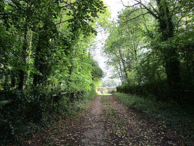
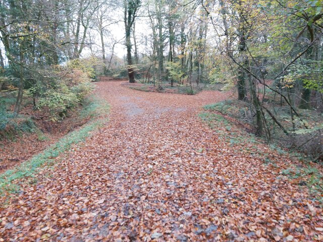
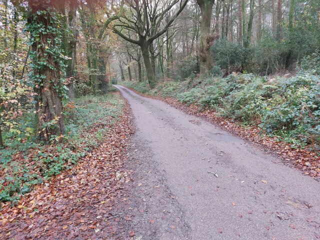
The copse is primarily composed of deciduous trees, such as oak, beech, and ash, which provide a lush canopy and create a serene atmosphere. The forest floor is covered with a variety of wildflowers, ferns, and mosses, adding to the copse's enchanting charm.

White Down Copse is home to a wide range of wildlife, including various bird species, such as woodpeckers, owls, and songbirds. Mammals like badgers, foxes, and squirrels also inhabit the copse, while reptiles like snakes and lizards can be spotted basking in the sunlight.

The copse is intersected by a small stream, which adds to its tranquil ambiance. The stream is teeming with small fish and provides a refreshing spot for visitors to sit and enjoy the sounds of nature.

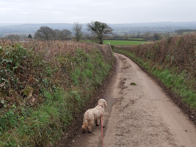
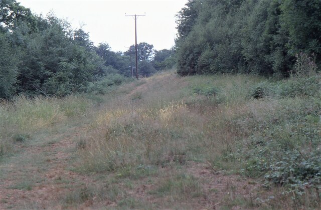
White Down Copse is a popular destination for nature lovers and hikers who enjoy exploring its well-maintained footpaths. These paths wind through the copse, providing visitors with the opportunity to immerse themselves in its natural splendor.

The copse is open to the public year-round, offering visitors the chance to witness the changing seasons and experience the different moods of the woodland. With its abundance of wildlife, breathtaking scenery, and peaceful atmosphere, White Down Copse is a true gem of Devon's natural landscape.

If you have any feedback on the listing, please let us know in the comments section below.

White Down Copse Images

Images are sourced within 2km of 50.802967/-3.4139292 or Grid Reference ST0001. Thanks to Geograph Open Source API. All images are credited.

The M5 north at B 245.5 marker
Track through woodland near Beare
Hele : River Culm The River Culm in the floodplain and has burst its banks.
Hele : River Culm
The River Culm in the floodplain and has burst its banks.
Hele : Station Road A van heading along a wet Station Road.
Hele : Station Road
A van heading along a wet Station Road.
Hele : Bristol to Exeter Railway Line A GWR train heads through floodwater at a slow pace.
Hele : Bristol to Exeter Railway Line
A GWR train heads through floodwater at a slow pace.
Hele : Station Road The Bristol to Exeter rail line at Station Road.
Hele : Station Road
The Bristol to Exeter rail line at Station Road.
Hele : Bristol to Exeter Railway Line A GWR train approaches.
Hele : Bristol to Exeter Railway Line
A GWR train approaches.
Hele : Station Road At the railway crossing.
Hele : Station Road
At the railway crossing.
Broad Clyst: The Antique Village
Country Lane near Hoop-Cross A country road between Sherways Farm and Hoop-Cross in the Clyst St Lawrence Country Park in Devon.
Country Lane near Hoop-Cross
A country road between Sherways Farm and Hoop-Cross in the Clyst St Lawrence Country Park in Devon.
Woodland Path A leaf covered woodland path in Paradise Copse, a National Trust Woodland just west of Clyst Hydon in Devon.
Woodland Path
A leaf covered woodland path in Paradise Copse, a National Trust Woodland just west of Clyst Hydon in Devon.
Minor Road through Woodland This minor road cuts through the National Trust woodland of Whitedown Copse and Paradise Copse just west of Clyst Hydon in Devon.
Minor Road through Woodland
This minor road cuts through the National Trust woodland of Whitedown Copse and Paradise Copse just west of Clyst Hydon in Devon.
Ashclyst Forest Somewhere on the 'Red Walk' within Ashclyst Forest. The forest ride was alive with butterflies.
Ashclyst Forest
Somewhere on the 'Red Walk' within Ashclyst Forest. The forest ride was alive with butterflies.
M5 straight near Beare
M5 at bridge over farm track
M5 crossing Station Road at Hele
Farmland
Farmland
Near Clyst Hayes
Near Clyst Hayes
Show me another place!

White Down Copse is located at Grid Ref: ST0001 (Lat: 50.802967, Lng: -3.4139292)

Administrative County: Devon

District: East Devon

Police Authority: Devon and Cornwall

What 3 Words

///glossed.silk.forced. Near Bradninch, Devon

Related Wikis

Devon Redlands

The Devon Redlands is a natural region in southwest Britain that has been designated as National Character Area (NCA) 148 by Natural England. == Extent... ==

Hele, Devon

Hele is a village in Devon, England, lying about one mile (1.6 km) SSW of Bradninch and 10 miles (16 km) NNE of Exeter, on the River Culm. The village...

Beare

Beare is a village in the civil parish of Broadclyst in Devon, England. == References == == External links == Media related to Beare at Wikimedia Commons

Bradninch Guildhall

Bradninch Guildhall is a municipal building in Fore Street, Bradninch, Devon, England. The structure, which is now used as a community events venue, is...

Clyst St Lawrence

Clyst St Lawrence is a village and civil parish about 8 miles north-east of the city of Exeter in the county of Devon, England. Historically it formed...

Clyst Hydon

Clyst Hydon is a village and civil parish in the county of Devon, England. It was in the Cliston Hundred and has a church dedicated to St Andrew. The parish...

Killerton

Killerton is an 18th-century house in Broadclyst, Exeter, Devon, England, which, with its hillside garden and estate, has been owned by the National Trust...

Bradninch

Bradninch is a small town, civil parish and manor in Devon, England, lying about 3 mi (5 km) south of Cullompton. Much of the surrounding farmland belongs...

Nearby Amenities

Located within 500m of 50.802967,-3.4139292
Barrier: swing_gate
Foot: yes
Horse: yes
Swing Gate Type: single
Vehicle: private
Lat/Long: 50.8008008/-3.4119697
Craft: beekeeper
Lat/Long: 50.8033047/-3.418265
Brand: National Grid
Brand Wikidata: Q1465461
Material: wood
Operator: National Grid Electricity Distribution Plc
Operator Old: Western Power Distribution
Operator Wikidata: Q7988183
Owner: National Grid Electricity Distribution (South West) Plc
Owner Wikidata: Q114397866
Power: pole
Lat/Long: 50.8003408/-3.4151602
Brand: National Grid
Brand Wikidata: Q1465461
Material: wood
Operator: National Grid Electricity Distribution Plc
Operator Old: Western Power Distribution
Operator Wikidata: Q7988183
Owner: National Grid Electricity Distribution (South West) Plc
Owner Wikidata: Q114397866
Power: pole
Lat/Long: 50.8000628/-3.4160909
Brand: National Grid
Brand Wikidata: Q1465461
Material: wood
Operator: National Grid Electricity Distribution Plc
Operator Old: Western Power Distribution
Operator Wikidata: Q7988183
Owner: National Grid Electricity Distribution (South West) Plc
Owner Wikidata: Q114397866
Power: pole
Lat/Long: 50.7996746/-3.4174454
Access: private
Door: hinged
Door Type: double
Entrance: yes
Lat/Long: 50.8002909/-3.4135298
The data included in this document is from www.openstreetmap.org. The data is made available under ODbL.

Have you been to White Down Copse?

Leave your review of White Down Copse below (or comments, questions and feedback).