Lower Gamblyn Wood

Wood, Forest in Somerset Somerset West and Taunton

England

Lower Gamblyn Wood

On Post Lane, heading south
On Post Lane, heading south Credit: Rob Purvis

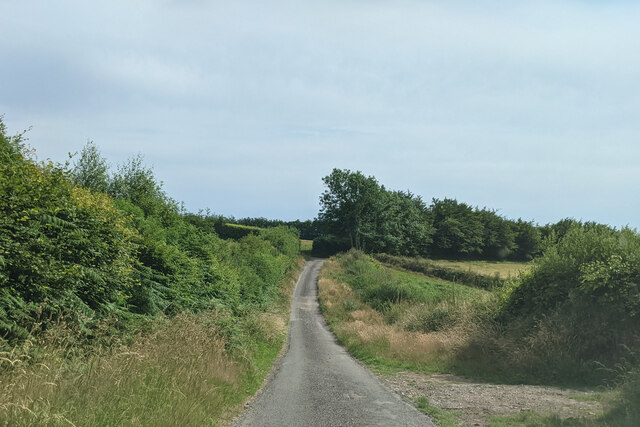
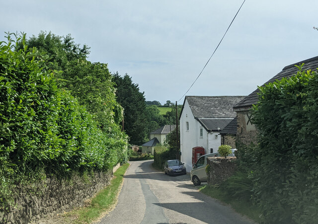
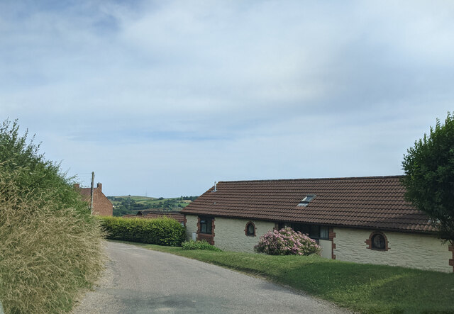
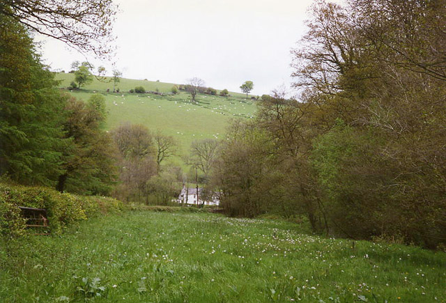
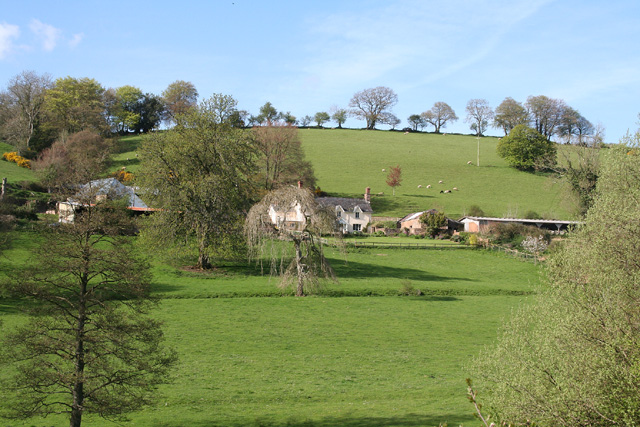
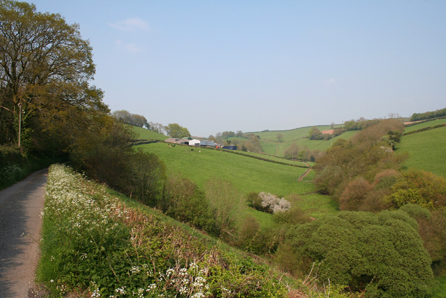
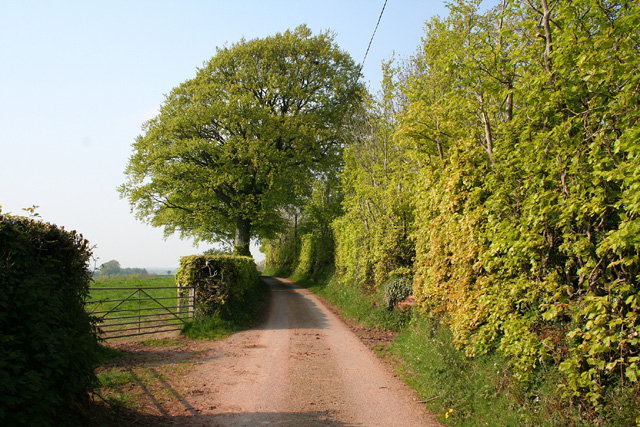
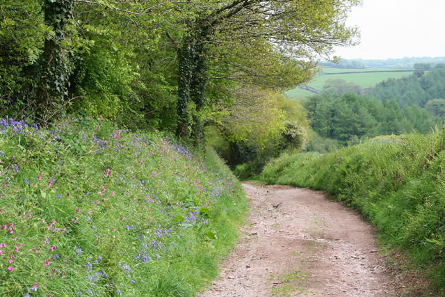
Lower Gamblyn Wood is a picturesque woodland located in Somerset, England. Spread over an area of approximately 100 acres, it is nestled in the heart of the county, offering visitors a tranquil and immersive experience in nature.

One of the notable features of Lower Gamblyn Wood is its diverse range of tree species. The wood is predominantly composed of broadleaf trees, including oak, beech, and ash. These majestic trees provide shade and shelter for a variety of wildlife, making it an ideal habitat for birds, small mammals, and insects.

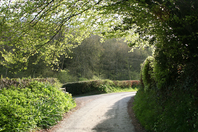
The woodland is crisscrossed by a network of well-maintained footpaths, allowing visitors to explore its beauty at their own pace. As visitors wander through the wood, they can enjoy the peaceful atmosphere and immerse themselves in the natural surroundings. The wood also offers opportunities for wildlife spotting, with several bird hides strategically placed throughout the area.

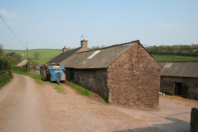
In addition to its natural beauty, Lower Gamblyn Wood also has historical significance. It has been managed as a working woodland for centuries, with evidence of charcoal production dating back to the medieval period. This rich history is reflected in the wood's management practices, which aim to preserve its ecological value while also allowing for sustainable timber production.

Overall, Lower Gamblyn Wood is a haven for nature enthusiasts and those seeking an escape from the hustle and bustle of everyday life. With its diverse flora and fauna, well-maintained footpaths, and historical significance, it offers a unique and enriching experience for visitors of all ages.

If you have any feedback on the listing, please let us know in the comments section below.

Lower Gamblyn Wood Images

Images are sourced within 2km of 51.033376/-3.4227144 or Grid Reference ST0026. Thanks to Geograph Open Source API. All images are credited.

On Post Lane, heading south
Houses, cars and a public telephone box at Skilgate
Hone Cross lane junction, looking south
House at Old Hayes
House at Old Hayes
Bampton: near Raddington In the Batherm valley near Batherm Bridge
Bampton: near Raddington
In the Batherm valley near Batherm Bridge
Upton: by Lotley Farm Looking south near the entrance to Lotley Farm
Upton: by Lotley Farm
Looking south near the entrance to Lotley Farm
Chipstable: Washers Farm Looking north-north-east. The farm faces south in an east-west valley; below it a stream runs westwards from Raddington to join the Batherm near Batherm Bridge
Chipstable: Washers Farm
Looking north-north-east. The farm faces south in an east-west valley; below it a stream runs westwards from Raddington to join the Batherm near Batherm Bridge
Upton: by the entrance to Ranscombe Farm Looking north west on the lane from Blackwell to Skilgate
Upton: by the entrance to Ranscombe Farm
Looking north west on the lane from Blackwell to Skilgate
Skilgate: near Bittescombe Hill Farm Looking north east on the lane from Blackwell
Skilgate: near Bittescombe Hill Farm
Looking north east on the lane from Blackwell
Skilgate: Bittescombe Hill Farm Farm buildings by the lane from Blackwell to Heydon Hill. Looking east
Skilgate: Bittescombe Hill Farm
Farm buildings by the lane from Blackwell to Heydon Hill. Looking east
Skilgate: lane with beech tree and hedge Looking north-north-east
Skilgate: lane with beech tree and hedge
Looking north-north-east
Skilgate: the road from Lowtrow Cross Looking south-south-west
Skilgate: the road from Lowtrow Cross
Looking south-south-west
Skilgate: bridleway from Haddon End Looking east-north-east. The track leads to Dulverton Lane and Heydon Hill
Skilgate: bridleway from Haddon End
Looking east-north-east. The track leads to Dulverton Lane and Heydon Hill
St Michael's church, Raddington Isolated from lanes, the C13 church <span class="nowrap"><a title="http://webapp1.somerset.gov.uk/her/details.asp?prn=41129" rel="nofollow ugc noopener" href="http://webapp1.somerset.gov.uk/her/details.asp?prn=41129">Link</a><img style="margin-left:2px;" alt="External link" title="External link - shift click to open in new window" src="https://s1.geograph.org.uk/img/external.png" width="10" height="10"/></span> sits on the lower slopes of a deep valley, Raddington Bottom. Seen from a gateway on Hill Lane.
St Michael's church, Raddington
Isolated from lanes, the C13 church LinkExternal link sits on the lower slopes of a deep valley, Raddington Bottom. Seen from a gateway on Hill Lane.
Gate with a view, Hill Lane The gate from which <a href="https://www.geograph.org.uk/photo/1957956">ST0226 : St Michael's church, Raddington</a>, visible on the left, was taken. Hill Lane  continues into <a href="https://www.geograph.org.uk/gridref/ST0126">ST0126</a> on the right, but after various twists and turns, during which it becomes Churchill Lane, keeps left of the church.
Gate with a view, Hill Lane
The gate from which ST0226 : St Michael's church, Raddington, visible on the left, was taken. Hill Lane continues into ST0126 on the right, but after various twists and turns, during which it becomes Churchill Lane, keeps left of the church.
Hill Lane At the right-angled bend to the left, where a track continues ahead, Hill Lane becomes Churchill Lane, which continues the tortuous descent from the ridge to Raddington Bottom.
Hill Lane
At the right-angled bend to the left, where a track continues ahead, Hill Lane becomes Churchill Lane, which continues the tortuous descent from the ridge to Raddington Bottom.
Hill Lane A view up the stretch of lane shown looking downhill in <a href="https://www.geograph.org.uk/photo/1958069">ST0126 : Hill Lane</a>, from a right-angled bend where it becomes Churchill Lane. The pale beech leaves in the hedges almost give the illusion of sunshine.
Hill Lane
A view up the stretch of lane shown looking downhill in ST0126 : Hill Lane, from a right-angled bend where it becomes Churchill Lane. The pale beech leaves in the hedges almost give the illusion of sunshine.
St Michael's church, Raddington A much closer view of <a href="https://www.geograph.org.uk/photo/1957956">ST0226 : St Michael's church, Raddington</a> from the south side but, unlike that image, taken out of square. <span class="nowrap"><a title="http://webapp1.somerset.gov.uk/her/details.asp?prn=41129" rel="nofollow ugc noopener" href="http://webapp1.somerset.gov.uk/her/details.asp?prn=41129">Link</a><img style="margin-left:2px;" alt="External link" title="External link - shift click to open in new window" src="https://s1.geograph.org.uk/img/external.png" width="10" height="10"/></span> . Formerly a parish in its own right, and united with Chipstable in 1929, Raddington is now a "chapelry within a parish".
St Michael's church, Raddington
A much closer view of ST0226 : St Michael's church, Raddington from the south side but, unlike that image, taken out of square. LinkExternal link . Formerly a parish in its own right, and united with Chipstable in 1929, Raddington is now a "chapelry within a parish".
Show me another place!

Lower Gamblyn Wood is located at Grid Ref: ST0026 (Lat: 51.033376, Lng: -3.4227144)

Administrative County: Somerset

District: Somerset West and Taunton

Police Authority: Avon and Somerset

What 3 Words

///mule.tradition.vibes. Near Wiveliscombe, Somerset

Related Wikis

Church of St John, Skilgate

The Anglican Church of St John in Skilgate, Somerset, England was built in the 14th century. It is a Grade II* listed building. == History == The church...

Skilgate

Skilgate is a village and civil parish 5 miles (8 km) east of Dulverton and 8 miles (13 km) west of Wiveliscombe in the Somerset West and Taunton district...

Upton, Somerset

Upton is a village and civil parish north of Skilgate in Somerset, England. It is situated on a hill above the eastern end of Wimbleball Lake. == History... ==

Petton, Devon

Petton, also known as Petton Cross, is an English village in the civil parish of Bampton, the district of Mid Devon, and the county of Devon. It lies on...

Old Church of St James, Upton

The Old St James's Church is a former church in the village of Upton, Somerset, England, of which only the tower remains, overlooking Wimbleball Lake....

Shillingford, Devon

Shillingford is a village two miles (3 km) northeast of Bampton on the River Batherm in Mid Devon, England, close to the border with West Somerset. It...

Church of All Saints, Chipstable

The Church of All Saints is an Anglican church in Chipstable, Somerset, England which probably dates from the early 13th century. It is located in the...

Chipstable

Chipstable is a village and civil parish in Somerset, England, situated beside Heydon Hill 10 miles (16.1 km) west of Taunton. The parish has a population...

Have you been to Lower Gamblyn Wood?

Leave your review of Lower Gamblyn Wood below (or comments, questions and feedback).