Clatworthy

Settlement in Somerset Somerset West and Taunton

England

Clatworthy

Clatworthy Church
Clatworthy Church Credit: Nick Chipchase

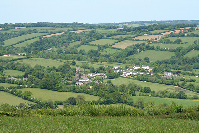
Clatworthy is a small village nestled in the picturesque countryside of Somerset, England. Located approximately 8 miles southwest of the county town of Taunton, Clatworthy offers a peaceful and idyllic setting for its residents and visitors alike.

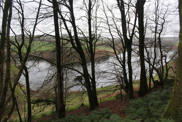
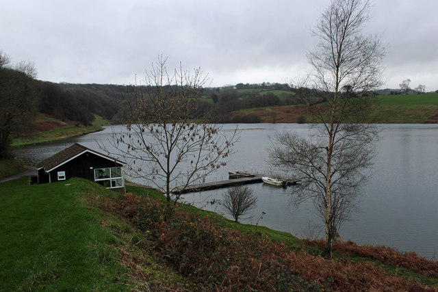
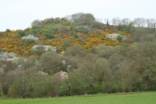
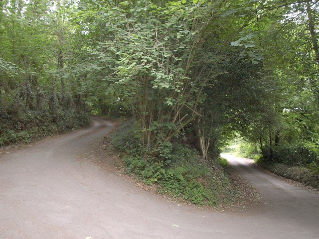
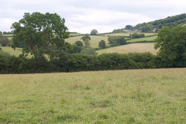
The village is surrounded by rolling hills, lush green fields, and dense woodlands, providing ample opportunities for outdoor activities such as hiking, cycling, and birdwatching. Clatworthy Reservoir, a large body of water located to the west of the village, is a popular spot for fishing and sailing enthusiasts.

The architecture in Clatworthy reflects its rural charm, with a mix of traditional thatched cottages and stone houses dotted throughout the village. The community is close-knit, with a friendly atmosphere and a strong sense of community spirit.

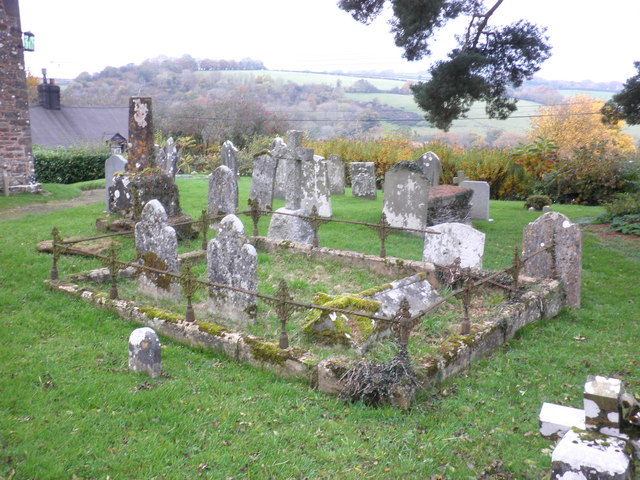
Despite its small size, Clatworthy has a few amenities to cater to the needs of its residents. The village boasts a village hall, hosting various social events and gatherings, as well as a quaint village church. Additionally, a nearby farm shop provides locals with fresh and locally sourced produce.

Clatworthy is also conveniently located close to the bustling market town of Taunton, which offers a wider range of amenities including shops, supermarkets, schools, and healthcare facilities.

Overall, Clatworthy is a charming and peaceful village, perfect for those seeking a tranquil countryside retreat while still having access to nearby amenities and attractions.

If you have any feedback on the listing, please let us know in the comments section below.

Clatworthy Images

Images are sourced within 2km of 51.069302/-3.353726 or Grid Reference ST0530. Thanks to Geograph Open Source API. All images are credited.

Clatworthy Church
Clatworthy Church
Clatworthy Church
Clatworthy Church
Waysdown Copse and Clatworthy Reservoir
Pontoon on Clatworthy Reservoir
Oak apples in Waysdown Copse Clatworthy Reservoir beyond.
Oak apples in Waysdown Copse
Clatworthy Reservoir beyond.
SCC Finger Post at Forche's Cross 5 fingered SCC Post.
SCC Finger Post at Forche's Cross
5 fingered SCC Post.
SCC Fingerpost at Clatworthy 3 fingered SCC Post.
SCC Fingerpost at Clatworthy
3 fingered SCC Post.
Clatworthy, St.Mary Magdalene Grade II Listed Cross.
Clatworthy, St.Mary Magdalene
Grade II Listed Cross.
St. Peter's church, Huish Champflower Looking east from the top of the churchyard.
St. Peter's church, Huish Champflower
Looking east from the top of the churchyard.
Wiveliscombe: Tuck Mill Copse The little building half hidden in the trees is on the site of Tuck Mill – probably the cottage associated with it. There is a datestone of 1675 set into the fabric. 'Tuck' or 'tucking' mill is the west-country equivalent of a 'fulling' mill and this was one of a number of  sites in Wiveliscombe parish where cloth was fulled in the 17th and 18th centuries. The fulling stocks in the mill would have been powered by a waterwheel fed from a leat carrying water from a weir on the river Tone; a leat also ran past here to serve Jews Mill further downstream
Wiveliscombe: Tuck Mill Copse
The little building half hidden in the trees is on the site of Tuck Mill – probably the cottage associated with it. There is a datestone of 1675 set into the fabric. 'Tuck' or 'tucking' mill is the west-country equivalent of a 'fulling' mill and this was one of a number of sites in Wiveliscombe parish where cloth was fulled in the 17th and 18th centuries. The fulling stocks in the mill would have been powered by a waterwheel fed from a leat carrying water from a weir on the river Tone; a leat also ran past here to serve Jews Mill further downstream
Wiveliscombe: near Jews Farm Looking south-south-east on the lane leading to Maundown
Wiveliscombe: near Jews Farm
Looking south-south-east on the lane leading to Maundown
Huish Champflower: the village Seen from Maundown Hill. Looking north west
Huish Champflower: the village
Seen from Maundown Hill. Looking north west
Hairpin on Holland's Lane The lane from Huish Champflower to Beech Tree Cross climbs around a sharp bend by the Old Rectory.
Hairpin on Holland's Lane
The lane from Huish Champflower to Beech Tree Cross climbs around a sharp bend by the Old Rectory.
Tone valley Looking across the southern edge of square from footpath DU7/74 as it leaves Huish Champflower. Maundown Dairy Farm, up on the right on the slopes of Maundown Hill, is in <a href="https://www.geograph.org.uk/gridref/ST0628">ST0628</a>.
Tone valley
Looking across the southern edge of square from footpath DU7/74 as it leaves Huish Champflower. Maundown Dairy Farm, up on the right on the slopes of Maundown Hill, is in ST0628.
Cottages, Huish Champflower
St Peter's Church, Huish Champflower
Family graves, St Peter's churchyard, Huish Champflower
Cottage and church, Huish Champflower
Show me another place!

Clatworthy is located at Grid Ref: ST0530 (Lat: 51.069302, Lng: -3.353726)

Administrative County: Somerset

District: Somerset West and Taunton

Police Authority: Avon and Somerset
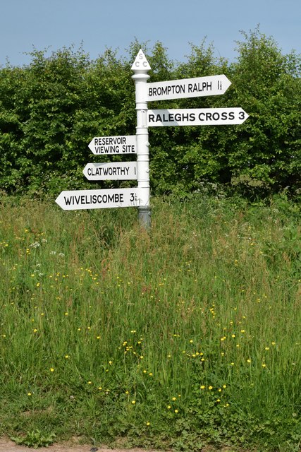
What 3 Words

///tutored.vegetable.plantings. Near Wiveliscombe, Somerset

Related Wikis

Clatworthy

Clatworthy is a village and civil parish in the Somerset West and Taunton district of Somerset, England. It is situated 10 miles (16 km) from Wellington...

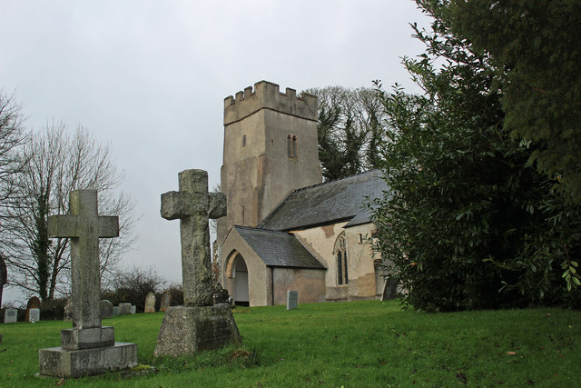
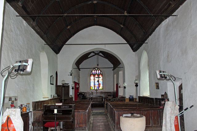
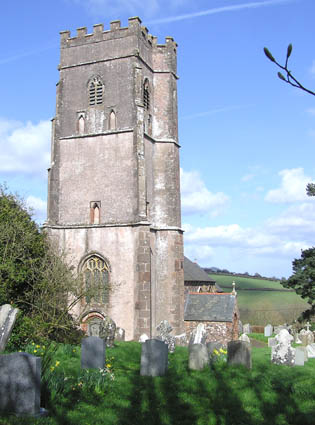
Church of St Mary Magdalene, Clatworthy

The Anglican Church of Mary Magdalene in Clatworthy, Somerset, England was built in the 12th century. It is a Grade II* listed building. == History... ==
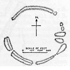
Clatworthy Camp

Clatworthy Camp is an Iron Age hill fort 3 miles (4.8 km) North West of Wiveliscombe, Somerset, England. It has been scheduled as an Ancient Monument....

Clatworthy Reservoir

Clatworthy Reservoir is situated near Clatworthy in the Brendon Hills on the edge of the Exmoor National Park in west Somerset, England. It is run by Wessex...

Huish Champflower

Huish Champflower is a village and civil parish in Somerset, England, three miles north-west of Wiveliscombe and ten miles north of Wellington. It has...

Elworthy Barrows

Elworthy Barrows is an unfinished Iron Age hill fort, rather than Bronze Age barrows, which is designated a scheduled ancient monument (No:188401). It...

Church of St Mary, Brompton Ralph

The Anglican Church of St Mary in Brompton Ralph, Somerset, England was built in the 15th century. It is a Grade II* listed building. == History == Parts...

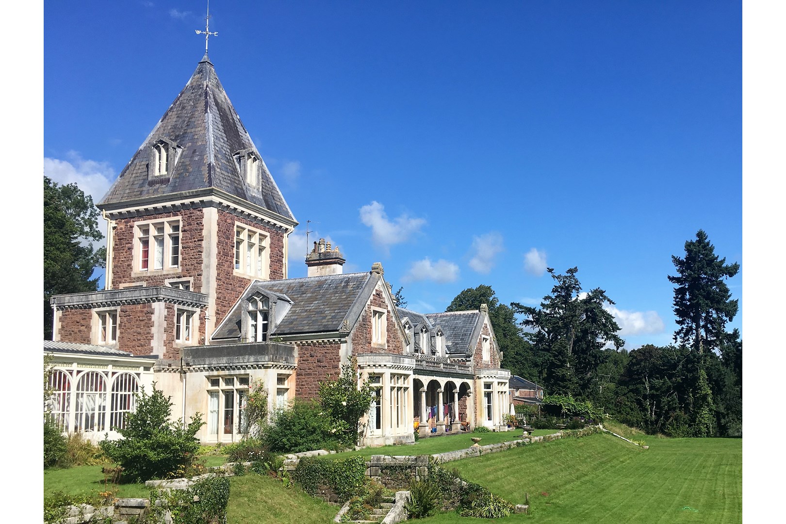
Abbotsfield, Wiveliscombe

Abbotsfield is a country house and farm, to the west of the town of Wiveliscombe, Somerset, England. Built in 1872, it became a Grade II listed building...

Nearby Amenities

Located within 500m of 51.069302,-3.353726
Clatworthy
Is In: Somerset, England, UK
Place: hamlet
Wikidata: Q2125298
Wikipedia: en:Clatworthy
Lat/Long: 51.0692488/-3.3539505
Post Box
Operator: Royal Mail
Operator Wikidata: Q638098
Post Box Type: lamp
Ref: TA4 79
Royal Cypher: EIIR
Royal Cypher Wikidata: Q33102113
Lat/Long: 51.0694278/-3.3536825
Community Centre
Village Hall
Addr City: Taunton
Addr Country: GB
Addr County: Somerset
Addr Postcode: TA4 2EQ
Addr Village: Clatworthy
Community Centre: village_hall
Fhrs Authority: West Somerset
Fhrs Id: 161806
Fhrs Local Authority Id: PI/000001901
Lat/Long: 51.0700717/-3.3522624
Booth: K6
Covered: booth
Man Made: telephone_box
Lat/Long: 51.06956/-3.3536082
The data included in this document is from www.openstreetmap.org. The data is made available under ODbL.

Have you been to Clatworthy?

Leave your review of Clatworthy below (or comments, questions and feedback).