Ashclyst Forest

Wood, Forest in Devon East Devon

England

Ashclyst Forest

Woodland Path One of the many woodland paths through the National Trust Ashclyst Forest situated north of Broadclyst and east of the M5 in Devon.
Woodland Path Credit: John P Reeves

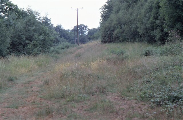
Ashclyst Forest is a sprawling woodland located in the county of Devon, England. Covering an area of approximately 2,900 acres, it is one of the largest forests in the region. The forest is part of the wider East Devon Pebblebed Heaths, which is a designated Site of Special Scientific Interest (SSSI).

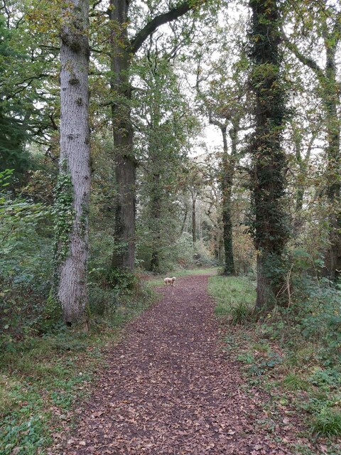
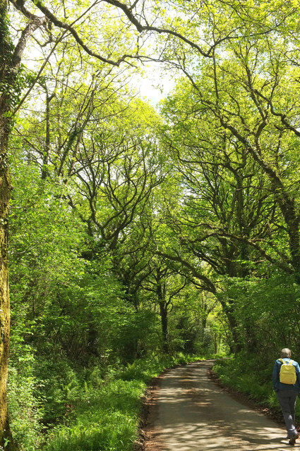
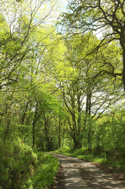
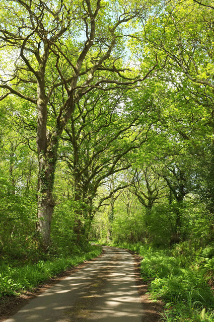
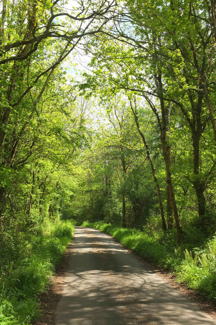
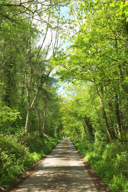
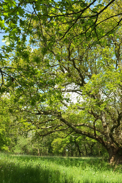
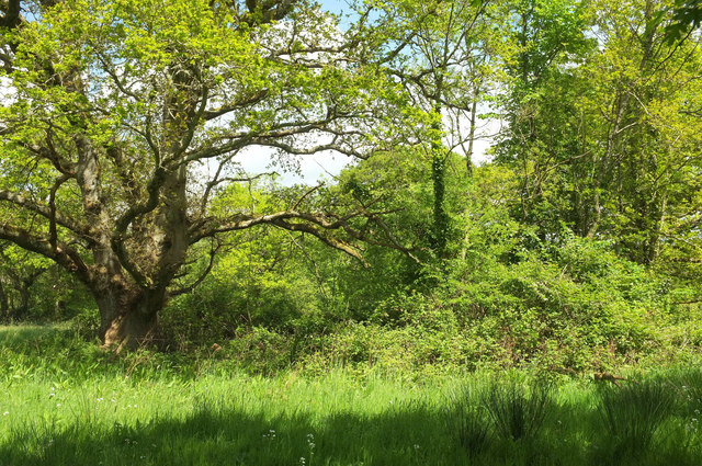
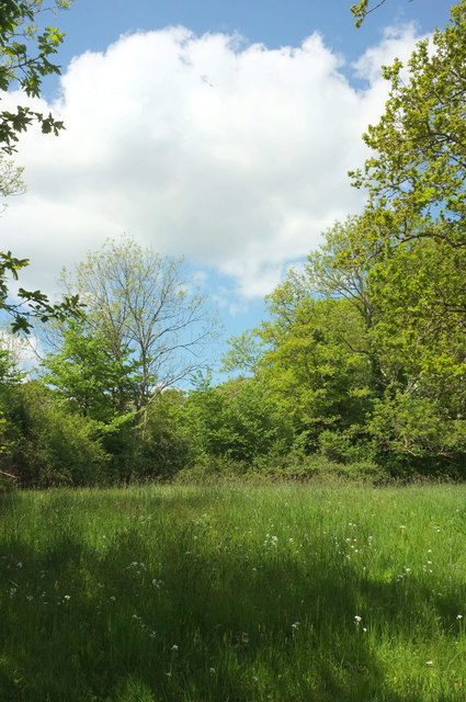
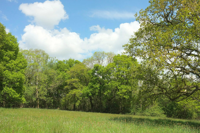
Ashclyst Forest is predominantly composed of ancient oak woodland, with towering oak trees that have stood for centuries. These majestic trees create a dense canopy, providing shade and shelter for a diverse range of flora and fauna. The forest floor is carpeted with a rich layer of mosses, ferns, and wildflowers, adding to its natural beauty.

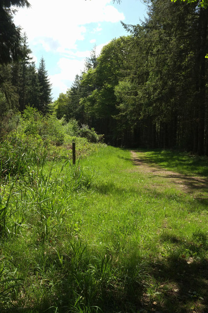
The forest is crisscrossed with a network of well-maintained footpaths, enabling visitors to explore its tranquil surroundings. These paths lead to various points of interest, such as the enchanting Ashclyst Forest House, which dates back to the 18th century and is now managed by the National Trust.

The forest is also home to a variety of wildlife, including deer, badgers, foxes, and an array of bird species, making it a popular spot for nature enthusiasts and birdwatchers. The diverse habitat within Ashclyst Forest supports a wide range of plant and animal species, contributing to its ecological importance.

Overall, Ashclyst Forest is a picturesque and ecologically significant woodland, offering visitors the chance to immerse themselves in nature and experience the beauty of Devon's countryside.

If you have any feedback on the listing, please let us know in the comments section below.

Ashclyst Forest Images

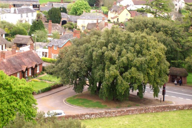
Images are sourced within 2km of 50.783547/-3.4171876 or Grid Reference SY0099. Thanks to Geograph Open Source API. All images are credited.

Woodland Path One of the many woodland paths through the National Trust Ashclyst Forest situated north of Broadclyst and east of the M5 in Devon.
Woodland Path
One of the many woodland paths through the National Trust Ashclyst Forest situated north of Broadclyst and east of the M5 in Devon.
Ashclyst Forest Somewhere on the 'Red Walk' within Ashclyst Forest. The forest ride was alive with butterflies.
Ashclyst Forest
Somewhere on the 'Red Walk' within Ashclyst Forest. The forest ride was alive with butterflies.
Lane from Rewes Cross Looking in the opposite direction from where <a href="https://www.geograph.org.uk/photo/5775404">SX9999 : Rewes Cross</a> was taken, down a delightful lane almost entirely free of traffic.
Lane from Rewes Cross
Looking in the opposite direction from where SX9999 : Rewes Cross was taken, down a delightful lane almost entirely free of traffic.
Lane across Merry Downs Further east from <a href="https://www.geograph.org.uk/photo/5775407">SY0099 : Lane from Rewes Cross</a> along the quiet lane through Ashclyst Forest to Caddihoe.
Lane across Merry Downs
Further east from SY0099 : Lane from Rewes Cross along the quiet lane through Ashclyst Forest to Caddihoe.
Lane to Rewes Cross Looking in the opposite direction from where <a href="https://www.geograph.org.uk/photo/5775417">SY0099 : Lane across Merry Downs</a> was taken, and therefore a reverse view of <a href="https://www.geograph.org.uk/photo/5775407">SY0099 : Lane from Rewes Cross</a>; the junction is just about visible around the bend.
Lane to Rewes Cross
Looking in the opposite direction from where SY0099 : Lane across Merry Downs was taken, and therefore a reverse view of SY0099 : Lane from Rewes Cross; the junction is just about visible around the bend.
Lane, Ashclyst Forest The quiet lane shown in <a href="https://www.geograph.org.uk/photo/5775417">SY0099 : Lane across Merry Downs</a> approaches Snaffle Park Gate.
Lane, Ashclyst Forest
The quiet lane shown in SY0099 : Lane across Merry Downs approaches Snaffle Park Gate.
Lane across Merry Downs Looking in the opposite direction from where <a href="https://www.geograph.org.uk/photo/5775438">SY0099 : Lane, Ashclyst Forest</a> was taken.
Lane across Merry Downs
Looking in the opposite direction from where SY0099 : Lane, Ashclyst Forest was taken.
Oak tree, Merry Downs In a meadow by the lane shown in <a href="https://www.geograph.org.uk/photo/5775443">SY0099 : Lane across Merry Downs</a>.
Oak tree, Merry Downs
In a meadow by the lane shown in SY0099 : Lane across Merry Downs.
Trees, Merry Downs In a meadow by the lane shown in <a href="https://www.geograph.org.uk/photo/5775443">SY0099 : Lane across Merry Downs</a>. On the left is the oak shown in <a href="https://www.geograph.org.uk/photo/5775483">SY0099 : Oak tree, Merry Downs</a>.
Trees, Merry Downs
In a meadow by the lane shown in SY0099 : Lane across Merry Downs. On the left is the oak shown in SY0099 : Oak tree, Merry Downs.
Meadow, Merry Downs A meadow by the lane shown in <a href="https://www.geograph.org.uk/photo/5775443">SY0099 : Lane across Merry Downs</a>. On the extreme right is the oak shown in <a href="https://www.geograph.org.uk/photo/5775483">SY0099 : Oak tree, Merry Downs</a>.
Meadow, Merry Downs
A meadow by the lane shown in SY0099 : Lane across Merry Downs. On the extreme right is the oak shown in SY0099 : Oak tree, Merry Downs.
Meadow, Merry Downs A meadow by the lane shown in <a href="https://www.geograph.org.uk/photo/5775443">SY0099 : Lane across Merry Downs</a>. On the right is the oak shown in <a href="https://www.geograph.org.uk/photo/5775483">SY0099 : Oak tree, Merry Downs</a>.
Meadow, Merry Downs
A meadow by the lane shown in SY0099 : Lane across Merry Downs. On the right is the oak shown in SY0099 : Oak tree, Merry Downs.
Snaffle Park Drive Similar to <a href="https://www.geograph.org.uk/photo/1744843">SY0099 : Ride in Ashclyst Forest</a> but at a very different season. This ride justly forms a key part of the Ashclyst Forest butterfly walk.
Snaffle Park Drive
Similar to SY0099 : Ride in Ashclyst Forest but at a very different season. This ride justly forms a key part of the Ashclyst Forest butterfly walk.
Ride, Ashclyst Forest The ride leads to Timbering Bridge.
Ride, Ashclyst Forest
The ride leads to Timbering Bridge.
Path, Ashclyst Forest Curving gently along the slopes above a tributary of the Clyst.
Path, Ashclyst Forest
Curving gently along the slopes above a tributary of the Clyst.
Ride, Ashclyst Forest The path shown in <a href="https://www.geograph.org.uk/photo/5775593">SY0099 : Path, Ashclyst Forest</a> seems to have developed into more of a ride - perhaps it always was.
Ride, Ashclyst Forest
The path shown in SY0099 : Path, Ashclyst Forest seems to have developed into more of a ride - perhaps it always was.
Bluebells, Ashclyst Forest To be honest, there were very few on our walk; these are on the ride shown in <a href="https://www.geograph.org.uk/photo/5775600">SY0099 : Ride, Ashclyst Forest</a>.
Bluebells, Ashclyst Forest
To be honest, there were very few on our walk; these are on the ride shown in SY0099 : Ride, Ashclyst Forest.
Broadclyst: lane near Brook Hill Looking west towards Frogmore Cross
Broadclyst: lane near Brook Hill
Looking west towards Frogmore Cross
Clyst St Lawrence: near Higher Comberoy Farm Looking south east. In the valley runs a tributary of the river Clyst
Clyst St Lawrence: near Higher Comberoy Farm
Looking south east. In the valley runs a tributary of the river Clyst
Show me another place!

Ashclyst Forest is located at Grid Ref: SY0099 (Lat: 50.783547, Lng: -3.4171876)

Administrative County: Devon

District: East Devon

Police Authority: Devon and Cornwall

What 3 Words

///cringe.impresses.cone. Near Whimple, Devon

Related Wikis

Devon Redlands

The Devon Redlands is a natural region in southwest Britain that has been designated as National Character Area (NCA) 148 by Natural England. == Extent... ==

Broadclyst

Broadclyst is a village and civil parish in the East Devon local government district. It lies approximately 5 miles northeast of the city of Exeter, Devon...

Beare

Beare is a village in the civil parish of Broadclyst in Devon, England. == References == == External links == Media related to Beare at Wikimedia Commons

Clyst St Lawrence

Clyst St Lawrence is a village and civil parish about 8 miles north-east of the city of Exeter in the county of Devon, England. Historically it formed...

Nearby Amenities

Located within 500m of 50.783547,-3.4171876
Bench
Lat/Long: 50.785285/-3.413862
Bench
Lat/Long: 50.7876327/-3.4174656
Information: map
Tourism: information
Lat/Long: 50.7859149/-3.4208103
Bench
Lat/Long: 50.785937/-3.421049
Bench
Lat/Long: 50.7859353/-3.4207325
Barrier: swing_gate
Lat/Long: 50.7827871/-3.4182876
Information: map
Tourism: information
Lat/Long: 50.7845415/-3.4231997
Ford: yes
Lat/Long: 50.7872806/-3.4144457
Ford: yes
Lat/Long: 50.7851504/-3.4146633
Sprydon Beacon
Ele: 128
Natural: peak
Lat/Long: 50.7853883/-3.4236306
The data included in this document is from www.openstreetmap.org. The data is made available under ODbL.

Have you been to Ashclyst Forest?

Leave your review of Ashclyst Forest below (or comments, questions and feedback).