Creely Copse

Wood, Forest in Devon East Devon

England

Creely Copse
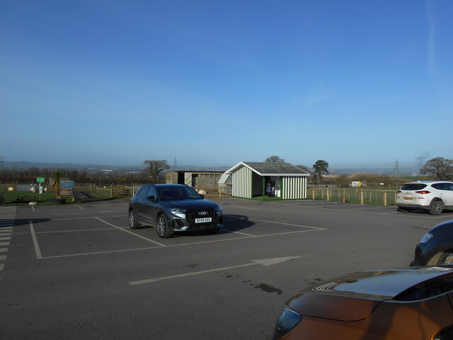
The milk shed An inventive way to promote milk sales. Greendale  Farm shop.
A vending machine provides fresh milk on tap.
The milk shed Credit: Anthony Vosper

Creely Copse is a picturesque woodland located in Devon, England. This enchanting forest covers an area of approximately 50 hectares and is nestled within the stunning countryside of the South Hams district. The copse is situated on undulating terrain, with gentle slopes and meandering footpaths that offer visitors a delightful walking experience.

The woodland is predominantly composed of native broadleaf trees, such as oak, beech, and ash, which create a dense canopy overhead, providing shade and shelter for an array of wildlife. The forest floor is carpeted with a rich variety of flora, including bluebells, wild garlic, and primroses, which burst into a vibrant display of colors during the spring months.

Creely Copse is home to a diverse range of fauna, making it a haven for nature lovers and wildlife enthusiasts. The woods are inhabited by a variety of bird species, including woodpeckers, owls, and songbirds. Mammals such as foxes, badgers, and deer can also be spotted, especially during the early morning or twilight hours.

The copse is a popular destination for outdoor activities, attracting visitors who enjoy hiking, birdwatching, and photography. The well-maintained footpaths wind through the woodland, offering visitors the opportunity to explore its beauty at their own pace. There are also designated picnic areas and benches, allowing visitors to relax and immerse themselves in the tranquil surroundings.

In summary, Creely Copse in Devon is a captivating woodland that offers visitors a serene and unspoiled natural environment. With its diverse wildlife, stunning flora, and scenic trails, this enchanting forest is a true gem of the South Hams district.

If you have any feedback on the listing, please let us know in the comments section below.

Creely Copse Images

Images are sourced within 2km of 50.707068/-3.4239581 or Grid Reference SX9990. Thanks to Geograph Open Source API. All images are credited.

The milk shed An inventive way to promote milk sales. Greendale  Farm shop.
A vending machine provides fresh milk on tap.
The milk shed
An inventive way to promote milk sales. Greendale Farm shop. A vending machine provides fresh milk on tap.
Lower Lane near Woodbury Salterton Looking down Lower Lane towards Woodbury Salterton outside the entrance to Bidgood's Farm in Devon.
Lower Lane near Woodbury Salterton
Looking down Lower Lane towards Woodbury Salterton outside the entrance to Bidgood's Farm in Devon.
Greendale Farm Shop The marquee was probably for the pre-Christmas vegetable stock. Note the two vintage Fordson tractors. It was a very dull and blustery day.
Greendale Farm Shop
The marquee was probably for the pre-Christmas vegetable stock. Note the two vintage Fordson tractors. It was a very dull and blustery day.
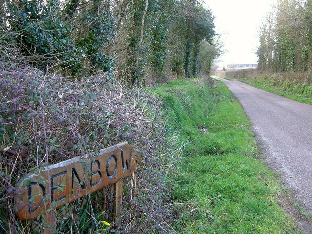
Approaching Denbow Cross The T junction ahead is shown in <a title="https://www.geograph.org.uk/search.php?i=60957253" href="https://www.geograph.org.uk/search.php?i=60957253">Link</a> . On the immediate left is the turn into Denbow Farm.
Approaching Denbow Cross
The T junction ahead is shown in Link . On the immediate left is the turn into Denbow Farm.
Denbow Cross A little closer to the T junction (also shown at <a title="https://www.geograph.org.uk/search.php?i=60957253" href="https://www.geograph.org.uk/search.php?i=60957253">Link</a> ) than <a href="https://www.geograph.org.uk/photo/4824130">SY0091 : Approaching Denbow Cross</a>.
Denbow Cross
A little closer to the T junction (also shown at Link ) than SY0091 : Approaching Denbow Cross.
By Denbow Cross The lane to the right in <a href="https://www.geograph.org.uk/photo/4824134">SY0091 : Denbow Cross</a> has a wide verge with a ditch at the back of it containing a tributary of a tributary of the Clyst, if you see what I mean.
By Denbow Cross
The lane to the right in SY0091 : Denbow Cross has a wide verge with a ditch at the back of it containing a tributary of a tributary of the Clyst, if you see what I mean.
Denbow Cross Okay, it's the same view as <a href="https://www.geograph.org.uk/photo/1155168">SY0091 : Denbow Cross</a>, but the important thing is that the large agricultural buildings in the background appeared during the three years between the photos being taken, and here distant trees can be seen.
Denbow Cross
Okay, it's the same view as SY0091 : Denbow Cross, but the important thing is that the large agricultural buildings in the background appeared during the three years between the photos being taken, and here distant trees can be seen.
Denbow Cross A reverse view of <a href="https://www.geograph.org.uk/photo/4824180">SY0091 : Denbow Cross</a>, with the scene in <a href="https://www.geograph.org.uk/photo/4824154">SY0091 : By Denbow Cross</a> in the background.
Denbow Cross
A reverse view of SY0091 : Denbow Cross, with the scene in SY0091 : By Denbow Cross in the background.
Lane to Exeter Airport As with <a href="https://www.geograph.org.uk/photo/4824180">SY0091 : Denbow Cross</a>, the view has changed since this was taken, with two large agricultural buildings having been built on the right of this lane north of Denbow Cross. The fence on the left marks a turn into Denbow Farm.
Lane to Exeter Airport
As with SY0091 : Denbow Cross, the view has changed since this was taken, with two large agricultural buildings having been built on the right of this lane north of Denbow Cross. The fence on the left marks a turn into Denbow Farm.
Farm lane to Denbow Farm Looking along the farm entrance lane on the immediate left of <a href="https://www.geograph.org.uk/photo/4824130">SY0091 : Approaching Denbow Cross</a>.
Farm lane to Denbow Farm
Looking along the farm entrance lane on the immediate left of SY0091 : Approaching Denbow Cross.
Spain Farm Zooming in on the scene in <a href="https://www.geograph.org.uk/photo/1154947">SY0092 : Spain Farm</a>, but without the snow. The trees are along a tributary of the Clyst.
Spain Farm
Zooming in on the scene in SY0092 : Spain Farm, but without the snow. The trees are along a tributary of the Clyst.
Stream crossing below Spain Farm The lane to Farringdon crosses a tributary of the Clyst.
Stream crossing below Spain Farm
The lane to Farringdon crosses a tributary of the Clyst.
Spain Farm Looking up the valley side from beside the oak tree shown in <a href="https://www.geograph.org.uk/photo/4824351">SY0092 : Stream crossing below Spain Farm</a>. The farm is also shown in <a href="https://www.geograph.org.uk/photo/4824333">SY0092 : Spain Farm</a> and <a href="https://www.geograph.org.uk/photo/1154947">SY0092 : Spain Farm</a>.
Spain Farm
Looking up the valley side from beside the oak tree shown in SY0092 : Stream crossing below Spain Farm. The farm is also shown in SY0092 : Spain Farm and SY0092 : Spain Farm.
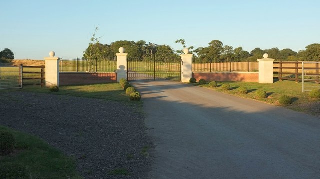
Gates at Denbow Cross In its way, a more telling change at <a href="https://www.geograph.org.uk/photo/4824180">SY0091 : Denbow Cross</a> and <a href="https://www.geograph.org.uk/photo/1155168">SY0091 : Denbow Cross</a> than the appearance of the large barns. An imposing entrance has replaced the steel gates, set back from the road some way. The gates lead to Wood Farm, which is not yet shown on some maps.
Gates at Denbow Cross
In its way, a more telling change at SY0091 : Denbow Cross and SY0091 : Denbow Cross than the appearance of the large barns. An imposing entrance has replaced the steel gates, set back from the road some way. The gates lead to Wood Farm, which is not yet shown on some maps.
New farm building near Denbow Farm I think this is the third large barn to be built along this stretch of lane in recent years.
New farm building near Denbow Farm
I think this is the third large barn to be built along this stretch of lane in recent years.
Harvested field, Denbow Farm On the other side of the lane from <a href="https://www.geograph.org.uk/photo/5078558">SY0091 : New farm building near Denbow Farm</a>.
Harvested field, Denbow Farm
On the other side of the lane from SY0091 : New farm building near Denbow Farm.
Harvested field, Denbow Farm From the same place as <a href="https://www.geograph.org.uk/photo/5080720">SY0091 : Harvested field, Denbow Farm</a>, looking right with the farm road into the farm, and into the lowering sun.
Harvested field, Denbow Farm
From the same place as SY0091 : Harvested field, Denbow Farm, looking right with the farm road into the farm, and into the lowering sun.
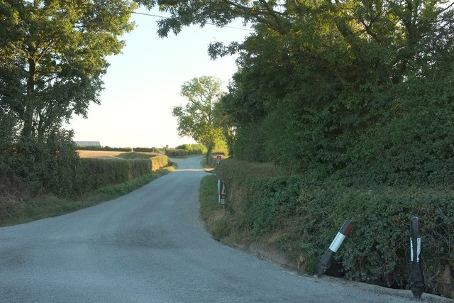
Lane from Denbow Cross Opposite the gates shown in <a href="https://www.geograph.org.uk/photo/5074204">SY0091 : Gates at Denbow Cross</a>.
Lane from Denbow Cross
Opposite the gates shown in SY0091 : Gates at Denbow Cross.
Show me another place!

Creely Copse is located at Grid Ref: SX9990 (Lat: 50.707068, Lng: -3.4239581)

Administrative County: Devon

District: East Devon

Police Authority: Devon and Cornwall

What 3 Words

///scouts.motel.establish. Near Woodbury, Devon

Nearby Locations

Creely Copse

Related Wikis

Crealy Theme Park & Resort

Crealy Theme Park & Resort, formerly Crealy Adventure Park & Resort, is Southwest England's largest family theme park attraction with over 60 rides, attractions...

Westpoint Arena

Westpoint Exeter (formerly Westpoint Arena) is a multi-purpose indoor arena and showground, at Clyst St Mary, near Exeter, England. The capacity of the...

Bishop's Clyst

Bishop's Clyst was an ancient manor in Devonshire and is also the modern name adopted by the council representing two civil parishes that form part of...

Farringdon, Devon

Farringdon is a village, civil parish and former manor in the district of East Devon in the county of Devon, England. The parish is surrounded clockwise...

Clyst St George

Clyst St George (anciently Clyst Champernowne) is a village and civil parish in East Devon, England, adjoining the River Clyst some 4 miles (6.4 km) southeast...

Clyst St Mary

Clyst St Mary is a small village and civil parish 3 miles (4.8 km) east of Exeter on the main roads to Exmouth and Sidmouth in East Devon. The name comes...

Woodbury Salterton

Woodbury Salterton is a village 6 miles (9.7 km) from Exeter, in the civil parish of Woodbury, in the East Devon district, in the county of Devon, England...

Sowton

Sowton is a village and civil parish east of Exeter in East Devon, England. It has a population of 639.Its parish council merged with that of nearby Clyst...

Nearby Amenities

Located within 500m of 50.707068,-3.4239581
Bus Stop
Bench: yes
Bin: yes
Bus: yes
Public Transport: platform
Shelter: yes
Tactile Paving: no
Lat/Long: 50.7082141/-3.4287743
Exeter City Training Ground
Leisure: pitch
Sport: soccer
Lat/Long: 50.7072505/-3.4270193
Post Box
Mapillary: 139588694857728
Operator: Royal Mail
Operator Wikidata: Q638098
Post Box Mounting: pier
Post Box Type: lamp
Survey Date: 2020-08-29
Lat/Long: 50.7083736/-3.4289183
Barrier: stile
Lat/Long: 50.7081894/-3.4292947
Generator Method: photovoltaic
Generator Output Electricity: yes
Generator Source: solar
Generator Type: solar_photovoltaic_panel
Location: roof
Power: generator
Lat/Long: 50.7080518/-3.4304447
Generator Method: photovoltaic
Generator Output Electricity: yes
Generator Source: solar
Generator Type: solar_photovoltaic_panel
Location: roof
Power: generator
Lat/Long: 50.7080654/-3.4304421
Barrier: yes
Lat/Long: 50.7103244/-3.4237512
The data included in this document is from www.openstreetmap.org. The data is made available under ODbL.

Have you been to Creely Copse?

Leave your review of Creely Copse below (or comments, questions and feedback).