Corkickle Brake

Wood, Forest in Cumberland Copeland

England

Corkickle Brake

A boulder beach near St Bees Head
A boulder beach near St Bees Head Credit: David Medcalf

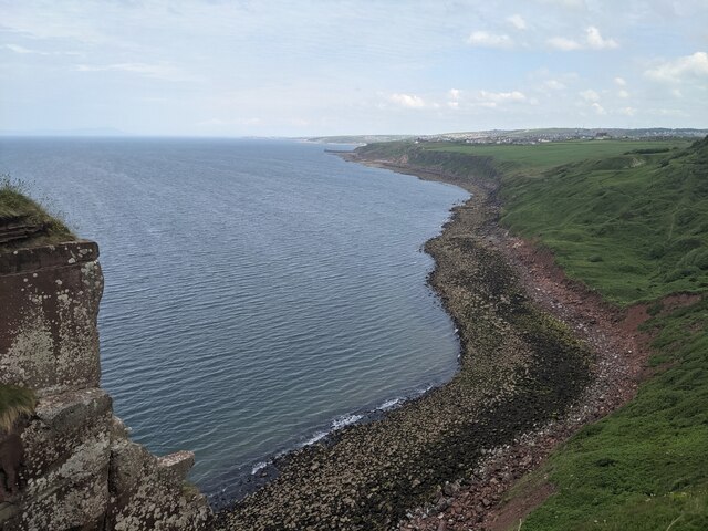
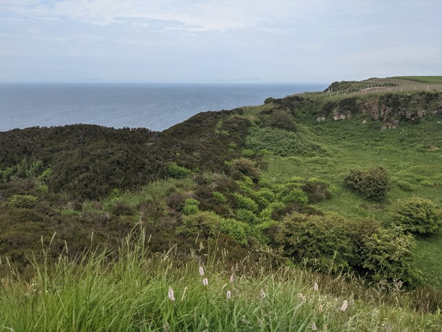
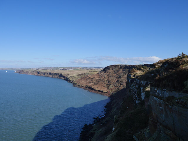
Corkickle Brake is a woodland area located in Cumberland, England. Situated near Whitehaven, it covers an approximate area of 10 hectares. The forest is predominantly composed of oak trees, with a dense undergrowth of various species including holly, hawthorn, and bramble.

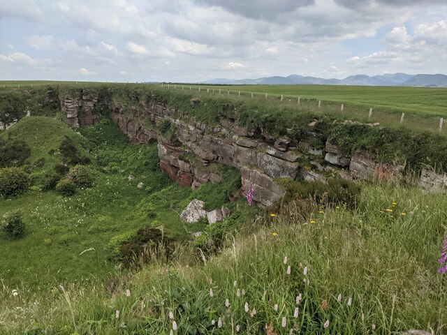
The woodland is a designated Site of Special Scientific Interest (SSSI) due to its rich biodiversity and unique ecosystem. It provides a habitat for a wide range of flora and fauna, including several rare and protected species. The diverse vegetation supports a variety of bird species, such as woodpeckers, robins, and tits, making it a popular spot for birdwatching enthusiasts.

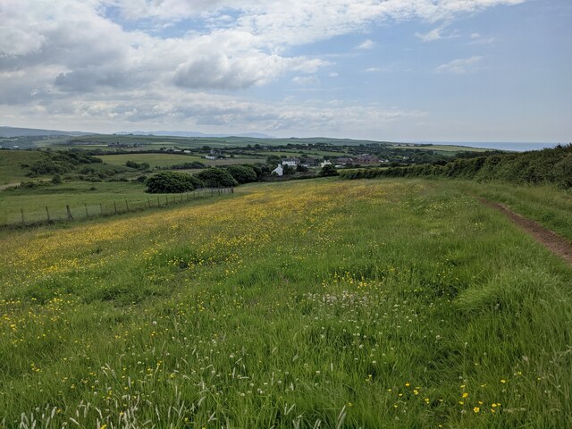
Corkickle Brake is also home to a network of footpaths and trails, allowing visitors to explore the natural beauty of the forest. These paths wind through the woodland, providing an opportunity for peaceful walks and nature observation. The forest is particularly enchanting in the spring when the ground is adorned with bluebells and wildflowers.

The management of Corkickle Brake is overseen by the local council, who ensure the conservation of the area and promote its accessibility to the public. Regular maintenance activities, such as tree planting and removal of invasive species, are carried out to preserve the ecological balance of the forest.

Overall, Corkickle Brake is a cherished natural gem in Cumberland, offering a serene escape into the heart of nature for locals and tourists alike.

If you have any feedback on the listing, please let us know in the comments section below.

Corkickle Brake Images

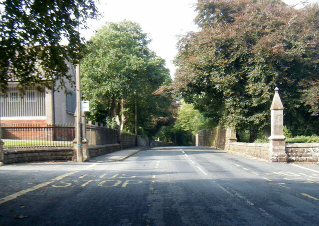
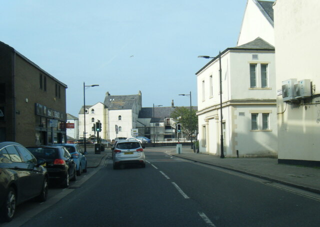
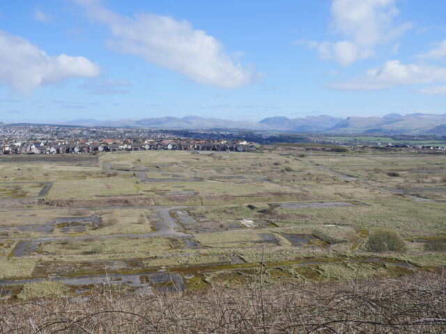
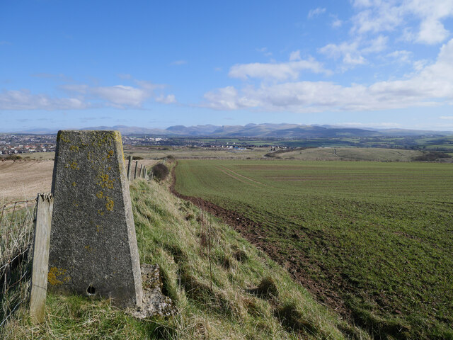
Images are sourced within 2km of 54.534486/-3.5911592 or Grid Reference NX9716. Thanks to Geograph Open Source API. All images are credited.

A boulder beach near St Bees Head
The entrance to St Bees Quarry Formerly known as Birkham's Quarry.  See: <span class="nowrap"><a title="https://www.lakesguides.co.uk/html/lgaz/lk17309.htm" rel="nofollow ugc noopener" href="https://www.lakesguides.co.uk/html/lgaz/lk17309.htm">Link</a><img style="margin-left:2px;" alt="External link" title="External link - shift click to open in new window" src="https://s1.geograph.org.uk/img/external.png" width="10" height="10"/></span>
The entrance to St Bees Quarry
Formerly known as Birkham's Quarry. See: LinkExternal link
Disused quarry by the Coast Path
The back wall of the disused quarry
Wildflower field above Sandwith village
B5345 Low Road at Cemetery Lodge
Swingpump Lane, Whitehaven
The site of the former Whitehaven chemical works The site of the former Marchon, latterly Huntsman chemical works on the outskirts of Whitehaven.  The works was operational from 1943 to 2005 with the site finally being cleared about a decade ago.

This photograph was taken during the Coronavirus (COVID-19) pandemic of 2020/21/22.
The site of the former Whitehaven chemical works
The site of the former Marchon, latterly Huntsman chemical works on the outskirts of Whitehaven. The works was operational from 1943 to 2005 with the site finally being cleared about a decade ago. This photograph was taken during the Coronavirus (COVID-19) pandemic of 2020/21/22.
Barrowmouth Wood triangulation pillar A fine view from this spot, 130 metres above sea level.  In this view, the former Whitehaven chemical works site and the distant Lake District fells can be noted.

This photograph was taken during the Coronavirus (COVID-19) pandemic of 2020/21/22.
Barrowmouth Wood triangulation pillar
A fine view from this spot, 130 metres above sea level. In this view, the former Whitehaven chemical works site and the distant Lake District fells can be noted. This photograph was taken during the Coronavirus (COVID-19) pandemic of 2020/21/22.
Along the coast to Whitehaven The rugged Cumbrian coast near Whitehaven.

This photograph was taken during the Coronavirus (COVID-19) pandemic of 2020/21/22.
Along the coast to Whitehaven
The rugged Cumbrian coast near Whitehaven. This photograph was taken during the Coronavirus (COVID-19) pandemic of 2020/21/22.
Leyland Olympian on Strand Street, Whitehaven An Olympian in Northumbria livery and a familiar sight on the coast on the other side of the country in times gone by.

This photograph was taken during the Coronavirus (COVID-19) pandemic of 2020/21/22.
Leyland Olympian on Strand Street, Whitehaven
An Olympian in Northumbria livery and a familiar sight on the coast on the other side of the country in times gone by. This photograph was taken during the Coronavirus (COVID-19) pandemic of 2020/21/22.
Greater Manchester PTE Leyland National at Whitehaven Harbour Dating from 1975 and owned by the SELNEC Preservation Society.

This photograph was taken during the Coronavirus (COVID-19) pandemic of 2020/21/22.
Greater Manchester PTE Leyland National at Whitehaven Harbour
Dating from 1975 and owned by the SELNEC Preservation Society. This photograph was taken during the Coronavirus (COVID-19) pandemic of 2020/21/22.
'Best Bus Around' on West Strand, Whitehaven A Leyland National 2 on West Strand near Whitehaven Harbour resplendent in Strathtay Scottish livery.

This photograph was taken during the Coronavirus (COVID-19) pandemic of 2020/21/22.
'Best Bus Around' on West Strand, Whitehaven
A Leyland National 2 on West Strand near Whitehaven Harbour resplendent in Strathtay Scottish livery. This photograph was taken during the Coronavirus (COVID-19) pandemic of 2020/21/22.
Suburban Express at Whitehaven Harbour Dating from 1973, the Suburban Express diverged away from the standard Leyland National design, with a high flat floor front to rear.  Out of the two demonstrators produced, this is the sole survivor.

This photograph was taken during the Coronavirus (COVID-19) pandemic of 2020/21/22.
Suburban Express at Whitehaven Harbour
Dating from 1973, the Suburban Express diverged away from the standard Leyland National design, with a high flat floor front to rear. Out of the two demonstrators produced, this is the sole survivor. This photograph was taken during the Coronavirus (COVID-19) pandemic of 2020/21/22.
A vintage pair of buses on West Strand, Whitehaven A Leyland National Mk 1 (B) dating from 1979 and pictured here in Ribble livery. 
 This vehicle was running timetabled trips to the former Leyland National factory at Lillyhall - rather nippy on the gradients heading up through Whitehaven and Distington!  A Volvo Olympian in Cleveland Transit livery can be noted to the rear.

This photograph was taken during the Coronavirus (COVID-19) pandemic of 2020/21/22.
A vintage pair of buses on West Strand, Whitehaven
A Leyland National Mk 1 (B) dating from 1979 and pictured here in Ribble livery. This vehicle was running timetabled trips to the former Leyland National factory at Lillyhall - rather nippy on the gradients heading up through Whitehaven and Distington! A Volvo Olympian in Cleveland Transit livery can be noted to the rear. This photograph was taken during the Coronavirus (COVID-19) pandemic of 2020/21/22.
Leyland National Mk 1 (B) by Whitehaven Harbour Parked up by the harbour, I travelled on this vehicle the previous day for a tour to the former Leyland National factory at Lillyhall.

This photograph was taken during the Coronavirus (COVID-19) pandemic of 2020/21/22.
Leyland National Mk 1 (B) by Whitehaven Harbour
Parked up by the harbour, I travelled on this vehicle the previous day for a tour to the former Leyland National factory at Lillyhall. This photograph was taken during the Coronavirus (COVID-19) pandemic of 2020/21/22.
Leyland National 'Super National' Entering service in 1975, this was one of two Super Nationals booked for the Leyland National 50 event.  The executive interior of the vehicle included a toilet compartment, cloakroom, servery, aircraft style seats with selectable audio, TV and video, radio telephone, on board mains generator and a Webasto heater.  The vehicle was used on corporate hire work in Britain as well as mainland Europe, with famous passengers including Dolly Parton and Fleetwood Mac.

This photograph was taken during the Coronavirus (COVID-19) pandemic of 2020/21/22.
Leyland National 'Super National'
Entering service in 1975, this was one of two Super Nationals booked for the Leyland National 50 event. The executive interior of the vehicle included a toilet compartment, cloakroom, servery, aircraft style seats with selectable audio, TV and video, radio telephone, on board mains generator and a Webasto heater. The vehicle was used on corporate hire work in Britain as well as mainland Europe, with famous passengers including Dolly Parton and Fleetwood Mac. This photograph was taken during the Coronavirus (COVID-19) pandemic of 2020/21/22.
Suburban Express display A close up of the restoration display in the Leyland National Suburban Express at Whitehaven Harbourside.

This photograph was taken during the Coronavirus (COVID-19) pandemic of 2020/21/22.
Suburban Express display
A close up of the restoration display in the Leyland National Suburban Express at Whitehaven Harbourside. This photograph was taken during the Coronavirus (COVID-19) pandemic of 2020/21/22.
Show me another place!

Corkickle Brake is located at Grid Ref: NX9716 (Lat: 54.534486, Lng: -3.5911592)

Administrative County: Cumbria

District: Copeland

Police Authority: Cumbria

What 3 Words

///playroom.vesting.flirts. Near Whitehaven, Cumbria

Related Wikis

Mirehouse, Copeland

Mirehouse is an area and ward in the English county of Cumbria and within the boundaries of the historic county of Cumberland. Mirehouse is 1.5 miles...

Kells, Whitehaven

Kells is an area of Whitehaven in Cumbria, England, elevated on a cliff to the south of the town centre, overlooking the Irish sea. The population of this...

Whitehaven A.F.C.

Whitehaven Amateur Football Club is a football club in Whitehaven, Cumbria. The club are currently members of the West Lancashire League Premier Division...

Recreation Ground (Whitehaven)

The Recreation Ground (known locally as the 'Recre') and for sponsorship reasons the Ortus REC is a rugby league stadium in Whitehaven, Cumbria, England...

Nearby Amenities

Located within 500m of 54.534486,-3.5911592
Woodhouse
Created By: Potlatch 0.10f
Is In: Whitehaven, Cumbria, UK
Place: suburb
Lat/Long: 54.5305343/-3.5924213
Bus Stop
Kells County Infant school
Bench: no
Bus: yes
Covered: no
Naptan AtcoCode: 090050300004
Naptan Bearing: S
Naptan CommonName: Kells County Infant school
Naptan Indicator: opp
Naptan Landmark: Kells County Infant school
Naptan NaptanCode: cumawgtp
Naptan Street: High Road
Naptan Verified: no
Public Transport: platform
Shelter: no
Source: naptan_import
Lat/Long: 54.534685/-3.5966238
Bus Stop
Ennerdale Terrace at High Road (E bound)
Bench: no
Bus: yes
Covered: no
Local Ref: AT
Naptan AtcoCode: 090050300123
Naptan Bearing: E
Naptan CommonName: Ennerdale Terrace at High Road (E bound)
Naptan Indicator: at
Naptan Landmark: junction with High Road
Naptan NaptanCode: cumawjdj
Naptan Street: Ennerdale Terrace
Naptan Verified: no
Public Transport: platform
Shelter: no
Source: naptan_import
Lat/Long: 54.5345645/-3.5962173
Bus Stop
Ennerdale Terrace at High Road (W bound)
Bench: no
Bus: yes
Covered: no
Local Ref: AT
Naptan AtcoCode: 090050300125
Naptan Bearing: W
Naptan CommonName: Ennerdale Terrace at High Road (W bound)
Naptan Indicator: at
Naptan Landmark: junction with High Road
Naptan NaptanCode: cumawjdp
Naptan Street: Ennerdale Terrace
Naptan Verified: no
Public Transport: platform
Shelter: no
Source: naptan_import
Lat/Long: 54.5345051/-3.5959522
Bus Stop
Rydal Ave jct Buttermere Ave
Bus: yes
Naptan AtcoCode: 090050300126
Naptan Bearing: E
Naptan CommonName: Rydal Ave jct Buttermere Ave
Naptan Indicator: near
Naptan Landmark: junction with Buttermere Avenue
Naptan NaptanCode: cumawjdt
Naptan Street: Rydal Avenue
Naptan Verified: no
Public Transport: platform
Source: naptan_import
Lat/Long: 54.5334219/-3.5956163
Bus Stop
Ennerdale Terrace at Lakeland Avenue (E)
Bus: yes
Local Ref: AT
Naptan AtcoCode: 090050300128
Naptan Bearing: E
Naptan CommonName: Ennerdale Terrace at Lakeland Avenue (E)
Naptan Indicator: at
Naptan Landmark: junction with Lakeland Avenue
Naptan NaptanCode: cumawjdw
Naptan Street: Ennerdale Terrace
Naptan Verified: no
Public Transport: platform
Source: naptan_import
Lat/Long: 54.5352102/-3.5935994
Bus Stop
Ennerdale Terrace at Lakeland Avenue (W)
Bus: yes
Local Ref: AT
Naptan AtcoCode: 090050300129
Naptan Bearing: W
Naptan CommonName: Ennerdale Terrace at Lakeland Avenue (W)
Naptan Indicator: at
Naptan Landmark: junction with Lakeland Avenue
Naptan NaptanCode: cumawjga
Naptan Street: Ennerdale Terrace
Naptan Verified: no
Public Transport: platform
Source: naptan_import
Lat/Long: 54.5351124/-3.5935183
Bus Stop
Woodhouse Road at Crummock Avenue
Bench: no
Bus: yes
Covered: no
Local Ref: AT
Naptan AtcoCode: 090050300130
Naptan Bearing: E
Naptan CommonName: Woodhouse Road at Crummock Avenue
Naptan Indicator: at
Naptan Landmark: junction with Crummock Avenue
Naptan NaptanCode: cumawjgd
Naptan Street: Woodhouse Road
Naptan Verified: no
Public Transport: platform
Shelter: no
Source: naptan_import
Lat/Long: 54.5305083/-3.5929989
Bus Stop
Woodhouse Road
Bench: no
Bus: yes
Covered: yes
Local Ref: AT
Naptan AtcoCode: 090050300131
Naptan Bearing: S
Naptan CommonName: Woodhouse Road
Naptan Indicator: at
Naptan Landmark: junction with Loweswater Avenue
Naptan NaptanCode: cumawjgj
Naptan Street: Loweswater Avenue
Naptan Verified: no
Public Transport: platform
Shelter: yes
Source: naptan_import
Lat/Long: 54.5308384/-3.5925018
Bus Stop
Fleswick Avenue
Bus: yes
Local Ref: IN
Naptan AtcoCode: 090050300133
Naptan Bearing: S
Naptan CommonName: Fleswick Avenue
Naptan Indicator: in
Naptan Landmark: Garden of no. 42
Naptan NaptanCode: cumawjgm
Naptan Street: Fleswick Avenue
Naptan Verified: no
Public Transport: platform
Source: naptan_import
Lat/Long: 54.530056/-3.5911731
Bus Stop
Low Road opp Castle Garage
Bench: no
Bin: no
Bus: yes
Lit: no
Naptan AtcoCode: 090050300142
Naptan Bearing: S
Naptan CommonName: Low Road opp Castle Garage
Naptan Indicator: near
Naptan Landmark: Cemetery
Naptan NaptanCode: cumawjmp
Naptan Street: Low Road
Naptan Verified: no
Public Transport: platform
Shelter: no
Source: naptan_import
Tactile Paving: no
Lat/Long: 54.5373635/-3.586372
Low Road Cemetery Lodge (N bound)
Naptan AtcoCode: 090050300151
Naptan Bearing: N
Naptan BusStopType: CUS
Naptan CommonName: Low Road Cemetery Lodge (N bound)
Naptan Indicator: o/s
Naptan Landmark: Cemetery Gates
Naptan NaptanCode: cumawjpw
Naptan Street: Low Road
Naptan Verified: no
Source: naptan_import
Lat/Long: 54.5342124/-3.5853997
Low Road Cemetery Lodge (S bound)
Local Ref: AT
Naptan AtcoCode: 090050300152
Naptan Bearing: S
Naptan BusStopType: CUS
Naptan CommonName: Low Road Cemetery Lodge (S bound)
Naptan Indicator: at
Naptan Landmark: Cemetery Gates
Naptan NaptanCode: cumawjta
Naptan Street: Low Road
Naptan Verified: no
Source: naptan_import
Lat/Long: 54.534259/-3.5852779
Bus Stop
Meadow View junction
Bench: no
Bin: no
Bus: yes
Lit: yes
Local Ref: AT
Naptan AtcoCode: 090050300153
Naptan Bearing: W
Naptan CommonName: Meadow View junction
Naptan Indicator: at
Naptan Landmark: junction with Low Road
Naptan NaptanCode: cumawjtd
Naptan Street: Meadow Road
Naptan Verified: no
Public Transport: platform
Shelter: no
Source: naptan_import
Tactile Paving: no
Lat/Long: 54.5363434/-3.5853432
Bus Stop
Meadow Road / Low Rd junction
Bench: no
Bin: no
Bus: yes
Lit: yes
Local Ref: AT
Naptan AtcoCode: 090050300154
Naptan Bearing: E
Naptan CommonName: Meadow Road / Low Rd junction
Naptan Indicator: at
Naptan Landmark: junction with Low Road
Naptan NaptanCode: cumawjtg
Naptan Street: Meadow Road
Naptan Verified: no
Public Transport: platform
Shelter: no
Source: naptan_import
Tactile Paving: no
Lat/Long: 54.5364442/-3.5851925
Bus Stop
Monkwray School
Bus: yes
Local Ref: AT
Naptan AtcoCode: 090050304338
Naptan Bearing: SW
Naptan BusStopType: CUS
Naptan CommonName: Monkwray School
Naptan Indicator: At
Naptan Landmark: School
Naptan NaptanCode: cumdtdtd
Naptan Street: Monkwray Brow
Naptan Verified: no
Public Transport: platform
Source: naptan_import
Lat/Long: 54.538896/-3.5901414
Post Box
Operator: Royal Mail
Operator Wikidata: Q638098
Ref: CA28 16
Lat/Long: 54.5362954/-3.5969131
Post Box
Ref: CA28 137
Lat/Long: 54.5356859/-3.5933874
Addr Housenumber: 20
Lat/Long: 54.5348098/-3.5983833
Addr Housenumber: 21
Lat/Long: 54.5348038/-3.5980742
Addr Housenumber: 24
Lat/Long: 54.5351645/-3.5981154
Addr Housenumber: 25
Lat/Long: 54.5350549/-3.5983901
Direction: S
Generator Method: photovoltaic
Generator Output Electricity: yes
Generator Solar Modules: 16
Generator Source: solar
Generator Type: solar_photovoltaic_panel
Location: roof
Power: generator
Lat/Long: 54.5356619/-3.5980412
Direction: S
Generator Method: photovoltaic
Generator Output Electricity: yes
Generator Solar Modules: 8
Generator Source: solar
Generator Type: solar_photovoltaic_panel
Location: roof
Power: generator
Lat/Long: 54.5356479/-3.5983453
Direction: W
Generator Method: photovoltaic
Generator Output Electricity: yes
Generator Solar Modules: 8
Generator Source: solar
Generator Type: solar_photovoltaic_panel
Location: roof
Power: generator
Lat/Long: 54.5358789/-3.59806
Direction: W
Generator Method: photovoltaic
Generator Output Electricity: yes
Generator Solar Modules: 8
Generator Source: solar
Generator Type: solar_photovoltaic_panel
Location: roof
Power: generator
Lat/Long: 54.5359302/-3.598069
Direction: W
Generator Method: photovoltaic
Generator Output Electricity: yes
Generator Solar Modules: 8
Generator Source: solar
Generator Type: solar_photovoltaic_panel
Location: roof
Power: generator
Lat/Long: 54.5359797/-3.5980675
Direction: W
Generator Method: photovoltaic
Generator Output Electricity: yes
Generator Solar Modules: 8
Generator Source: solar
Generator Type: solar_photovoltaic_panel
Location: roof
Power: generator
Lat/Long: 54.5360338/-3.5980637
Direction: W
Generator Method: photovoltaic
Generator Output Electricity: yes
Generator Solar Modules: 8
Generator Source: solar
Generator Type: solar_photovoltaic_panel
Location: roof
Power: generator
Lat/Long: 54.5360976/-3.5980991
Direction: W
Generator Method: photovoltaic
Generator Output Electricity: yes
Generator Solar Modules: 8
Generator Source: solar
Generator Type: solar_photovoltaic_panel
Location: roof
Power: generator
Lat/Long: 54.5361521/-3.5981066
Direction: W
Generator Method: photovoltaic
Generator Output Electricity: yes
Generator Solar Modules: 8
Generator Source: solar
Generator Type: solar_photovoltaic_panel
Location: roof
Power: generator
Lat/Long: 54.5362009/-3.598112
Direction: W
Generator Method: photovoltaic
Generator Output Electricity: yes
Generator Solar Modules: 8
Generator Source: solar
Generator Type: solar_photovoltaic_panel
Location: roof
Power: generator
Lat/Long: 54.536251/-3.5981131
Direction: S
Generator Method: photovoltaic
Generator Output Electricity: yes
Generator Solar Modules: 8
Generator Source: solar
Generator Type: solar_photovoltaic_panel
Location: roof
Power: generator
Lat/Long: 54.5356485/-3.5982778
Direction: S
Generator Method: photovoltaic
Generator Output Electricity: yes
Generator Solar Modules: 8
Generator Source: solar
Generator Type: solar_photovoltaic_panel
Location: roof
Power: generator
Lat/Long: 54.5356485/-3.5982086
Direction: S
Generator Method: photovoltaic
Generator Output Electricity: yes
Generator Solar Modules: 8
Generator Source: solar
Generator Type: solar_photovoltaic_panel
Location: roof
Power: generator
Lat/Long: 54.5356507/-3.5981416
The data included in this document is from www.openstreetmap.org. The data is made available under ODbL.

Have you been to Corkickle Brake?

Leave your review of Corkickle Brake below (or comments, questions and feedback).