Ball Copse

Wood, Forest in Somerset Somerset West and Taunton

England

Ball Copse

Minehead railway station Minehead railway station with 4277 GWR locomotive
Minehead railway station Credit: Colin Prosser

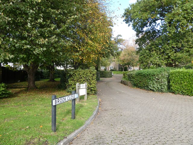
Ball Copse is a charming woodland located in Somerset, England. Situated near the town of Shepton Mallet, this enchanting forest covers an area of approximately 50 hectares. It is a popular destination for nature enthusiasts and offers a tranquil escape from the hustle and bustle of daily life.

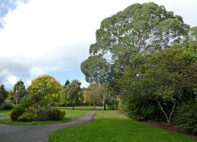
The woodland is characterized by a diverse range of tree species, including oak, ash, beech, and silver birch. These majestic trees provide a beautiful canopy that filters sunlight, creating a serene and shaded atmosphere. The forest floor is covered with a rich carpet of wildflowers, ferns, and mosses, adding to its natural beauty.

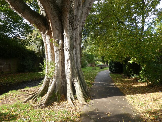
Visitors to Ball Copse can explore the network of well-maintained walking trails that wind their way through the woods. These paths provide an opportunity to immerse oneself in the peaceful surroundings and observe the abundant wildlife that inhabits the area. Birdwatchers will delight in the many species that call the woodland home, including woodpeckers, owls, and various songbirds.

The woodland also offers a variety of recreational activities, such as picnicking, wildlife photography, and nature study. It is a haven for outdoor enthusiasts, offering a peaceful retreat for walkers, joggers, and cyclists alike.

Additionally, Ball Copse has a rich historical significance. It is believed to have been part of an ancient royal hunting ground and has remnants of old boundary walls and ditches that date back centuries.

Overall, Ball Copse in Somerset is a captivating woodland that provides a haven for nature lovers and a glimpse into the region's rich history.

If you have any feedback on the listing, please let us know in the comments section below.
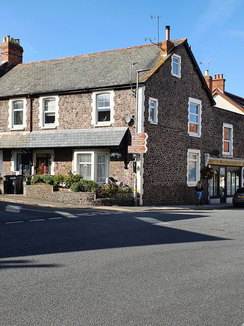
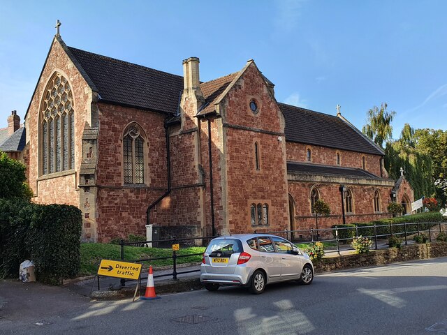
Ball Copse Images

Images are sourced within 2km of 51.197429/-3.4856718 or Grid Reference SS9645. Thanks to Geograph Open Source API. All images are credited.

Minehead railway station Minehead railway station with 4277 GWR locomotive
Minehead railway station
Minehead railway station with 4277 GWR locomotive
A Somerset County League Div 1 game at Minehead AFC Minehead repel an attack in the second half. The game ended Minehead 3 Nailsea & Tickenham Reserves 0.
A Somerset County League Div 1 game at Minehead AFC
Minehead repel an attack in the second half. The game ended Minehead 3 Nailsea & Tickenham Reserves 0.
Minehead manager, Avril Cooke makes a late substitution at Irnham Road The game ended Minehead 3 Nailsea & Tickenham Reserves 0.
Minehead manager, Avril Cooke makes a late substitution at Irnham Road
The game ended Minehead 3 Nailsea & Tickenham Reserves 0.
A tribute to George Formby at Minehead 1940's weekend On the railway station platform.
A tribute to George Formby at Minehead 1940's weekend
On the railway station platform.
Selbourne Place, Minehead Number 41 Selbourne Place, Minehead. This property also has an Ordnance Survey bench mark.
<a href="https://www.geograph.org.uk/photo/6999397">SS9646 : Ordnance Survey Bench Mark</a>
Selbourne Place, Minehead
Number 41 Selbourne Place, Minehead. This property also has an Ordnance Survey bench mark. SS9646 : Ordnance Survey Bench Mark
Ordnance Survey Bench Mark This mark is located on the wall at 41 Selbourne Place, Minehead. These marks were used by Ordnance Survey for mapping purposes.
<a href="https://www.geograph.org.uk/photo/6999393">SS9646 : Selbourne Place, Minehead</a>
Ordnance Survey Bench Mark
This mark is located on the wall at 41 Selbourne Place, Minehead. These marks were used by Ordnance Survey for mapping purposes. SS9646 : Selbourne Place, Minehead
Church of St Andrew, Minehead The Church of St Andrew, Minehead. The Church also has an Ordnance Survey bench mark.
<a href="https://www.geograph.org.uk/photo/6999438">SS9646 : Ordnance Survey Bench Mark</a>
Church of St Andrew, Minehead
The Church of St Andrew, Minehead. The Church also has an Ordnance Survey bench mark. SS9646 : Ordnance Survey Bench Mark
Ordnance Survey Bench Mark This mark is located on a stone gatepost at the Church of St Andrew in Minehead. these marks were used by Ordnance Survey for mapping purposes.
<a href="https://www.geograph.org.uk/photo/6999436">SS9646 : Church of St Andrew, Minehead</a>
Ordnance Survey Bench Mark
This mark is located on a stone gatepost at the Church of St Andrew in Minehead. these marks were used by Ordnance Survey for mapping purposes. SS9646 : Church of St Andrew, Minehead
Entrance to Brook Close
Paths through 'The Parks', Minehead
Mature Poplar tree in  'The Parks', Minehead
Mature Poplar tree in 'The Parks', Minehead
Model railway exhibition at Sainsbury Hall
Lane, at the rear of Elm Grove
The lower part of King George Road
Playground at Minehead First School
Temporary Library, Minehead
Main entrance, Tesco, Minehead
'Warning - Uneven Ground' Signs are cheaper than refurbishments. This 'tarmac' path has not been resurfaced for at least 25 years.
'Warning - Uneven Ground'
Signs are cheaper than refurbishments. This 'tarmac' path has not been resurfaced for at least 25 years.
Show me another place!

Ball Copse is located at Grid Ref: SS9645 (Lat: 51.197429, Lng: -3.4856718)

Administrative County: Somerset

District: Somerset West and Taunton

Police Authority: Avon and Somerset

What 3 Words

///perkily.bowhead.named. Near Minehead, Somerset

Nearby Locations

Little Hill Ball Copse

Related Wikis

The Kildare Lodge Inn

The Kildare Lodge Inn in Minehead, Somerset, England, was built in 1905/6, and is located at 18 Townsend Road, to the south east of the town centre of...

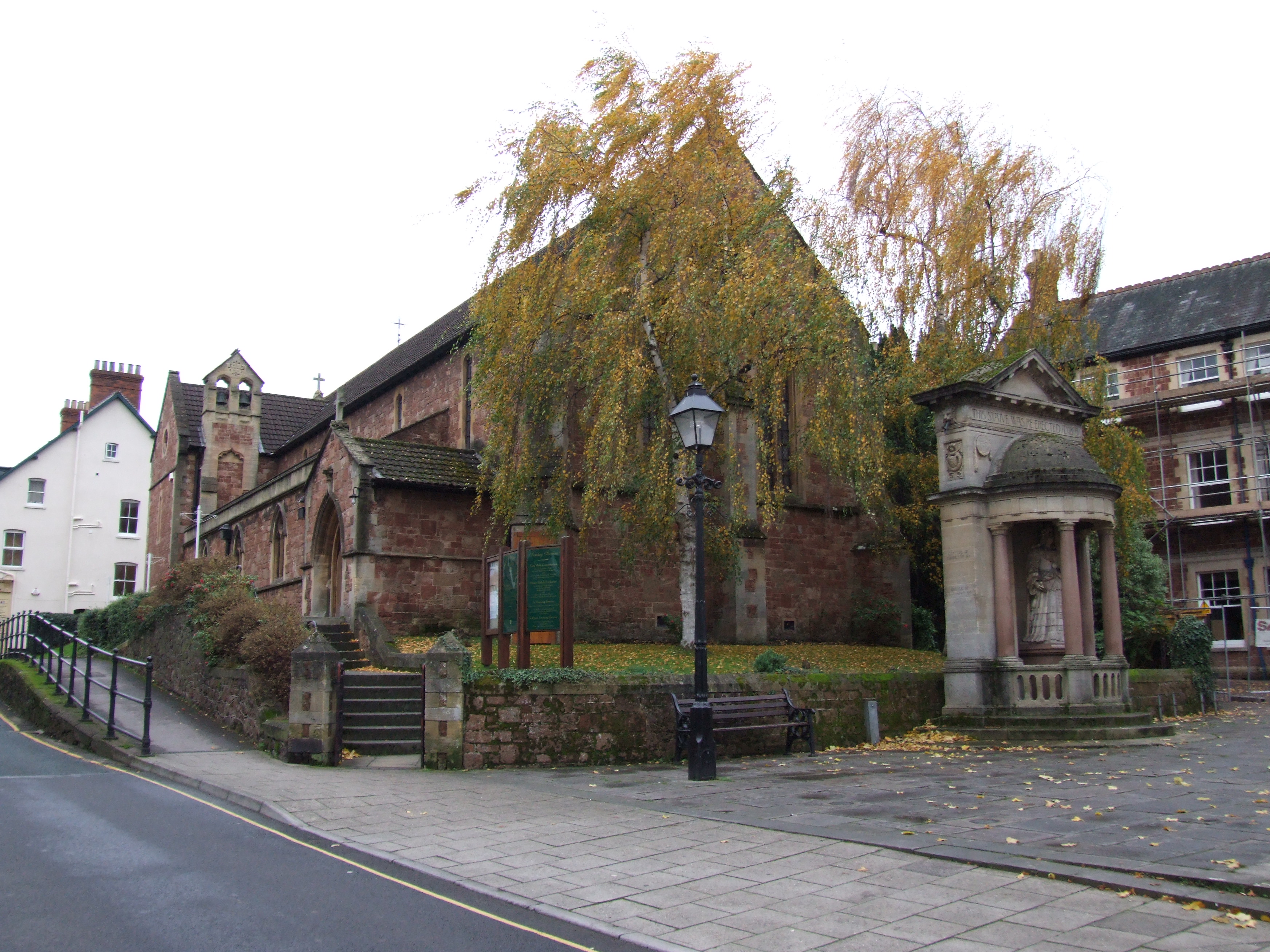
St Andrew's Church, Minehead

St Andrew's Church is a Church of England church in Minehead, Somerset, England. Designed by George Edmund Street, it was built in 1877–80 and has been...

Statue of Queen Anne, Minehead

The Statue of Queen Anne in Minehead, Somerset, England was built in 1719. It is a Grade II* listed building. == History == The statue depicts Queen Anne...
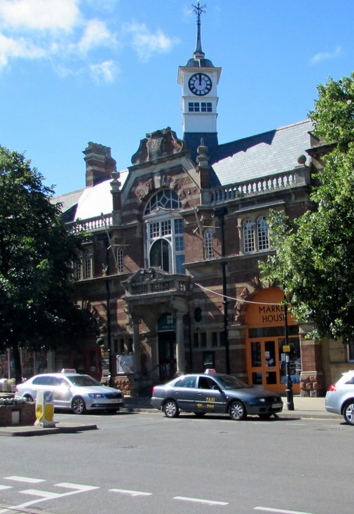
Minehead Town Hall

Minehead Town Hall is a municipal building in The Parade, Minehead, Somerset, England. The structure, which is the meeting place of Minehead Town Council...

Minehead

Minehead is a coastal town and civil parish in Somerset, England. It lies on the south bank of the Bristol Channel, 21 miles (34 km) north-west of the...

Minehead A.F.C.

Minehead Association Football Club is a football club based in Minehead, Somerset, England. The club are currently members of the Somerset County League...

Dunster Park and Heathlands

Dunster Park and Heathlands (grid reference SS955441) is a 466.6 hectare biological Site of Special Scientific Interest in Somerset, notified in 2000....

Church of St Michael, Minehead

The Anglican Church of St Michael in Minehead, Somerset, England was built in the 15th century. It is a Grade II* listed building. == History == The church...

Nearby Amenities

Located within 500m of 51.197429,-3.4856718
Lower Hopcott
Place: locality
Lat/Long: 51.1989567/-3.4840751
Generator Method: photovoltaic
Generator Output Electricity: yes
Generator Source: solar
Generator Type: solar_photovoltaic_panel
Location: roof
Power: generator
Lat/Long: 51.2006469/-3.4875959
Generator Method: photovoltaic
Generator Output Electricity: yes
Generator Source: solar
Generator Type: solar_photovoltaic_panel
Location: roof
Power: generator
Lat/Long: 51.1998654/-3.4865096
Generator Method: photovoltaic
Generator Output Electricity: yes
Generator Source: solar
Generator Type: solar_photovoltaic_panel
Location: roof
Power: generator
Lat/Long: 51.1998486/-3.4857345
Generator Method: photovoltaic
Generator Output Electricity: yes
Generator Source: solar
Generator Type: solar_photovoltaic_panel
Location: roof
Power: generator
Lat/Long: 51.2002066/-3.4834948
Generator Method: photovoltaic
Generator Output Electricity: yes
Generator Source: solar
Generator Type: solar_photovoltaic_panel
Location: roof
Power: generator
Lat/Long: 51.1999057/-3.4806517
Generator Method: photovoltaic
Generator Output Electricity: yes
Generator Source: solar
Generator Type: solar_photovoltaic_panel
Location: roof
Power: generator
Lat/Long: 51.2005007/-3.4841815
Generator Method: photovoltaic
Generator Output Electricity: yes
Generator Source: solar
Generator Type: solar_photovoltaic_panel
Location: roof
Power: generator
Lat/Long: 51.2014553/-3.4861341
Generator Method: photovoltaic
Generator Output Electricity: yes
Generator Source: solar
Generator Type: solar_photovoltaic_panel
Location: roof
Power: generator
Lat/Long: 51.2013561/-3.4854341
Generator Method: photovoltaic
Generator Output Electricity: yes
Generator Source: solar
Generator Type: solar_photovoltaic_panel
Location: roof
Power: generator
Lat/Long: 51.2013427/-3.4853697
Generator Method: photovoltaic
Generator Output Electricity: yes
Generator Source: solar
Generator Type: solar_photovoltaic_panel
Location: roof
Power: generator
Lat/Long: 51.2015141/-3.4857774
Generator Method: photovoltaic
Generator Output Electricity: yes
Generator Source: solar
Generator Type: solar_photovoltaic_panel
Location: roof
Power: generator
Lat/Long: 51.2015578/-3.4857559
Generator Method: photovoltaic
Generator Output Electricity: yes
Generator Source: solar
Generator Type: solar_photovoltaic_panel
Location: roof
Power: generator
Lat/Long: 51.2015628/-3.4855896
Generator Method: photovoltaic
Generator Output Electricity: yes
Generator Source: solar
Generator Type: solar_photovoltaic_panel
Location: roof
Power: generator
Lat/Long: 51.2003108/-3.4892616
Generator Method: photovoltaic
Generator Output Electricity: yes
Generator Source: solar
Generator Type: solar_photovoltaic_panel
Location: roof
Power: generator
Lat/Long: 51.2005208/-3.4898141
Generator Method: photovoltaic
Generator Output Electricity: yes
Generator Source: solar
Generator Type: solar_photovoltaic_panel
Location: roof
Power: generator
Lat/Long: 51.2005074/-3.4897551
Generator Method: photovoltaic
Generator Output Electricity: yes
Generator Source: solar
Generator Type: solar_photovoltaic_panel
Location: roof
Power: generator
Lat/Long: 51.2011259/-3.4892347
Communication 2G: yes
Communication 3G: yes
Communication 4G: yes
Communication 4G+: yes
Man Made: antenna
Operator: Vodafone, o2, EE, 3
Lat/Long: 51.19746/-3.4804465
Higher Hopcott
Place: locality
Lat/Long: 51.195976/-3.487145
The data included in this document is from www.openstreetmap.org. The data is made available under ODbL.

Have you been to Ball Copse?

Leave your review of Ball Copse below (or comments, questions and feedback).