Beasley Wood
Wood, Forest in Somerset Somerset West and Taunton
England
Beasley Wood
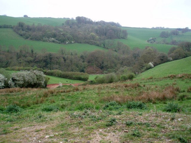
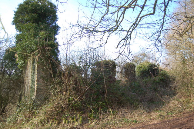
Beasley Wood is a picturesque forest located in the county of Somerset, England. Spanning an area of approximately 100 acres, this beautiful woodland is a haven for nature lovers and outdoor enthusiasts alike.
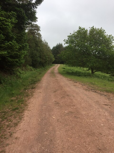
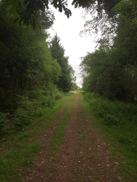
The forest is characterized by its dense, lush vegetation and a diverse range of tree species, including oak, beech, and ash. The towering trees provide a tranquil and serene ambiance, making it a popular destination for those seeking respite from the hustle and bustle of city life.
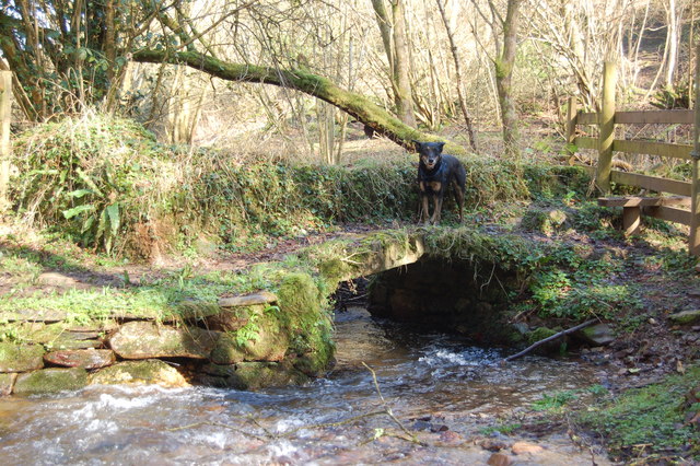
Beasley Wood is home to a variety of wildlife, with numerous species of birds, mammals, and insects calling this forest their habitat. Visitors can spot woodland birds such as blue tits, great tits, and woodpeckers flitting among the branches, while squirrels scurry up and down the tree trunks in search of food. The forest floor is carpeted with an array of wildflowers, adding bursts of color to the natural landscape.
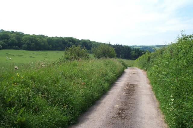
The wood offers a network of well-maintained walking trails, allowing visitors to explore its beauty at their own pace. These trails wind through the forest, leading to hidden clearings, babbling brooks, and tranquil ponds. It is a perfect setting for leisurely walks, picnics, or simply sitting back and enjoying the serenity of nature.
Beasley Wood is easily accessible and attracts visitors from both within the local community and beyond. Its natural beauty, abundant wildlife, and peaceful atmosphere make it a must-visit destination for anyone seeking a connection with nature in the heart of Somerset.
If you have any feedback on the listing, please let us know in the comments section below.
Beasley Wood Images
Images are sourced within 2km of 51.158699/-3.4933078 or Grid Reference SS9540. Thanks to Geograph Open Source API. All images are credited.


Beasley Wood is located at Grid Ref: SS9540 (Lat: 51.158699, Lng: -3.4933078)
Administrative County: Somerset
District: Somerset West and Taunton
Police Authority: Avon and Somerset
What 3 Words
///impeached.regret.spin. Near Minehead, Somerset
Nearby Locations
Related Wikis

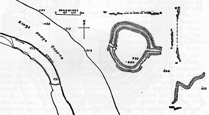
Long Wood Enclosure
Long Wood Enclosure is an enclosure which may have been a univallate Iron Age hill fort, in the West Somerset district of Somerset, England. The hill fort...

Wootton Courtenay
Wootton Courtenay is a village and civil parish on Exmoor in the Somerset West and Taunton district of Somerset, England. The parish includes the hamlets...

Dunster Park and Heathlands
Dunster Park and Heathlands (grid reference SS955441) is a 466.6 hectare biological Site of Special Scientific Interest in Somerset, notified in 2000....

Church of St John, Cutcombe
The Anglican Church of St John in Cutcombe, Somerset, England was built in the 13th and 14th centuries. It is a Grade II* listed building. == History... ==

Black Ball Camp
Black Ball Camp is an Iron Age hillfort South West of Dunster, Somerset, England on the northern summit of Gallox Hill. It is a Scheduled Monument.It is...
Cutcombe
Cutcombe is a village and civil parish 9 miles (14 km) south of Minehead and north of Dulverton straddling the ridge between Exmoor and the Brendon Hills...
Bat's Castle
Bats Castle is an Iron Age hillfort at the top of a 213 metres (699 ft) high hill in the parish of Carhampton south south west of Dunster in Somerset,...

St Mary's Church, Luxborough
The Anglican St Mary's Church at Luxborough within the English county of Somerset dates from the 13th century. It is a Grade II listed building.The chancel...
Have you been to Beasley Wood?
Leave your review of Beasley Wood below (or comments, questions and feedback).