Bury Wood

Wood, Forest in Somerset Somerset West and Taunton

England

Bury Wood

Former Dulverton Station Seen from a bridge over the dismantled railway line. The stationmaster's house and goods shed were built by the Devon and somerset Railway and opened in 1873. The Exe Valley Railway also had its terminus here. The station is actually about 2 miles south of Dulverton and in Brushford.
Former Dulverton Station Credit: Chris Allen

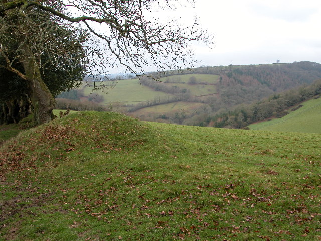
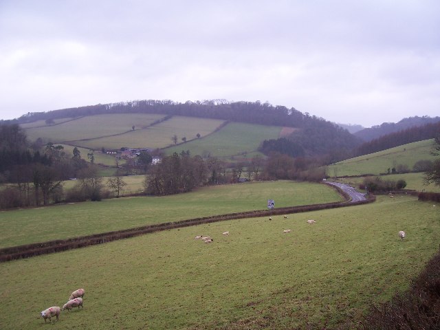
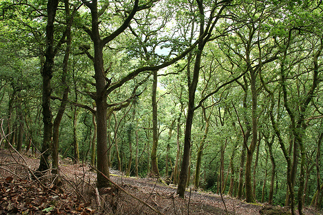
Bury Wood is a picturesque forest located in Somerset, England. Covering an area of approximately 200 acres, it is a popular destination for nature lovers and outdoor enthusiasts alike. The wood is nestled within the rolling countryside of Somerset, offering visitors a tranquil and serene environment to explore.

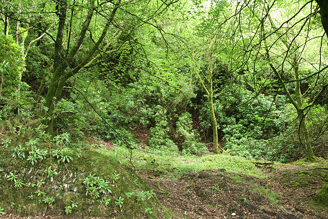
Bury Wood boasts a diverse range of flora and fauna, making it an important habitat for various species of plants and animals. The woodland is predominantly made up of broadleaf trees, including oak, beech, and ash, which create a dense canopy providing shade and shelter. Beneath the towering trees, a carpet of bluebells, wood anemones, and wild garlic adds a splash of color during the spring months.

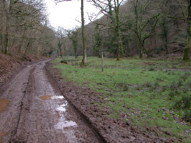
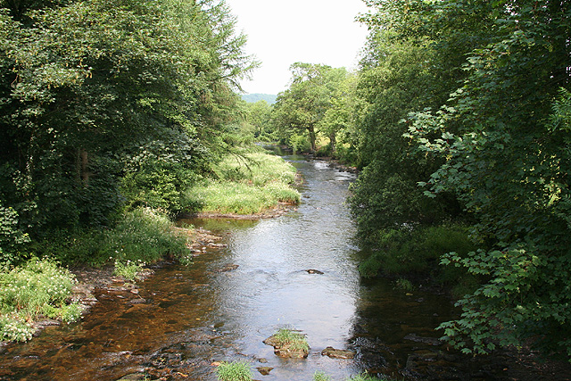
The forest is crisscrossed by a network of trails and footpaths, allowing visitors to wander and discover its hidden gems. These paths lead to secluded glades, babbling brooks, and small ponds, providing opportunities for peaceful walks or picnics in the great outdoors. The wood is also home to a variety of wildlife, including deer, badgers, and a plethora of bird species, making it a haven for birdwatchers and wildlife enthusiasts.

Bury Wood holds historical significance as well, with remnants of ancient earthworks and old boundary walls scattered throughout the forest. These remnants offer a glimpse into the area's rich past, providing a sense of connection to the generations that have roamed these woods before.

Overall, Bury Wood in Somerset offers a delightful escape from the hustle and bustle of everyday life, providing a sanctuary for both nature and history lovers to explore and enjoy.

If you have any feedback on the listing, please let us know in the comments section below.
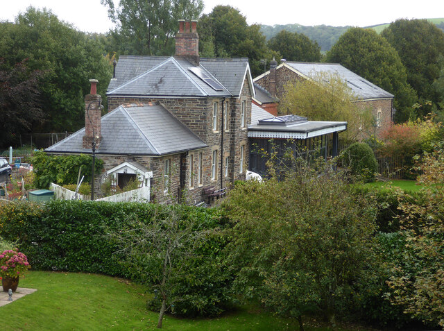
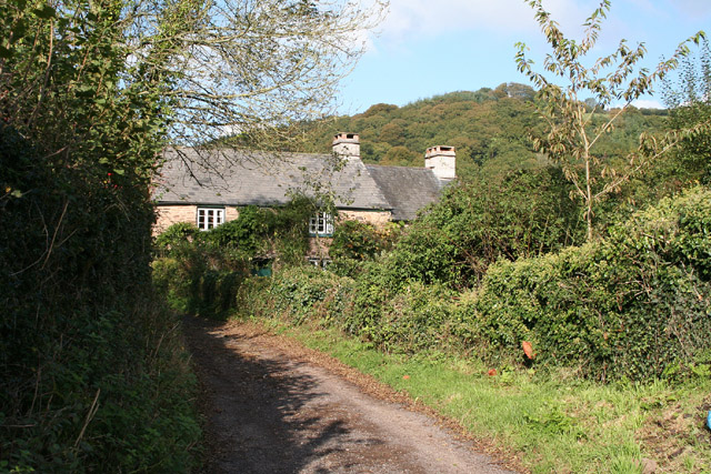
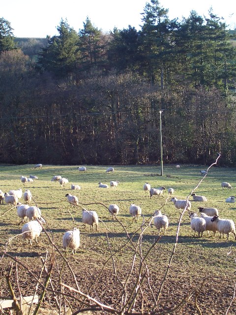
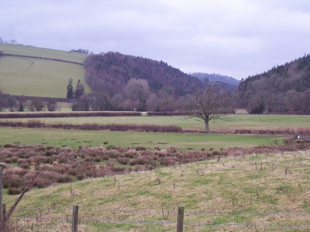
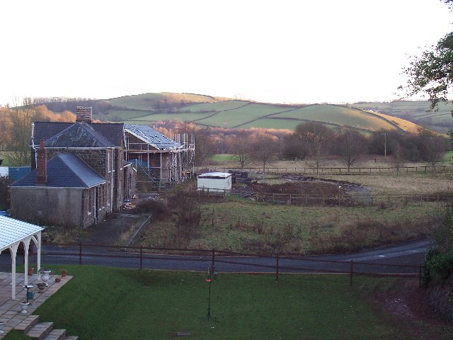
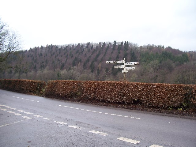
Bury Wood Images

Images are sourced within 2km of 51.031958/-3.5133886 or Grid Reference SS9326. Thanks to Geograph Open Source API. All images are credited.

Former Dulverton Station Seen from a bridge over the dismantled railway line. The stationmaster's house and goods shed were built by the Devon and somerset Railway and opened in 1873. The Exe Valley Railway also had its terminus here. The station is actually about 2 miles south of Dulverton and in Brushford.
Former Dulverton Station
Seen from a bridge over the dismantled railway line. The stationmaster's house and goods shed were built by the Devon and somerset Railway and opened in 1873. The Exe Valley Railway also had its terminus here. The station is actually about 2 miles south of Dulverton and in Brushford.
Haddeo Valley Lady Harriet Acland's drive in the Haddeo valley near the village of Bury.
Haddeo Valley
Lady Harriet Acland's drive in the Haddeo valley near the village of Bury.
Bridge in village of Bury The bridge and ford crossing the River Haddeo in the village of Bury on Somerset.
Bridge in village of Bury
The bridge and ford crossing the River Haddeo in the village of Bury on Somerset.
Haddeo Valley The Haddeo valley viewed from the Haddon Lane, above the village of Bury.
Haddeo Valley
The Haddeo valley viewed from the Haddon Lane, above the village of Bury.
Brompton Regis: ford and packhorse bridge at Bury Crossing the river Haddeo, a tributary of the Exe
Brompton Regis: ford and packhorse bridge at Bury
Crossing the river Haddeo, a tributary of the Exe
Brompton Regis: Hunt’s Farm The farm offers bed and breakfast and has organic eggs for sale
Brompton Regis: Hunt’s Farm
The farm offers bed and breakfast and has organic eggs for sale
Farmland near Willishayes Farm Farmland just south of Willishayes Farm, looking southwards
Farmland near Willishayes Farm
Farmland just south of Willishayes Farm, looking southwards
River Exe flood plain The river Exe emerges from the steep wooded valley into a flood plain and flows south (right to left) along the row of trees in the middle distance, to meet with the river Barle at the "Meeting of the Waters" towards the southern end of this square.
River Exe flood plain
The river Exe emerges from the steep wooded valley into a flood plain and flows south (right to left) along the row of trees in the middle distance, to meet with the river Barle at the "Meeting of the Waters" towards the southern end of this square.
Railway Station, Brushford Railway Station at Brushford is Dulverton Station, on the Taunton to Barnstaple line. The station and goods shed are visible from the road bridge. The line was closed in 1966.
Railway Station, Brushford
Railway Station at Brushford is Dulverton Station, on the Taunton to Barnstaple line. The station and goods shed are visible from the road bridge. The line was closed in 1966.
Bury Cross The junction of 'Bury Cross', looking west towards Pixton Hill.
Bury Cross
The junction of 'Bury Cross', looking west towards Pixton Hill.
Machine Cross The road junction 'Machine Cross', and the Exe valley. The river Exe flows south along the far (western) edge of the valley floor.
Machine Cross
The road junction 'Machine Cross', and the Exe valley. The river Exe flows south along the far (western) edge of the valley floor.
Dulverton: the Barle at Allers Wood Looking north-north-west from one of the access roads into Pixton Park, a private estate. Nearby a public footpath runs through fields to Dulverton town
Dulverton: the Barle at Allers Wood
Looking north-north-west from one of the access roads into Pixton Park, a private estate. Nearby a public footpath runs through fields to Dulverton town
Dulverton: Bath Meadow Drive Looking north-north-west amongst bungalows
Dulverton: Bath Meadow Drive
Looking north-north-west amongst bungalows
Dulverton: entrance to Pixton Park House There are several entrances to the private estate, of which this is one. Some of the others have lodges or gatehouses. Looking west-north-west
Dulverton: entrance to Pixton Park House
There are several entrances to the private estate, of which this is one. Some of the others have lodges or gatehouses. Looking west-north-west
Brompton Regis: old quarry On Bury Hill by the road from Machine Cross, and now populated with rhododendrons. Looking north east
Brompton Regis: old quarry
On Bury Hill by the road from Machine Cross, and now populated with rhododendrons. Looking north east
Brompton Regis: Barlynch Wood A hanging wood in the Exe valley. Looking south-south-west
Brompton Regis: Barlynch Wood
A hanging wood in the Exe valley. Looking south-south-west
Dulverton: the Exe above Helebridge Looking north-north-east towards Barlynch Wood
Dulverton: the Exe above Helebridge
Looking north-north-east towards Barlynch Wood
Old hydroelectric scheme  on the Barle below Dulverton This old electricity generating installation can be viewed from the Exe Valley Way, it is viewed across the River Barle. Looking towards the West on a warm winter's afternoon. 
 
(Update: The building has been pulled down since this photo was taken. See forum <a title="https://www.geograph.org.uk/discuss/index.php?gridref=SS9226" href="https://www.geograph.org.uk/discuss/index.php?gridref=SS9226">Link</a> for further information.)
Old hydroelectric scheme on the Barle below Dulverton
This old electricity generating installation can be viewed from the Exe Valley Way, it is viewed across the River Barle. Looking towards the West on a warm winter's afternoon. (Update: The building has been pulled down since this photo was taken. See forum Link for further information.)
Show me another place!

Bury Wood is located at Grid Ref: SS9326 (Lat: 51.031958, Lng: -3.5133886)

Administrative County: Somerset

District: Somerset West and Taunton

Police Authority: Avon and Somerset

What 3 Words

///motivate.wicket.landowner. Near Dulverton, Somerset

Related Wikis

Bury Castle, Brompton Regis

Bury Castle near Brompton Regis in the English county of Somerset was an Iron Age univallate hillfort which was reused with the creation of a motte after...
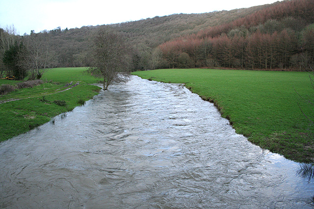
River Haddeo

The River Haddeo on Exmoor in Somerset, England flows from the Wimbleball Lake to the River Exe. The valley of the river consists of three tributary valleys...

Bury Bridge

Bury Bridge at Bury in the parish of Brompton Regis within the English county of Somerset is a medieval packhorse bridge. It has been scheduled as an ancient...

Brushford, Somerset

Brushford is a village and civil parish 2 miles (3.2 km) south of Dulverton and 12 miles (19 km) north of Tiverton in Devon, in the Somerset West and Taunton...

Barlynch Priory

Barlynch Priory (also known as St Nicholas's Priory and sometimes spelled Barlich Priory) in Brompton Regis, Somerset, England was an Augustinian priory...

St George's Church, Morebath

St George's Church, Morebath is a Grade II* listed parish church in the Church of England Diocese of Exeter in Morebath, Devon. It is part of the Hukeley...

Exebridge

Exebridge is a village that lies on the border between Devon and Somerset, England. It lies at the confluence of the Barle and Exe rivers. Exebridge is...

Morebath

Morebath is an upland village in the county of Devon, England. It is mostly given over to sheep-farming, and situated on the southern edge of Exmoor. An...

Nearby Amenities

Located within 500m of 51.031958,-3.5133886
Historic: milestone
Inscription: 18 Miles to Minehead
Lat/Long: 51.0329449/-3.5176175
Dyehouse Wood
Place: locality
Lat/Long: 51.0307363/-3.5100819
Lower Copse
Place: locality
Lat/Long: 51.0310944/-3.5077758
Poor Tenement Plantation
Place: locality
Lat/Long: 51.030192/-3.5069493
Pixy Copse
Place: locality
Lat/Long: 51.0276935/-3.514157
The data included in this document is from www.openstreetmap.org. The data is made available under ODbL.

Have you been to Bury Wood?

Leave your review of Bury Wood below (or comments, questions and feedback).