Broomclose Copse

Wood, Forest in Somerset Somerset West and Taunton

England

Broomclose Copse

Norman Cottage, Wheddon Cross The pair of thatched semi-detached cottages (late C18-early C19) are Grade II listed buildings, see: <span class="nowrap"><a title="https://britishlistedbuildings.co.uk/101345718-norman-cottage-cutcombe#.YVcPs33TXIU" rel="nofollow ugc noopener" href="https://britishlistedbuildings.co.uk/101345718-norman-cottage-cutcombe#.YVcPs33TXIU">Link</a><img style="margin-left:2px;" alt="External link" title="External link - shift click to open in new window" src="https://s1.geograph.org.uk/img/external.png" width="10" height="10"/></span> . The whole block including the nearer 3rd cottage appears to be known as 'Norman Cottage'. Beyond, the road for Cutcombe veers off to the right with the village war memorial at the junction.
I've subsequently discovered that the just-visible telephone kiosk is a K6 type which apparently warrants it being Grade II listed too! See: <span class="nowrap"><a title="https://britishlistedbuildings.co.uk/101057316-k6-telephone-kiosk-wheddon-cross-cutcombe#.YVcQ2H3TXIU" rel="nofollow ugc noopener" href="https://britishlistedbuildings.co.uk/101057316-k6-telephone-kiosk-wheddon-cross-cutcombe#.YVcQ2H3TXIU">Link</a><img style="margin-left:2px;" alt="External link" title="External link - shift click to open in new window" src="https://s1.geograph.org.uk/img/external.png" width="10" height="10"/></span> .
Norman Cottage, Wheddon Cross Credit: Martin Tester

Broomclose Copse is a picturesque woodland located in Somerset, England. Situated near the small village of Broomclose, the copse covers an area of approximately 30 acres. It is a popular spot for nature enthusiasts, hikers, and those seeking a peaceful retreat in the heart of the countryside.

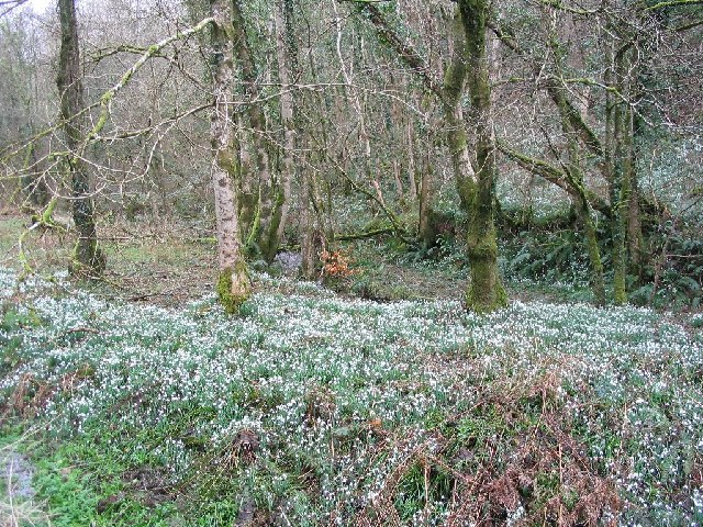
The copse is primarily composed of deciduous trees, including oak, beech, and ash, which create a dense and vibrant canopy. It is also home to a variety of wildlife, including squirrels, rabbits, and a diverse range of bird species. The forest floor is covered in a carpet of wildflowers during the spring and summer months, adding to the natural beauty of the area.

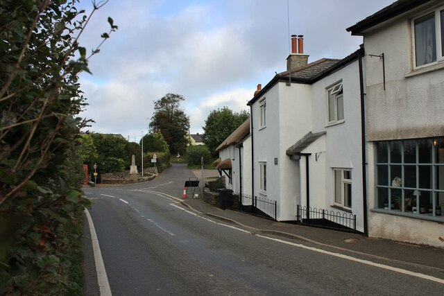
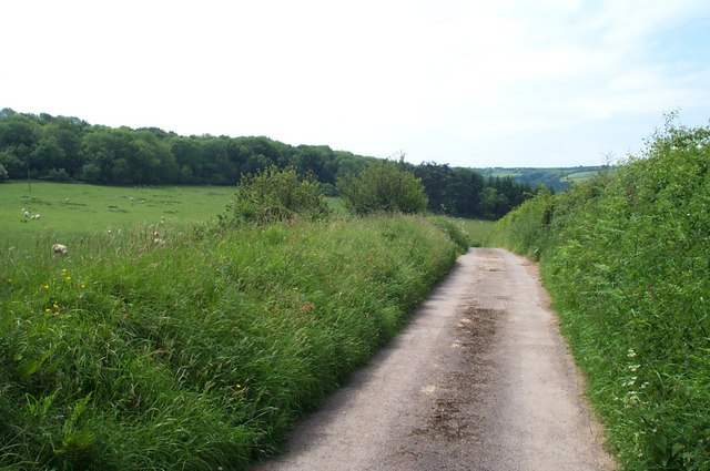
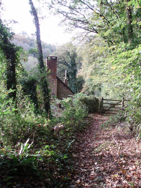
There are several walking trails that meander through Broomclose Copse, allowing visitors to explore its serene surroundings. These trails are well-maintained and provide opportunities to observe the diverse flora and fauna that inhabit the copse. Along the way, visitors may encounter babbling brooks, small ponds, and ancient stone walls, adding to the charm and character of the woodland.

The copse is a designated Site of Special Scientific Interest (SSSI), due to its ecological importance and the presence of rare plant species. The management of the copse focuses on preserving its biodiversity and protecting its delicate ecosystem.

Overall, Broomclose Copse offers a tranquil and enchanting experience for those seeking to immerse themselves in nature. Its rich biodiversity, scenic beauty, and well-maintained trails make it a must-visit destination for nature lovers and outdoor enthusiasts alike.

If you have any feedback on the listing, please let us know in the comments section below.

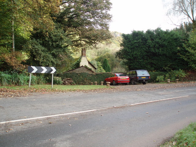
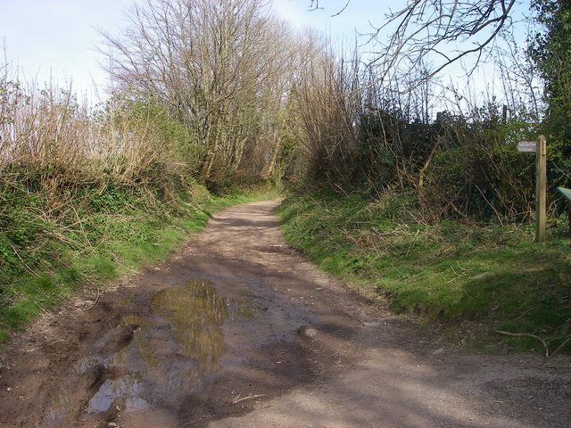
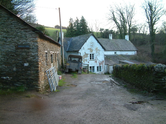
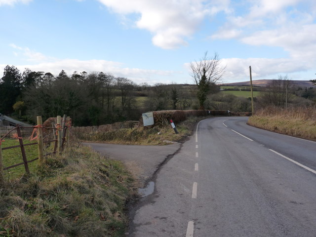
Broomclose Copse Images

Images are sourced within 2km of 51.152572/-3.5214358 or Grid Reference SS9340. Thanks to Geograph Open Source API. All images are credited.

Norman Cottage, Wheddon Cross The pair of thatched semi-detached cottages (late C18-early C19) are Grade II listed buildings, see: <span class="nowrap"><a title="https://britishlistedbuildings.co.uk/101345718-norman-cottage-cutcombe#.YVcPs33TXIU" rel="nofollow ugc noopener" href="https://britishlistedbuildings.co.uk/101345718-norman-cottage-cutcombe#.YVcPs33TXIU">Link</a><img style="margin-left:2px;" alt="External link" title="External link - shift click to open in new window" src="https://s1.geograph.org.uk/img/external.png" width="10" height="10"/></span> . The whole block including the nearer 3rd cottage appears to be known as 'Norman Cottage'. Beyond, the road for Cutcombe veers off to the right with the village war memorial at the junction.
I've subsequently discovered that the just-visible telephone kiosk is a K6 type which apparently warrants it being Grade II listed too! See: <span class="nowrap"><a title="https://britishlistedbuildings.co.uk/101057316-k6-telephone-kiosk-wheddon-cross-cutcombe#.YVcQ2H3TXIU" rel="nofollow ugc noopener" href="https://britishlistedbuildings.co.uk/101057316-k6-telephone-kiosk-wheddon-cross-cutcombe#.YVcQ2H3TXIU">Link</a><img style="margin-left:2px;" alt="External link" title="External link - shift click to open in new window" src="https://s1.geograph.org.uk/img/external.png" width="10" height="10"/></span> .
Norman Cottage, Wheddon Cross
The pair of thatched semi-detached cottages (late C18-early C19) are Grade II listed buildings, see: LinkExternal link . The whole block including the nearer 3rd cottage appears to be known as 'Norman Cottage'. Beyond, the road for Cutcombe veers off to the right with the village war memorial at the junction. I've subsequently discovered that the just-visible telephone kiosk is a K6 type which apparently warrants it being Grade II listed too! See: LinkExternal link .
Snow Drop Valley North Hawkwell Woods in early spring.
Snow Drop Valley
North Hawkwell Woods in early spring.
CUTCOMBE, Somerset The church of St John
CUTCOMBE, Somerset
The church of St John
The track to Stowey Farm
Sully Sully consists of one cottage. Photo taken from the footpath in the woods behind the cottage.
Sully
Sully consists of one cottage. Photo taken from the footpath in the woods behind the cottage.
Sully, on the A396 near Wheddon Cross. The one and only dwelling in Sully.
Sully, on the A396 near Wheddon Cross.
The one and only dwelling in Sully.
Putham Lane Leading east from Cutcombe - this is one of many restricted byways in this part of Exmoor.
Putham Lane
Leading east from Cutcombe - this is one of many restricted byways in this part of Exmoor.
Drapers Way At the crossroads to Ford Farm (<a href="https://www.geograph.org.uk/photo/527027">SS9140 : Ford Farm</a>) and Walland Farm.
Drapers Way
At the crossroads to Ford Farm (SS9140 : Ford Farm) and Walland Farm.
Kersham Farm
Kersham Farm
Avill valley From the lane called Drapers Way which drops down its southern slopes, a view across a steep field towards the River Avill, hidden among trees. Along the foot of the field runs the farm road to <a href="https://www.geograph.org.uk/photo/527027">SS9140 : Ford Farm</a>, visible at lower left. The road is followed by bridleway WL6/17. <a href="https://www.geograph.org.uk/photo/760422">SS9240 : Gates above Ford Farm</a> shows the field boundary junction at upper right.
Avill valley
From the lane called Drapers Way which drops down its southern slopes, a view across a steep field towards the River Avill, hidden among trees. Along the foot of the field runs the farm road to SS9140 : Ford Farm, visible at lower left. The road is followed by bridleway WL6/17. SS9240 : Gates above Ford Farm shows the field boundary junction at upper right.
Bridleway up the Avill valley The bridleway from Drapers Way descends the valley side on its way towards Dunkery Hill. The farm is Walland, in SS9140.
Bridleway up the Avill valley
The bridleway from Drapers Way descends the valley side on its way towards Dunkery Hill. The farm is Walland, in SS9140.
The A396 Cutcombe Hill just north of Wheddon Cross
The junction of Cutcombe Hill (A396) with Higher Park Lane, Wheddon Cross
A road sign at the junction of the A396 and the B3224 at Wheddon Cross
The junction of the A396 with the B3224 at Wheddon Cross
A footpath which runs near Raleigh Manor
A footpath through Snowdrop Valley, North Hawkswell Wood
Snowdrops in Snowdrop Valley, North Hawkswell Wood
Show me another place!

Broomclose Copse is located at Grid Ref: SS9340 (Lat: 51.152572, Lng: -3.5214358)

Administrative County: Somerset

District: Somerset West and Taunton

Police Authority: Avon and Somerset

What 3 Words

///bloom.populate.seriously. Near Minehead, Somerset

Related Wikis

Church of St John, Cutcombe

The Anglican Church of St John in Cutcombe, Somerset, England was built in the 13th and 14th centuries. It is a Grade II* listed building. == History... ==

Cutcombe

Cutcombe is a village and civil parish 9 miles (14 km) south of Minehead and north of Dulverton straddling the ridge between Exmoor and the Brendon Hills...

Timberscombe

Timberscombe is a village and civil parish on the River Avill 2.5 miles (4 km) south-west of Dunster, and 5.5 miles (9 km) south of Minehead within the...

Wootton Courtenay

Wootton Courtenay is a village and civil parish on Exmoor in the Somerset West and Taunton district of Somerset, England. The parish includes the hamlets...

Brendon Hills

The Brendon Hills are a range of hills in west Somerset, England. The hills merge level into the eastern side of Exmoor and are included within the Exmoor...

Dunster Park and Heathlands

Dunster Park and Heathlands (grid reference SS955441) is a 466.6 hectare biological Site of Special Scientific Interest in Somerset, notified in 2000....

St Mary's Church, Luxborough

The Anglican St Mary's Church at Luxborough within the English county of Somerset dates from the 13th century. It is a Grade II listed building.The chancel...

Luxborough

Luxborough is a small village and civil parish located some 6 miles (9.7 km) south of Dunster, lying amongst the Brendon Hills and the Exmoor National...

Nearby Amenities

Located within 500m of 51.152572,-3.5214358
West Harwood Farm
Note Retag: CS #48756035
Place: isolated_dwelling
Lat/Long: 51.1522976/-3.5262337
Power: pole
Lat/Long: 51.1483849/-3.5234517
Power: pole
Lat/Long: 51.1494971/-3.5225303
Power: pole
Lat/Long: 51.1515278/-3.5219175
Power: pole
Lat/Long: 51.1523884/-3.5210176
Power: pole
Lat/Long: 51.1533953/-3.51982
Power: pole
Lat/Long: 51.155664/-3.5190395
The data included in this document is from www.openstreetmap.org. The data is made available under ODbL.

Have you been to Broomclose Copse?

Leave your review of Broomclose Copse below (or comments, questions and feedback).