Alder Grove
Wood, Forest in Devon Mid Devon
England
Alder Grove
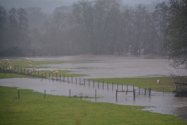
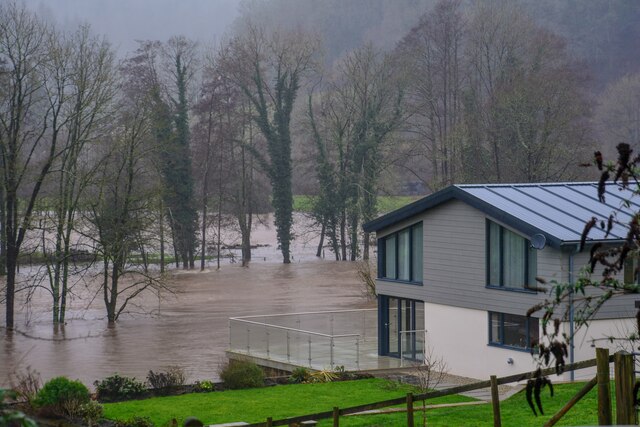
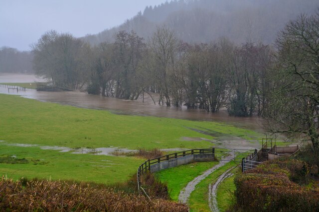
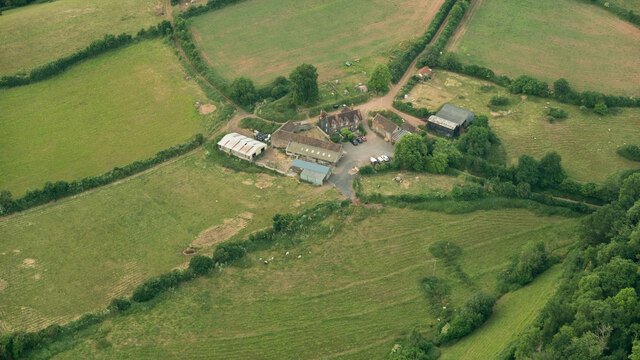
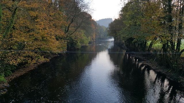
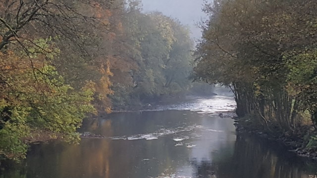
Alder Grove, located in Devon, England, is a picturesque wood known for its dense forest and striking beauty. Spanning an area of approximately 100 acres, this captivating grove is a haven for nature enthusiasts and those seeking tranquility amidst the lush green surroundings.
The grove is predominantly composed of alder trees, which lend their name to the area. These trees, with their distinctive dark bark and vibrant green leaves, create a truly enchanting atmosphere. The alder trees thrive in the moist and fertile soil found in the Devon region, resulting in a dense forest with a rich biodiversity.
Walking through Alder Grove, one can expect to encounter a diverse range of flora and fauna. The forest floor is carpeted with a variety of wildflowers, such as bluebells and primroses, adding splashes of color to the verdant landscape. The air is filled with the pleasant fragrance of damp earth and the sweet scent of blossoming flowers.
The grove is also home to a wide array of wildlife. Birdwatchers can spot various species of birds, including woodpeckers, thrushes, and owls, while smaller creatures like squirrels and rabbits scuttle through the undergrowth. Keen-eyed visitors may even catch a glimpse of deer or foxes, which occasionally venture into the grove.
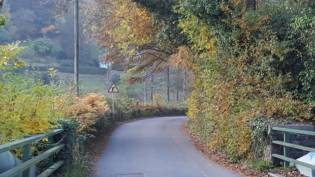
Alder Grove offers several walking trails and paths, allowing visitors to explore the woods at their own pace. The tranquil atmosphere and the symphony of natural sounds make it an idyllic location for hiking, birdwatching, or simply enjoying a peaceful picnic surrounded by nature's beauty.
In conclusion, Alder Grove in Devon is a captivating and biodiverse wood, offering visitors a chance to immerse themselves in the tranquility of a lush forest. Whether one seeks solitude, adventure, or a deeper connection with nature, this enchanting grove is sure to leave a lasting impression.
If you have any feedback on the listing, please let us know in the comments section below.
Alder Grove Images
Images are sourced within 2km of 50.939434/-3.5172282 or Grid Reference SS9316. Thanks to Geograph Open Source API. All images are credited.


Alder Grove is located at Grid Ref: SS9316 (Lat: 50.939434, Lng: -3.5172282)
Administrative County: Devon
District: Mid Devon
Police Authority: Devon and Cornwall
What 3 Words
///rejects.glow.crusaders. Near Tiverton, Devon
Nearby Locations
Related Wikis

Washfield
Washfield is a village, parish and former manor in Devon, England, situated about 2 miles north-west of Tiverton. The parish church is dedicated to St Mary the Virgin. It was within the jurisdiction of the historic West Budleigh Hundred.

Castle Close
Castle Close is a circular earthwork located near Stoodleigh in Mid Devon, England at OS grid reference SS937181. It is described on maps as a settlement. Situated some 208 metres above sea level, overlooking the River Exe, it is most likely to be an Iron Age Hill fort or enclosure.

Loxbeare
Loxbeare is a village and civil parish in Devon, England. The church is from the twelfth century and the tower is probably Norman. It is dedicated to St Michael and All Angels and is a grade II* listed building.In the Doomsday Book Loxbeare is recorded as Lochesbera.

Stoodleigh
Stoodleigh is a village and civil parish in the Mid Devon district of Devon, England, located 6 miles (10 km) north of Tiverton and 5 miles (8 km) south of Bampton. It is situated 800 feet (240 m) above the Exe Valley, close to the Devon / Somerset border. The centre of the village is a conservation area.In the past it formed part of Witheridge Hundred and it is within the Tiverton Deanery of the Church of England.

Calverleigh
Calverleigh (anciently Calwoodleigh) is a village and former civil parish and manor, now in the parish of Loxbeare, in the Mid Devon district, in the county of Devon, England. It is situated 2 miles north-west of Tiverton. The parish church is dedicated to St Mary.

Knightshayes Court
Knightshayes Court is a Victorian country house near Tiverton, Devon, England, designed by William Burges for the Heathcoat-Amory family. Nikolaus Pevsner describes it as "an eloquent expression of High Victorian ideals in a country house of moderate size." The house is Grade I listed. The gardens are Grade II* listed in the National Register of Historic Parks and Gardens.

Cove, Devon
Cove is a small village in the county of Devon, England. It is 4 miles north of Tiverton and 2 miles from Bampton in the Exe Valley some 450 feet above sea level. Cove was formed into an ecclesiastical parish in 1886.

Tiverton High School
Tiverton High School is a state secondary school located in Tiverton, Devon, England. It is located on the outskirts of the town, and has a close working relationship with the co-sited Petroc (formerly East Devon College). The school currently has approximately 1,200 pupils aged 11–16; the school's capacity is 1425.
Nearby Amenities
Located within 500m of 50.939434,-3.5172282Have you been to Alder Grove?
Leave your review of Alder Grove below (or comments, questions and feedback).