Cleeve Plantation

Wood, Forest in Somerset Somerset West and Taunton

England

Cleeve Plantation

A396 north of Quarme Bridge
A396 north of Quarme Bridge Credit: David Smith

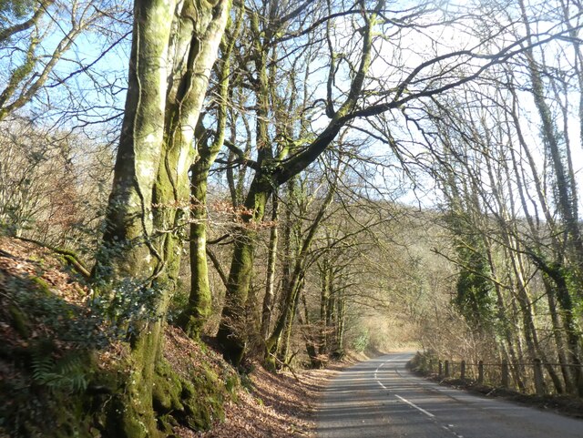
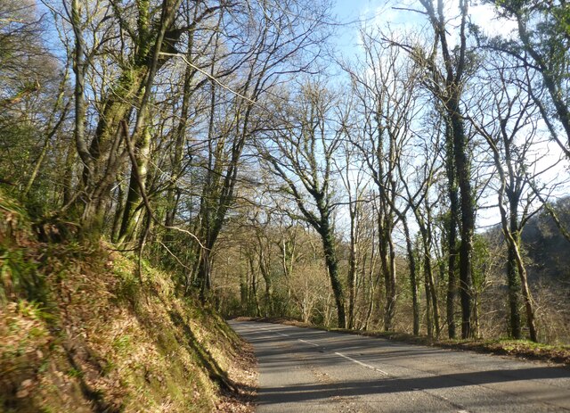
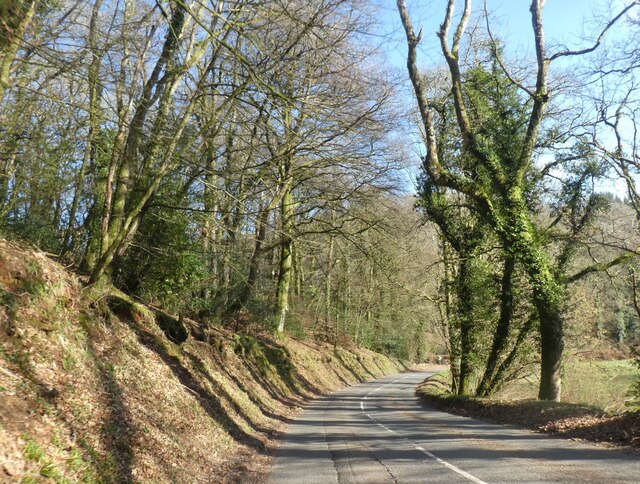
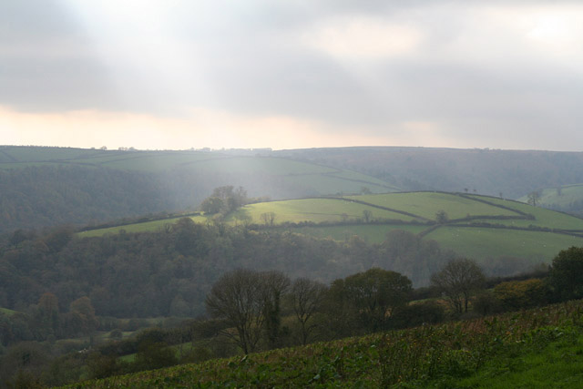
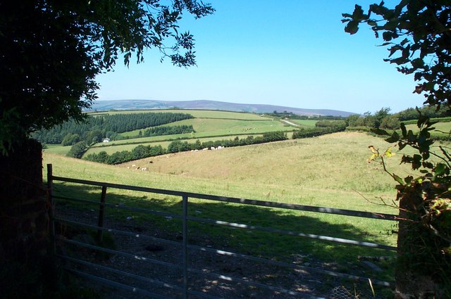
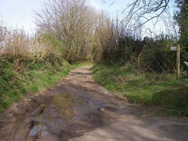
Cleeve Plantation is a picturesque woodland located in Somerset, England. It covers an area of approximately 100 acres and is situated in the beautiful Mendip Hills, a designated Area of Outstanding Natural Beauty. The plantation is renowned for its diverse range of tree species, including oak, beech, ash, and birch, which create a captivating and ever-changing landscape throughout the seasons.

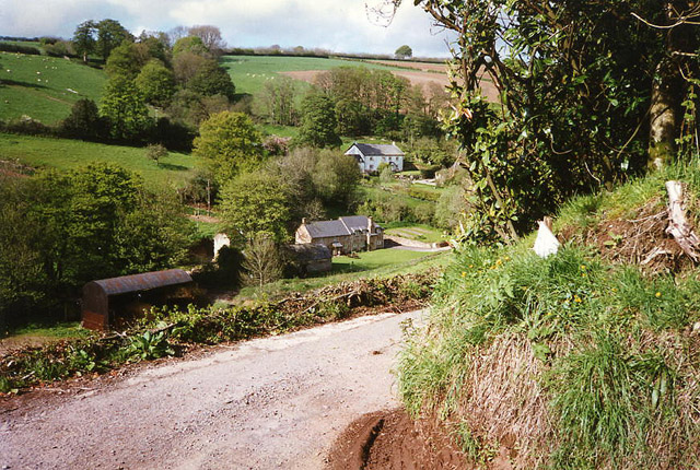
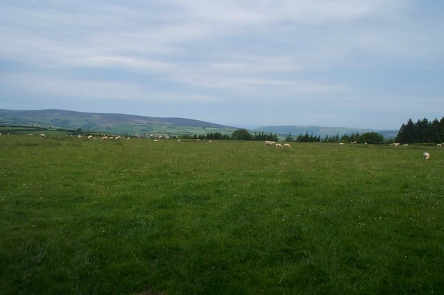
The woodland is home to a rich variety of wildlife, making it a popular destination for both nature enthusiasts and casual visitors. Roe deer, badgers, and foxes can often be spotted roaming among the trees, while a plethora of bird species, such as woodpeckers, owls, and buzzards, nest and hunt within the plantation. The tranquil atmosphere and natural beauty of Cleeve Plantation provide a haven for these creatures and a peaceful retreat for visitors.

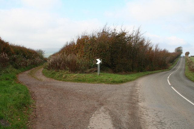
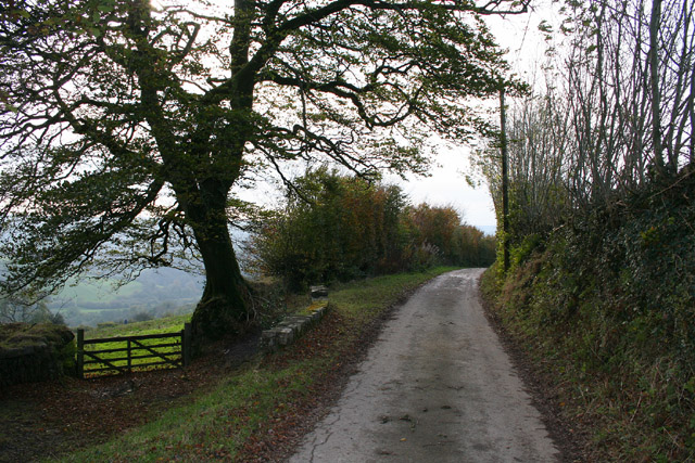
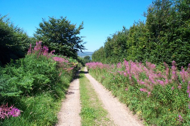
Trails and footpaths wind their way through the plantation, allowing visitors to explore the woodland's hidden corners and discover its hidden gems. A well-maintained network of paths ensures accessibility for all, making it a suitable destination for families and individuals alike. Additionally, benches and picnic areas are scattered throughout the plantation, providing ample opportunities for relaxation and enjoying the surrounding scenery.

Cleeve Plantation also holds historical significance, with evidence of ancient settlements and charcoal production dating back centuries. The remnants of charcoal platforms can still be found within the woodland, serving as a reminder of the area's past industries and the importance of sustainable resource management.

Overall, Cleeve Plantation offers a unique blend of natural beauty, wildlife, and historical interest, making it a must-visit destination for those seeking a tranquil escape within the stunning surroundings of Somerset.

If you have any feedback on the listing, please let us know in the comments section below.

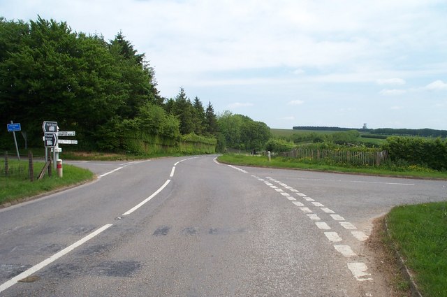
Cleeve Plantation Images

Images are sourced within 2km of 51.122066/-3.5319789 or Grid Reference SS9236. Thanks to Geograph Open Source API. All images are credited.

A396 north of Quarme Bridge
Winter sunlight: A396 in Quarme Wood
How the A396 is cut into the slope of Quarme Wood
Modern Milestone by the A396, Wheddon Cross Metal plate attached to stone post by the A396, in parish of  Cutcombe (WEST SOMERSET District), CERDIC new iron plate, erected by the County Council in the 21st century. 

Inscription reads:-
9
MILES
To
Minehead
CERDIC 2006 

Milestone Society National ID: SO_MHEB09.
Modern Milestone by the A396, Wheddon Cross
Metal plate attached to stone post by the A396, in parish of Cutcombe (WEST SOMERSET District), CERDIC new iron plate, erected by the County Council in the 21st century. Inscription reads:- 9 MILES To Minehead CERDIC 2006 Milestone Society National ID: SO_MHEB09.
Exton: Lower North Quarme and North Quarme A 12’ diameter waterwheel powered machinery installed in a barn at Lower North Quarme in the 1920s. The decayed wheel was still in situ when this photograph was taken in 1996, although the machinery had been removed. The farm is now a private residence
Exton: Lower North Quarme and North Quarme
A 12’ diameter waterwheel powered machinery installed in a barn at Lower North Quarme in the 1920s. The decayed wheel was still in situ when this photograph was taken in 1996, although the machinery had been removed. The farm is now a private residence
Cutcombe: Summerway Cross On the left is the ‘Hare Path’ or herepath. S H Burton, writing in 1969, saw this as one of the country’s most significant and ancient trackways. He claimed that it once linked Bristol and Gloucester with Barnstaple and Cornwall by way of the Quantocks, Exford and Simonsbath. Apparently the Saxons adopted the old route so that they could control the high ground to which they had driven the Celts, while they themselves occupied the lowland farmsteads. Here the track forms the boundary between Cutcome and Exton parishes. On the right the present-day road runs to Wheddon Cross. See <a href="https://www.geograph.org.uk/gridref/SS7340">SS7340</a> for another view of the track west of Simonsbath
Cutcombe: Summerway Cross
On the left is the ‘Hare Path’ or herepath. S H Burton, writing in 1969, saw this as one of the country’s most significant and ancient trackways. He claimed that it once linked Bristol and Gloucester with Barnstaple and Cornwall by way of the Quantocks, Exford and Simonsbath. Apparently the Saxons adopted the old route so that they could control the high ground to which they had driven the Celts, while they themselves occupied the lowland farmsteads. Here the track forms the boundary between Cutcome and Exton parishes. On the right the present-day road runs to Wheddon Cross. See SS7340 for another view of the track west of Simonsbath
Exton: near Stone Lane Exmoor’s heights in the distance, beyond the Quarme valley; a field of kale in the foreground. Looking south-west
Exton: near Stone Lane
Exmoor’s heights in the distance, beyond the Quarme valley; a field of kale in the foreground. Looking south-west
Exton: Stone Lane Looking west-south-west near Stone Lodge
Exton: Stone Lane
Looking west-south-west near Stone Lodge
Bridleway at White Moor, near Lype Hill A public Bridleway, now part of the Coleridge Way long distance path, runs across this field from where the photo was taken. Obviously not used by horses, nor by many people!
Bridleway at White Moor, near Lype Hill
A public Bridleway, now part of the Coleridge Way long distance path, runs across this field from where the photo was taken. Obviously not used by horses, nor by many people!
Heath Poult Cross Looking east along the B3224, which runs along the top of the Brendon Hills
Heath Poult Cross
Looking east along the B3224, which runs along the top of the Brendon Hills
Hare Path, a track near Wheddon Cross
Looking west from Quarme Lane In the foreground; Quarme Combe.In the distance; Dunkery Beacon.
Looking west from Quarme Lane
In the foreground; Quarme Combe.In the distance; Dunkery Beacon.
Modern Mosaic The side wall of the public conveniences in Wheddon Cross car park have been decorated with this large mosaic of Exmoor. The bottom right hand corner identifies it as a "Community Project 1992-1995."
Modern Mosaic
The side wall of the public conveniences in Wheddon Cross car park have been decorated with this large mosaic of Exmoor. The bottom right hand corner identifies it as a "Community Project 1992-1995."
Quarme Bridge, Upcott Lane The River Quarme is a left bank tributary of the River Exe and it is crossed here by Upcott Lane at the eponymously named bridge.  The lane will take you to Winsford.
Quarme Bridge, Upcott Lane
The River Quarme is a left bank tributary of the River Exe and it is crossed here by Upcott Lane at the eponymously named bridge. The lane will take you to Winsford.
Putham Lane Leading east from Cutcombe - this is one of many restricted byways in this part of Exmoor.
Putham Lane
Leading east from Cutcombe - this is one of many restricted byways in this part of Exmoor.
River Quarme near Bushel Bridge This crystal clear little river trickles over stones in a quiet Somerset valley.
See also <a href="https://www.geograph.org.uk/photo/455222">SS9137 : Bushel Bridge</a>
River Quarme near Bushel Bridge
This crystal clear little river trickles over stones in a quiet Somerset valley. See also SS9137 : Bushel Bridge
Bushel Bridge Bushel Bridge straddles the SS38 gridline with this southern side being just inside the SS9137 gridsquare. The river it crosses is the very shallow River Quarme. (See also <a href="https://www.geograph.org.uk/photo/455220">SS9137 : River Quarme near Bushel Bridge</a>)
Bushel Bridge
Bushel Bridge straddles the SS38 gridline with this southern side being just inside the SS9137 gridsquare. The river it crosses is the very shallow River Quarme. (See also SS9137 : River Quarme near Bushel Bridge)
Drive to Luckyard Farm This metalled track through Luckyard Wood leads off the A396 to Luckyard Farm.
Drive to Luckyard Farm
This metalled track through Luckyard Wood leads off the A396 to Luckyard Farm.
Show me another place!

Cleeve Plantation is located at Grid Ref: SS9236 (Lat: 51.122066, Lng: -3.5319789)

Administrative County: Somerset

District: Somerset West and Taunton

Police Authority: Avon and Somerset

What 3 Words

///owls.beefed.bulldozer. Near Dulverton, Somerset

Related Wikis

Timberscombe

Timberscombe is a village and civil parish on the River Avill 2.5 miles (4 km) south-west of Dunster, and 5.5 miles (9 km) south of Minehead within the...

Brendon Hills

The Brendon Hills are a range of hills in west Somerset, England. The hills merge level into the eastern side of Exmoor and are included within the Exmoor...

Cutcombe

Cutcombe is a village and civil parish 9 miles (14 km) south of Minehead and north of Dulverton straddling the ridge between Exmoor and the Brendon Hills...

Church of St John, Cutcombe

The Anglican Church of St John in Cutcombe, Somerset, England was built in the 13th and 14th centuries. It is a Grade II* listed building. == History... ==

Related Videos

Exmoor, Devon. Quick view of our holiday cottage and surroundings 😁☀️

We are at Wheddon Cross, Exmoor in Somerst/Devon, England. The location and weather are perfect and I have my own private ...

West Bagborough to Bicknoller, Part IV, Great Marrow Hill & Cairn'

After leaving the sleepy hamlet of Triscombe I head upwards following old bridle tracks to the top of Great Marrow Hill and the ...

(Funny comedy) Different Bradley's on holiday

If a holiday can be straight forward...... think again, holiday's always contain drama, welcome to a special addition of my comedy ...

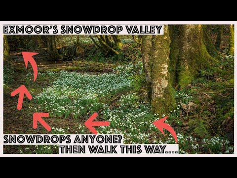
You have GOT TO VISIT this place....SNOWDROP VALLEY

take a walk with me around snowdrop valley near Wheddon cross on exmoor, The snowdrops are out in blossom in full force, ...

Nearby Amenities

Located within 500m of 51.122066,-3.5319789
Quarme Combe Farm
Place: farm
Lat/Long: 51.1243734/-3.5300208
The data included in this document is from www.openstreetmap.org. The data is made available under ODbL.

Have you been to Cleeve Plantation?

Leave your review of Cleeve Plantation below (or comments, questions and feedback).