Broford Wood

Wood, Forest in Somerset Somerset West and Taunton

England

Broford Wood

Halscombe Farm, near Dulverton: aerial 2021
Halscombe Farm, near Dulverton: aerial 2021 Credit: Chris

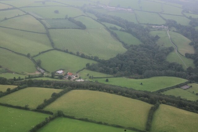
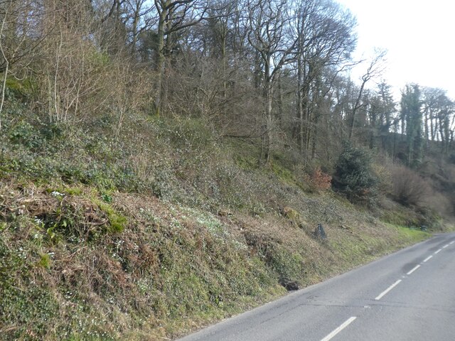
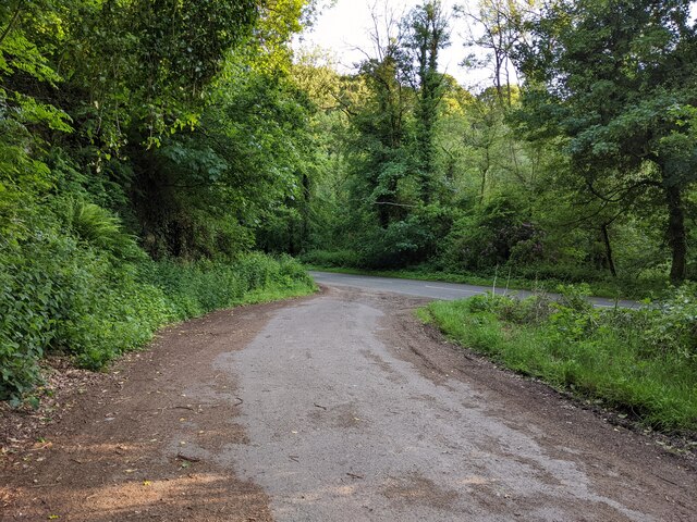
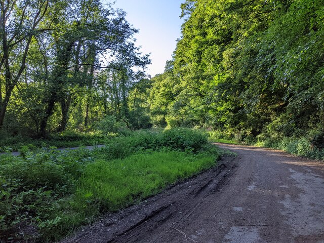
Broford Wood is a picturesque woodland located in Somerset, England. Covering an area of approximately 50 acres, it is nestled in the heart of the countryside and offers a serene and tranquil escape from the hustle and bustle of city life. The wood is situated near the small village of Broford, and its lush greenery and diverse range of flora and fauna make it a popular destination for nature enthusiasts and outdoor lovers.

The wood is primarily composed of broadleaf trees, including oak, beech, and ash, which create a dense canopy overhead, providing shade and shelter for the woodland floor. The forest floor is covered in a carpet of wildflowers, ferns, and moss, giving it a mystical and enchanting ambiance.

Broford Wood is also home to a variety of wildlife, including deer, foxes, and a wide range of bird species. Birdwatchers can spot woodpeckers, owls, and various warblers among the trees. The wood is a haven for bird nesting during the breeding season, and the tranquil atmosphere allows for peaceful observation and study.

Visitors to Broford Wood can explore the network of winding footpaths that meander through the woodland, offering opportunities for leisurely walks, wildlife spotting, and photography. The wood is also equipped with picnic areas and benches, allowing visitors to relax and immerse themselves in the natural surroundings.

With its abundant natural beauty, diverse wildlife, and peaceful atmosphere, Broford Wood is a hidden gem in Somerset, attracting visitors from near and far who seek solace in the embrace of nature.

If you have any feedback on the listing, please let us know in the comments section below.

Broford Wood Images

Images are sourced within 2km of 51.076984/-3.5389688 or Grid Reference SS9231. Thanks to Geograph Open Source API. All images are credited.

Halscombe Farm, near Dulverton: aerial 2021
Bridgetown : A396 A road through the village.
Bridgetown : A396
A road through the village.
The Badgers Holt, Bridgetown Since <a href="https://www.geograph.org.uk/photo/3541981">SS9233 : The Badgers Holt in Bridgetown</a> was taken, a picture of a badger has been added to the wall
The Badgers Holt, Bridgetown
Since SS9233 : The Badgers Holt in Bridgetown was taken, a picture of a badger has been added to the wall
Bridgetown Wood
Bridgetown Wood
Bridgetown telephone box Inside the box are two notices, dated 2019 and 2020, informing the public that BT are considering removing the phone box.  It is still operational.
Bridgetown telephone box
Inside the box are two notices, dated 2019 and 2020, informing the public that BT are considering removing the phone box. It is still operational.
Layby on the A396, looking south
Layby on the A396, looking north
Bridgetown : Exmoor Rocks Festival A festival takes place on a sunny afternoon.
Bridgetown : Exmoor Rocks Festival
A festival takes place on a sunny afternoon.
Bridgetown : Exmoor Rocks Festival A festival held in Bridgetown.
Bridgetown : Exmoor Rocks Festival
A festival held in Bridgetown.
EXTON, Somerset St Peter's church high up overlooking the valley of the River Exe
EXTON, Somerset
St Peter's church high up overlooking the valley of the River Exe
Exton: Bridgetown Mill The 14’ by 4’ waterwheel is an all-iron low-breastshot type, fed by a leat from a weir on the river Exe at SS922337. The wheel once powered three pairs of stones and the mill is thought to have worked up until the Second World War. The building, which retains most of the machinery, has been house converted and is now the headquarters of the Exe Valley Caravan Site – see <span class="nowrap"><a title="http://www.exevalleycamping.co.uk/" rel="nofollow ugc noopener" href="http://www.exevalleycamping.co.uk/">Link</a><img style="margin-left:2px;" alt="External link" title="External link - shift click to open in new window" src="https://s1.geograph.org.uk/img/external.png" width="10" height="10"/></span> Submitted with permission from the owners
Exton: Bridgetown Mill
The 14’ by 4’ waterwheel is an all-iron low-breastshot type, fed by a leat from a weir on the river Exe at SS922337. The wheel once powered three pairs of stones and the mill is thought to have worked up until the Second World War. The building, which retains most of the machinery, has been house converted and is now the headquarters of the Exe Valley Caravan Site – see LinkExternal link Submitted with permission from the owners
Dulverton: near Chilly Bridge The Exe valley, looking south-south-east
Dulverton: near Chilly Bridge
The Exe valley, looking south-south-east
Dulverton: above Higher Broford Looking east-south-east over the Exe valley with Haddon Hill on the horizon, far right
Dulverton: above Higher Broford
Looking east-south-east over the Exe valley with Haddon Hill on the horizon, far right
Exton: on South Hill Looking north on Leigh Lane
Exton: on South Hill
Looking north on Leigh Lane
Dulverton: valley above Highercombe and Musicpark Looking south west. The track leads to Highercombe
Dulverton: valley above Highercombe and Musicpark
Looking south west. The track leads to Highercombe
Exton: stream south of Leigh By Leigh Lane, looking south-south-west
Exton: stream south of Leigh
By Leigh Lane, looking south-south-west
Exton: On Edbrooke Hill Looking south west on the lane to Leigh. An Exmoor landscape
Exton: On Edbrooke Hill
Looking south west on the lane to Leigh. An Exmoor landscape
Exton: Week Cottages Looking north-north-east by the lane to Bridgetown
Exton: Week Cottages
Looking north-north-east by the lane to Bridgetown
Show me another place!

Broford Wood is located at Grid Ref: SS9231 (Lat: 51.076984, Lng: -3.5389688)

Administrative County: Somerset

District: Somerset West and Taunton

Police Authority: Avon and Somerset

What 3 Words

///seriously.scripted.filer. Near Dulverton, Somerset

Related Wikis

Exton, Somerset

Exton is a village and civil parish 5 miles (8 km) north-east of Dulverton and 9 miles (14 km) south-west of Dunster in Somerset, England. It lies on the...

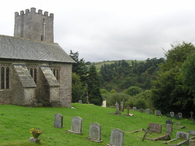
St Peter's Church, Exton

The Anglican St Peter's Church at Exton within the English county of Somerset has a 13th-century tower and 15th century aisle. It is a Grade II* listed...

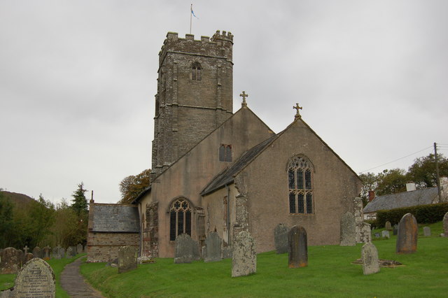
Church of St Mary, Brompton Regis

The Anglican Church of St Mary in Brompton Regis, Somerset, England was built in the 13th century. It is a Grade II* listed building. == History == The...

Winsford, Somerset

Winsford is a village and civil parish in Somerset, England, located about 5 miles (8 km) north-west of Dulverton. It is within the borders of the Exmoor...

Brompton Regis

Brompton Regis (formerly known as Kingsbrompton) is a village and civil parish in the Somerset West and Taunton district of Somerset, England about 5 miles...

Barlynch Priory

Barlynch Priory (also known as St Nicholas's Priory and sometimes spelled Barlich Priory) in Brompton Regis, Somerset, England was an Augustinian priory...

Dulverton Rural District

Dulverton was a rural district in Somerset, England, from 1894 to 1974. It was created in 1894 under the Local Government Act 1894. In 1974 it was abolished...

Dulverton

Dulverton is a town and civil parish in west Somerset, England, near the border with Devon. The town had a population of 1,408 at the 2011 Census. The...

Nearby Amenities

Located within 500m of 51.076984,-3.5389688
Historic: milestone
Inscription: 14 Miles to Minehead
Lat/Long: 51.0779755/-3.5347645
The data included in this document is from www.openstreetmap.org. The data is made available under ODbL.

Have you been to Broford Wood?

Leave your review of Broford Wood below (or comments, questions and feedback).