Bridgetown Plantation
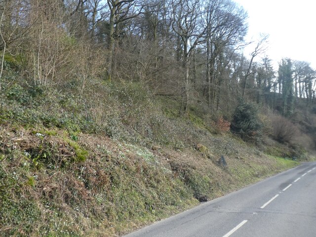
Wood, Forest in Somerset Somerset West and Taunton
England
Bridgetown Plantation

Bridgetown Plantation, Somerset (Wood, Forest) is a historic property located in the scenic countryside of Somerset County, Maryland. Spanning over a vast area, the plantation is encompassed by lush woodlands and verdant forests, creating a serene and picturesque environment.
The plantation dates back to the 18th century, making it a significant landmark in the region's history. It was originally established as a working farm, with its primary focus on agriculture and the cultivation of various crops. Over the years, Bridgetown Plantation has evolved into a multifaceted estate, offering a blend of historical charm and natural beauty.
The property features an array of architectural structures that reflect the plantation's rich heritage. The main house, a stately manor, showcases traditional Georgian-style architecture, adorned with intricate detailing and elegant proportions. Surrounding the main house are several outbuildings, including a carriage house and a barn, which have been meticulously preserved to maintain their original character.
Beyond the historic buildings, Bridgetown Plantation boasts expansive grounds that are ideal for outdoor activities and exploration. Visitors can take leisurely strolls through the woodland trails, immersing themselves in the tranquil atmosphere and observing the abundant wildlife that calls the plantation home.
Today, Bridgetown Plantation serves as a popular venue for weddings, special events, and guided tours, allowing guests to experience the plantation's historical significance and natural splendor. Its idyllic setting and rich heritage make it a cherished destination for locals and tourists alike, providing a glimpse into the past while offering a peaceful retreat in the heart of Somerset County.
If you have any feedback on the listing, please let us know in the comments section below.
Bridgetown Plantation Images
Images are sourced within 2km of 51.083545/-3.5412853 or Grid Reference SS9232. Thanks to Geograph Open Source API. All images are credited.


Bridgetown Plantation is located at Grid Ref: SS9232 (Lat: 51.083545, Lng: -3.5412853)
Administrative County: Somerset
District: Somerset West and Taunton
Police Authority: Avon and Somerset
What 3 Words
///gullible.added.storming. Near Dulverton, Somerset
Nearby Locations
Related Wikis

Exton, Somerset
Exton is a village and civil parish 5 miles (8 km) north-east of Dulverton and 9 miles (14 km) south-west of Dunster in Somerset, England. It lies on the...
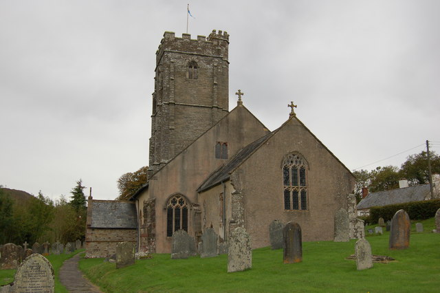
St Peter's Church, Exton
The Anglican St Peter's Church at Exton within the English county of Somerset has a 13th-century tower and 15th century aisle. It is a Grade II* listed...
Winsford, Somerset
Winsford is a village and civil parish in Somerset, England, located about 5 miles (8 km) north-west of Dulverton. It is within the borders of the Exmoor...

Garratts Wood
Garratts Wood is a woodland in Somerset, England, near the village of Winsford. It covers a total area of 1.11 hectares (2.74 acres). It is owned and managed...
Nearby Amenities
Located within 500m of 51.083545,-3.5412853Have you been to Bridgetown Plantation?
Leave your review of Bridgetown Plantation below (or comments, questions and feedback).