Vulscombe Wood

Wood, Forest in Devon Mid Devon

England

Vulscombe Wood

Cruwys Morchard: cattle in a field near Lythe-land Looking north towards Templeton
Cruwys Morchard: cattle in a field near Lythe-land Credit: Martin Bodman

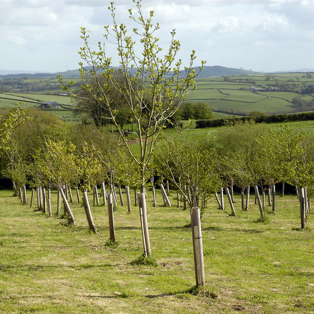
Vulscombe Wood is a picturesque woodland situated in the county of Devon, England. It covers an area of approximately 30 acres and is known for its diverse range of flora and fauna. The woodland is located near the village of Nomansland, just a few miles away from Tiverton.

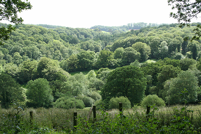
The wood is predominantly composed of broadleaf trees, including oak, beech, and ash, creating a lush and verdant environment. These ancient trees provide a dense canopy that filters the sunlight, resulting in a cool and tranquil atmosphere within the wood. The forest floor is carpeted with a rich assortment of wildflowers, ferns, and mosses, adding to its natural beauty.

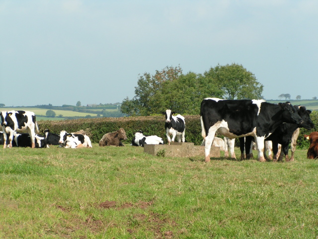
Vulscombe Wood is home to a variety of wildlife, making it a popular spot for nature enthusiasts and birdwatchers. Visitors may catch a glimpse of woodland birds such as woodpeckers, nuthatches, and tawny owls. The wood also provides a habitat for small mammals like squirrels, foxes, and badgers.

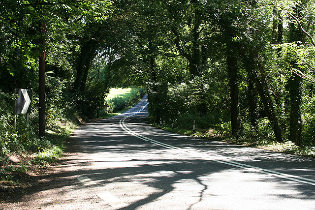
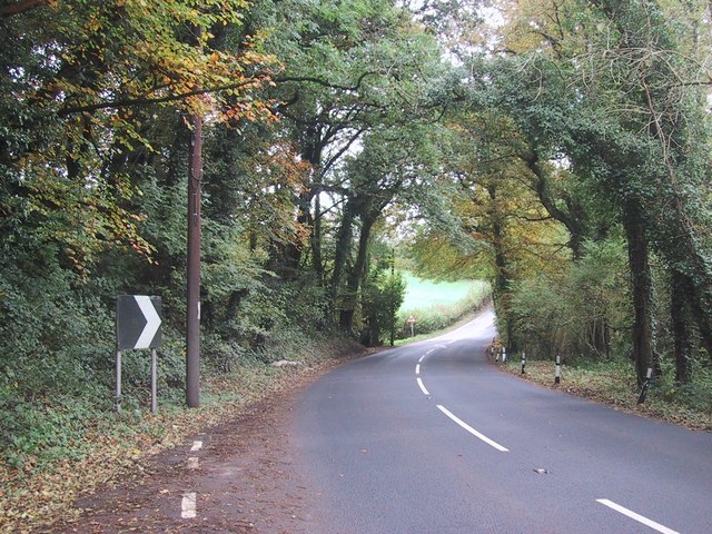
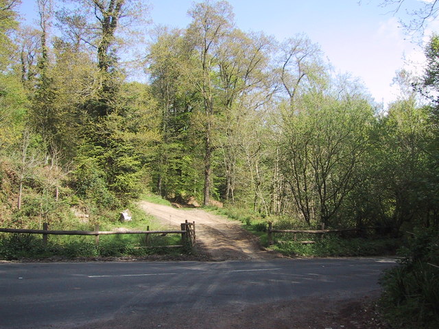
There are several walking trails that wind through the wood, allowing visitors to immerse themselves in the peaceful surroundings. These paths offer stunning views of the woodland and provide opportunities for nature photography and exploration. Additionally, there are designated picnic areas where visitors can relax and enjoy a meal amidst nature.

Vulscombe Wood is a cherished natural gem in Devon, offering a serene and enchanting experience for all who venture into its depths. Whether it's a leisurely stroll, a bird-watching expedition, or simply a desire to connect with nature, this woodland provides an idyllic setting for anyone seeking respite from the bustling world.

If you have any feedback on the listing, please let us know in the comments section below.

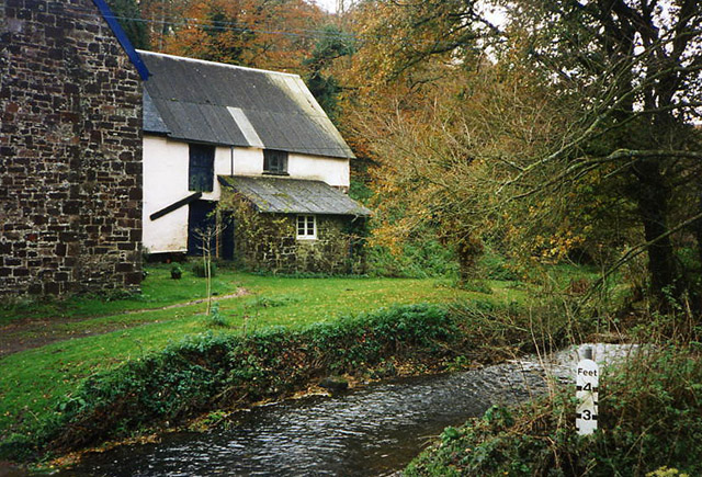
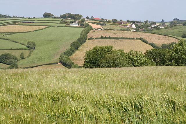
Vulscombe Wood Images

Images are sourced within 2km of 50.898397/-3.5717104 or Grid Reference SS8912. Thanks to Geograph Open Source API. All images are credited.

Cruwys Morchard: cattle in a field near Lythe-land Looking north towards Templeton
Cruwys Morchard: cattle in a field near Lythe-land
Looking north towards Templeton
Cruwys Morchard: Windmill Farm Entrance to farmyard. In 1553 a windmill stood across the road to the east, probably near the trig point 253m up from sea level, where it would have worked in all winds
Cruwys Morchard: Windmill Farm
Entrance to farmyard. In 1553 a windmill stood across the road to the east, probably near the trig point 253m up from sea level, where it would have worked in all winds
Cruwys Morchard: Morchard Mill By a ford on the Dart, a tributary of the Exe. The overshot waterwheel, once fed by a high-level leat, has gone but inside the mill retains an almost complete set of mill gear
Cruwys Morchard: Morchard Mill
By a ford on the Dart, a tributary of the Exe. The overshot waterwheel, once fed by a high-level leat, has gone but inside the mill retains an almost complete set of mill gear
Cruwys Morchard: near Old Ford House Overlooking a valley; its stream a tributary of the Dart, itself a tributary of the Exe. Looking west-south-west
Cruwys Morchard: near Old Ford House
Overlooking a valley; its stream a tributary of the Dart, itself a tributary of the Exe. Looking west-south-west
Cruwys Morchard: Thorne Farm Looking north east with a new Massey Ferguson tractor parked up
Cruwys Morchard: Thorne Farm
Looking north east with a new Massey Ferguson tractor parked up
Cruwys Morchard: towards Withleigh Withleigh church tower is just visible almost on the horizon, part shrouded in a clump of trees. Looking east-north-east
Cruwys Morchard: towards Withleigh
Withleigh church tower is just visible almost on the horizon, part shrouded in a clump of trees. Looking east-north-east
Templeton: the Dart valley Seen from the entrance to The Old Rectory. A second valley runs down from Cruwys Morchard beyond. Looking south west
Templeton: the Dart valley
Seen from the entrance to The Old Rectory. A second valley runs down from Cruwys Morchard beyond. Looking south west
Tiverton: by Palmer’s Bridge The A373 Tiverton – Witheridge road looking east-south-east towards Withleigh. The climb up to Withleigh is a relatively new route, replacing the old 18th century turnpike which ran steeply up from Groubear Bridge
Tiverton: by Palmer’s Bridge
The A373 Tiverton – Witheridge road looking east-south-east towards Withleigh. The climb up to Withleigh is a relatively new route, replacing the old 18th century turnpike which ran steeply up from Groubear Bridge
Titchen's Bradley Looking from Titchen's Bradley towards Plainsfield and beyond towards East Devon.
Titchen's Bradley
Looking from Titchen's Bradley towards Plainsfield and beyond towards East Devon.
The road to Hookway
The road to Hookway
Chicken and lake at Hookway
Looking towards Way Village, cut hay in the fields
Cows near Thorne Farm
Highgate junction Anyone with a sense of direction will be confused at this junction because Tiverton is East of here, not West.
Highgate junction
Anyone with a sense of direction will be confused at this junction because Tiverton is East of here, not West.
Road through the trees
Track into the woodland
Field View from Windmill Down Triangulation Pillar Looking eastward. I presume that the exposed foundations were once at ground level.
Field View from Windmill Down Triangulation Pillar
Looking eastward. I presume that the exposed foundations were once at ground level.
Road and woodland west of High Gate The evergreens on the right shield the house at High Gate
Road and woodland west of High Gate
The evergreens on the right shield the house at High Gate
Show me another place!

Vulscombe Wood is located at Grid Ref: SS8912 (Lat: 50.898397, Lng: -3.5717104)

Administrative County: Devon

District: Mid Devon

Police Authority: Devon and Cornwall

What 3 Words

///documents.tarred.copies. Near Tiverton, Devon

Related Wikis

Templeton, Devon

Templeton is a hamlet, parish and former manor in Devon, England, situated 4 miles west of Tiverton. The parish church is dedicated to St Margaret. �...

Cruwys Morchard

Cruwys Morchard is an ecclesiastical and civil parish in the Mid Devon district of the county of Devon in England. It is located about four to five miles...

Calverleigh

Calverleigh (anciently Calwoodleigh) is a village and former civil parish and manor, now in the parish of Loxbeare, in the Mid Devon district, in the county...

Loxbeare

Loxbeare is a village and civil parish in Devon, England. The church is from the twelfth century and the tower is probably Norman. It is dedicated to St...

Washfield

Washfield is a village, parish and former manor in Devon, England, situated about 2 miles north-west of Tiverton. The parish church is dedicated to St...

St Paul's Church, Tiverton

St Paul's Church, Tiverton, is a Grade II listed parish church in the Church of England in Tiverton, Devon. == History == The church was built between...

Cadeleigh

Cadeleigh is a small village in the county of Devon in England. It sits in the hills above the valley of the River Exe and is about 15 km (9 miles) north...

Tiverton and District Hospital

Tiverton and District Hospital is a health facility based in Kennedy Way, Tiverton, Devon, England. It is managed by Royal Devon and Exeter NHS Foundation...

Nearby Amenities

Located within 500m of 50.898397,-3.5717104
Ford: yes
Lat/Long: 50.8981438/-3.5676666
Generator Method: photovoltaic
Generator Output Electricity: yes
Generator Source: solar
Generator Type: solar_photovoltaic_panel
Location: roof
Power: generator
Lat/Long: 50.9019463/-3.5753652
The data included in this document is from www.openstreetmap.org. The data is made available under ODbL.

Have you been to Vulscombe Wood?

Leave your review of Vulscombe Wood below (or comments, questions and feedback).